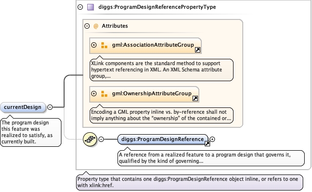
<element minOccurs="0" maxOccurs="1" name="currentDesign" type="diggs:ProgramDesignReferencePropertyType"><annotation><documentation>The program design this feature was realized to satisfy, as currently built.</documentation></annotation></element>
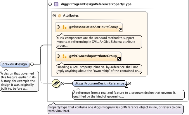
A design that governed this feature earlier in its history, forexample the design it was originally built to, before a later repairor modification. Use designRole and effectiveFrom on the referenceto state which design and when.
<element minOccurs="0" maxOccurs="unbounded" name="previousDesign" type="diggs:ProgramDesignReferencePropertyType"><annotation><documentation>A design that governed this feature earlier in its history, for example the design it was originally built to, before a later repair or modification. Use designRole and effectiveFrom on the reference to state which design and when.</documentation></annotation></element>
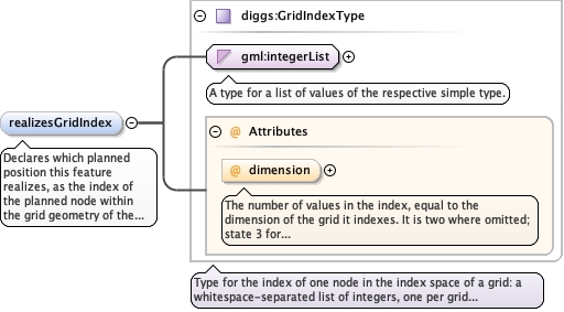
Declares which planned position this feature realizes, as the indexof the planned node within the grid geometry of the design cited byprogramDesignRef. Where that design states no plannedPositions ofits own, the grid is the one resolved through its basedOnRef chain,most specific first. Ordered per the grid's axisLabels and of thesame dimension as the grid; see diggs:GridIndexType. Omit it forinstance-scoped designs, where programDesignRef alone identifies theplan, and for zone-scoped designs, which state no planned positionsto index into. Only the grid form needs it, because a grid node isnot an object and has no gml:id to point at. Do not match a realizedfeature to its planned position by proximity: nearest-node matchingfails silently where it matters most, since a column placed outsideits position tolerance is what a conformance check exists to catch,and it may lie nearer another node.
The number of values in the index, equal to the dimension of the grid itindexes. It is two where omitted; state 3 for an index into athree-dimensional grid.
Source
<element minOccurs="0" name="realizesGridIndex" type="diggs:GridIndexType"><annotation><documentation>Declares which planned position this feature realizes, as the index of the planned node within the grid geometry of the design cited by programDesignRef. Where that design states no plannedPositions of its own, the grid is the one resolved through its basedOnRef chain, most specific first. Ordered per the grid's axisLabels and of the same dimension as the grid; see diggs:GridIndexType. Omit it for instance-scoped designs, where programDesignRef alone identifies the plan, and for zone-scoped designs, which state no planned positions to index into. Only the grid form needs it, because a grid node is not an object and has no gml:id to point at. Do not match a realized feature to its planned position by proximity: nearest-node matching fails silently where it matters most, since a column placed outside its position tolerance is what a conformance check exists to catch, and it may lie nearer another node.</documentation></annotation></element>
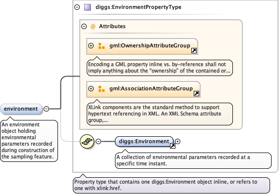
<element maxOccurs="unbounded" minOccurs="0" name="environment" type="diggs:EnvironmentPropertyType"><annotation><documentation>An environment object holding environmental parameters recorded during construction of the sampling feature.</documentation></annotation></element>
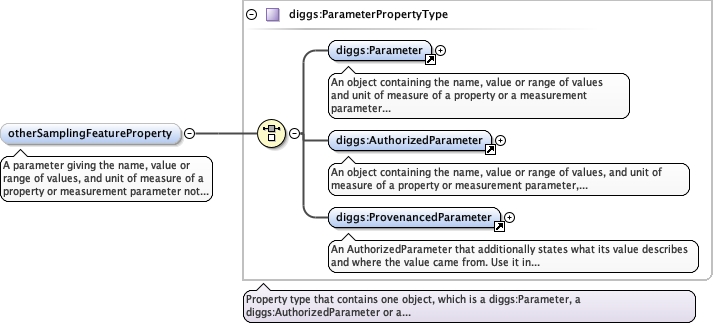
A parameter giving the name, value or range of values, and unit ofmeasure of a property or measurement parameter not otherwiseprovided for. Repeat for each property.
<element maxOccurs="unbounded" minOccurs="0" name="otherSamplingFeatureProperty" type="diggs:ParameterPropertyType"><annotation><documentation>A parameter giving the name, value or range of values, and unit of measure of a property or measurement parameter not otherwise provided for. Repeat for each property.</documentation></annotation></element>
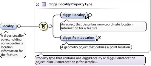
<element name="locality" type="diggs:LocalityPropertyType" minOccurs="0" maxOccurs="1"><annotation><documentation>A diggs:Locality object holding non-coordinate location information for the feature.</documentation></annotation></element>
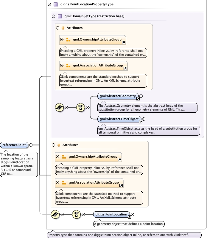
The location of the sampling feature, as a diggs:PointLocationwithin a known spatial 3D CRS or compound CRS (a geographic orprojected 2D CRS plus a vertical CRS). Required.
<element name="referencePoint" type="diggs:PointLocationPropertyType" minOccurs="1"><annotation><documentation>The location of the sampling feature, as a diggs:PointLocation within a known spatial 3D CRS or compound CRS (a geographic or projected 2D CRS plus a vertical CRS). Required.</documentation></annotation></element>
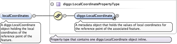
<element minOccurs="0" name="localCoordinates" type="diggs:LocalCoordinatePropertyType"><annotation><documentation>A diggs:LocalCoordinate object holding the local coordinates of the reference point of the feature.</documentation></annotation></element>
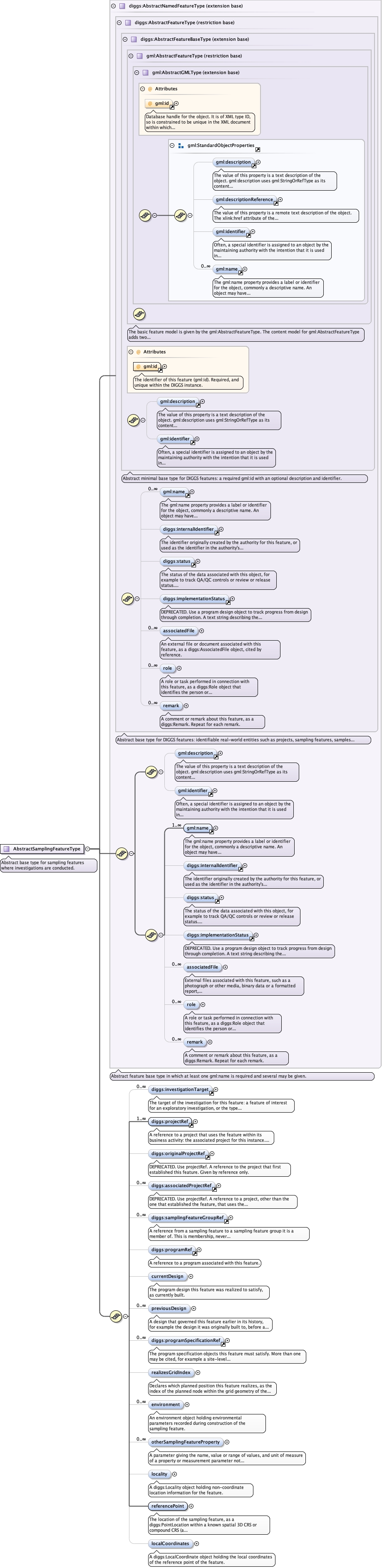
Complex Type diggs:AbstractSamplingFeatureType
Namespace
http://diggsml.org/schemas/3
Annotations
Abstract base type for sampling features where investigations are conducted.
Database handle for the object. It is of XML type ID, so is constrained to beunique in the XML document within which it occurs. An external identifier for the object inthe form of a URI may be constructed using standard XML and XPointer methods. This is doneby concatenating the URI for the document, a fragment separator, and the value of the idattribute.
Source
<complexType name="AbstractSamplingFeatureType" abstract="true"><annotation><documentation>Abstract base type for sampling features where investigations are conducted.</documentation></annotation><complexContent><extension base="diggs:AbstractNamedFeatureType"><sequence><element ref="diggs:investigationTarget" maxOccurs="unbounded" minOccurs="0"/><element ref="diggs:projectRef" maxOccurs="unbounded"/><element minOccurs="0" ref="diggs:originalProjectRef"/><element maxOccurs="unbounded" minOccurs="0" ref="diggs:associatedProjectRef"/><element minOccurs="0" maxOccurs="unbounded" ref="diggs:samplingFeatureGroupRef"/><element minOccurs="0" ref="diggs:programRef"/><element minOccurs="0" maxOccurs="1" name="currentDesign" type="diggs:ProgramDesignReferencePropertyType"><annotation><documentation>The program design this feature was realized to satisfy, as currently built.</documentation></annotation></element><element minOccurs="0" maxOccurs="unbounded" name="previousDesign" type="diggs:ProgramDesignReferencePropertyType"><annotation><documentation>A design that governed this feature earlier in its history, for example the design it was originally built to, before a later repair or modification. Use designRole and effectiveFrom on the reference to state which design and when.</documentation></annotation></element><element minOccurs="0" maxOccurs="unbounded" ref="diggs:programSpecificationRef"><annotation><documentation>The program specification objects this feature must satisfy. More than one may be cited, for example a site-level performance specification and a project-level tolerance specification.</documentation></annotation></element><element minOccurs="0" name="realizesGridIndex" type="diggs:GridIndexType"><annotation><documentation>Declares which planned position this feature realizes, as the index of the planned node within the grid geometry of the design cited by programDesignRef. Where that design states no plannedPositions of its own, the grid is the one resolved through its basedOnRef chain, most specific first. Ordered per the grid's axisLabels and of the same dimension as the grid; see diggs:GridIndexType. Omit it for instance-scoped designs, where programDesignRef alone identifies the plan, and for zone-scoped designs, which state no planned positions to index into. Only the grid form needs it, because a grid node is not an object and has no gml:id to point at. Do not match a realized feature to its planned position by proximity: nearest-node matching fails silently where it matters most, since a column placed outside its position tolerance is what a conformance check exists to catch, and it may lie nearer another node.</documentation></annotation></element><element maxOccurs="unbounded" minOccurs="0" name="environment" type="diggs:EnvironmentPropertyType"><annotation><documentation>An environment object holding environmental parameters recorded during construction of the sampling feature.</documentation></annotation></element><element maxOccurs="unbounded" minOccurs="0" name="otherSamplingFeatureProperty" type="diggs:ParameterPropertyType"><annotation><documentation>A parameter giving the name, value or range of values, and unit of measure of a property or measurement parameter not otherwise provided for. Repeat for each property.</documentation></annotation></element><element name="locality" type="diggs:LocalityPropertyType" minOccurs="0" maxOccurs="1"><annotation><documentation>A diggs:Locality object holding non-coordinate location information for the feature.</documentation></annotation></element><element name="referencePoint" type="diggs:PointLocationPropertyType" minOccurs="1"><annotation><documentation>The location of the sampling feature, as a diggs:PointLocation within a known spatial 3D CRS or compound CRS (a geographic or projected 2D CRS plus a vertical CRS). Required.</documentation></annotation></element><element minOccurs="0" name="localCoordinates" type="diggs:LocalCoordinatePropertyType"><annotation><documentation>A diggs:LocalCoordinate object holding the local coordinates of the reference point of the feature.</documentation></annotation></element></sequence></extension></complexContent></complexType>