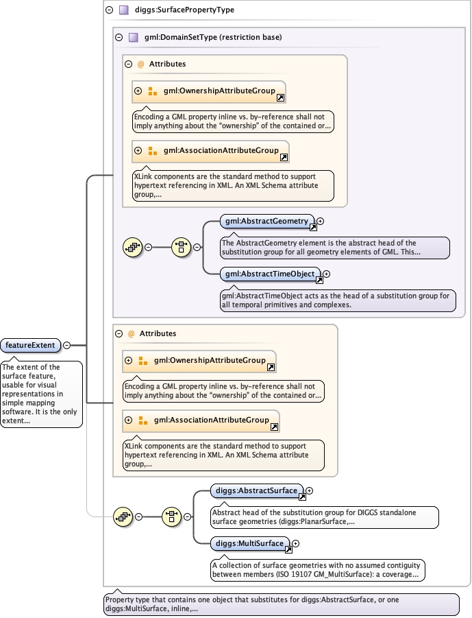
The extent of the surface feature, usable for visual representationsin simple mapping software. It is the only extent property needed:the srsName of the surface may name either a spatial CRS or adiggs:LocalCartesianCRS declared in DocumentInformation/crs, so afeature described in local coordinates gives its extent here andpoints srsName at that local CRS. relativeFeatureBoundary,referenceEdge and planarReferencing are deprecated. The surface maybe given inline or cited with xlink:href, pointing at a surfacedeclared elsewhere in the document, so that one polygon need not berestated everywhere it applies. A reference asserts identity: thisfeature's extent is that surface, not an approximation of it orderived from it. Where two extents differ, however slightly, eachstates its own geometry and no reference is used. For example, anas-built feature whose extent matched the designed extent itrealizes cites that surface, while one that departed from it carriesits own.
<element name="featureExtent" type="diggs:SurfacePropertyType" maxOccurs="1" minOccurs="1"><annotation><documentation>The extent of the surface feature, usable for visual representations in simple mapping software. It is the only extent property needed: the srsName of the surface may name either a spatial CRS or a diggs:LocalCartesianCRS declared in DocumentInformation/crs, so a feature described in local coordinates gives its extent here and points srsName at that local CRS. relativeFeatureBoundary, referenceEdge and planarReferencing are deprecated. The surface may be given inline or cited with xlink:href, pointing at a surface declared elsewhere in the document, so that one polygon need not be restated everywhere it applies. A reference asserts identity: this feature's extent is that surface, not an approximation of it or derived from it. Where two extents differ, however slightly, each states its own geometry and no reference is used. For example, an as-built feature whose extent matched the designed extent it realizes cites that surface, while one that departed from it carries its own.</documentation></annotation></element>
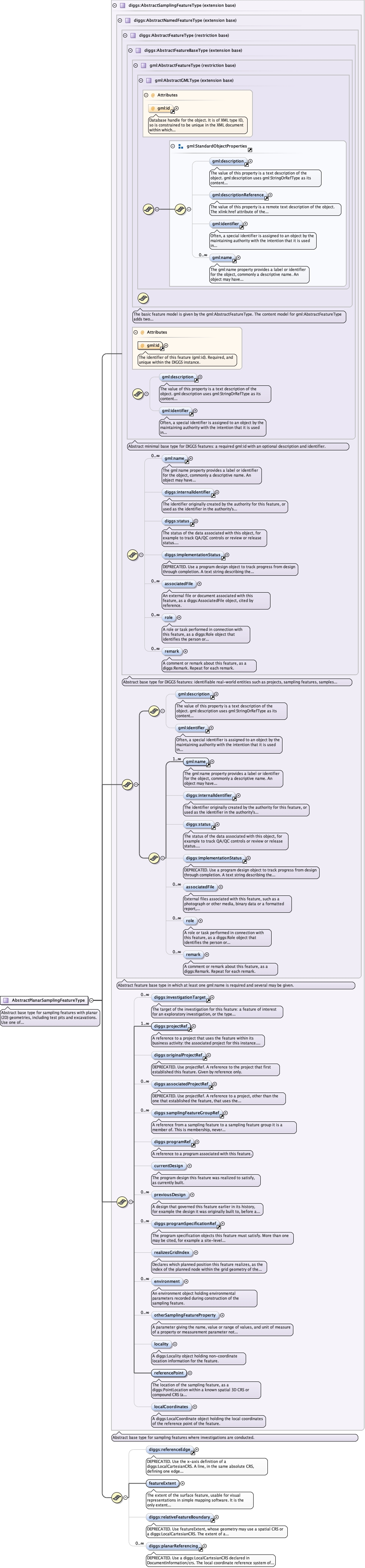
Complex Type diggs:AbstractPlanarSamplingFeatureType
Namespace
http://diggsml.org/schemas/3
Annotations
Abstract base type for sampling features with planar (2D) geometries, including testpits and excavations. Use one of its concrete extensions, for examplediggs:PlanarSamplingFeature.
Database handle for the object. It is of XML type ID, so is constrained to beunique in the XML document within which it occurs. An external identifier for the object inthe form of a URI may be constructed using standard XML and XPointer methods. This is doneby concatenating the URI for the document, a fragment separator, and the value of the idattribute.
Source
<complexType name="AbstractPlanarSamplingFeatureType" abstract="true"><annotation><documentation>Abstract base type for sampling features with planar (2D) geometries, including test pits and excavations. Use one of its concrete extensions, for example diggs:PlanarSamplingFeature.</documentation></annotation><complexContent><extension base="diggs:AbstractSamplingFeatureType"><sequence><element minOccurs="0" maxOccurs="1" ref="diggs:referenceEdge"/><element name="featureExtent" type="diggs:SurfacePropertyType" maxOccurs="1" minOccurs="1"><annotation><documentation>The extent of the surface feature, usable for visual representations in simple mapping software. It is the only extent property needed: the srsName of the surface may name either a spatial CRS or a diggs:LocalCartesianCRS declared in DocumentInformation/crs, so a feature described in local coordinates gives its extent here and points srsName at that local CRS. relativeFeatureBoundary, referenceEdge and planarReferencing are deprecated. The surface may be given inline or cited with xlink:href, pointing at a surface declared elsewhere in the document, so that one polygon need not be restated everywhere it applies. A reference asserts identity: this feature's extent is that surface, not an approximation of it or derived from it. Where two extents differ, however slightly, each states its own geometry and no reference is used. For example, an as-built feature whose extent matched the designed extent it realizes cites that surface, while one that departed from it carries its own.</documentation></annotation></element><element ref="diggs:relativeFeatureBoundary" maxOccurs="1" minOccurs="0"/><element ref="diggs:planarReferencing" maxOccurs="unbounded" minOccurs="0"/></sequence></extension></complexContent></complexType>