Showing:

Annotations
Attributes
Diagrams
Instances
Model
Properties
Source
Used by
Element diggs:relativeFeatureBoundary
Namespace http://diggsml.org/schemas/3
Annotations
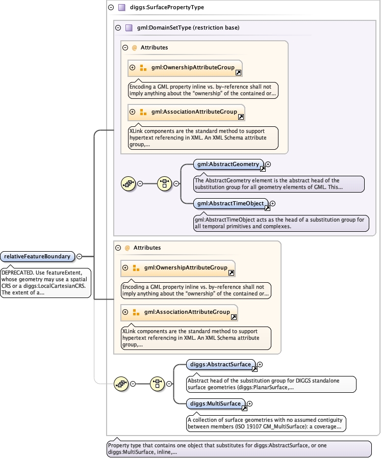
DEPRECATED. Use featureExtent, whose geometry may use a spatial CRS or a
diggs:LocalCartesianCRS. The extent of a planar feature in a relative planar
referencing system.
Diagram
Diagramgml3_2Profile_diggs_xsd_Attribute_Group_gml_OwnershipAttributeGroup.tmp#OwnershipAttributeGroupgml3_2Profile_diggs_xsd_Attribute_Group_gml_AssociationAttributeGroup.tmp#AssociationAttributeGroupgml3_2Profile_diggs_xsd_Element_gml_AbstractGeometry.tmp#AbstractGeometrygml3_2Profile_diggs_xsd_Element_gml_AbstractTimeObject.tmp#AbstractTimeObjectgml3_2Profile_diggs_xsd_Complex_Type_gml_DomainSetType.tmp#DomainSetTypegml3_2Profile_diggs_xsd_Attribute_Group_gml_OwnershipAttributeGroup.tmp#OwnershipAttributeGroupgml3_2Profile_diggs_xsd_Attribute_Group_gml_AssociationAttributeGroup.tmp#AssociationAttributeGroupAbstractTypes_xsd_Element_diggs_AbstractSurface.tmp#http___diggsml.org_schemas_3_AbstractSurfaceCore_xsd_Element_diggs_MultiSurface.tmp#MultiSurfaceCore_xsd_Complex_Type_diggs_SurfacePropertyType.tmp#SurfacePropertyType
Type diggs:SurfacePropertyType
Type hierarchy
Properties
content complex
Used by
Model
Children diggs:AbstractSurface, diggs:MultiSurface
Instance
<diggs:relativeFeatureBoundary owns="false" xlink:href="" nilReason="" xmlns:diggs="http://diggsml.org/schemas/3">
  <diggs:AbstractSurface axisLabels="" gml:id="" srsDimension="" srsName="" uomLabels="">{1,1}</diggs:AbstractSurface>
  <diggs:MultiSurface aggregationType="" axisLabels="" gml:id="" srsDimension="" srsName="" uomLabels="">{1,1}</diggs:MultiSurface>
</diggs:relativeFeatureBoundary>
Attributes
QName Type Default Use
nilReason gml:NilReasonType optional
owns boolean false optional
xlink:href anyURI optional
Source
<element name="relativeFeatureBoundary" type="diggs:SurfacePropertyType">
  <annotation>
    <appinfo>
      <diggs:deprecated since="3.1.0" replacedBy="diggs:featureExtent" note="with its geometry in a spatial CRS or a diggs:LocalCartesianCRS"/>
    </appinfo>
    <documentation>DEPRECATED. Use featureExtent, whose geometry may use a spatial CRS or a diggs:LocalCartesianCRS. The extent of a planar feature in a relative planar referencing system.</documentation>
  </annotation>
</element>