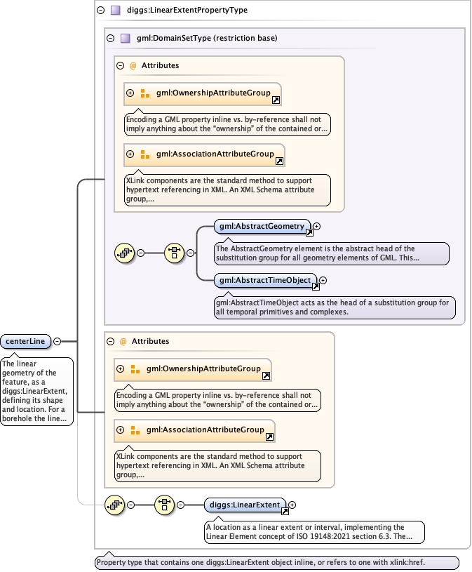
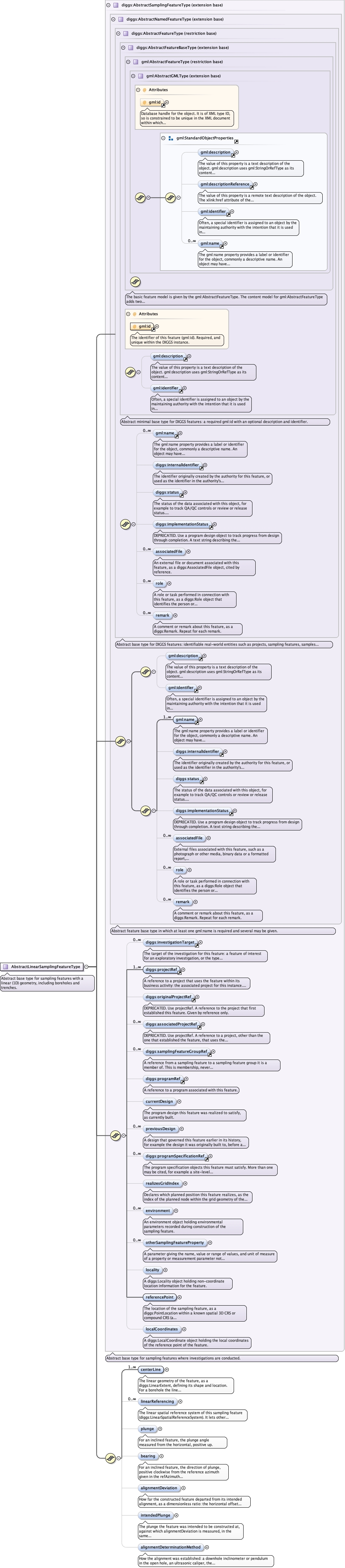
The linear geometry of the feature, as a diggs:LinearExtent,defining its shape and location. For a borehole the line is thetrajectory of the borehole in 3D space. Several center lines, allassociated with the same reference point, may define complex objectssuch as a wellbore with sidetracks, or different reference datumsfor one borehole.
<element name="centerLine" type="diggs:LinearExtentPropertyType" maxOccurs="unbounded" minOccurs="1"><annotation><documentation>The linear geometry of the feature, as a diggs:LinearExtent, defining its shape and location. For a borehole the line is the trajectory of the borehole in 3D space. Several center lines, all associated with the same reference point, may define complex objects such as a wellbore with sidetracks, or different reference datums for one borehole.</documentation></annotation></element>
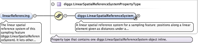
The linear spatial reference system of this sampling feature(diggs:LinearSpatialReferenceSystem). It lets other objects statetheir position as a 1D distance along the feature, typically fromthe center line origin. For a borehole the coordinates are measureddepths down the center line.
<element name="linearReferencing" type="diggs:LinearSpatialReferenceSystemPropertyType" minOccurs="0" maxOccurs="unbounded"><annotation><documentation>The linear spatial reference system of this sampling feature (diggs:LinearSpatialReferenceSystem). It lets other objects state their position as a 1D distance along the feature, typically from the center line origin. For a borehole the coordinates are measured depths down the center line.</documentation></annotation></element>
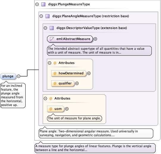
<element minOccurs="0" name="plunge" type="diggs:PlungeMeasureType"><annotation><documentation>For an inclined feature, the plunge angle measured from the horizontal, positive up.</documentation></annotation></element>
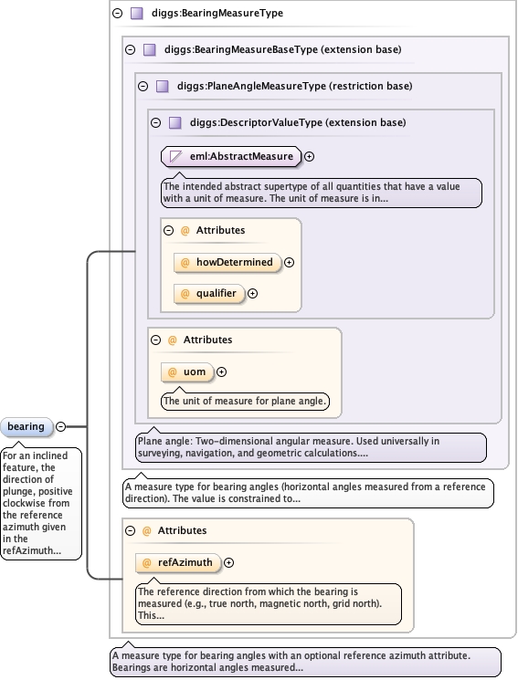
The reference direction from which the bearing is measured (e.g., true north, magnetic north, grid north). This attribute specifies the azimuth reference system used.
<element minOccurs="0" name="bearing" type="diggs:BearingMeasureType"><annotation><documentation>For an inclined feature, the direction of plunge, positive clockwise from the reference azimuth given in the refAzimuth attribute.</documentation></annotation></element>
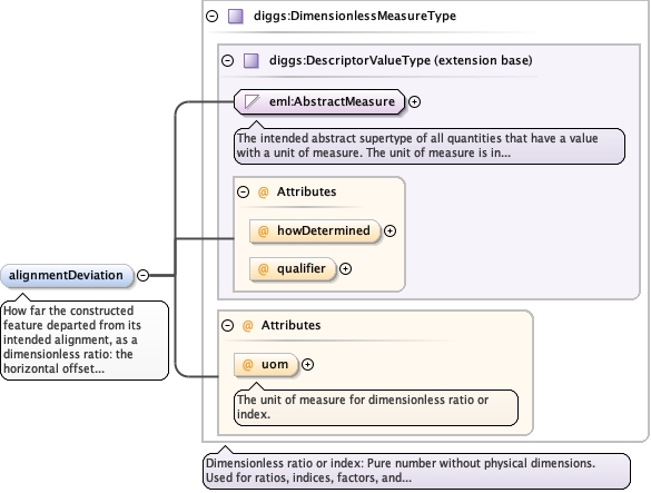
How far the constructed feature departed from its intendedalignment, as a dimensionless ratio: the horizontal offsetaccumulated over the length travelled. Use uom="Euc" for a ratio(0.02) or uom="%" for a percentage (2); a 1:50 tolerance is 0.02 Eucor 2 %. It measures deviation from the intended alignment, not fromvertical. Where no intended plunge is stated anywhere, vertical isthe intent, as it is for rigid inclusion columns. For a featureintended to be raked, such as a grout hole or a battered pile, itcarries only the construction error and not the design rake: a pileintended at 1:4 and built almost perfectly reports a smalldeviation, not 25 %. The datum is intendedPlunge where given,otherwise the plunge stated by the design or target object for thisfeature, otherwise vertical. Which source governs: where the centerline is genuinely inclined it is a survey and governs, and thisproperty is a derived convenience that should agree with it. Wherethe center line is vertical it is almost certainly nominal ratherthan measured, and this property carries the measurement; manyconstruction techniques yield only an inclination (for example ofthe rig mast) with no azimuth, so no center line can be surveyed.Read alignmentDeterminationMethod rather than inferring from thegeometry, since coordinate rounding can make a nominal center lineslightly non-vertical.
The unit of measure for dimensionless ratio or index.
Source
<element minOccurs="0" name="alignmentDeviation" type="diggs:DimensionlessMeasureType"><annotation><documentation>How far the constructed feature departed from its intended alignment, as a dimensionless ratio: the horizontal offset accumulated over the length travelled. Use uom="Euc" for a ratio (0.02) or uom="%" for a percentage (2); a 1:50 tolerance is 0.02 Euc or 2 %. It measures deviation from the intended alignment, not from vertical. Where no intended plunge is stated anywhere, vertical is the intent, as it is for rigid inclusion columns. For a feature intended to be raked, such as a grout hole or a battered pile, it carries only the construction error and not the design rake: a pile intended at 1:4 and built almost perfectly reports a small deviation, not 25 %. The datum is intendedPlunge where given, otherwise the plunge stated by the design or target object for this feature, otherwise vertical. Which source governs: where the center line is genuinely inclined it is a survey and governs, and this property is a derived convenience that should agree with it. Where the center line is vertical it is almost certainly nominal rather than measured, and this property carries the measurement; many construction techniques yield only an inclination (for example of the rig mast) with no azimuth, so no center line can be surveyed. Read alignmentDeterminationMethod rather than inferring from the geometry, since coordinate rounding can make a nominal center line slightly non-vertical.</documentation></annotation></element>
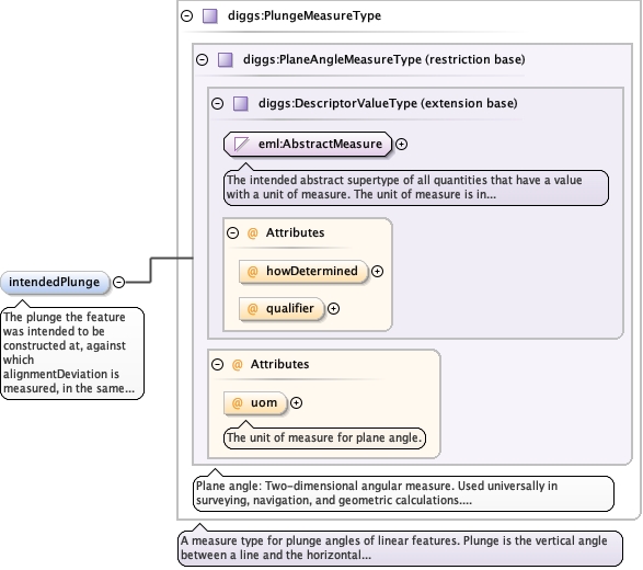
The plunge the feature was intended to be constructed at, againstwhich alignmentDeviation is measured, in the same angular conventionas plunge. Populate it only where the intent is not otherwiserecoverable, that is, where the design or target object carrying theplanned rake is not transferred with the file; where it is, thatobject is the authority and this element should be omitted. Omit itfor a feature intended to be vertical, such as a rigid inclusioncolumn.
<element minOccurs="0" name="intendedPlunge" type="diggs:PlungeMeasureType"><annotation><documentation>The plunge the feature was intended to be constructed at, against which alignmentDeviation is measured, in the same angular convention as plunge. Populate it only where the intent is not otherwise recoverable, that is, where the design or target object carrying the planned rake is not transferred with the file; where it is, that object is the authority and this element should be omitted. Omit it for a feature intended to be vertical, such as a rigid inclusion column.</documentation></annotation></element>
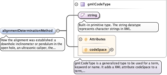
How the alignment was established: a downhole inclinometer orpendulum in the open hole, an ultrasonic caliper, the inclination ofthe rig mast, or not determined. This is the provenance of thetrajectory and the only place it can be stated: a center line ismandatory, so a feature whose trajectory was never surveyed muststill assert one, and a nominal vertical line is otherwiseindistinguishable from a surveyed one. A mast-derived valuedescribes the rig, not the finished element, which is a weaker claimthan a downhole survey. Absent, together with an exactly verticalcenter line and no alignmentDeviation, the alignment was notdetermined; read this as an absence of information, not a claim ofverticality. Use the DIGGS dictionaryalignmentDeterminationMethod.xml for the list of values.
<element minOccurs="0" name="alignmentDeterminationMethod" type="gml:CodeType"><annotation><documentation>How the alignment was established: a downhole inclinometer or pendulum in the open hole, an ultrasonic caliper, the inclination of the rig mast, or not determined. This is the provenance of the trajectory and the only place it can be stated: a center line is mandatory, so a feature whose trajectory was never surveyed must still assert one, and a nominal vertical line is otherwise indistinguishable from a surveyed one. A mast-derived value describes the rig, not the finished element, which is a weaker claim than a downhole survey. Absent, together with an exactly vertical center line and no alignmentDeviation, the alignment was not determined; read this as an absence of information, not a claim of verticality. Use the DIGGS dictionary alignmentDeterminationMethod.xml for the list of values.</documentation></annotation></element>
Complex Type diggs:AbstractLinearSamplingFeatureType
Namespace
http://diggsml.org/schemas/3
Annotations
Abstract base type for sampling features with a linear (1D) geometry, includingboreholes and trenches.
Database handle for the object. It is of XML type ID, so is constrained to beunique in the XML document within which it occurs. An external identifier for the object inthe form of a URI may be constructed using standard XML and XPointer methods. This is doneby concatenating the URI for the document, a fragment separator, and the value of the idattribute.
Source
<complexType name="AbstractLinearSamplingFeatureType" abstract="true"><annotation><documentation>Abstract base type for sampling features with a linear (1D) geometry, including boreholes and trenches.</documentation></annotation><complexContent><extension base="diggs:AbstractSamplingFeatureType"><sequence><element name="centerLine" type="diggs:LinearExtentPropertyType" maxOccurs="unbounded" minOccurs="1"><annotation><documentation>The linear geometry of the feature, as a diggs:LinearExtent, defining its shape and location. For a borehole the line is the trajectory of the borehole in 3D space. Several center lines, all associated with the same reference point, may define complex objects such as a wellbore with sidetracks, or different reference datums for one borehole.</documentation></annotation></element><element name="linearReferencing" type="diggs:LinearSpatialReferenceSystemPropertyType" minOccurs="0" maxOccurs="unbounded"><annotation><documentation>The linear spatial reference system of this sampling feature (diggs:LinearSpatialReferenceSystem). It lets other objects state their position as a 1D distance along the feature, typically from the center line origin. For a borehole the coordinates are measured depths down the center line.</documentation></annotation></element><element minOccurs="0" name="plunge" type="diggs:PlungeMeasureType"><annotation><documentation>For an inclined feature, the plunge angle measured from the horizontal, positive up.</documentation></annotation></element><element minOccurs="0" name="bearing" type="diggs:BearingMeasureType"><annotation><documentation>For an inclined feature, the direction of plunge, positive clockwise from the reference azimuth given in the refAzimuth attribute.</documentation></annotation></element><element minOccurs="0" name="alignmentDeviation" type="diggs:DimensionlessMeasureType"><annotation><documentation>How far the constructed feature departed from its intended alignment, as a dimensionless ratio: the horizontal offset accumulated over the length travelled. Use uom="Euc" for a ratio (0.02) or uom="%" for a percentage (2); a 1:50 tolerance is 0.02 Euc or 2 %. It measures deviation from the intended alignment, not from vertical. Where no intended plunge is stated anywhere, vertical is the intent, as it is for rigid inclusion columns. For a feature intended to be raked, such as a grout hole or a battered pile, it carries only the construction error and not the design rake: a pile intended at 1:4 and built almost perfectly reports a small deviation, not 25 %. The datum is intendedPlunge where given, otherwise the plunge stated by the design or target object for this feature, otherwise vertical. Which source governs: where the center line is genuinely inclined it is a survey and governs, and this property is a derived convenience that should agree with it. Where the center line is vertical it is almost certainly nominal rather than measured, and this property carries the measurement; many construction techniques yield only an inclination (for example of the rig mast) with no azimuth, so no center line can be surveyed. Read alignmentDeterminationMethod rather than inferring from the geometry, since coordinate rounding can make a nominal center line slightly non-vertical.</documentation></annotation></element><element minOccurs="0" name="intendedPlunge" type="diggs:PlungeMeasureType"><annotation><documentation>The plunge the feature was intended to be constructed at, against which alignmentDeviation is measured, in the same angular convention as plunge. Populate it only where the intent is not otherwise recoverable, that is, where the design or target object carrying the planned rake is not transferred with the file; where it is, that object is the authority and this element should be omitted. Omit it for a feature intended to be vertical, such as a rigid inclusion column.</documentation></annotation></element><element minOccurs="0" name="alignmentDeterminationMethod" type="gml:CodeType"><annotation><documentation>How the alignment was established: a downhole inclinometer or pendulum in the open hole, an ultrasonic caliper, the inclination of the rig mast, or not determined. This is the provenance of the trajectory and the only place it can be stated: a center line is mandatory, so a feature whose trajectory was never surveyed must still assert one, and a nominal vertical line is otherwise indistinguishable from a surveyed one. A mast-derived value describes the rig, not the finished element, which is a weaker claim than a downhole survey. Absent, together with an exactly vertical center line and no alignmentDeviation, the alignment was not determined; read this as an absence of information, not a claim of verticality. Use the DIGGS dictionary alignmentDeterminationMethod.xml for the list of values.</documentation></annotation></element></sequence></extension></complexContent></complexType>