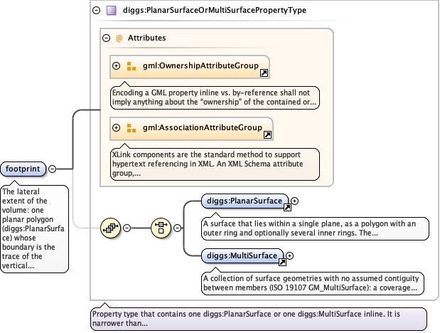
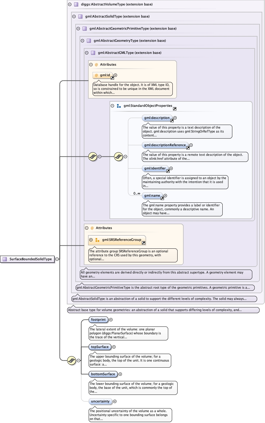
The lateral extent of the volume: one planar polygon(diggs:PlanarSurface) whose boundary is the trace of the verticalsides, or several disjoint polygons (diggs:MultiSurface, each memberexpected to be a diggs:PlanarSurface) when the plan-view extent isitself disconnected, for instance a geologic unit present asseparate unconnected patches. Unlike topSurface and bottomSurface,which are each one continuous surface, the footprint may be adiggs:MultiSurface, because each component is one planar region andwalls are erected on each component's own boundary; a MultiSurfacefootprint over one pair of continuous bounding surfaces yields aseparate body for each member. Each component's exterior ring is itsouter wall; each interior ring is a hole through the body andgenerates its own wall. Components shall not overlap in plan view.The footprint is normally horizontal and authored as a plan-viewpolygon, but the content model does not require it. Elevationcarried by the footprint's coordinates is not the volume's top orbottom: the footprint supplies (x, y) only, and the boundingsurfaces supply elevation.
<element name="footprint" type="diggs:PlanarSurfaceOrMultiSurfacePropertyType"><annotation><documentation>The lateral extent of the volume: one planar polygon (diggs:PlanarSurface) whose boundary is the trace of the vertical sides, or several disjoint polygons (diggs:MultiSurface, each member expected to be a diggs:PlanarSurface) when the plan-view extent is itself disconnected, for instance a geologic unit present as separate unconnected patches. Unlike topSurface and bottomSurface, which are each one continuous surface, the footprint may be a diggs:MultiSurface, because each component is one planar region and walls are erected on each component's own boundary; a MultiSurface footprint over one pair of continuous bounding surfaces yields a separate body for each member. Each component's exterior ring is its outer wall; each interior ring is a hole through the body and generates its own wall. Components shall not overlap in plan view. The footprint is normally horizontal and authored as a plan-view polygon, but the content model does not require it. Elevation carried by the footprint's coordinates is not the volume's top or bottom: the footprint supplies (x, y) only, and the bounding surfaces supply elevation.</documentation></annotation></element>
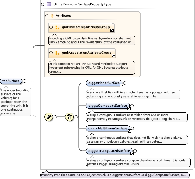
The upper bounding surface of the volume; for a geologic body, thetop of the unit. It is one continuous surface: adiggs:PlanarSurface, a multi-patch diggs:MultiPlanarSurface ordiggs:CompositeSurface (whose patches or members share boundaries, astep being a vertical member), or a diggs:TriangulatedSurface mesh;not a diggs:MultiSurface. It shall extend to or beyond the footprintover the footprint's whole area. The portion outside the footprintis not part of the solid, which allows one authored surface to serveseveral adjacent bodies.
<element name="topSurface" type="diggs:BoundingSurfacePropertyType"><annotation><documentation>The upper bounding surface of the volume; for a geologic body, the top of the unit. It is one continuous surface: a diggs:PlanarSurface, a multi-patch diggs:MultiPlanarSurface or diggs:CompositeSurface (whose patches or members share boundaries, a step being a vertical member), or a diggs:TriangulatedSurface mesh; not a diggs:MultiSurface. It shall extend to or beyond the footprint over the footprint's whole area. The portion outside the footprint is not part of the solid, which allows one authored surface to serve several adjacent bodies.</documentation></annotation></element>
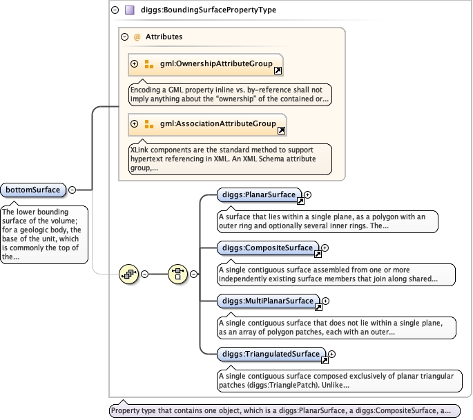
The lower bounding surface of the volume; for a geologic body, thebase of the unit, which is commonly the top of the unit below andmay be the same surface object cited twice by reference. It admitsthe same surfaces as topSurface and is subject to the same coveragerequirement. It may touch or cross topSurface: where it lies at orabove the top the body pinches out and that part of the footprint isempty; see diggs:SurfaceBoundedSolid.
<element name="bottomSurface" type="diggs:BoundingSurfacePropertyType"><annotation><documentation>The lower bounding surface of the volume; for a geologic body, the base of the unit, which is commonly the top of the unit below and may be the same surface object cited twice by reference. It admits the same surfaces as topSurface and is subject to the same coverage requirement. It may touch or cross topSurface: where it lies at or above the top the body pinches out and that part of the footprint is empty; see diggs:SurfaceBoundedSolid.</documentation></annotation></element>
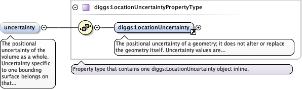
<element minOccurs="0" name="uncertainty" type="diggs:LocationUncertaintyPropertyType"><annotation><documentation>The positional uncertainty of the volume as a whole. Uncertainty specific to one bounding surface belongs on that surface's own uncertainty property.</documentation></annotation></element>
Database handle for the object. It is of XML type ID, so is constrained to beunique in the XML document within which it occurs. An external identifier for the object inthe form of a URI may be constructed using standard XML and XPointer methods. This is doneby concatenating the URI for the document, a fragment separator, and the value of the idattribute.
<complexType name="SurfaceBoundedSolidType"><complexContent><extension base="diggs:AbstractVolumeType"><sequence><element name="footprint" type="diggs:PlanarSurfaceOrMultiSurfacePropertyType"><annotation><documentation>The lateral extent of the volume: one planar polygon (diggs:PlanarSurface) whose boundary is the trace of the vertical sides, or several disjoint polygons (diggs:MultiSurface, each member expected to be a diggs:PlanarSurface) when the plan-view extent is itself disconnected, for instance a geologic unit present as separate unconnected patches. Unlike topSurface and bottomSurface, which are each one continuous surface, the footprint may be a diggs:MultiSurface, because each component is one planar region and walls are erected on each component's own boundary; a MultiSurface footprint over one pair of continuous bounding surfaces yields a separate body for each member. Each component's exterior ring is its outer wall; each interior ring is a hole through the body and generates its own wall. Components shall not overlap in plan view. The footprint is normally horizontal and authored as a plan-view polygon, but the content model does not require it. Elevation carried by the footprint's coordinates is not the volume's top or bottom: the footprint supplies (x, y) only, and the bounding surfaces supply elevation.</documentation></annotation></element><element name="topSurface" type="diggs:BoundingSurfacePropertyType"><annotation><documentation>The upper bounding surface of the volume; for a geologic body, the top of the unit. It is one continuous surface: a diggs:PlanarSurface, a multi-patch diggs:MultiPlanarSurface or diggs:CompositeSurface (whose patches or members share boundaries, a step being a vertical member), or a diggs:TriangulatedSurface mesh; not a diggs:MultiSurface. It shall extend to or beyond the footprint over the footprint's whole area. The portion outside the footprint is not part of the solid, which allows one authored surface to serve several adjacent bodies.</documentation></annotation></element><element name="bottomSurface" type="diggs:BoundingSurfacePropertyType"><annotation><documentation>The lower bounding surface of the volume; for a geologic body, the base of the unit, which is commonly the top of the unit below and may be the same surface object cited twice by reference. It admits the same surfaces as topSurface and is subject to the same coverage requirement. It may touch or cross topSurface: where it lies at or above the top the body pinches out and that part of the footprint is empty; see diggs:SurfaceBoundedSolid.</documentation></annotation></element><element minOccurs="0" name="uncertainty" type="diggs:LocationUncertaintyPropertyType"><annotation><documentation>The positional uncertainty of the volume as a whole. Uncertainty specific to one bounding surface belongs on that surface's own uncertainty property.</documentation></annotation></element></sequence></extension></complexContent></complexType>