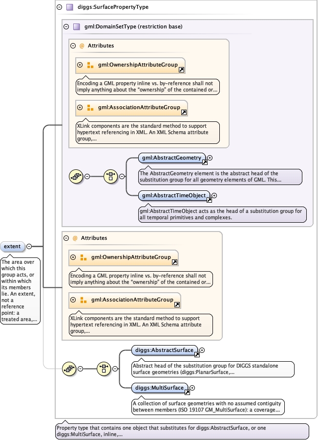
The area over which this group acts, or within which its memberslie. An extent, not a reference point: a treated area, a monitoringnetwork or a paired investigation has no single meaningful position.Optional, because a group need not be spatially delimited; aborehole/CPT pair, for example, is defined by the proximity of itstwo members. Two-dimensional; elevation is not meaningful for agroup extent. Where a concrete group also carries a scalar area, thegeometry prevails. May be given inline or by reference (xlink:href).A group extent and a member's featureExtent are not the same thingby default: a group's members often lie outside the area the groupis about, for example exploratory boreholes drilled beyond a treatedfootprint. Where the two genuinely coincide, give the polygon onceand reference it from the other rather than writing the samecoordinates twice. See diggs:featureExtent.
<element minOccurs="0" name="extent" type="diggs:SurfacePropertyType"><annotation><documentation>The area over which this group acts, or within which its members lie. An extent, not a reference point: a treated area, a monitoring network or a paired investigation has no single meaningful position. Optional, because a group need not be spatially delimited; a borehole/CPT pair, for example, is defined by the proximity of its two members. Two-dimensional; elevation is not meaningful for a group extent. Where a concrete group also carries a scalar area, the geometry prevails. May be given inline or by reference (xlink:href). A group extent and a member's featureExtent are not the same thing by default: a group's members often lie outside the area the group is about, for example exploratory boreholes drilled beyond a treated footprint. Where the two genuinely coincide, give the polygon once and reference it from the other rather than writing the same coordinates twice. See diggs:featureExtent.</documentation></annotation></element>
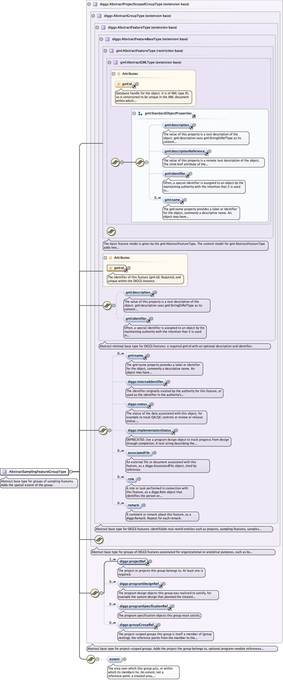
Complex Type diggs:AbstractSamplingFeatureGroupType
Namespace
http://diggsml.org/schemas/3
Annotations
Abstract base type for groups of sampling features. Adds the spatial extent of thegroup.
Database handle for the object. It is of XML type ID, so is constrained to beunique in the XML document within which it occurs. An external identifier for the object inthe form of a URI may be constructed using standard XML and XPointer methods. This is doneby concatenating the URI for the document, a fragment separator, and the value of the idattribute.
Source
<complexType name="AbstractSamplingFeatureGroupType" abstract="true"><annotation><documentation>Abstract base type for groups of sampling features. Adds the spatial extent of the group.</documentation></annotation><complexContent><extension base="diggs:AbstractProjectScopedGroupType"><sequence><element minOccurs="0" name="extent" type="diggs:SurfacePropertyType"><annotation><documentation>The area over which this group acts, or within which its members lie. An extent, not a reference point: a treated area, a monitoring network or a paired investigation has no single meaningful position. Optional, because a group need not be spatially delimited; a borehole/CPT pair, for example, is defined by the proximity of its two members. Two-dimensional; elevation is not meaningful for a group extent. Where a concrete group also carries a scalar area, the geometry prevails. May be given inline or by reference (xlink:href). A group extent and a member's featureExtent are not the same thing by default: a group's members often lie outside the area the group is about, for example exploratory boreholes drilled beyond a treated footprint. Where the two genuinely coincide, give the polygon once and reference it from the other rather than writing the same coordinates twice. See diggs:featureExtent.</documentation></annotation></element></sequence></extension></complexContent></complexType>