Showing:

Annotations
Attributes
Diagrams
Instances
Model
Properties
Source
Used by
Element diggs:AbstractPileType / diggs:whenInstalled
Namespace http://diggsml.org/schemas/3
Annotations
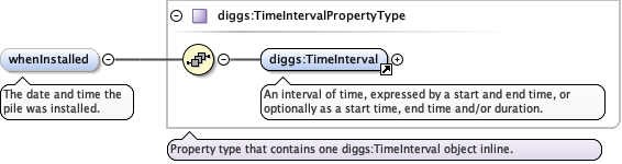
The date and time the pile was installed.
Diagram
DiagramCommon_xsd_Element_diggs_TimeInterval.tmp#TimeIntervalCommon_xsd_Complex_Type_diggs_TimeIntervalPropertyType.tmp#TimeIntervalPropertyType
Type diggs:TimeIntervalPropertyType
Properties
content complex
minOccurs 0
Model
Children diggs:TimeInterval
Instance
<diggs:whenInstalled xmlns:diggs="http://diggsml.org/schemas/3">
  <diggs:TimeInterval gml:id="">{1,1}</diggs:TimeInterval>
</diggs:whenInstalled>
Source
<element minOccurs="0" name="whenInstalled" type="diggs:TimeIntervalPropertyType">
  <annotation>
    <documentation>The date and time the pile was installed.</documentation>
  </annotation>
</element>
Element diggs:AbstractPileType / diggs:referenceElevation
Namespace http://diggsml.org/schemas/3
Annotations
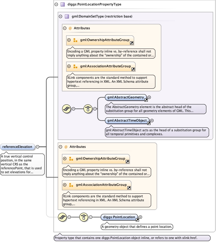
A true vertical control position, in the same vertical CRS as the
referencePoint, that is used to set elevations for the structural elements, and not
the top of the piling. This property is used when groundSurfaceElevation is not used
as the reference elevation.
                                
An elevation is a position, not a length. The value may be given as a
one-dimensional position in a vertical CRS, as a one-dimensional position in this
pile's own linear referencing system, or as a full three-dimensional position;
srsName on the PointLocation states which, and overrides the referencePoint default
above. Populate uomLabels so that a consumer can read the unit without resolving the
CRS.
Diagram
Diagramgml3_2Profile_diggs_xsd_Attribute_Group_gml_OwnershipAttributeGroup.tmp#OwnershipAttributeGroupgml3_2Profile_diggs_xsd_Attribute_Group_gml_AssociationAttributeGroup.tmp#AssociationAttributeGroupgml3_2Profile_diggs_xsd_Element_gml_AbstractGeometry.tmp#AbstractGeometrygml3_2Profile_diggs_xsd_Element_gml_AbstractTimeObject.tmp#AbstractTimeObjectgml3_2Profile_diggs_xsd_Complex_Type_gml_DomainSetType.tmp#DomainSetTypegml3_2Profile_diggs_xsd_Attribute_Group_gml_OwnershipAttributeGroup.tmp#OwnershipAttributeGroupgml3_2Profile_diggs_xsd_Attribute_Group_gml_AssociationAttributeGroup.tmp#AssociationAttributeGroupCore_xsd_Element_diggs_PointLocation.tmp#PointLocationCore_xsd_Complex_Type_diggs_PointLocationPropertyType.tmp#PointLocationPropertyType
Type diggs:PointLocationPropertyType
Type hierarchy
Properties
content complex
minOccurs 0
Model
Children diggs:PointLocation
Instance
<diggs:referenceElevation owns="false" xlink:href="" nilReason="" xmlns:diggs="http://diggsml.org/schemas/3">
  <diggs:PointLocation axisLabels="" gml:id="" srsDimension="" srsName="" uomLabels="">{1,1}</diggs:PointLocation>
</diggs:referenceElevation>
Attributes
QName Type Default Use
nilReason gml:NilReasonType optional
owns boolean false optional
xlink:href anyURI optional
Source
<element minOccurs="0" name="referenceElevation" type="diggs:PointLocationPropertyType">
  <annotation>
    <documentation>A true vertical control position, in the same vertical CRS as the referencePoint, that is used to set elevations for the structural elements, and not the top of the piling. This property is used when groundSurfaceElevation is not used as the reference elevation. An elevation is a position, not a length. The value may be given as a one-dimensional position in a vertical CRS, as a one-dimensional position in this pile's own linear referencing system, or as a full three-dimensional position; srsName on the PointLocation states which, and overrides the referencePoint default above. Populate uomLabels so that a consumer can read the unit without resolving the CRS.</documentation>
  </annotation>
</element>
Element diggs:AbstractPileType / diggs:groundSurfaceElevation
Namespace http://diggsml.org/schemas/3
Annotations
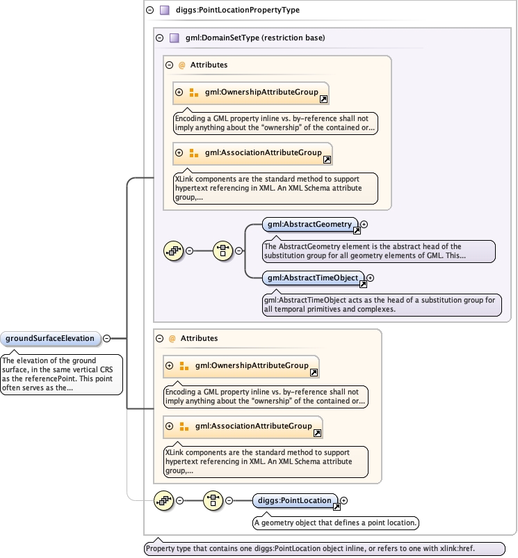
The elevation of the ground surface, in the same vertical CRS as the
referencePoint. This point often serves as the pile's reference elevation.
                                
An elevation is a position, not a length - see referenceElevation for the frame
options and the uomLabels guidance. Optional: this value duplicates information the
geometry may already carry, and a duplicate cannot be mandatory. It was
minOccurs="1" before this change.
Diagram
Diagramgml3_2Profile_diggs_xsd_Attribute_Group_gml_OwnershipAttributeGroup.tmp#OwnershipAttributeGroupgml3_2Profile_diggs_xsd_Attribute_Group_gml_AssociationAttributeGroup.tmp#AssociationAttributeGroupgml3_2Profile_diggs_xsd_Element_gml_AbstractGeometry.tmp#AbstractGeometrygml3_2Profile_diggs_xsd_Element_gml_AbstractTimeObject.tmp#AbstractTimeObjectgml3_2Profile_diggs_xsd_Complex_Type_gml_DomainSetType.tmp#DomainSetTypegml3_2Profile_diggs_xsd_Attribute_Group_gml_OwnershipAttributeGroup.tmp#OwnershipAttributeGroupgml3_2Profile_diggs_xsd_Attribute_Group_gml_AssociationAttributeGroup.tmp#AssociationAttributeGroupCore_xsd_Element_diggs_PointLocation.tmp#PointLocationCore_xsd_Complex_Type_diggs_PointLocationPropertyType.tmp#PointLocationPropertyType
Type diggs:PointLocationPropertyType
Type hierarchy
Properties
content complex
minOccurs 0
Model
Children diggs:PointLocation
Instance
<diggs:groundSurfaceElevation owns="false" xlink:href="" nilReason="" xmlns:diggs="http://diggsml.org/schemas/3">
  <diggs:PointLocation axisLabels="" gml:id="" srsDimension="" srsName="" uomLabels="">{1,1}</diggs:PointLocation>
</diggs:groundSurfaceElevation>
Attributes
QName Type Default Use
nilReason gml:NilReasonType optional
owns boolean false optional
xlink:href anyURI optional
Source
<element minOccurs="0" name="groundSurfaceElevation" type="diggs:PointLocationPropertyType">
  <annotation>
    <documentation>The elevation of the ground surface, in the same vertical CRS as the referencePoint. This point often serves as the pile's reference elevation. An elevation is a position, not a length - see referenceElevation for the frame options and the uomLabels guidance. Optional: this value duplicates information the geometry may already carry, and a duplicate cannot be mandatory. It was minOccurs="1" before this change.</documentation>
  </annotation>
</element>
Element diggs:AbstractPileType / diggs:cutoffElevation
Namespace http://diggsml.org/schemas/3
Annotations
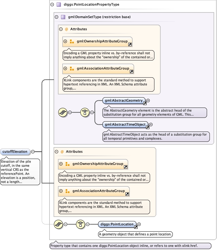
Elevation of the pile cutoff, in the same vertical CRS as the
referencePoint.
                                
An elevation is a position, not a length - see referenceElevation for the frame
options and the uomLabels guidance. WHERE THIS ELEVATION IS EXTRACTABLE FROM THE
GEOMETRY, THE GEOMETRY PREVAILS: the cutoff is the first point of the pile's
centerLine, so this property is a convenience for consumers that do not want to walk
the geometry, and it is optional for that reason. It was minOccurs="1" before this
change.
Diagram
Diagramgml3_2Profile_diggs_xsd_Attribute_Group_gml_OwnershipAttributeGroup.tmp#OwnershipAttributeGroupgml3_2Profile_diggs_xsd_Attribute_Group_gml_AssociationAttributeGroup.tmp#AssociationAttributeGroupgml3_2Profile_diggs_xsd_Element_gml_AbstractGeometry.tmp#AbstractGeometrygml3_2Profile_diggs_xsd_Element_gml_AbstractTimeObject.tmp#AbstractTimeObjectgml3_2Profile_diggs_xsd_Complex_Type_gml_DomainSetType.tmp#DomainSetTypegml3_2Profile_diggs_xsd_Attribute_Group_gml_OwnershipAttributeGroup.tmp#OwnershipAttributeGroupgml3_2Profile_diggs_xsd_Attribute_Group_gml_AssociationAttributeGroup.tmp#AssociationAttributeGroupCore_xsd_Element_diggs_PointLocation.tmp#PointLocationCore_xsd_Complex_Type_diggs_PointLocationPropertyType.tmp#PointLocationPropertyType
Type diggs:PointLocationPropertyType
Type hierarchy
Properties
content complex
minOccurs 0
Model
Children diggs:PointLocation
Instance
<diggs:cutoffElevation owns="false" xlink:href="" nilReason="" xmlns:diggs="http://diggsml.org/schemas/3">
  <diggs:PointLocation axisLabels="" gml:id="" srsDimension="" srsName="" uomLabels="">{1,1}</diggs:PointLocation>
</diggs:cutoffElevation>
Attributes
QName Type Default Use
nilReason gml:NilReasonType optional
owns boolean false optional
xlink:href anyURI optional
Source
<element minOccurs="0" name="cutoffElevation" type="diggs:PointLocationPropertyType">
  <annotation>
    <documentation>Elevation of the pile cutoff, in the same vertical CRS as the referencePoint. An elevation is a position, not a length - see referenceElevation for the frame options and the uomLabels guidance. WHERE THIS ELEVATION IS EXTRACTABLE FROM THE GEOMETRY, THE GEOMETRY PREVAILS: the cutoff is the first point of the pile's centerLine, so this property is a convenience for consumers that do not want to walk the geometry, and it is optional for that reason. It was minOccurs="1" before this change.</documentation>
  </annotation>
</element>
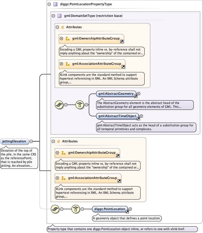
Element diggs:AbstractPileType / diggs:jettingElevation
Namespace http://diggsml.org/schemas/3
Annotations
Elevation of the top of the pile, in the same CRS as the referencePoint,
that is reached by pile jetting.
                                
An elevation is a position, not a length - see referenceElevation for the frame
options and the uomLabels guidance.
Diagram
Diagramgml3_2Profile_diggs_xsd_Attribute_Group_gml_OwnershipAttributeGroup.tmp#OwnershipAttributeGroupgml3_2Profile_diggs_xsd_Attribute_Group_gml_AssociationAttributeGroup.tmp#AssociationAttributeGroupgml3_2Profile_diggs_xsd_Element_gml_AbstractGeometry.tmp#AbstractGeometrygml3_2Profile_diggs_xsd_Element_gml_AbstractTimeObject.tmp#AbstractTimeObjectgml3_2Profile_diggs_xsd_Complex_Type_gml_DomainSetType.tmp#DomainSetTypegml3_2Profile_diggs_xsd_Attribute_Group_gml_OwnershipAttributeGroup.tmp#OwnershipAttributeGroupgml3_2Profile_diggs_xsd_Attribute_Group_gml_AssociationAttributeGroup.tmp#AssociationAttributeGroupCore_xsd_Element_diggs_PointLocation.tmp#PointLocationCore_xsd_Complex_Type_diggs_PointLocationPropertyType.tmp#PointLocationPropertyType
Type diggs:PointLocationPropertyType
Type hierarchy
Properties
content complex
minOccurs 0
Model
Children diggs:PointLocation
Instance
<diggs:jettingElevation owns="false" xlink:href="" nilReason="" xmlns:diggs="http://diggsml.org/schemas/3">
  <diggs:PointLocation axisLabels="" gml:id="" srsDimension="" srsName="" uomLabels="">{1,1}</diggs:PointLocation>
</diggs:jettingElevation>
Attributes
QName Type Default Use
nilReason gml:NilReasonType optional
owns boolean false optional
xlink:href anyURI optional
Source
<element minOccurs="0" name="jettingElevation" type="diggs:PointLocationPropertyType">
  <annotation>
    <documentation>Elevation of the top of the pile, in the same CRS as the referencePoint, that is reached by pile jetting. An elevation is a position, not a length - see referenceElevation for the frame options and the uomLabels guidance.</documentation>
  </annotation>
</element>
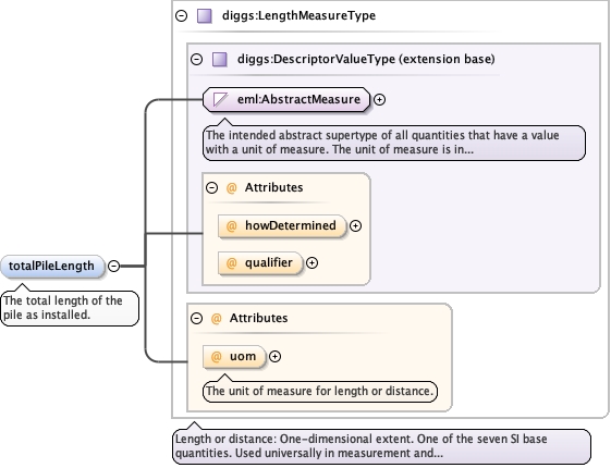
Element diggs:AbstractPileType / diggs:totalPileLength
Namespace http://diggsml.org/schemas/3
Annotations
The total length of the pile as
installed.
Diagram
DiagramEmlAllObjects_xsd_Simple_Type_eml_AbstractMeasure.tmp#AbstractMeasureMeasureTypes_xsd_Complex_Type_diggs_DescriptorValueType.tmp#DescriptorValueType_howDeterminedMeasureTypes_xsd_Complex_Type_diggs_DescriptorValueType.tmp#DescriptorValueType_qualifierMeasureTypes_xsd_Complex_Type_diggs_DescriptorValueType.tmp#DescriptorValueTypeMeasureTypes_xsd_Complex_Type_diggs_LengthMeasureType.tmp#LengthMeasureType_uomMeasureTypes_xsd_Complex_Type_diggs_LengthMeasureType.tmp#LengthMeasureType
Type diggs:LengthMeasureType
Type hierarchy
Properties
content complex
minOccurs 0
Attributes
QName Type Use Annotation
howDetermined diggs:DescriptorMethodEnumType optional
qualifier diggs:QualifierEnumExtType optional
uom diggs:LengthUomEnumType optional
The unit of measure for length or distance.
Source
<element minOccurs="0" name="totalPileLength" type="diggs:LengthMeasureType">
  <annotation>
    <documentation>The total length of the pile as installed.</documentation>
  </annotation>
</element>
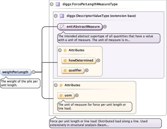
Element diggs:AbstractPileType / diggs:weightPerLength
Namespace http://diggsml.org/schemas/3
Annotations
The weight of the pile per unit length.
Diagram
DiagramEmlAllObjects_xsd_Simple_Type_eml_AbstractMeasure.tmp#AbstractMeasureMeasureTypes_xsd_Complex_Type_diggs_DescriptorValueType.tmp#DescriptorValueType_howDeterminedMeasureTypes_xsd_Complex_Type_diggs_DescriptorValueType.tmp#DescriptorValueType_qualifierMeasureTypes_xsd_Complex_Type_diggs_DescriptorValueType.tmp#DescriptorValueTypeMeasureTypes_xsd_Complex_Type_diggs_ForcePerLengthMeasureType.tmp#ForcePerLengthMeasureType_uomMeasureTypes_xsd_Complex_Type_diggs_ForcePerLengthMeasureType.tmp#ForcePerLengthMeasureType
Type diggs:ForcePerLengthMeasureType
Type hierarchy
Properties
content complex
minOccurs 0
Attributes
QName Type Use Annotation
howDetermined diggs:DescriptorMethodEnumType optional
qualifier diggs:QualifierEnumExtType optional
uom diggs:ForcePerLengthUomEnumType optional
The unit of measure for force per unit length or line load.
Source
<element minOccurs="0" name="weightPerLength" type="diggs:ForcePerLengthMeasureType">
  <annotation>
    <documentation>The weight of the pile per unit length.</documentation>
  </annotation>
</element>
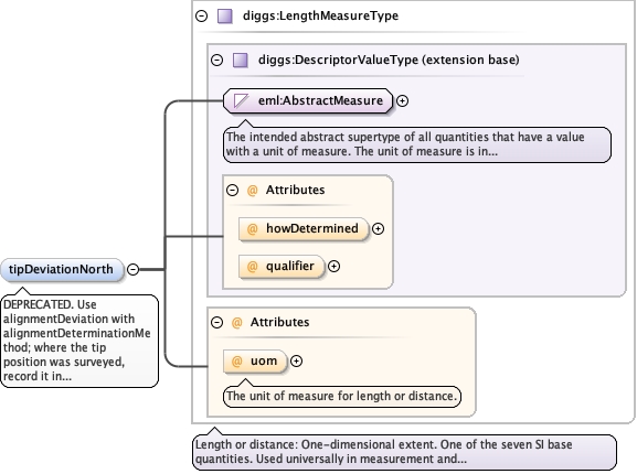
Element diggs:AbstractPileType / diggs:tipDeviationNorth
Namespace http://diggsml.org/schemas/3
Annotations
DEPRECATED. Use alignmentDeviation with
alignmentDeterminationMethod; where the tip position was surveyed,
record it in centerLine. The deviation of the pile tip from the
vertical in the north direction.
Diagram
DiagramEmlAllObjects_xsd_Simple_Type_eml_AbstractMeasure.tmp#AbstractMeasureMeasureTypes_xsd_Complex_Type_diggs_DescriptorValueType.tmp#DescriptorValueType_howDeterminedMeasureTypes_xsd_Complex_Type_diggs_DescriptorValueType.tmp#DescriptorValueType_qualifierMeasureTypes_xsd_Complex_Type_diggs_DescriptorValueType.tmp#DescriptorValueTypeMeasureTypes_xsd_Complex_Type_diggs_LengthMeasureType.tmp#LengthMeasureType_uomMeasureTypes_xsd_Complex_Type_diggs_LengthMeasureType.tmp#LengthMeasureType
Type diggs:LengthMeasureType
Type hierarchy
Properties
content complex
minOccurs 0
Attributes
QName Type Use Annotation
howDetermined diggs:DescriptorMethodEnumType optional
qualifier diggs:QualifierEnumExtType optional
uom diggs:LengthUomEnumType optional
The unit of measure for length or distance.
Source
<element minOccurs="0" name="tipDeviationNorth" type="diggs:LengthMeasureType">
  <annotation>
    <appinfo>
      <diggs:deprecated since="3.1.0" replacedBy="diggs:alignmentDeviation" note="with alignmentDeterminationMethod; where the tip position was surveyed, record it in centerLine"/>
    </appinfo>
    <documentation>DEPRECATED. Use alignmentDeviation with alignmentDeterminationMethod; where the tip position was surveyed, record it in centerLine. The deviation of the pile tip from the vertical in the north direction.</documentation>
  </annotation>
</element>
Element diggs:AbstractPileType / diggs:tipDeviationEast
Namespace http://diggsml.org/schemas/3
Annotations
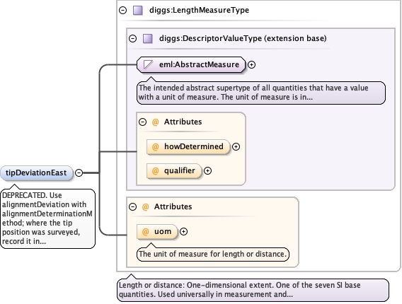
DEPRECATED. Use alignmentDeviation with
alignmentDeterminationMethod; where the tip position was surveyed,
record it in centerLine. The deviation of the pile tip from the
vertical in the east direction.
Diagram
DiagramEmlAllObjects_xsd_Simple_Type_eml_AbstractMeasure.tmp#AbstractMeasureMeasureTypes_xsd_Complex_Type_diggs_DescriptorValueType.tmp#DescriptorValueType_howDeterminedMeasureTypes_xsd_Complex_Type_diggs_DescriptorValueType.tmp#DescriptorValueType_qualifierMeasureTypes_xsd_Complex_Type_diggs_DescriptorValueType.tmp#DescriptorValueTypeMeasureTypes_xsd_Complex_Type_diggs_LengthMeasureType.tmp#LengthMeasureType_uomMeasureTypes_xsd_Complex_Type_diggs_LengthMeasureType.tmp#LengthMeasureType
Type diggs:LengthMeasureType
Type hierarchy
Properties
content complex
minOccurs 0
Attributes
QName Type Use Annotation
howDetermined diggs:DescriptorMethodEnumType optional
qualifier diggs:QualifierEnumExtType optional
uom diggs:LengthUomEnumType optional
The unit of measure for length or distance.
Source
<element minOccurs="0" name="tipDeviationEast" type="diggs:LengthMeasureType">
  <annotation>
    <appinfo>
      <diggs:deprecated since="3.1.0" replacedBy="diggs:alignmentDeviation" note="with alignmentDeterminationMethod; where the tip position was surveyed, record it in centerLine"/>
    </appinfo>
    <documentation>DEPRECATED. Use alignmentDeviation with alignmentDeterminationMethod; where the tip position was surveyed, record it in centerLine. The deviation of the pile tip from the vertical in the east direction.</documentation>
  </annotation>
</element>
Element diggs:AbstractPileType / diggs:lengthAboveGroundSurface
Namespace http://diggsml.org/schemas/3
Annotations
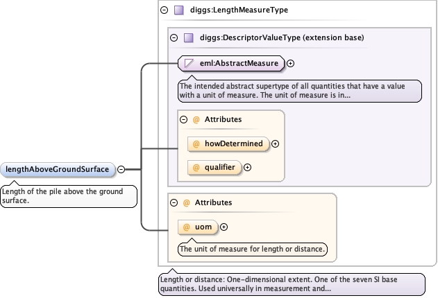
Length of the pile above the ground
surface.
Diagram
DiagramEmlAllObjects_xsd_Simple_Type_eml_AbstractMeasure.tmp#AbstractMeasureMeasureTypes_xsd_Complex_Type_diggs_DescriptorValueType.tmp#DescriptorValueType_howDeterminedMeasureTypes_xsd_Complex_Type_diggs_DescriptorValueType.tmp#DescriptorValueType_qualifierMeasureTypes_xsd_Complex_Type_diggs_DescriptorValueType.tmp#DescriptorValueTypeMeasureTypes_xsd_Complex_Type_diggs_LengthMeasureType.tmp#LengthMeasureType_uomMeasureTypes_xsd_Complex_Type_diggs_LengthMeasureType.tmp#LengthMeasureType
Type diggs:LengthMeasureType
Type hierarchy
Properties
content complex
minOccurs 0
Attributes
QName Type Use Annotation
howDetermined diggs:DescriptorMethodEnumType optional
qualifier diggs:QualifierEnumExtType optional
uom diggs:LengthUomEnumType optional
The unit of measure for length or distance.
Source
<element minOccurs="0" name="lengthAboveGroundSurface" type="diggs:LengthMeasureType">
  <annotation>
    <documentation>Length of the pile above the ground surface.</documentation>
  </annotation>
</element>
Element diggs:AbstractPileType / diggs:lengthBelowGroundSurface
Namespace http://diggsml.org/schemas/3
Annotations
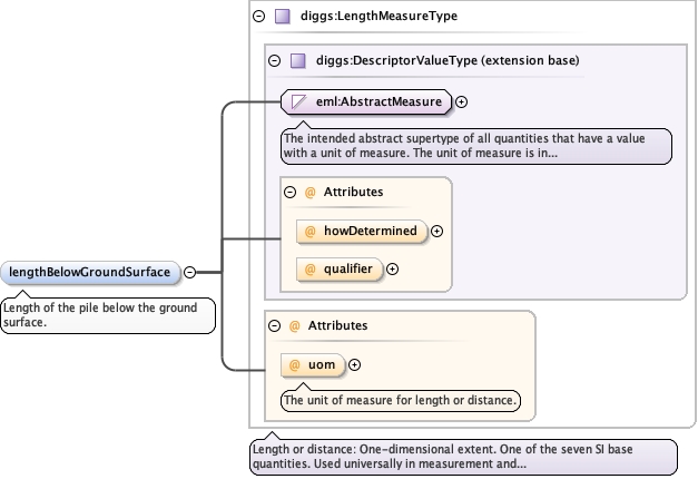
Length of the pile below the ground
surface.
Diagram
DiagramEmlAllObjects_xsd_Simple_Type_eml_AbstractMeasure.tmp#AbstractMeasureMeasureTypes_xsd_Complex_Type_diggs_DescriptorValueType.tmp#DescriptorValueType_howDeterminedMeasureTypes_xsd_Complex_Type_diggs_DescriptorValueType.tmp#DescriptorValueType_qualifierMeasureTypes_xsd_Complex_Type_diggs_DescriptorValueType.tmp#DescriptorValueTypeMeasureTypes_xsd_Complex_Type_diggs_LengthMeasureType.tmp#LengthMeasureType_uomMeasureTypes_xsd_Complex_Type_diggs_LengthMeasureType.tmp#LengthMeasureType
Type diggs:LengthMeasureType
Type hierarchy
Properties
content complex
minOccurs 0
Attributes
QName Type Use Annotation
howDetermined diggs:DescriptorMethodEnumType optional
qualifier diggs:QualifierEnumExtType optional
uom diggs:LengthUomEnumType optional
The unit of measure for length or distance.
Source
<element minOccurs="0" name="lengthBelowGroundSurface" type="diggs:LengthMeasureType">
  <annotation>
    <documentation>Length of the pile below the ground surface.</documentation>
  </annotation>
</element>
Element diggs:AbstractPileType / diggs:lengthNonFriction
Namespace http://diggsml.org/schemas/3
Annotations
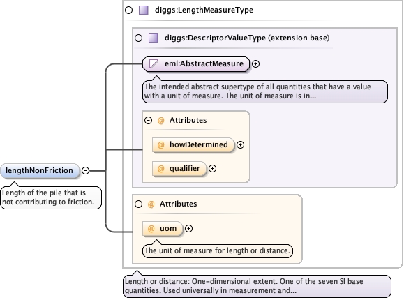
Length of the pile that is not contributing to
friction.
Diagram
DiagramEmlAllObjects_xsd_Simple_Type_eml_AbstractMeasure.tmp#AbstractMeasureMeasureTypes_xsd_Complex_Type_diggs_DescriptorValueType.tmp#DescriptorValueType_howDeterminedMeasureTypes_xsd_Complex_Type_diggs_DescriptorValueType.tmp#DescriptorValueType_qualifierMeasureTypes_xsd_Complex_Type_diggs_DescriptorValueType.tmp#DescriptorValueTypeMeasureTypes_xsd_Complex_Type_diggs_LengthMeasureType.tmp#LengthMeasureType_uomMeasureTypes_xsd_Complex_Type_diggs_LengthMeasureType.tmp#LengthMeasureType
Type diggs:LengthMeasureType
Type hierarchy
Properties
content complex
minOccurs 0
Attributes
QName Type Use Annotation
howDetermined diggs:DescriptorMethodEnumType optional
qualifier diggs:QualifierEnumExtType optional
uom diggs:LengthUomEnumType optional
The unit of measure for length or distance.
Source
<element minOccurs="0" name="lengthNonFriction" type="diggs:LengthMeasureType">
  <annotation>
    <documentation>Length of the pile that is not contributing to friction.</documentation>
  </annotation>
</element>
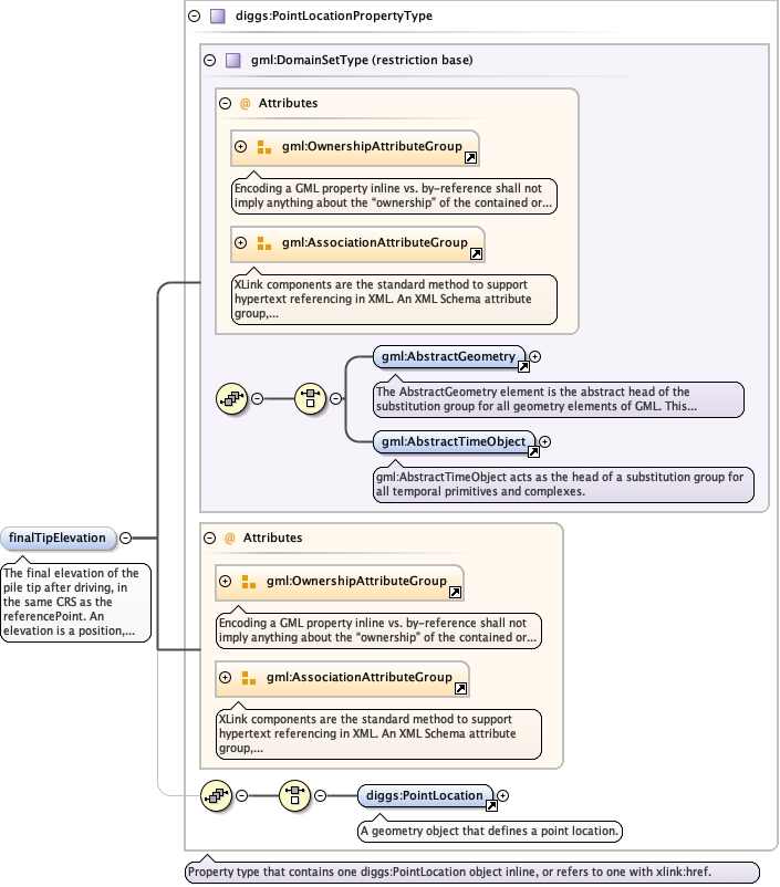
Element diggs:AbstractPileType / diggs:finalTipElevation
Namespace http://diggsml.org/schemas/3
Annotations
The final elevation of the pile tip after driving, in the same CRS as the
referencePoint.
                                
An elevation is a position, not a length - see referenceElevation for the frame
options and the uomLabels guidance. WHERE THIS ELEVATION IS EXTRACTABLE FROM THE
GEOMETRY, THE GEOMETRY PREVAILS: the tip is the last point of the pile's centerLine.
The released PileDrivingExample.xml states -45.25 here against a centerLine tip of
-45.75, which is exactly the disagreement this rule resolves.
Diagram
Diagramgml3_2Profile_diggs_xsd_Attribute_Group_gml_OwnershipAttributeGroup.tmp#OwnershipAttributeGroupgml3_2Profile_diggs_xsd_Attribute_Group_gml_AssociationAttributeGroup.tmp#AssociationAttributeGroupgml3_2Profile_diggs_xsd_Element_gml_AbstractGeometry.tmp#AbstractGeometrygml3_2Profile_diggs_xsd_Element_gml_AbstractTimeObject.tmp#AbstractTimeObjectgml3_2Profile_diggs_xsd_Complex_Type_gml_DomainSetType.tmp#DomainSetTypegml3_2Profile_diggs_xsd_Attribute_Group_gml_OwnershipAttributeGroup.tmp#OwnershipAttributeGroupgml3_2Profile_diggs_xsd_Attribute_Group_gml_AssociationAttributeGroup.tmp#AssociationAttributeGroupCore_xsd_Element_diggs_PointLocation.tmp#PointLocationCore_xsd_Complex_Type_diggs_PointLocationPropertyType.tmp#PointLocationPropertyType
Type diggs:PointLocationPropertyType
Type hierarchy
Properties
content complex
minOccurs 0
maxOccurs 1
Model
Children diggs:PointLocation
Instance
<diggs:finalTipElevation owns="false" xlink:href="" nilReason="" xmlns:diggs="http://diggsml.org/schemas/3">
  <diggs:PointLocation axisLabels="" gml:id="" srsDimension="" srsName="" uomLabels="">{1,1}</diggs:PointLocation>
</diggs:finalTipElevation>
Attributes
QName Type Default Use
nilReason gml:NilReasonType optional
owns boolean false optional
xlink:href anyURI optional
Source
<element form="qualified" maxOccurs="1" minOccurs="0" name="finalTipElevation" type="diggs:PointLocationPropertyType">
  <annotation>
    <documentation>The final elevation of the pile tip after driving, in the same CRS as the referencePoint. An elevation is a position, not a length - see referenceElevation for the frame options and the uomLabels guidance. WHERE THIS ELEVATION IS EXTRACTABLE FROM THE GEOMETRY, THE GEOMETRY PREVAILS: the tip is the last point of the pile's centerLine. The released PileDrivingExample.xml states -45.25 here against a centerLine tip of -45.75, which is exactly the disagreement this rule resolves.</documentation>
  </annotation>
</element>
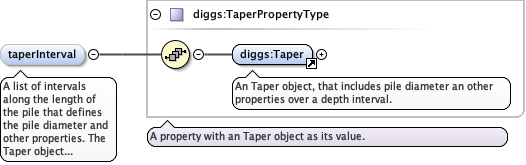
Element diggs:AbstractPileType / diggs:taperInterval
Namespace http://diggsml.org/schemas/3
Annotations
A list of intervals along the length of the pile that
defines the pile diameter and other properties. The Taper object is
used to define the parameters of any kind of pile
taper.
Diagram
DiagramDeepFoundation_xsd_Element_diggs_Taper.tmp#TaperDeepFoundation_xsd_Complex_Type_diggs_TaperPropertyType.tmp#TaperPropertyType
Type diggs:TaperPropertyType
Properties
content complex
minOccurs 0
maxOccurs unbounded
Model
Children diggs:Taper
Instance
<diggs:taperInterval xmlns:diggs="http://diggsml.org/schemas/3">
  <diggs:Taper gml:id="">{1,1}</diggs:Taper>
</diggs:taperInterval>
Source
<element maxOccurs="unbounded" minOccurs="0" name="taperInterval" type="diggs:TaperPropertyType">
  <annotation>
    <documentation>A list of intervals along the length of the pile that defines the pile diameter and other properties. The Taper object is used to define the parameters of any kind of pile taper.</documentation>
  </annotation>
</element>
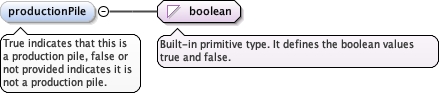
Element diggs:AbstractPileType / diggs:productionPile
Namespace http://diggsml.org/schemas/3
Annotations
True indicates that this is a production pile, false or
not provided indicates it is not a production pile.
Diagram
Diagram
Type boolean
Properties
content simple
minOccurs 0
Source
<element minOccurs="0" name="productionPile" type="boolean">
  <annotation>
    <documentation>True indicates that this is a production pile, false or not provided indicates it is not a production pile.</documentation>
  </annotation>
</element>
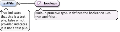
Element diggs:AbstractPileType / diggs:testPile
Namespace http://diggsml.org/schemas/3
Annotations
True indicates that this is a test pile, false or not
provided indicates it is not a test pile.
Diagram
Diagram
Type boolean
Properties
content simple
minOccurs 0
Source
<element minOccurs="0" name="testPile" type="boolean">
  <annotation>
    <documentation>True indicates that this is a test pile, false or not provided indicates it is not a test pile.</documentation>
  </annotation>
</element>
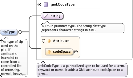
Element diggs:AbstractPileType / diggs:tipType
Namespace http://diggsml.org/schemas/3
Annotations
The type of tip used on the pile, if applicable. Intended
to come from a controlled list of terms (eg. normal, heavy, conical,
etc.)
Diagram
Diagramgml3_2Profile_diggs_xsd_Complex_Type_gml_CodeType.tmp#CodeType_codeSpacegml3_2Profile_diggs_xsd_Complex_Type_gml_CodeType.tmp#CodeType
Type gml:CodeType
Properties
content complex
minOccurs 0
Attributes
QName Type Use
codeSpace anyURI optional
Source
<element minOccurs="0" name="tipType" type="gml:CodeType">
  <annotation>
    <documentation>The type of tip used on the pile, if applicable. Intended to come from a controlled list of terms (eg. normal, heavy, conical, etc.)</documentation>
  </annotation>
</element>
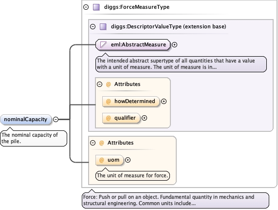
Element diggs:AbstractPileType / diggs:nominalCapacity
Namespace http://diggsml.org/schemas/3
Annotations
The nominal capacity of the pile.
Diagram
DiagramEmlAllObjects_xsd_Simple_Type_eml_AbstractMeasure.tmp#AbstractMeasureMeasureTypes_xsd_Complex_Type_diggs_DescriptorValueType.tmp#DescriptorValueType_howDeterminedMeasureTypes_xsd_Complex_Type_diggs_DescriptorValueType.tmp#DescriptorValueType_qualifierMeasureTypes_xsd_Complex_Type_diggs_DescriptorValueType.tmp#DescriptorValueTypeMeasureTypes_xsd_Complex_Type_diggs_ForceMeasureType.tmp#ForceMeasureType_uomMeasureTypes_xsd_Complex_Type_diggs_ForceMeasureType.tmp#ForceMeasureType
Type diggs:ForceMeasureType
Type hierarchy
Properties
content complex
minOccurs 0
Attributes
QName Type Use Annotation
howDetermined diggs:DescriptorMethodEnumType optional
qualifier diggs:QualifierEnumExtType optional
uom diggs:ForceUomEnumType optional
The unit of measure for force.
Source
<element minOccurs="0" name="nominalCapacity" type="diggs:ForceMeasureType">
  <annotation>
    <documentation>The nominal capacity of the pile.</documentation>
  </annotation>
</element>
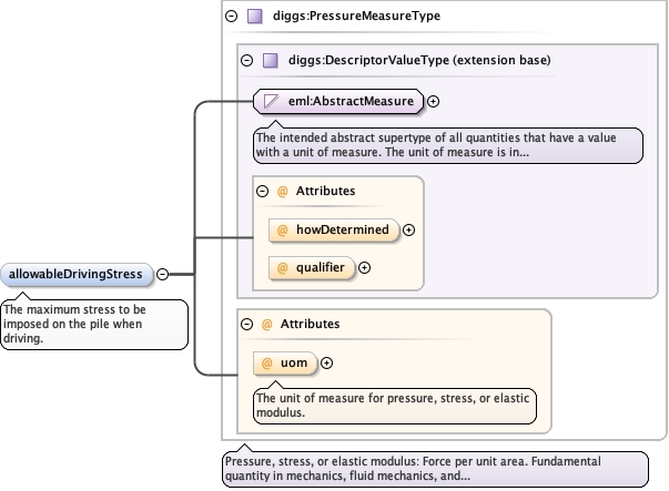
Element diggs:AbstractPileType / diggs:allowableDrivingStress
Namespace http://diggsml.org/schemas/3
Annotations
The maximum stress to be imposed on the pile when
driving.
Diagram
DiagramEmlAllObjects_xsd_Simple_Type_eml_AbstractMeasure.tmp#AbstractMeasureMeasureTypes_xsd_Complex_Type_diggs_DescriptorValueType.tmp#DescriptorValueType_howDeterminedMeasureTypes_xsd_Complex_Type_diggs_DescriptorValueType.tmp#DescriptorValueType_qualifierMeasureTypes_xsd_Complex_Type_diggs_DescriptorValueType.tmp#DescriptorValueTypeMeasureTypes_xsd_Complex_Type_diggs_PressureMeasureType.tmp#PressureMeasureType_uomMeasureTypes_xsd_Complex_Type_diggs_PressureMeasureType.tmp#PressureMeasureType
Type diggs:PressureMeasureType
Type hierarchy
Properties
content complex
minOccurs 0
Attributes
QName Type Use Annotation
howDetermined diggs:DescriptorMethodEnumType optional
qualifier diggs:QualifierEnumExtType optional
uom diggs:PressureUomEnumType optional
The unit of measure for pressure, stress, or elastic modulus.
Source
<element minOccurs="0" name="allowableDrivingStress" type="diggs:PressureMeasureType">
  <annotation>
    <documentation>The maximum stress to be imposed on the pile when driving.</documentation>
  </annotation>
</element>
Complex Type diggs:AbstractPileType
Namespace http://diggsml.org/schemas/3
Annotations
Abstract supertype for all pile types.
Diagram
Diagram
Type extension of diggs:AbstractLinearInstallationType
Type hierarchy
Properties
abstract true
Used by
Model
Children diggs:alignmentDeterminationMethod, diggs:alignmentDeviation, diggs:allowableDrivingStress, diggs:associatedFile, diggs:associatedProjectRef, diggs:bearing, diggs:centerLine, diggs:currentDesign, diggs:cutoffElevation, diggs:environment, diggs:finalTipElevation, diggs:groundSurfaceElevation, diggs:implementationStatus, diggs:installationConstructionEvent, diggs:installationEquipment, diggs:intendedPlunge, diggs:internalIdentifier, diggs:investigationTarget, diggs:jettingElevation, diggs:lengthAboveGroundSurface, diggs:lengthBelowGroundSurface, diggs:lengthNonFriction, diggs:linearReferencing, diggs:localCoordinates, diggs:locality, diggs:nominalCapacity, diggs:originalProjectRef, diggs:otherSamplingFeatureProperty, diggs:plunge, diggs:previousDesign, diggs:productionPile, diggs:programRef, diggs:programSpecificationRef, diggs:projectRef, diggs:realizesGridIndex, diggs:referenceElevation, diggs:referencePoint, diggs:remark, diggs:role, diggs:samplingFeatureGroupRef, diggs:samplingFeatureRef, diggs:status, diggs:taperInterval, diggs:testPile, diggs:tipDeviationEast, diggs:tipDeviationNorth, diggs:tipType, diggs:totalPileLength, diggs:weightPerLength, diggs:whenInstalled, gml:description, gml:identifier, gml:name
Attributes
QName Type Use Annotation
gml:id ID required
Database handle for the object. It is of XML type ID, so is constrained to be
unique in the XML document within which it occurs. An external identifier for the object in
the form of a URI may be constructed using standard XML and XPointer methods. This is done
by concatenating the URI for the document, a fragment separator, and the value of the id
attribute.
Source
<complexType name="AbstractPileType" abstract="true">
  <annotation>
    <documentation>Abstract supertype for all pile types.</documentation>
  </annotation>
  <complexContent>
    <extension base="diggs:AbstractLinearInstallationType">
      <sequence>
        <element minOccurs="0" name="whenInstalled" type="diggs:TimeIntervalPropertyType">
          <annotation>
            <documentation>The date and time the pile was installed.</documentation>
          </annotation>
        </element>
        <element minOccurs="0" name="referenceElevation" type="diggs:PointLocationPropertyType">
          <annotation>
            <documentation>A true vertical control position, in the same vertical CRS as the referencePoint, that is used to set elevations for the structural elements, and not the top of the piling. This property is used when groundSurfaceElevation is not used as the reference elevation. An elevation is a position, not a length. The value may be given as a one-dimensional position in a vertical CRS, as a one-dimensional position in this pile's own linear referencing system, or as a full three-dimensional position; srsName on the PointLocation states which, and overrides the referencePoint default above. Populate uomLabels so that a consumer can read the unit without resolving the CRS.</documentation>
          </annotation>
        </element>
        <element minOccurs="0" name="groundSurfaceElevation" type="diggs:PointLocationPropertyType">
          <annotation>
            <documentation>The elevation of the ground surface, in the same vertical CRS as the referencePoint. This point often serves as the pile's reference elevation. An elevation is a position, not a length - see referenceElevation for the frame options and the uomLabels guidance. Optional: this value duplicates information the geometry may already carry, and a duplicate cannot be mandatory. It was minOccurs="1" before this change.</documentation>
          </annotation>
        </element>
        <element minOccurs="0" name="cutoffElevation" type="diggs:PointLocationPropertyType">
          <annotation>
            <documentation>Elevation of the pile cutoff, in the same vertical CRS as the referencePoint. An elevation is a position, not a length - see referenceElevation for the frame options and the uomLabels guidance. WHERE THIS ELEVATION IS EXTRACTABLE FROM THE GEOMETRY, THE GEOMETRY PREVAILS: the cutoff is the first point of the pile's centerLine, so this property is a convenience for consumers that do not want to walk the geometry, and it is optional for that reason. It was minOccurs="1" before this change.</documentation>
          </annotation>
        </element>
        <element minOccurs="0" name="jettingElevation" type="diggs:PointLocationPropertyType">
          <annotation>
            <documentation>Elevation of the top of the pile, in the same CRS as the referencePoint, that is reached by pile jetting. An elevation is a position, not a length - see referenceElevation for the frame options and the uomLabels guidance.</documentation>
          </annotation>
        </element>
        <element minOccurs="0" name="totalPileLength" type="diggs:LengthMeasureType">
          <annotation>
            <documentation>The total length of the pile as installed.</documentation>
          </annotation>
        </element>
        <element minOccurs="0" name="weightPerLength" type="diggs:ForcePerLengthMeasureType">
          <annotation>
            <documentation>The weight of the pile per unit length.</documentation>
          </annotation>
        </element>
        <element minOccurs="0" name="tipDeviationNorth" type="diggs:LengthMeasureType">
          <annotation>
            <appinfo>
              <diggs:deprecated since="3.1.0" replacedBy="diggs:alignmentDeviation" note="with alignmentDeterminationMethod; where the tip position was surveyed, record it in centerLine"/>
            </appinfo>
            <documentation>DEPRECATED. Use alignmentDeviation with alignmentDeterminationMethod; where the tip position was surveyed, record it in centerLine. The deviation of the pile tip from the vertical in the north direction.</documentation>
          </annotation>
        </element>
        <element minOccurs="0" name="tipDeviationEast" type="diggs:LengthMeasureType">
          <annotation>
            <appinfo>
              <diggs:deprecated since="3.1.0" replacedBy="diggs:alignmentDeviation" note="with alignmentDeterminationMethod; where the tip position was surveyed, record it in centerLine"/>
            </appinfo>
            <documentation>DEPRECATED. Use alignmentDeviation with alignmentDeterminationMethod; where the tip position was surveyed, record it in centerLine. The deviation of the pile tip from the vertical in the east direction.</documentation>
          </annotation>
        </element>
        <element minOccurs="0" name="lengthAboveGroundSurface" type="diggs:LengthMeasureType">
          <annotation>
            <documentation>Length of the pile above the ground surface.</documentation>
          </annotation>
        </element>
        <element minOccurs="0" name="lengthBelowGroundSurface" type="diggs:LengthMeasureType">
          <annotation>
            <documentation>Length of the pile below the ground surface.</documentation>
          </annotation>
        </element>
        <element minOccurs="0" name="lengthNonFriction" type="diggs:LengthMeasureType">
          <annotation>
            <documentation>Length of the pile that is not contributing to friction.</documentation>
          </annotation>
        </element>
        <element form="qualified" maxOccurs="1" minOccurs="0" name="finalTipElevation" type="diggs:PointLocationPropertyType">
          <annotation>
            <documentation>The final elevation of the pile tip after driving, in the same CRS as the referencePoint. An elevation is a position, not a length - see referenceElevation for the frame options and the uomLabels guidance. WHERE THIS ELEVATION IS EXTRACTABLE FROM THE GEOMETRY, THE GEOMETRY PREVAILS: the tip is the last point of the pile's centerLine. The released PileDrivingExample.xml states -45.25 here against a centerLine tip of -45.75, which is exactly the disagreement this rule resolves.</documentation>
          </annotation>
        </element>
        <element maxOccurs="unbounded" minOccurs="0" name="taperInterval" type="diggs:TaperPropertyType">
          <annotation>
            <documentation>A list of intervals along the length of the pile that defines the pile diameter and other properties. The Taper object is used to define the parameters of any kind of pile taper.</documentation>
          </annotation>
        </element>
        <element minOccurs="0" name="productionPile" type="boolean">
          <annotation>
            <documentation>True indicates that this is a production pile, false or not provided indicates it is not a production pile.</documentation>
          </annotation>
        </element>
        <element minOccurs="0" name="testPile" type="boolean">
          <annotation>
            <documentation>True indicates that this is a test pile, false or not provided indicates it is not a test pile.</documentation>
          </annotation>
        </element>
        <element minOccurs="0" name="tipType" type="gml:CodeType">
          <annotation>
            <documentation>The type of tip used on the pile, if applicable. Intended to come from a controlled list of terms (eg. normal, heavy, conical, etc.)</documentation>
          </annotation>
        </element>
        <element minOccurs="0" name="nominalCapacity" type="diggs:ForceMeasureType">
          <annotation>
            <documentation>The nominal capacity of the pile.</documentation>
          </annotation>
        </element>
        <element minOccurs="0" name="allowableDrivingStress" type="diggs:PressureMeasureType">
          <annotation>
            <documentation>The maximum stress to be imposed on the pile when driving.</documentation>
          </annotation>
        </element>
      </sequence>
    </extension>
  </complexContent>
</complexType>