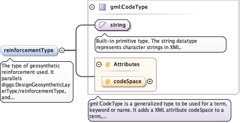
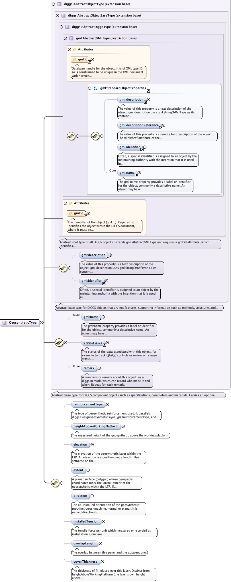
The type of geosynthetic reinforcement used. It parallelsdiggs:DesignGeosyntheticLayerType/reinforcementType, and takes itsvalues from the same list. Use the DIGGS dictionarygeosyntheticReinforcementType.xml for the list of values.
<element minOccurs="0" name="reinforcementType" type="gml:CodeType"><annotation><documentation>The type of geosynthetic reinforcement used. It parallels diggs:DesignGeosyntheticLayerType/reinforcementType, and takes its values from the same list. Use the DIGGS dictionary geosyntheticReinforcementType.xml for the list of values.</documentation></annotation></element>
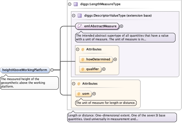
<element maxOccurs="1" minOccurs="0" name="heightAboveWorkingPlatform" type="diggs:LengthMeasureType"><annotation><documentation>The measured height of the geosynthetic above the working platform.</documentation></annotation></element>
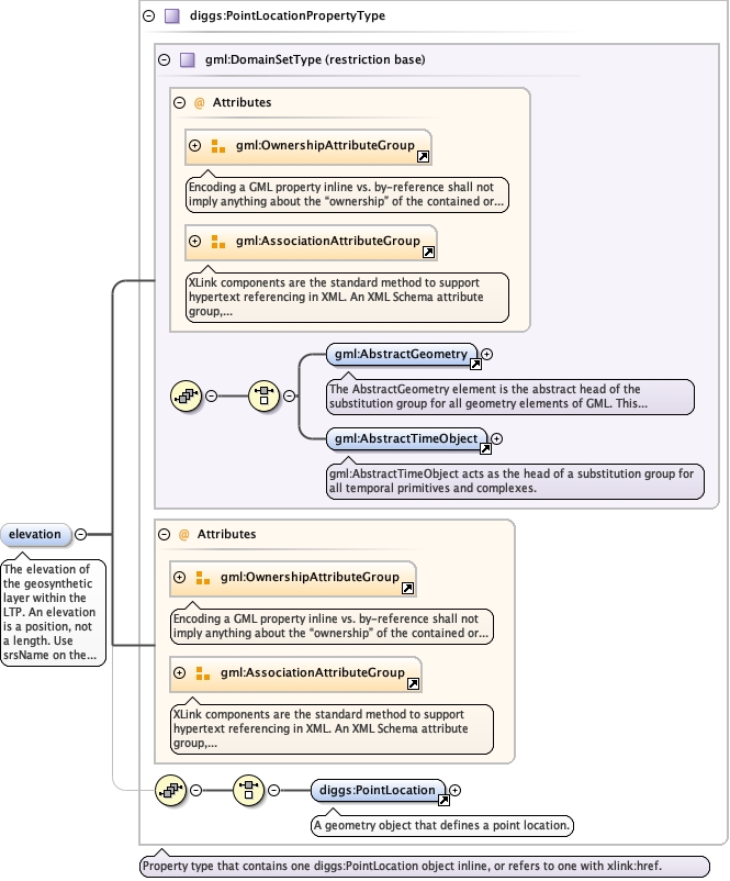
The elevation of the geosynthetic layer within the LTP.

                                An elevation is a position, not a length. Use srsName on the
                                PointLocation to state the vertical CRS, and populate uomLabels so
                                the unit is readable without resolving it. This is a convenience property, only necessary where extent is not reported in a 3D CRS.
<element minOccurs="0" name="elevation" type="diggs:PointLocationPropertyType"><annotation><documentation>The elevation of the geosynthetic layer within the LTP. An elevation is a position, not a length. Use srsName on the PointLocation to state the vertical CRS, and populate uomLabels so the unit is readable without resolving it. This is a convenience property, only necessary where extent is not reported in a 3D CRS.</documentation></annotation></element>
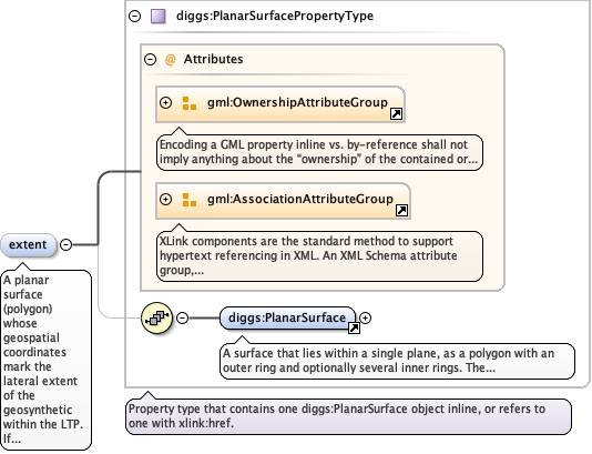
A planar surface (polygon) whose geospatial coordinates mark thelateral extent of the geosynthetic within the LTP. If it is notpresent, the geosynthetic is assumed to extend across the entireLTP.
<element minOccurs="0" name="extent" type="diggs:PlanarSurfacePropertyType"><annotation><documentation>A planar surface (polygon) whose geospatial coordinates mark the lateral extent of the geosynthetic within the LTP. If it is not present, the geosynthetic is assumed to extend across the entire LTP.</documentation></annotation></element>
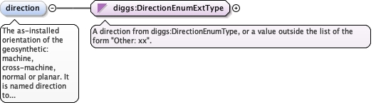
The as-installed orientation of the geosynthetic: machine,cross-machine, normal or planar. It is named direction to matchdiggs:DesignGeosyntheticLayerType/direction, the design counterpartthis value is checked against. Values come from the enumerated list,or "Other: xx", where xx is a user-defined term whose meaningdiffers from every listed value (not a synonym of one).
<element minOccurs="0" name="direction" type="diggs:DirectionEnumExtType"><annotation><documentation>The as-installed orientation of the geosynthetic: machine, cross-machine, normal or planar. It is named direction to match diggs:DesignGeosyntheticLayerType/direction, the design counterpart this value is checked against. Values come from the enumerated list, or "Other: xx", where xx is a user-defined term whose meaning differs from every listed value (not a synonym of one).</documentation></annotation></element>
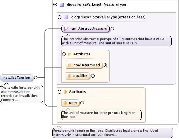
The tensile force per unit width measured or recorded atinstallation. Comparediggs:DesignGeosyntheticLayerType/designTension, the designcounterpart, which is split by load path (arching, lateralspreading); this is the single as-installed value that an inspectionand test plan records, with no load-path split.
The unit of measure for force per unit length or line load.
Source
<element minOccurs="0" name="installedTension" type="diggs:ForcePerLengthMeasureType"><annotation><documentation>The tensile force per unit width measured or recorded at installation. Compare diggs:DesignGeosyntheticLayerType/designTension, the design counterpart, which is split by load path (arching, lateral spreading); this is the single as-installed value that an inspection and test plan records, with no load-path split.</documentation></annotation></element>
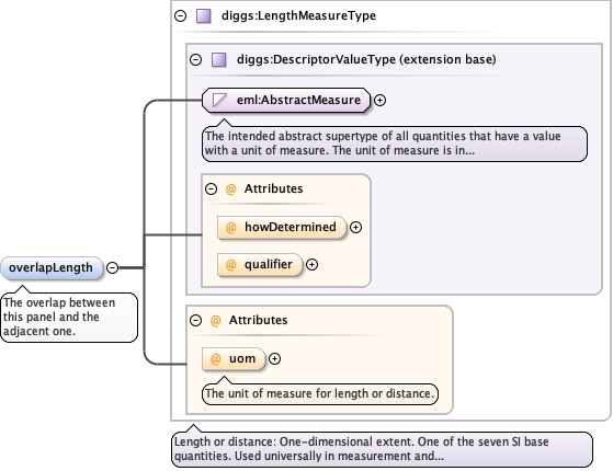
<element minOccurs="0" name="overlapLength" type="diggs:LengthMeasureType"><annotation><documentation>The overlap between this panel and the adjacent one.</documentation></annotation></element>
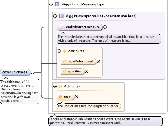
The thickness of fill placed over this layer.Distinct from heightAboveWorkingPlatform (the layer's own heightabove the working platform) and elevation (the layer's absolutelevel): this is the depth of material subsequently placed on top ofit, which neither existing element states.
<element minOccurs="0" name="coverThickness" type="diggs:LengthMeasureType"><annotation><documentation>The thickness of fill placed over this layer. Distinct from heightAboveWorkingPlatform (the layer's own height above the working platform) and elevation (the layer's absolute level): this is the depth of material subsequently placed on top of it, which neither existing element states.</documentation></annotation></element>
Database handle for the object. It is of XML type ID, so is constrained to beunique in the XML document within which it occurs. An external identifier for the object inthe form of a URI may be constructed using standard XML and XPointer methods. This is doneby concatenating the URI for the document, a fragment separator, and the value of the idattribute.
Source
<complexType name="GeosyntheticType"><complexContent><extension base="diggs:AbstractObjectType"><sequence><element minOccurs="0" name="reinforcementType" type="gml:CodeType"><annotation><documentation>The type of geosynthetic reinforcement used. It parallels diggs:DesignGeosyntheticLayerType/reinforcementType, and takes its values from the same list. Use the DIGGS dictionary geosyntheticReinforcementType.xml for the list of values.</documentation></annotation></element><element maxOccurs="1" minOccurs="0" name="heightAboveWorkingPlatform" type="diggs:LengthMeasureType"><annotation><documentation>The measured height of the geosynthetic above the working platform.</documentation></annotation></element><element minOccurs="0" name="elevation" type="diggs:PointLocationPropertyType"><annotation><documentation>The elevation of the geosynthetic layer within the LTP. An elevation is a position, not a length. Use srsName on the PointLocation to state the vertical CRS, and populate uomLabels so the unit is readable without resolving it. This is a convenience property, only necessary where extent is not reported in a 3D CRS.</documentation></annotation></element><element minOccurs="0" name="extent" type="diggs:PlanarSurfacePropertyType"><annotation><documentation>A planar surface (polygon) whose geospatial coordinates mark the lateral extent of the geosynthetic within the LTP. If it is not present, the geosynthetic is assumed to extend across the entire LTP.</documentation></annotation></element><element minOccurs="0" name="direction" type="diggs:DirectionEnumExtType"><annotation><documentation>The as-installed orientation of the geosynthetic: machine, cross-machine, normal or planar. It is named direction to match diggs:DesignGeosyntheticLayerType/direction, the design counterpart this value is checked against. Values come from the enumerated list, or "Other: xx", where xx is a user-defined term whose meaning differs from every listed value (not a synonym of one).</documentation></annotation></element><element minOccurs="0" name="installedTension" type="diggs:ForcePerLengthMeasureType"><annotation><documentation>The tensile force per unit width measured or recorded at installation. Compare diggs:DesignGeosyntheticLayerType/designTension, the design counterpart, which is split by load path (arching, lateral spreading); this is the single as-installed value that an inspection and test plan records, with no load-path split.</documentation></annotation></element><element minOccurs="0" name="overlapLength" type="diggs:LengthMeasureType"><annotation><documentation>The overlap between this panel and the adjacent one.</documentation></annotation></element><element minOccurs="0" name="coverThickness" type="diggs:LengthMeasureType"><annotation><documentation>The thickness of fill placed over this layer. Distinct from heightAboveWorkingPlatform (the layer's own height above the working platform) and elevation (the layer's absolute level): this is the depth of material subsequently placed on top of it, which neither existing element states.</documentation></annotation></element></sequence></extension></complexContent></complexType>