GML Subset schema for,PointPropertyType,CodeType,EngineeringDatum,CoordinateSystemAxis,CurvePropertyType,AbstractGML,AbstractFeature,MultiGeometryPropertyType,MultiPointPropertyType,AssociationAttributeGroup,ReferenceType,EngineeringDatumType,CoordinateSystemAxisType,AbstractGMLType,AbstractFeatureCollectionType,AbstractFeatureType,written by gmlSubset.xslt.
Date 2012-06-29. Further valid restrictions made to this GML 3.2 profile forDIGGS V2.0.a by David S. Burggraf (DSB), Galdos Systems. (look for changes following commentswith the text: 'DSB: restricted from profile'). All profile restrictions were validated inaccordance with GML 3.2 rules (ISO TC 211 19136 (2007), clauses 2.3 and 20). In particular,the DIGGS schemas continue to validate against the full set of GML schemas (tested byreplacing all gml profile imports with the complete GML schema document wrapper,gml.xsd)
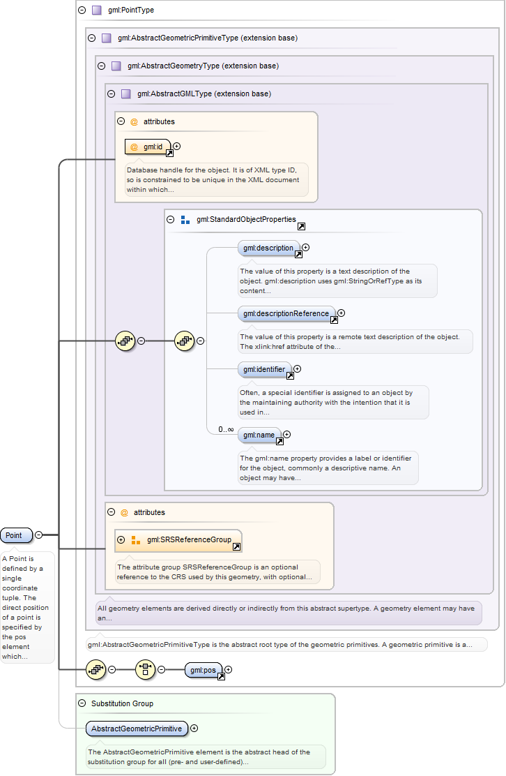
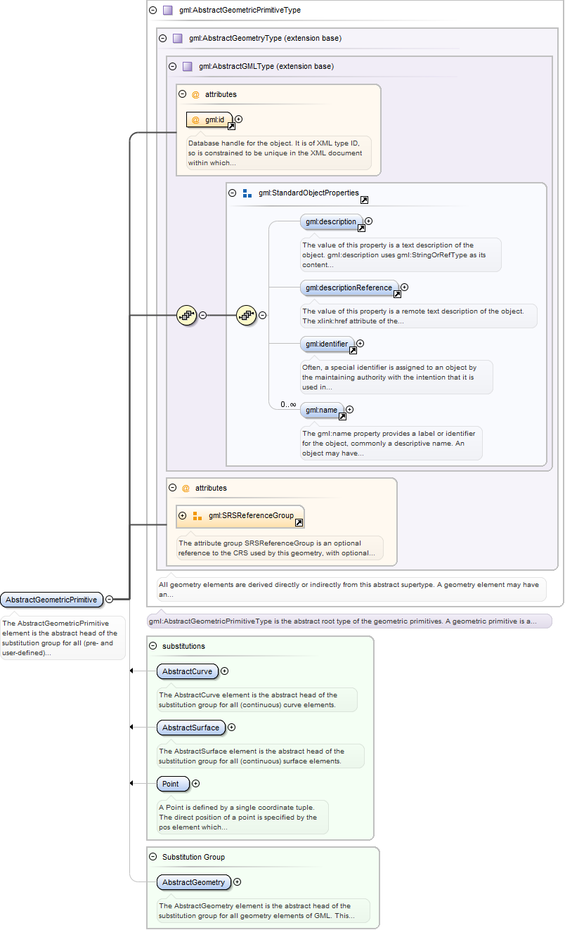
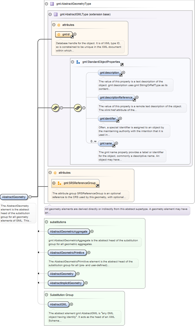
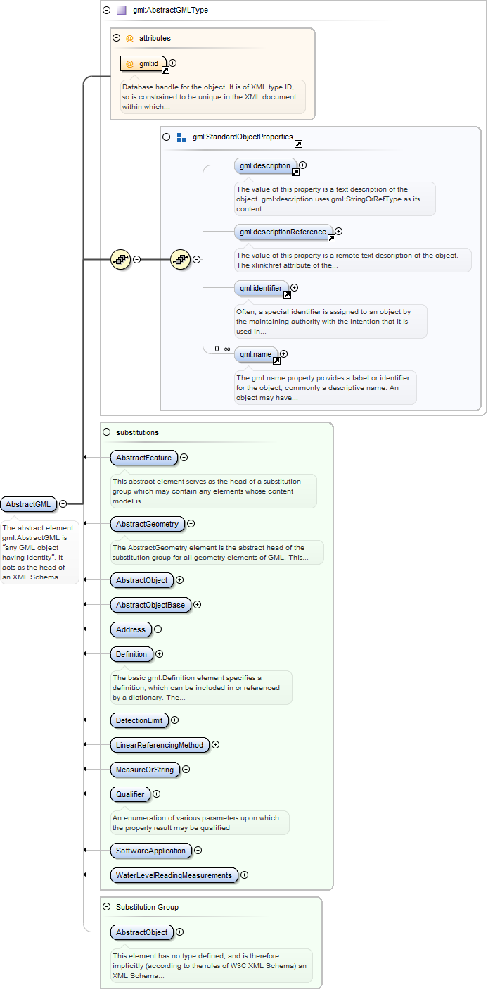
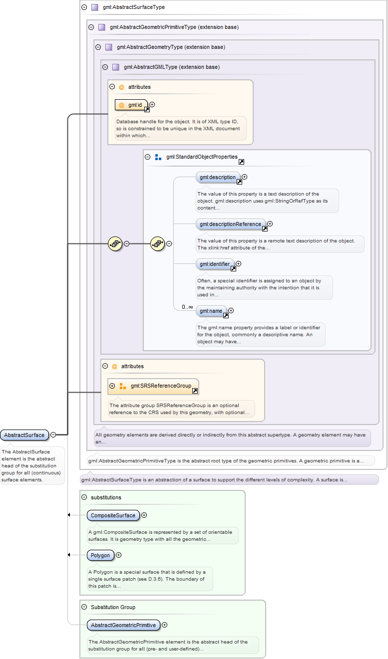
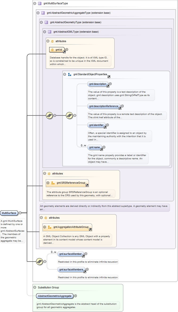
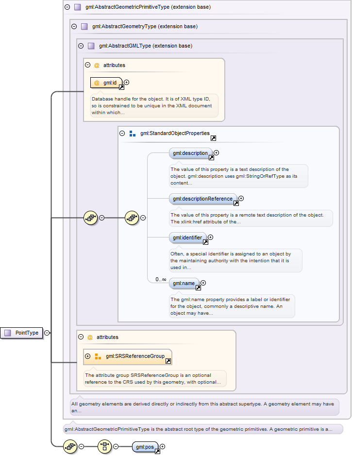
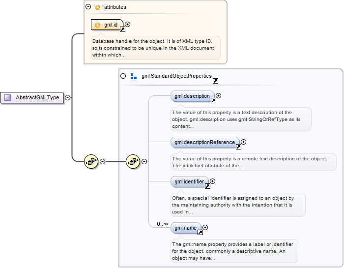
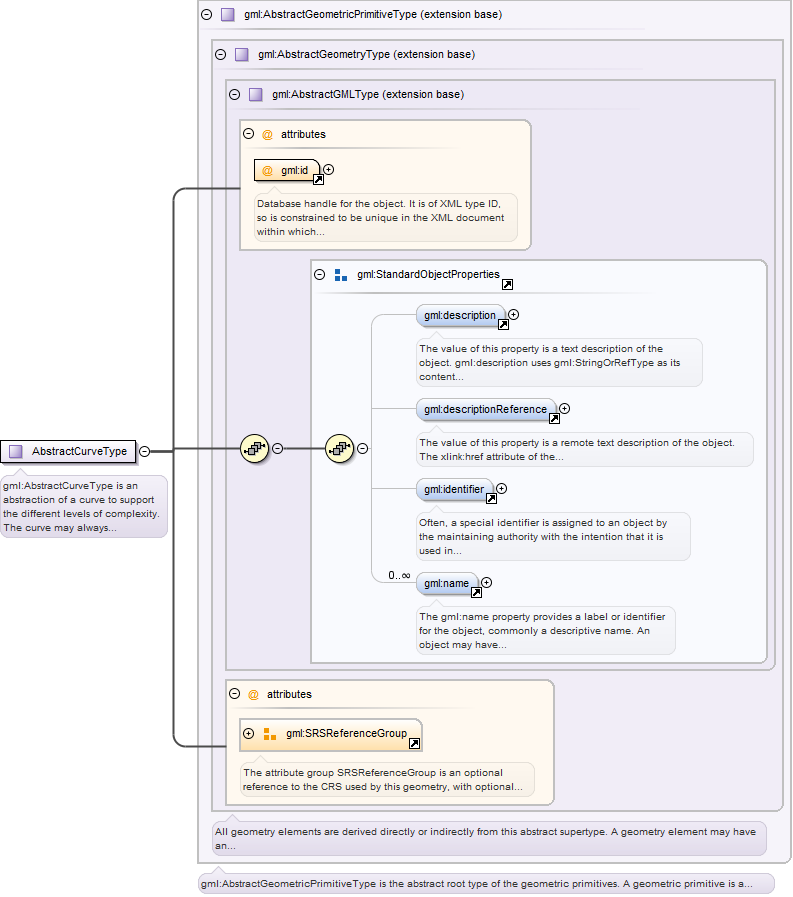
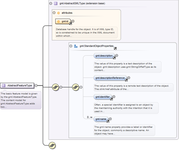
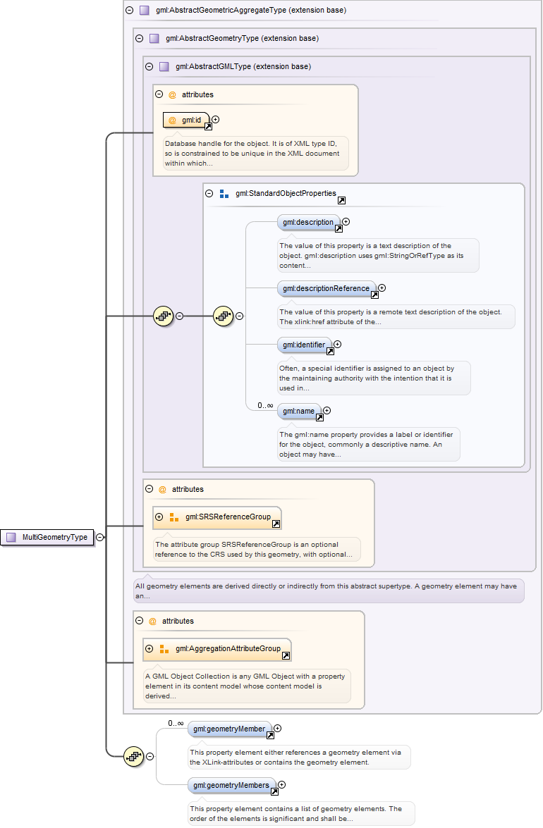
Database handle for the object. It is of XML type ID, so is constrained to beunique in the XML document within which it occurs. An external identifier for the object inthe form of a URI may be constructed using standard XML and XPointer methods. This is doneby concatenating the URI for the document, a fragment separator, and the value of the idattribute.
<element name="Point" type="gml:PointType" substitutionGroup="gml:AbstractGeometricPrimitive"><annotation><documentation>A Point is defined by a single coordinate tuple. The direct position of a point is specified by the pos element which is of type DirectPositionType.</documentation></annotation></element>
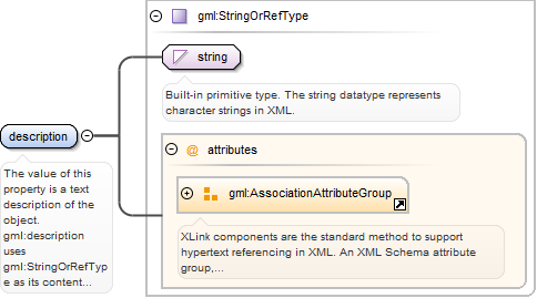
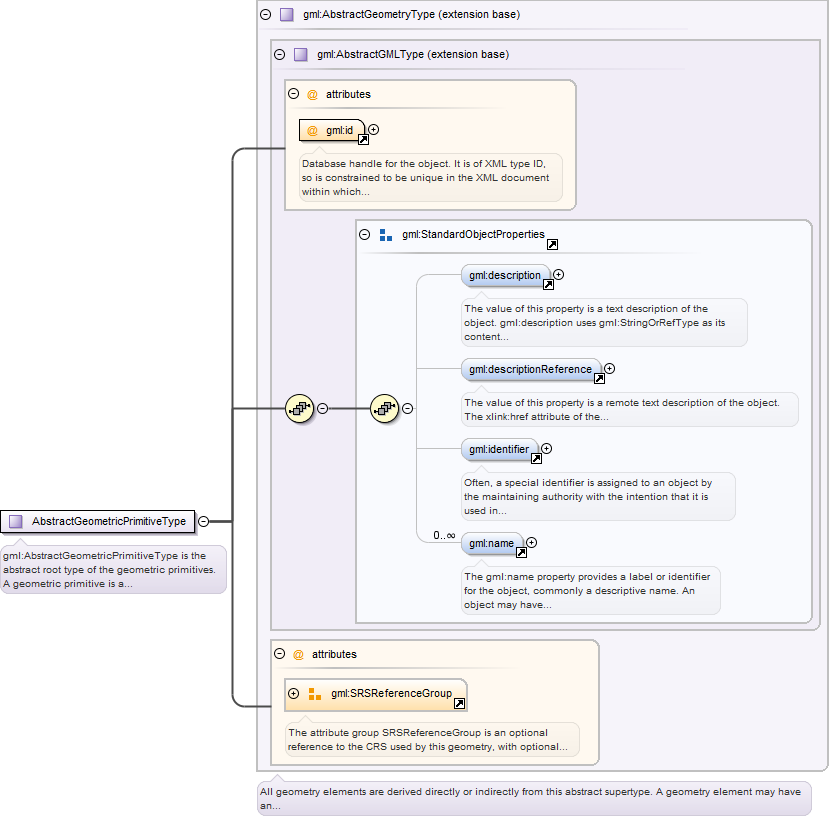
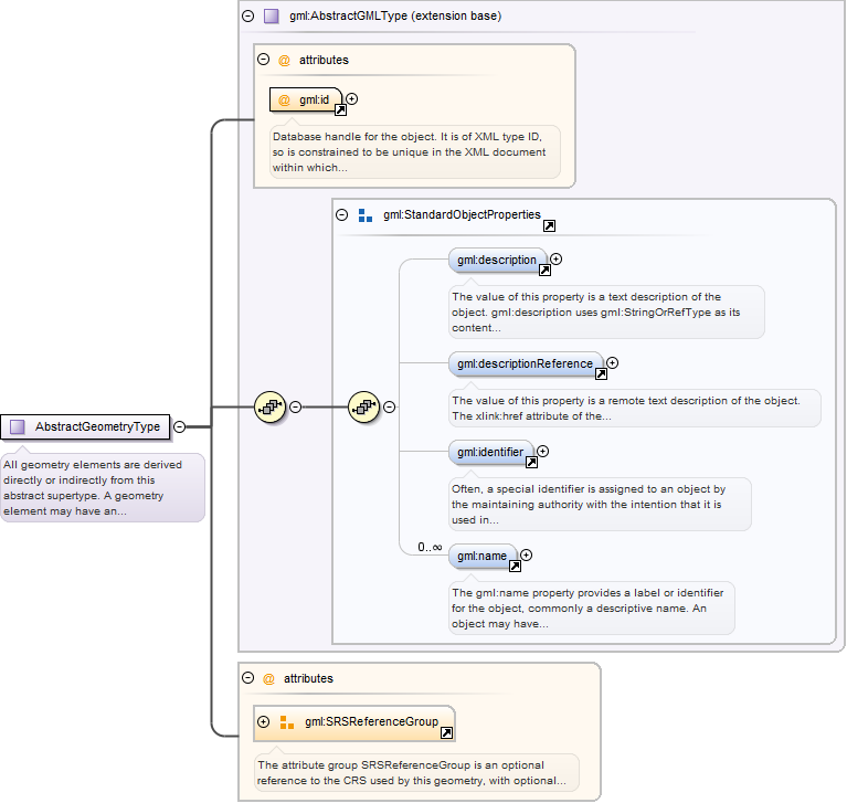
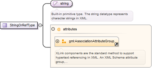
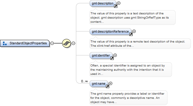
The value of this property is a text description of the object. gml:descriptionuses gml:StringOrRefType as its content model, so it may contain a simple text stringcontent, or carry a reference to an external description. The use of gml:description toreference an external description has been deprecated and replaced by thegml:descriptionReference property.
<element name="description" type="gml:StringOrRefType"><annotation><documentation>The value of this property is a text description of the object. gml:description uses gml:StringOrRefType as its content model, so it may contain a simple text string content, or carry a reference to an external description. The use of gml:description to reference an external description has been deprecated and replaced by the gml:descriptionReference property.</documentation></annotation></element>
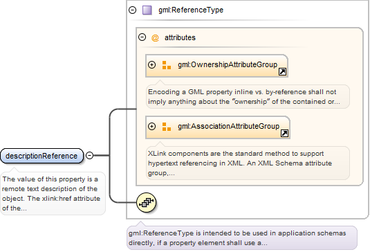
The value of this property is a remote text description of the object. Thexlink:href attribute of the gml:descriptionReference property references the externaldescription.
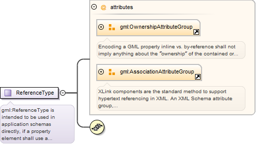
<element name="descriptionReference" type="gml:ReferenceType"><annotation><documentation>The value of this property is a remote text description of the object. The xlink:href attribute of the gml:descriptionReference property references the external description.</documentation></annotation></element>
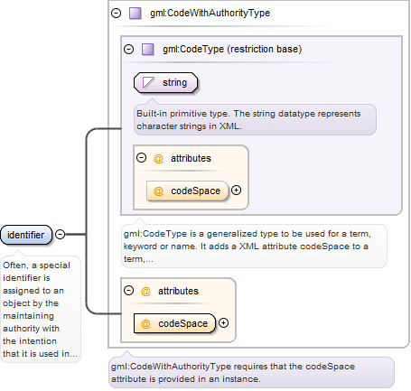
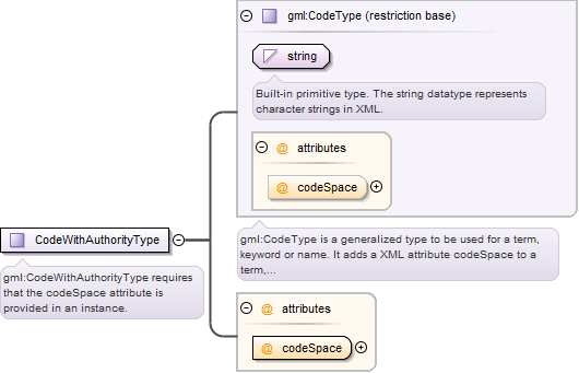
Often, a special identifier is assigned to an object by the maintainingauthority with the intention that it is used in references to the object For such cases, thecodeSpace shall be provided. That identifier is usually unique either globally or within anapplication domain. gml:identifier is a pre-defined property for suchidentifiers.
<element name="identifier" type="gml:CodeWithAuthorityType"><annotation><documentation>Often, a special identifier is assigned to an object by the maintaining authority with the intention that it is used in references to the object For such cases, the codeSpace shall be provided. That identifier is usually unique either globally or within an application domain. gml:identifier is a pre-defined property for such identifiers.</documentation></annotation></element>
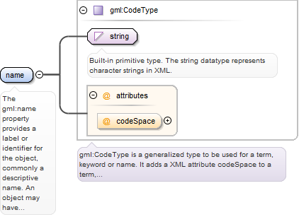
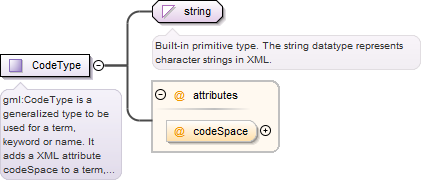
The gml:name property provides a label or identifier for the object, commonly adescriptive name. An object may have several names, typically assigned by differentauthorities. gml:name uses the gml:CodeType content model. The authority for a name isindicated by the value of its (optional) codeSpace attribute. The name may or may not beunique, as determined by the rules of the organization responsible for the codeSpace. Incommon usage there will be one name per authority, so a processing application may selectthe name from its preferred codeSpace.
<element name="name" type="gml:CodeType"><annotation><documentation>The gml:name property provides a label or identifier for the object, commonly a descriptive name. An object may have several names, typically assigned by different authorities. gml:name uses the gml:CodeType content model. The authority for a name is indicated by the value of its (optional) codeSpace attribute. The name may or may not be unique, as determined by the rules of the organization responsible for the codeSpace. In common usage there will be one name per authority, so a processing application may select the name from its preferred codeSpace.</documentation></annotation></element>
Database handle for the object. It is of XML type ID, so is constrained to beunique in the XML document within which it occurs. An external identifier for the object inthe form of a URI may be constructed using standard XML and XPointer methods. This is doneby concatenating the URI for the document, a fragment separator, and the value of the idattribute.
<element name="AbstractGeometricPrimitive" type="gml:AbstractGeometricPrimitiveType" abstract="true" substitutionGroup="gml:AbstractGeometry"><annotation><documentation>The AbstractGeometricPrimitive element is the abstract head of the substitution group for all (pre- and user-defined) geometric primitives.</documentation></annotation></element>
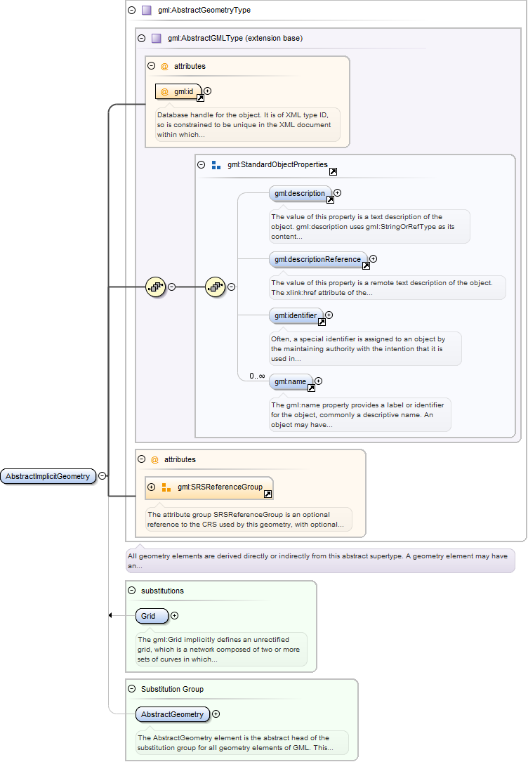
The AbstractGeometry element is the abstract head of the substitution group forall geometry elements of GML. This includes pre-defined and user-defined geometry elements.Any geometry element shall be a direct or indirect extension/restriction ofAbstractGeometryType and shall be directly or indirectly in the substitution group ofAbstractGeometry.
Database handle for the object. It is of XML type ID, so is constrained to beunique in the XML document within which it occurs. An external identifier for the object inthe form of a URI may be constructed using standard XML and XPointer methods. This is doneby concatenating the URI for the document, a fragment separator, and the value of the idattribute.
<element name="AbstractGeometry" type="gml:AbstractGeometryType" abstract="true" substitutionGroup="gml:AbstractGML"><annotation><documentation>The AbstractGeometry element is the abstract head of the substitution group for all geometry elements of GML. This includes pre-defined and user-defined geometry elements. Any geometry element shall be a direct or indirect extension/restriction of AbstractGeometryType and shall be directly or indirectly in the substitution group of AbstractGeometry.</documentation></annotation></element>
The abstract element gml:AbstractGML is “any GML object having identity”. Itacts as the head of an XML Schema substitution group, which may include any element which isa GML feature, or other object, with identity. This is used as a variable in content modelsin GML core and application schemas. It is effectively an abstract superclass for all GMLobjects.
Database handle for the object. It is of XML type ID, so is constrained to beunique in the XML document within which it occurs. An external identifier for the object inthe form of a URI may be constructed using standard XML and XPointer methods. This is doneby concatenating the URI for the document, a fragment separator, and the value of the idattribute.
Source
<element name="AbstractGML" type="gml:AbstractGMLType" abstract="true" substitutionGroup="gml:AbstractObject"><annotation><documentation>The abstract element gml:AbstractGML is “any GML object having identity”. It acts as the head of an XML Schema substitution group, which may include any element which is a GML feature, or other object, with identity. This is used as a variable in content models in GML core and application schemas. It is effectively an abstract superclass for all GML objects.</documentation></annotation></element>
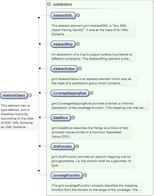
This element has no type defined, and is therefore implicitly (according to therules of W3C XML Schema) an XML Schema anyType. It is used as the head of an XML Schemasubstitution group which unifies complex content and certain simple content elements usedfor datatypes in GML, including the gml:AbstractGML substitution group.
<element name="AbstractObject" abstract="true"><annotation><documentation>This element has no type defined, and is therefore implicitly (according to the rules of W3C XML Schema) an XML Schema anyType. It is used as the head of an XML Schema substitution group which unifies complex content and certain simple content elements used for datatypes in GML, including the gml:AbstractGML substitution group.</documentation></annotation></element>
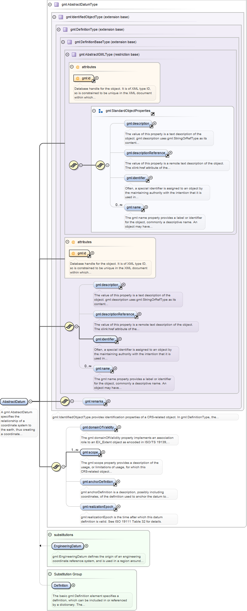
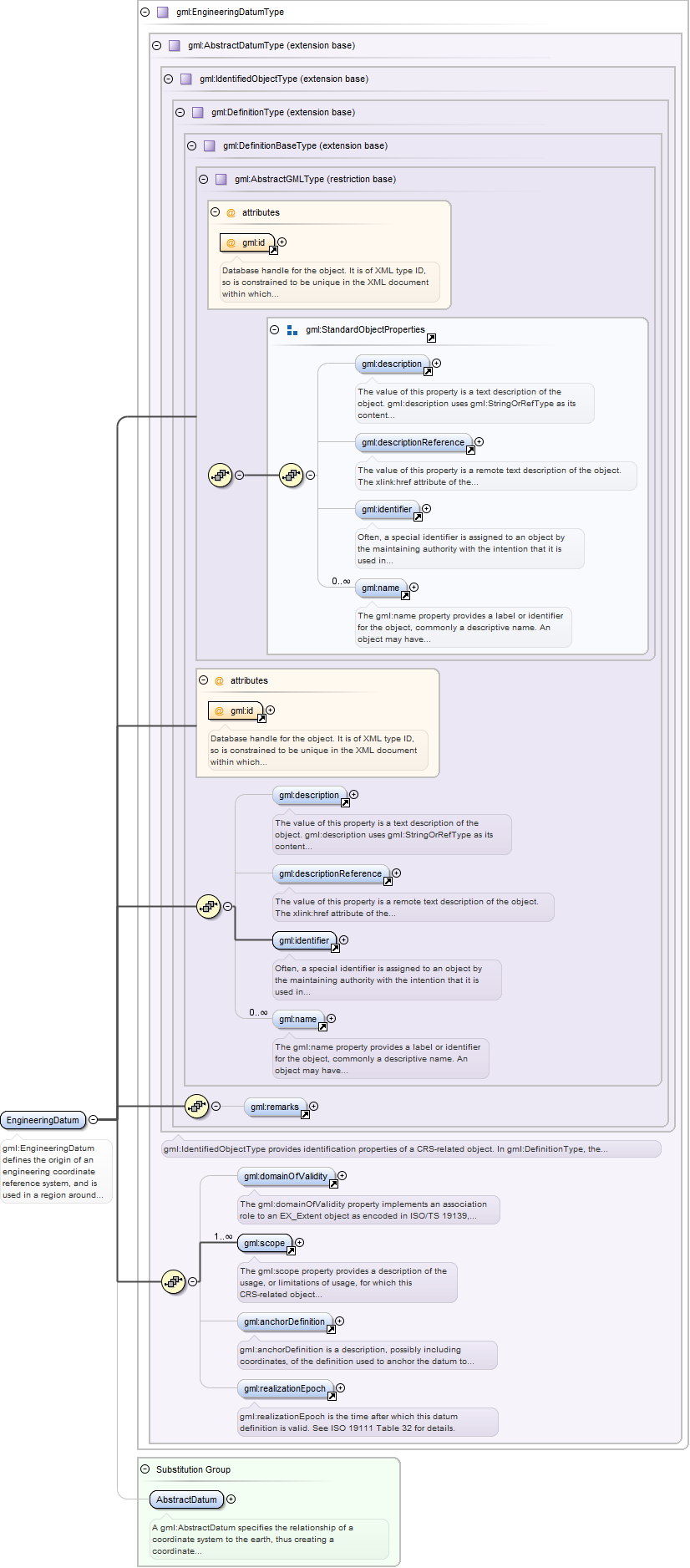
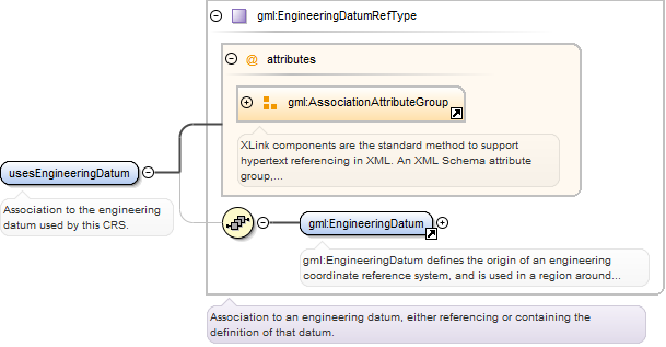
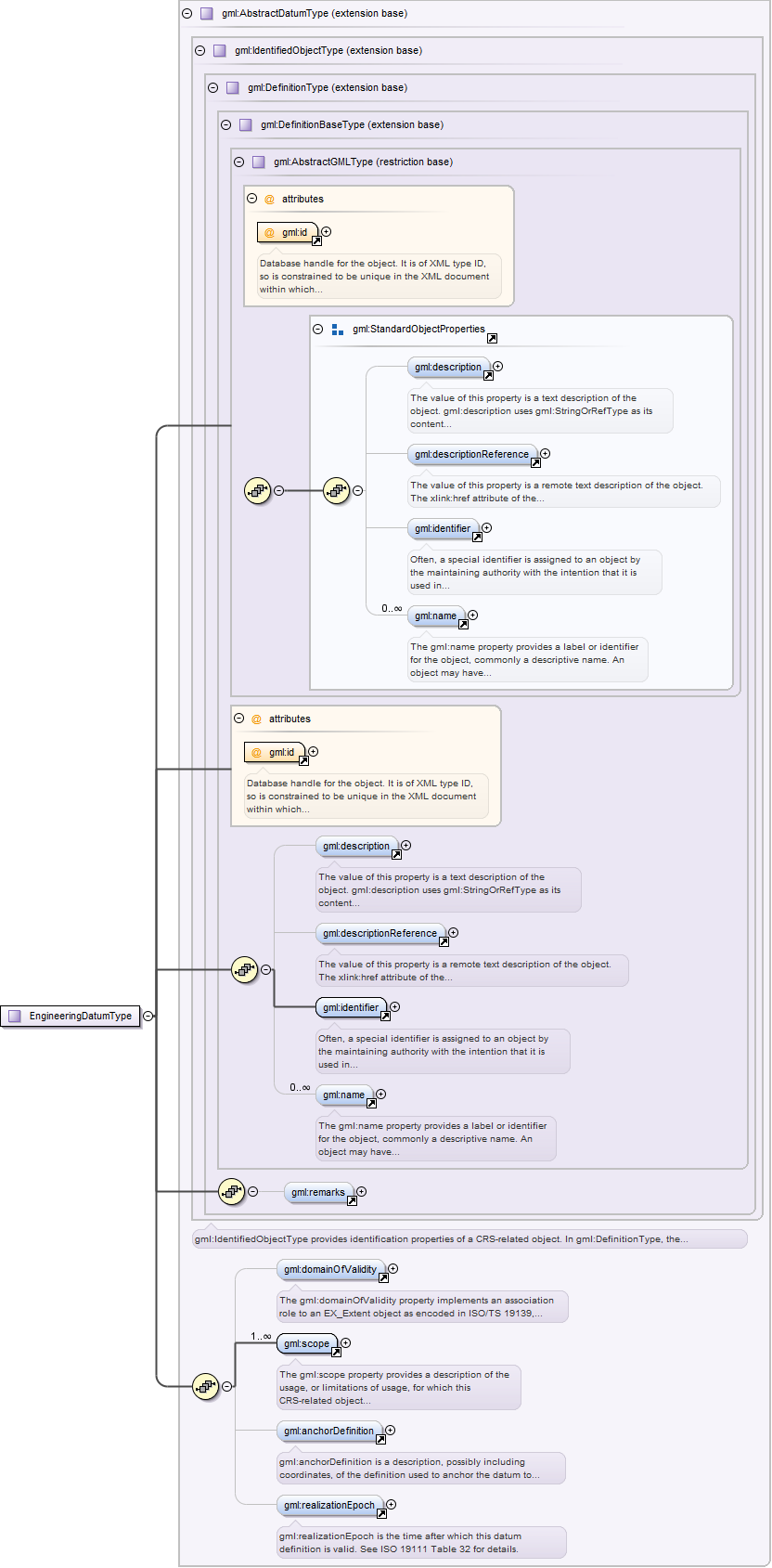
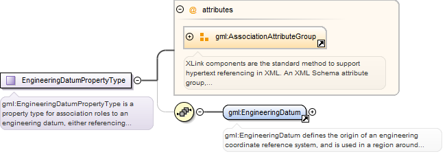
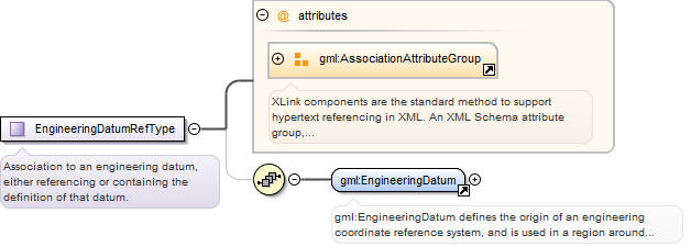
gml:EngineeringDatum defines the origin of an engineering coordinate referencesystem, and is used in a region around that origin. This origin may be fixed with respect tothe earth (such as a defined point at a construction site), or be a defined point on amoving vehicle (such as on a ship or satellite).
Database handle for the object. It is of XML type ID, so is constrained to beunique in the XML document within which it occurs. An external identifier for the object inthe form of a URI may be constructed using standard XML and XPointer methods. This is doneby concatenating the URI for the document, a fragment separator, and the value of the idattribute.
Source
<element name="EngineeringDatum" type="gml:EngineeringDatumType" substitutionGroup="gml:AbstractDatum"><annotation><documentation>gml:EngineeringDatum defines the origin of an engineering coordinate reference system, and is used in a region around that origin. This origin may be fixed with respect to the earth (such as a defined point at a construction site), or be a defined point on a moving vehicle (such as on a ship or satellite).</documentation></annotation></element>
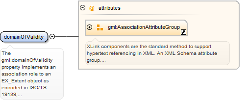
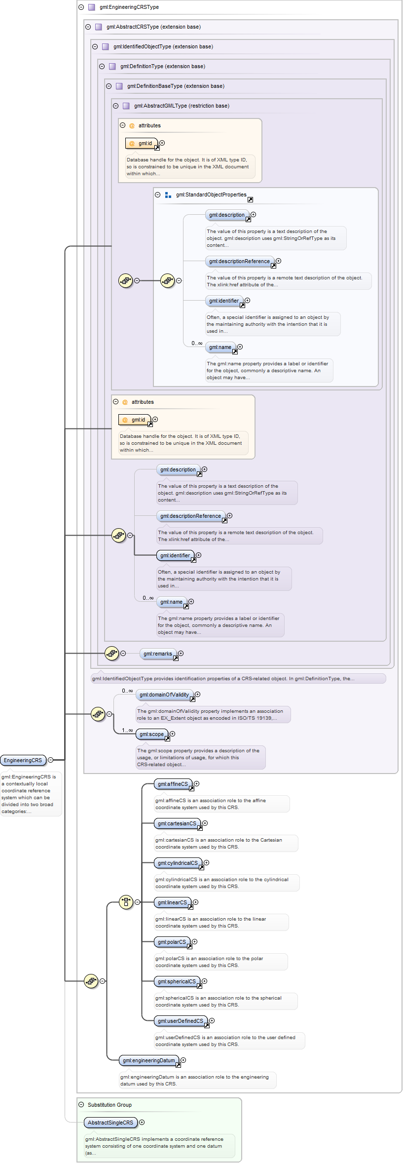
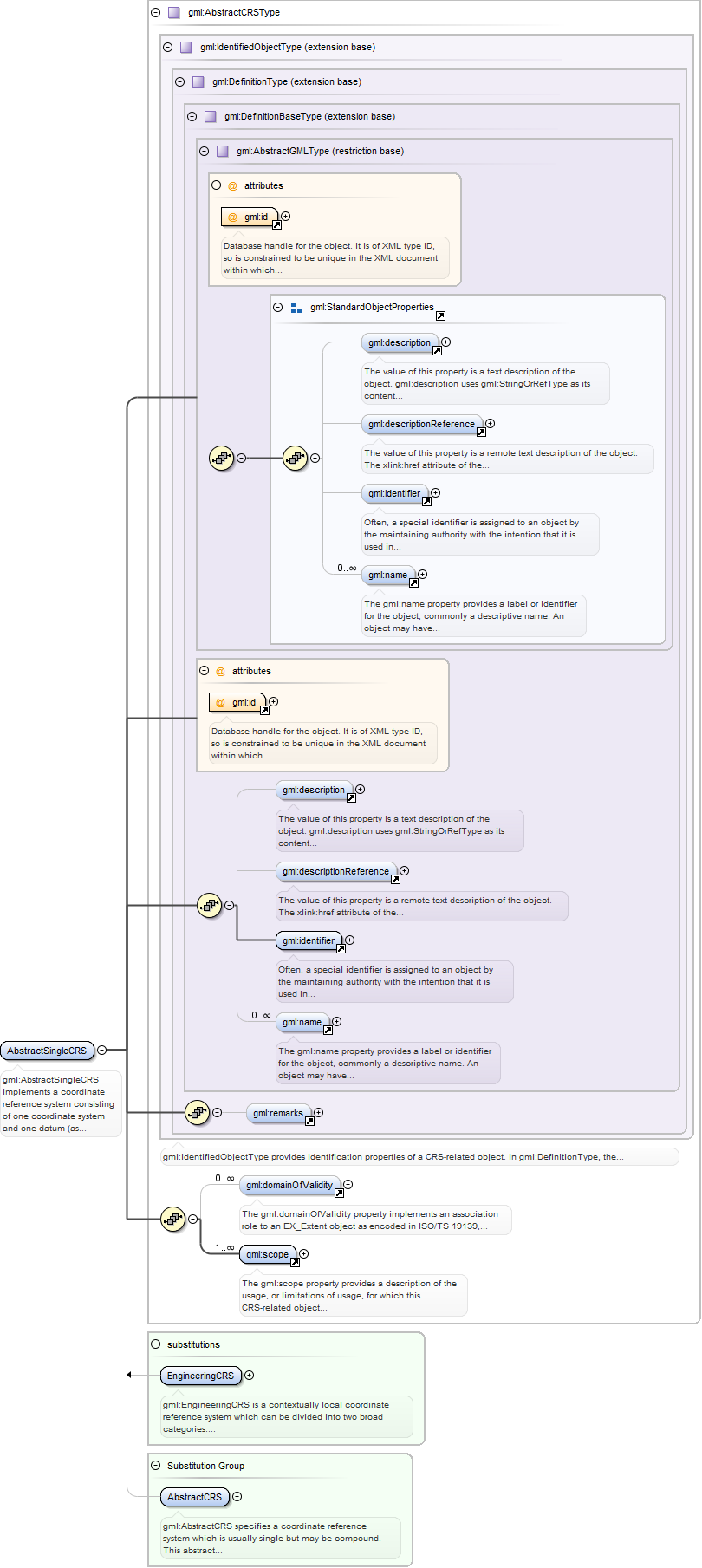
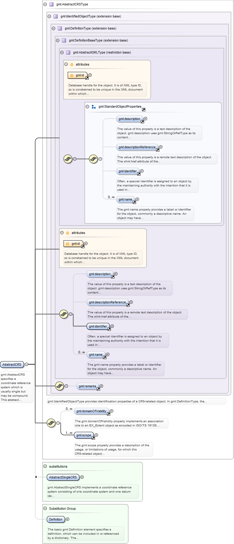
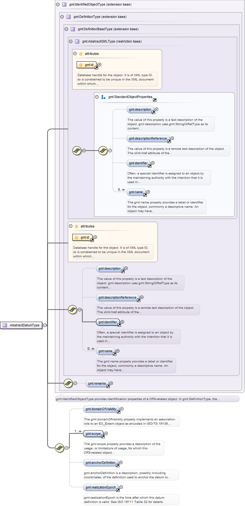
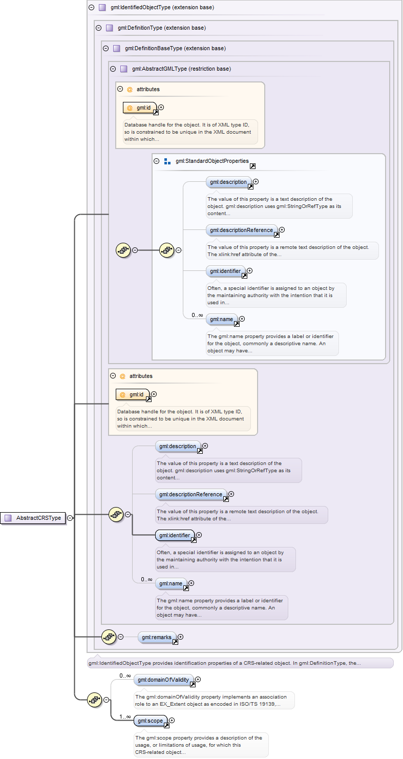
The gml:domainOfValidity property implements an association role to anEX_Extent object as encoded in ISO/TS 19139, either referencing or containing the definitionof that extent.
<element name="domainOfValidity"><annotation><documentation>The gml:domainOfValidity property implements an association role to an EX_Extent object as encoded in ISO/TS 19139, either referencing or containing the definition of that extent.</documentation></annotation><complexType><!--DSB: restricted from profile
<sequence minOccurs="0">
<element ref="gmd:EX_Extent"/>
</sequence>
--><attributeGroup ref="gml:AssociationAttributeGroup"/></complexType></element>
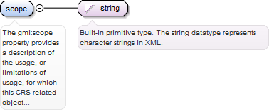
The gml:scope property provides a description of the usage, or limitations ofusage, for which this CRS-related object is valid. If unknown, enter "notknown".
<element name="scope" type="string"><annotation><documentation>The gml:scope property provides a description of the usage, or limitations of usage, for which this CRS-related object is valid. If unknown, enter "not known".</documentation></annotation></element>
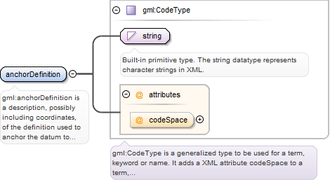
gml:anchorDefinition is a description, possibly including coordinates, of thedefinition used to anchor the datum to the Earth. Also known as the "origin", especially forengineering and image datums. The codeSpace attribute may be used to reference a source ofmore detailed on this point or surface, or on a set of such descriptions. - For a geodeticdatum, this point is also known as the fundamental point, which is traditionally the pointwhere the relationship between geoid and ellipsoid is defined. In some cases, the"fundamental point" may consist of a number of points. In those cases, the parametersdefining the geoid/ellipsoid relationship have been averaged for these points, and theaverages adopted as the datum definition. - For an engineering datum, the anchor definitionmay be a physical point, or it may be a point with defined coordinates in another CRS.may -For an image datum, the anchor definition is usually either the centre of the image or thecorner of the image. - For a temporal datum, this attribute is not defined. Instead of theanchor definition, a temporal datum carries a separate time origin of typeDateTime.
<element name="anchorDefinition" type="gml:CodeType"><annotation><documentation>gml:anchorDefinition is a description, possibly including coordinates, of the definition used to anchor the datum to the Earth. Also known as the "origin", especially for engineering and image datums. The codeSpace attribute may be used to reference a source of more detailed on this point or surface, or on a set of such descriptions. - For a geodetic datum, this point is also known as the fundamental point, which is traditionally the point where the relationship between geoid and ellipsoid is defined. In some cases, the "fundamental point" may consist of a number of points. In those cases, the parameters defining the geoid/ellipsoid relationship have been averaged for these points, and the averages adopted as the datum definition. - For an engineering datum, the anchor definition may be a physical point, or it may be a point with defined coordinates in another CRS.may - For an image datum, the anchor definition is usually either the centre of the image or the corner of the image. - For a temporal datum, this attribute is not defined. Instead of the anchor definition, a temporal datum carries a separate time origin of type DateTime.</documentation></annotation></element>
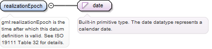
<element name="realizationEpoch" type="date"><annotation><documentation>gml:realizationEpoch is the time after which this datum definition is valid. See ISO 19111 Table 32 for details.</documentation></annotation></element>
A gml:AbstractDatum specifies the relationship of a coordinate system to theearth, thus creating a coordinate reference system. A datum uses a parameter or set ofparameters that determine the location of the origin of the coordinate reference system.Each datum subtype may be associated with only specific types of coordinate systems. Thisabstract complex type shall not be used, extended, or restricted, in a GML ApplicationSchema, to define a concrete subtype with a meaning equivalent to a concrete subtypespecified in this document.
Database handle for the object. It is of XML type ID, so is constrained to beunique in the XML document within which it occurs. An external identifier for the object inthe form of a URI may be constructed using standard XML and XPointer methods. This is doneby concatenating the URI for the document, a fragment separator, and the value of the idattribute.
Source
<element name="AbstractDatum" type="gml:AbstractDatumType" abstract="true" substitutionGroup="gml:Definition"><annotation><documentation>A gml:AbstractDatum specifies the relationship of a coordinate system to the earth, thus creating a coordinate reference system. A datum uses a parameter or set of parameters that determine the location of the origin of the coordinate reference system. Each datum subtype may be associated with only specific types of coordinate systems. This abstract complex type shall not be used, extended, or restricted, in a GML Application Schema, to define a concrete subtype with a meaning equivalent to a concrete subtype specified in this document.</documentation></annotation></element>
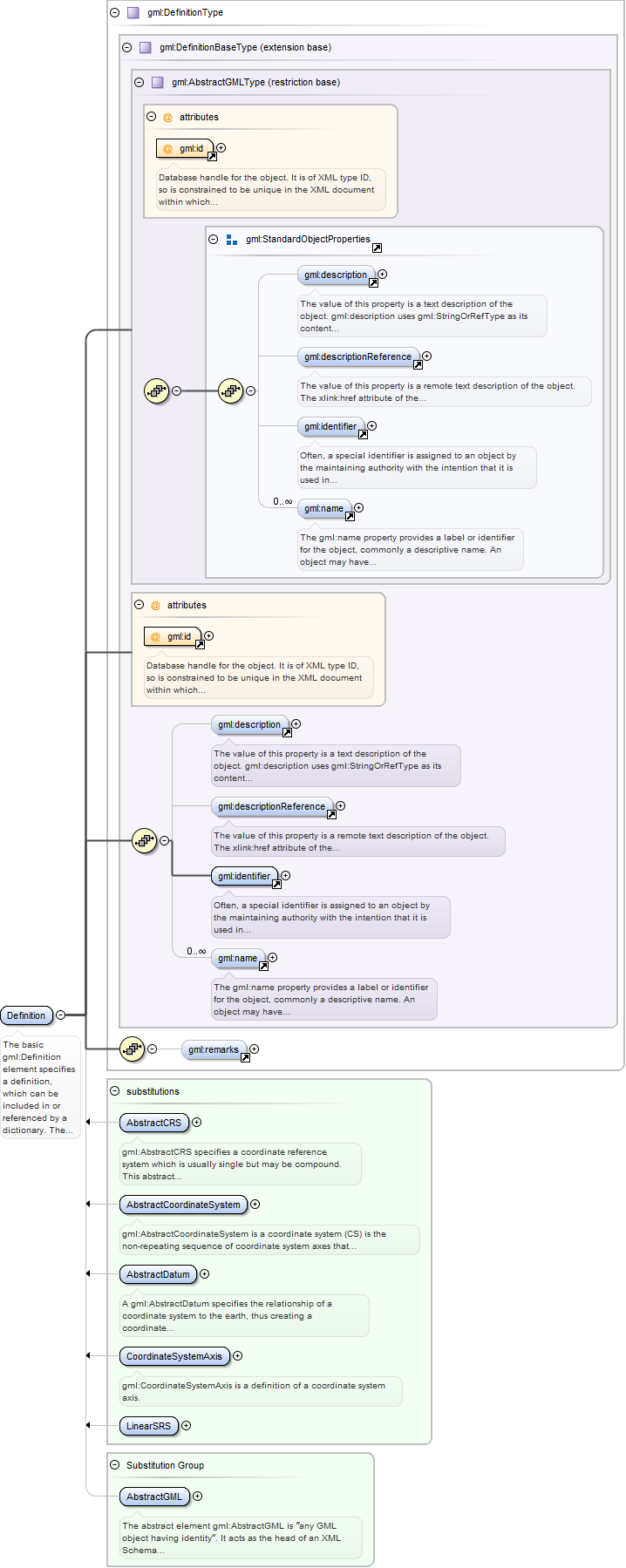
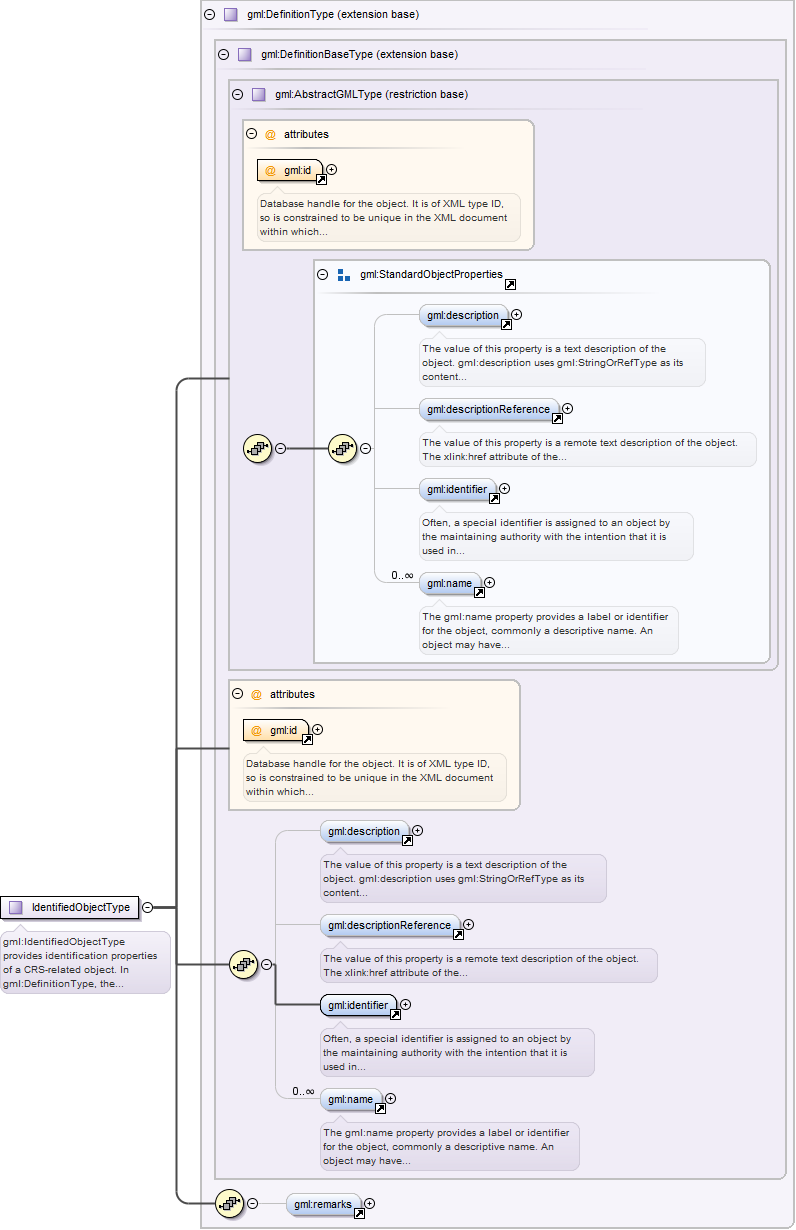
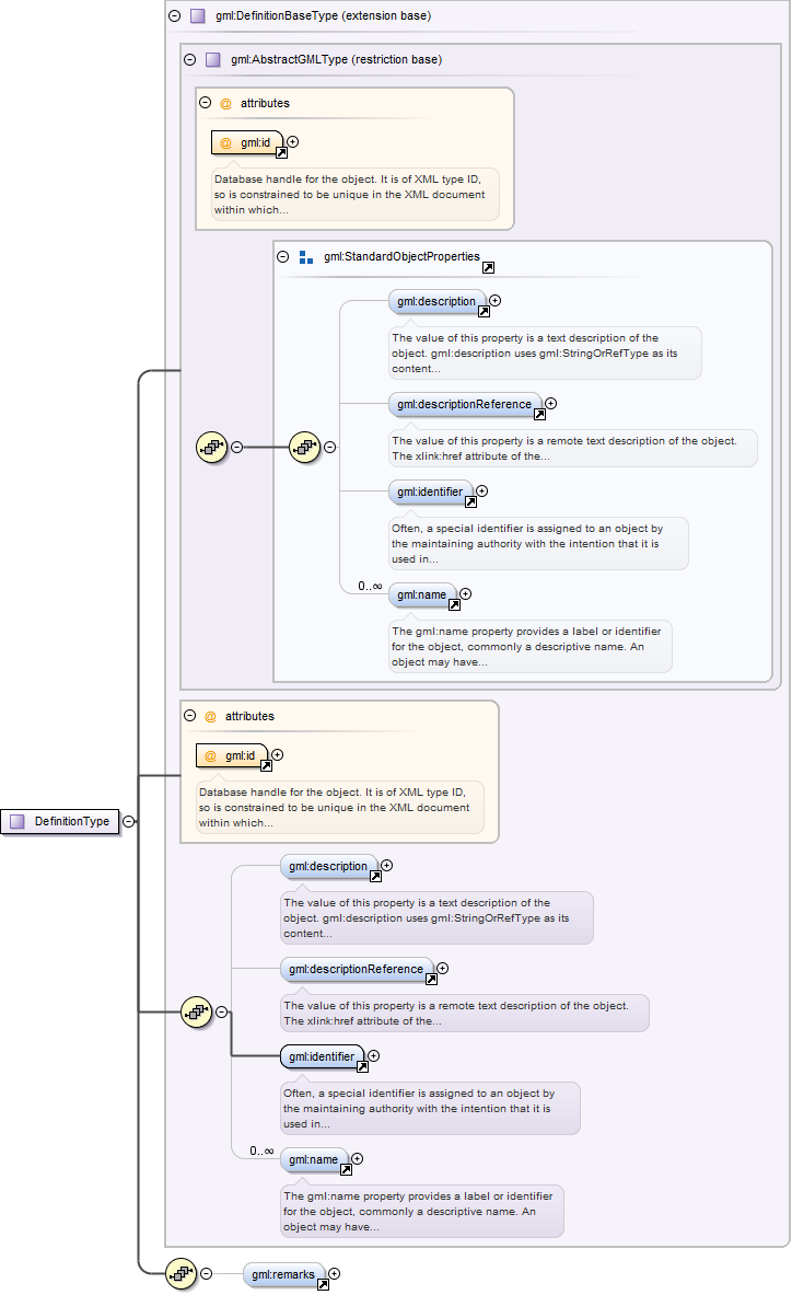
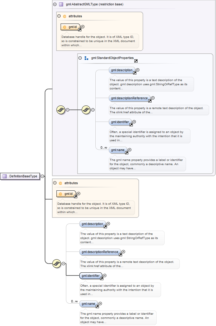
The basic gml:Definition element specifies a definition, which can be includedin or referenced by a dictionary. The content model for a generic definition is a derivationfrom gml:AbstractGMLType. The gml:description property element shall hold the definition ifthis can be captured in a simple text string, or the gml:descriptionReference propertyelement may carry a link to a description elsewhere. The gml:identifier element shallprovide one identifier identifying this definition. The identifier shall be unique withinthe dictionaries using this definition. The gml:name elements shall provide zero or moreterms and synonyms for which this is the definition. The gml:remarks element shall be usedto hold additional textual information that is not conceptually part of the definition butis useful in understanding the definition.
Database handle for the object. It is of XML type ID, so is constrained to beunique in the XML document within which it occurs. An external identifier for the object inthe form of a URI may be constructed using standard XML and XPointer methods. This is doneby concatenating the URI for the document, a fragment separator, and the value of the idattribute.
Source
<element name="Definition" type="gml:DefinitionType" substitutionGroup="gml:AbstractGML"><annotation><documentation>The basic gml:Definition element specifies a definition, which can be included in or referenced by a dictionary. The content model for a generic definition is a derivation from gml:AbstractGMLType. The gml:description property element shall hold the definition if this can be captured in a simple text string, or the gml:descriptionReference property element may carry a link to a description elsewhere. The gml:identifier element shall provide one identifier identifying this definition. The identifier shall be unique within the dictionaries using this definition. The gml:name elements shall provide zero or more terms and synonyms for which this is the definition. The gml:remarks element shall be used to hold additional textual information that is not conceptually part of the definition but is useful in understanding the definition.</documentation></annotation></element>
Database handle for the object. It is of XML type ID, so is constrained to beunique in the XML document within which it occurs. An external identifier for the object inthe form of a URI may be constructed using standard XML and XPointer methods. This is doneby concatenating the URI for the document, a fragment separator, and the value of the idattribute.
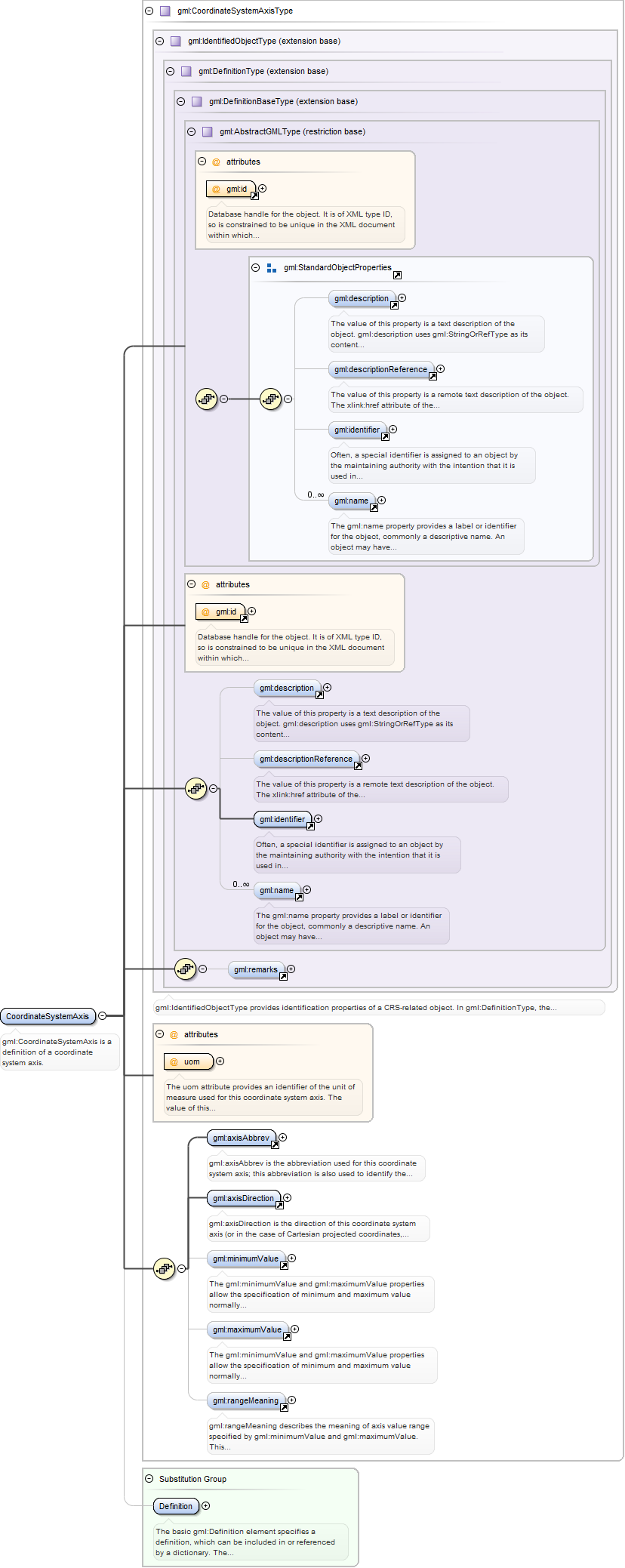
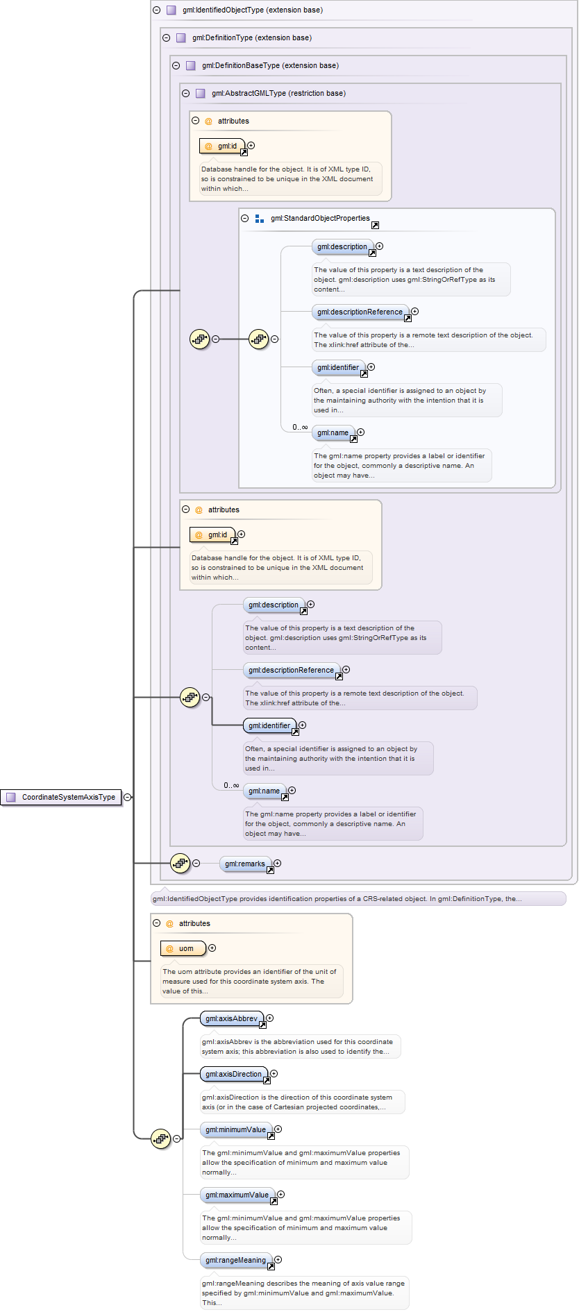
The uom attribute provides an identifier of the unit of measure used forthis coordinate system axis. The value of this coordinate in a coordinate tuple shallbe recorded using this unit of measure, whenever those coordinates use a coordinatereference system that uses a coordinate system that uses this axis.
Source
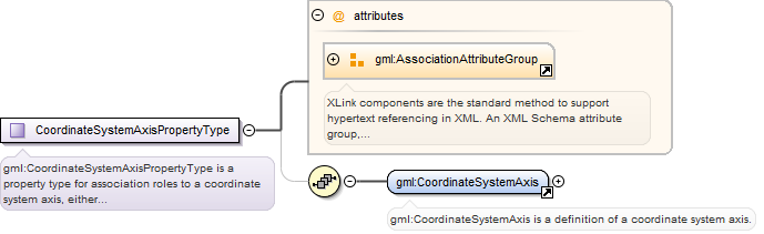
<element name="CoordinateSystemAxis" type="gml:CoordinateSystemAxisType" substitutionGroup="gml:Definition"><annotation><documentation>gml:CoordinateSystemAxis is a definition of a coordinate system axis.</documentation></annotation></element>
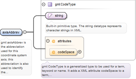
gml:axisAbbrev is the abbreviation used for this coordinate system axis; thisabbreviation is also used to identify the coordinates in the coordinate tuple. The codeSpaceattribute may reference a source of more information on a set of standardized abbreviations,or on this abbreviation.
<element name="axisAbbrev" type="gml:CodeType"><annotation><documentation>gml:axisAbbrev is the abbreviation used for this coordinate system axis; this abbreviation is also used to identify the coordinates in the coordinate tuple. The codeSpace attribute may reference a source of more information on a set of standardized abbreviations, or on this abbreviation.</documentation></annotation></element>
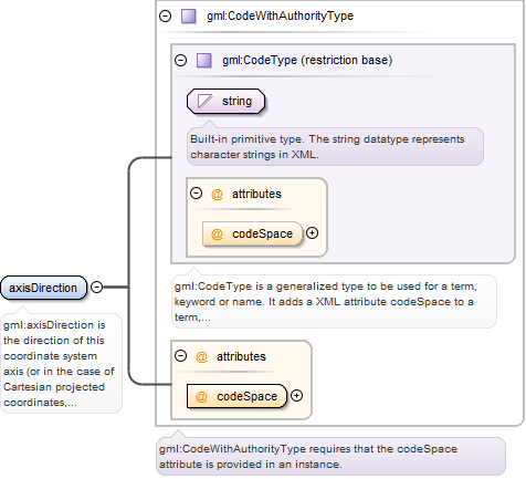
gml:axisDirection is the direction of this coordinate system axis (or in thecase of Cartesian projected coordinates, the direction of this coordinate system axis at theorigin). Within any set of coordinate system axes, only one of each pair of terms may beused. For earth-fixed CRSs, this direction is often approximate and intended to provide ahuman interpretable meaning to the axis. When a geodetic datum is used, the precisedirections of the axes may therefore vary slightly from this approximate direction. ThecodeSpace attribute shall reference a source of information specifying the values andmeanings of all the allowed string values for this property.
<element name="axisDirection" type="gml:CodeWithAuthorityType"><annotation><documentation>gml:axisDirection is the direction of this coordinate system axis (or in the case of Cartesian projected coordinates, the direction of this coordinate system axis at the origin). Within any set of coordinate system axes, only one of each pair of terms may be used. For earth-fixed CRSs, this direction is often approximate and intended to provide a human interpretable meaning to the axis. When a geodetic datum is used, the precise directions of the axes may therefore vary slightly from this approximate direction. The codeSpace attribute shall reference a source of information specifying the values and meanings of all the allowed string values for this property.</documentation></annotation></element>
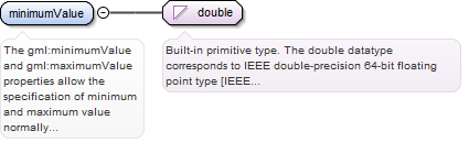
The gml:minimumValue and gml:maximumValue properties allow the specification ofminimum and maximum value normally allowed for this axis, in the unit of measure for theaxis. For a continuous angular axis such as longitude, the values wrap-around at this value.Also, values beyond this minimum/maximum can be used for specified purposes, such as in abounding box. A value of minus infinity shall be allowed for the gml:minimumValue element, avalue of plus infiniy for the gml:maximumValue element. If these elements are omitted, thevalue is unspecified.
<element name="minimumValue" type="double"><annotation><documentation>The gml:minimumValue and gml:maximumValue properties allow the specification of minimum and maximum value normally allowed for this axis, in the unit of measure for the axis. For a continuous angular axis such as longitude, the values wrap-around at this value. Also, values beyond this minimum/maximum can be used for specified purposes, such as in a bounding box. A value of minus infinity shall be allowed for the gml:minimumValue element, a value of plus infiniy for the gml:maximumValue element. If these elements are omitted, the value is unspecified.</documentation></annotation></element>
The gml:minimumValue and gml:maximumValue properties allow the specification ofminimum and maximum value normally allowed for this axis, in the unit of measure for theaxis. For a continuous angular axis such as longitude, the values wrap-around at this value.Also, values beyond this minimum/maximum can be used for specified purposes, such as in abounding box. A value of minus infinity shall be allowed for the gml:minimumValue element, avalue of plus infiniy for the gml:maximumValue element. If these elements are omitted, thevalue is unspecified.
<element name="maximumValue" type="double"><annotation><documentation>The gml:minimumValue and gml:maximumValue properties allow the specification of minimum and maximum value normally allowed for this axis, in the unit of measure for the axis. For a continuous angular axis such as longitude, the values wrap-around at this value. Also, values beyond this minimum/maximum can be used for specified purposes, such as in a bounding box. A value of minus infinity shall be allowed for the gml:minimumValue element, a value of plus infiniy for the gml:maximumValue element. If these elements are omitted, the value is unspecified.</documentation></annotation></element>
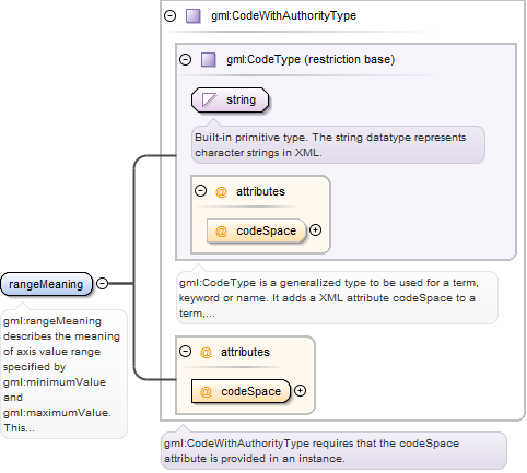
gml:rangeMeaning describes the meaning of axis value range specified bygml:minimumValue and gml:maximumValue. This element shall be omitted when bothgml:minimumValue and gml:maximumValue are omitted. This element should be included whengml:minimumValue and/or gml:maximumValue are included. If this element is omitted when thegml:minimumValue and/or gml:maximumValue are included, the meaning is unspecified. ThecodeSpace attribute shall reference a source of information specifying the values andmeanings of all the allowed string values for this property.
<element name="rangeMeaning" type="gml:CodeWithAuthorityType"><annotation><documentation>gml:rangeMeaning describes the meaning of axis value range specified by gml:minimumValue and gml:maximumValue. This element shall be omitted when both gml:minimumValue and gml:maximumValue are omitted. This element should be included when gml:minimumValue and/or gml:maximumValue are included. If this element is omitted when the gml:minimumValue and/or gml:maximumValue are included, the meaning is unspecified. The codeSpace attribute shall reference a source of information specifying the values and meanings of all the allowed string values for this property.</documentation></annotation></element>
Database handle for the object. It is of XML type ID, so is constrained to beunique in the XML document within which it occurs. An external identifier for the object inthe form of a URI may be constructed using standard XML and XPointer methods. This is doneby concatenating the URI for the document, a fragment separator, and the value of the idattribute.
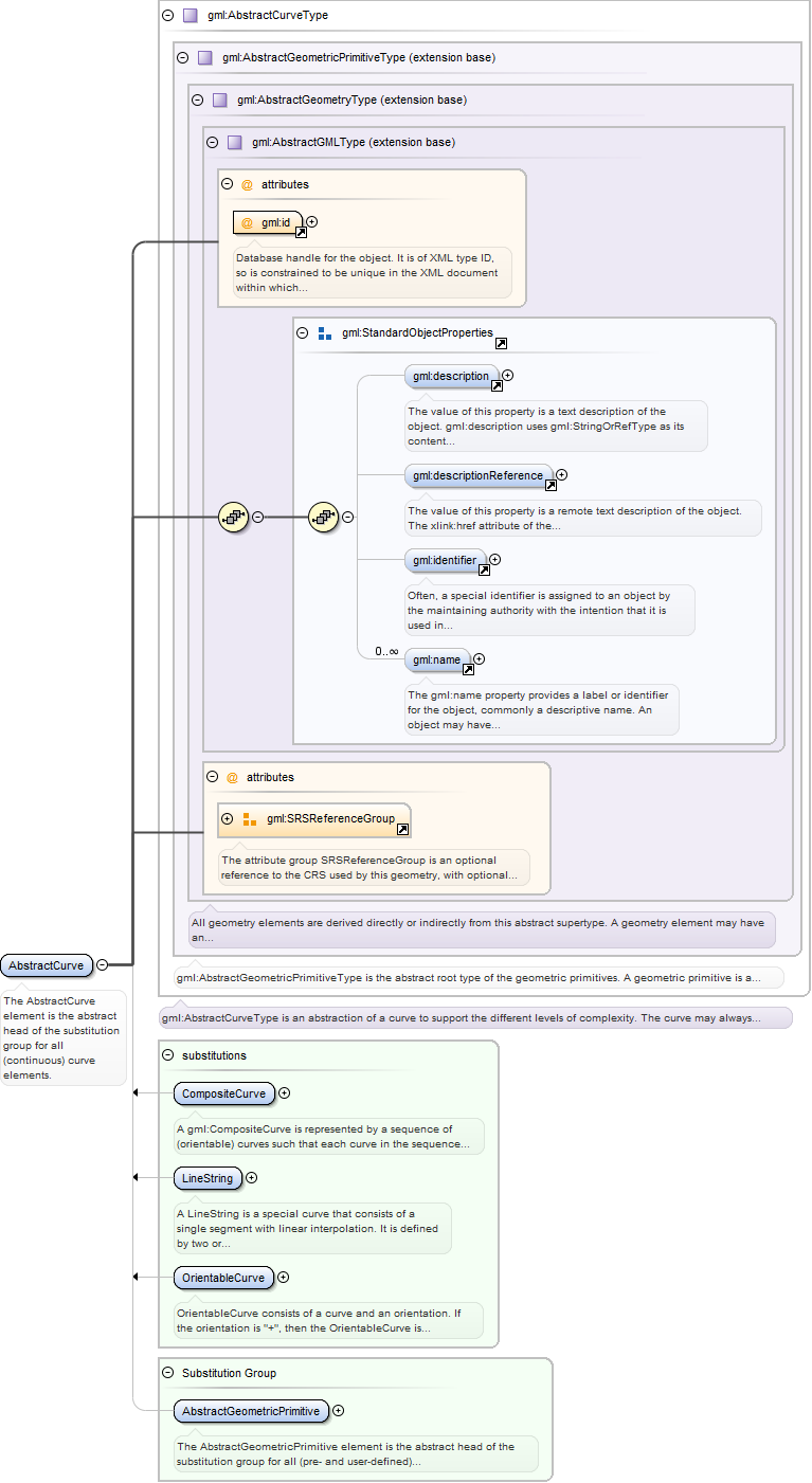
<element name="AbstractCurve" type="gml:AbstractCurveType" abstract="true" substitutionGroup="gml:AbstractGeometricPrimitive"><annotation><documentation>The AbstractCurve element is the abstract head of the substitution group for all (continuous) curve elements.</documentation></annotation></element>
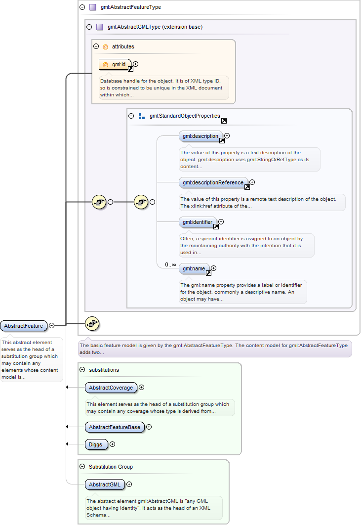
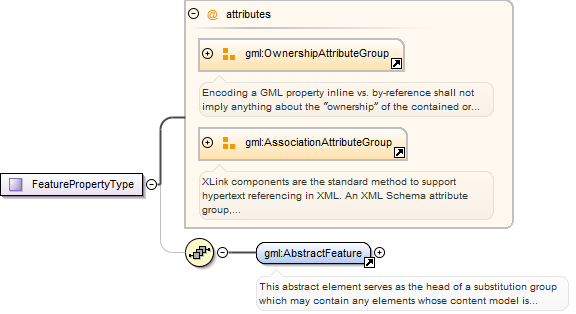
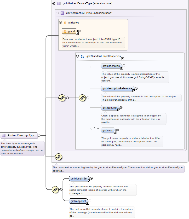
This abstract element serves as the head of a substitution group which maycontain any elements whose content model is derived from gml:AbstractFeatureType. This maybe used as a variable in the construction of content models. gml:AbstractFeature may bethought of as “anything that is a GML feature” and may be used to define variables ortemplates in which the value of a GML property is “any feature”. This occurs in particularin a GML feature collection where the feature member properties contain one or multiplecopies of gml:AbstractFeature respectively.
Database handle for the object. It is of XML type ID, so is constrained to beunique in the XML document within which it occurs. An external identifier for the object inthe form of a URI may be constructed using standard XML and XPointer methods. This is doneby concatenating the URI for the document, a fragment separator, and the value of the idattribute.
Source
<element name="AbstractFeature" type="gml:AbstractFeatureType" abstract="true" substitutionGroup="gml:AbstractGML"><annotation><documentation>This abstract element serves as the head of a substitution group which may contain any elements whose content model is derived from gml:AbstractFeatureType. This may be used as a variable in the construction of content models. gml:AbstractFeature may be thought of as “anything that is a GML feature” and may be used to define variables or templates in which the value of a GML property is “any feature”. This occurs in particular in a GML feature collection where the feature member properties contain one or multiple copies of gml:AbstractFeature respectively.</documentation></annotation></element>
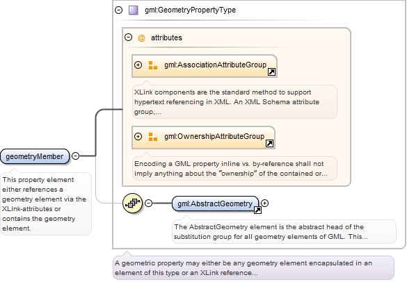
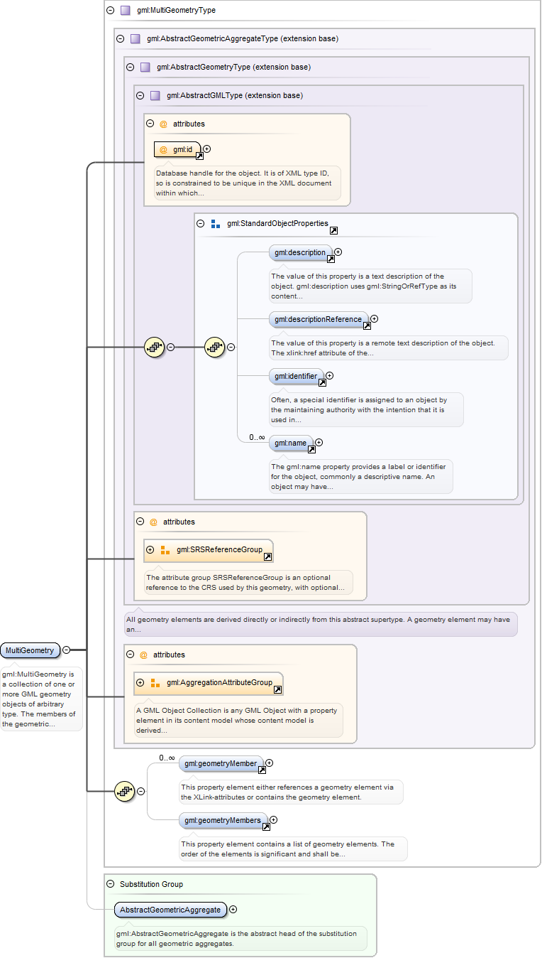
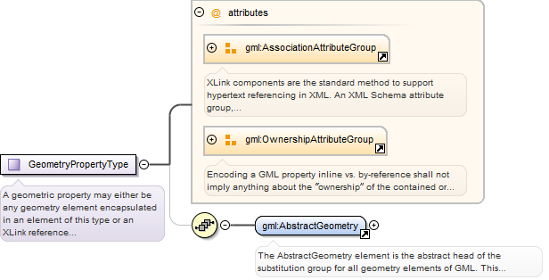
<element name="geometryMember" type="gml:GeometryPropertyType"><annotation><documentation>This property element either references a geometry element via the XLink-attributes or contains the geometry element.</documentation></annotation></element>
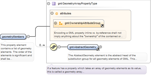
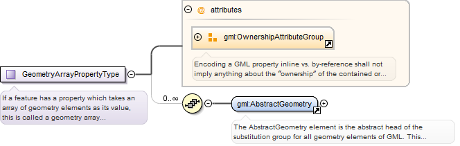
<element name="geometryMembers" type="gml:GeometryArrayPropertyType"><annotation><documentation>This property element contains a list of geometry elements. The order of the elements is significant and shall be preserved when processing the array.</documentation></annotation></element>
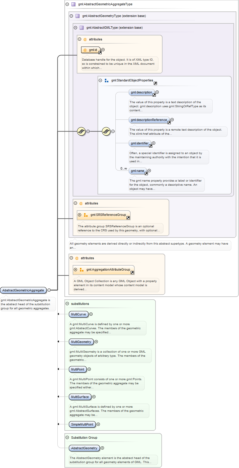
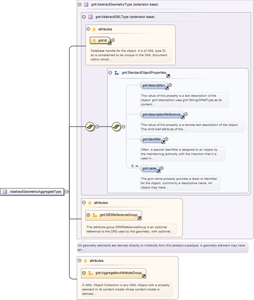
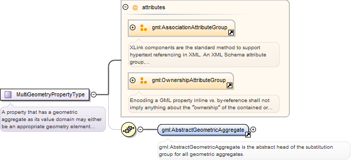
gml:MultiGeometry is a collection of one or more GML geometry objects ofarbitrary type. The members of the geometric aggregate may be specified either using the"standard" property (gml:geometryMember) or the array property (gml:geometryMembers). It isalso valid to use both the "standard" and the array properties in the samecollection.
Database handle for the object. It is of XML type ID, so is constrained to beunique in the XML document within which it occurs. An external identifier for the object inthe form of a URI may be constructed using standard XML and XPointer methods. This is doneby concatenating the URI for the document, a fragment separator, and the value of the idattribute.
<element name="MultiGeometry" type="gml:MultiGeometryType" substitutionGroup="gml:AbstractGeometricAggregate"><annotation><documentation>gml:MultiGeometry is a collection of one or more GML geometry objects of arbitrary type. The members of the geometric aggregate may be specified either using the "standard" property (gml:geometryMember) or the array property (gml:geometryMembers). It is also valid to use both the "standard" and the array properties in the same collection.</documentation></annotation></element>
Database handle for the object. It is of XML type ID, so is constrained to beunique in the XML document within which it occurs. An external identifier for the object inthe form of a URI may be constructed using standard XML and XPointer methods. This is doneby concatenating the URI for the document, a fragment separator, and the value of the idattribute.
<element name="AbstractGeometricAggregate" type="gml:AbstractGeometricAggregateType" abstract="true" substitutionGroup="gml:AbstractGeometry"><annotation><documentation>gml:AbstractGeometricAggregate is the abstract head of the substitution group for all geometric aggregates.</documentation></annotation></element>
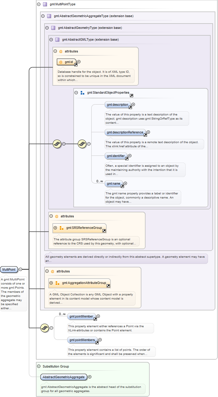
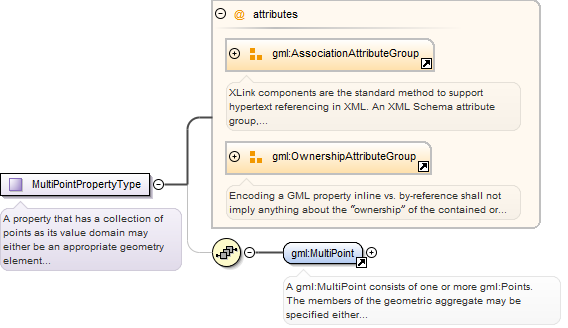
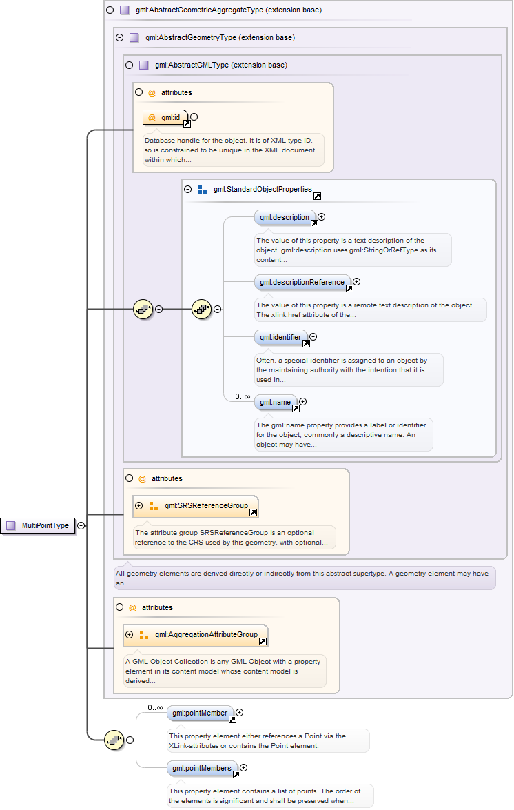
A gml:MultiPoint consists of one or more gml:Points. The members of thegeometric aggregate may be specified either using the "standard" property (gml:pointMember)or the array property (gml:pointMembers). It is also valid to use both the "standard" andthe array properties in the same collection.
Database handle for the object. It is of XML type ID, so is constrained to beunique in the XML document within which it occurs. An external identifier for the object inthe form of a URI may be constructed using standard XML and XPointer methods. This is doneby concatenating the URI for the document, a fragment separator, and the value of the idattribute.
<element name="MultiPoint" type="gml:MultiPointType" substitutionGroup="gml:AbstractGeometricAggregate"><annotation><documentation>A gml:MultiPoint consists of one or more gml:Points. The members of the geometric aggregate may be specified either using the "standard" property (gml:pointMember) or the array property (gml:pointMembers). It is also valid to use both the "standard" and the array properties in the same collection.</documentation></annotation></element>
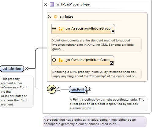
<element name="pointMember" type="gml:PointPropertyType"><annotation><documentation>This property element either references a Point via the XLink-attributes or contains the Point element.</documentation></annotation></element>
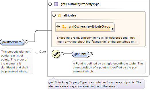
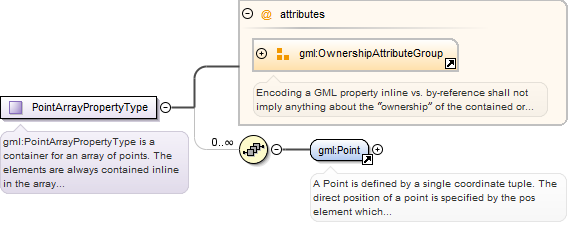
<element name="pointMembers" type="gml:PointArrayPropertyType"><annotation><documentation>This property element contains a list of points. The order of the elements is significant and shall be preserved when processing the array.</documentation></annotation></element>
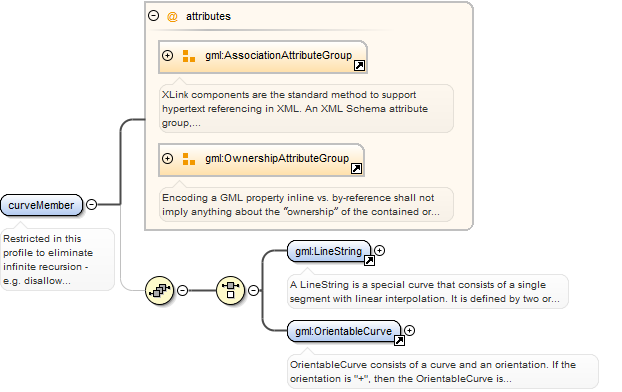
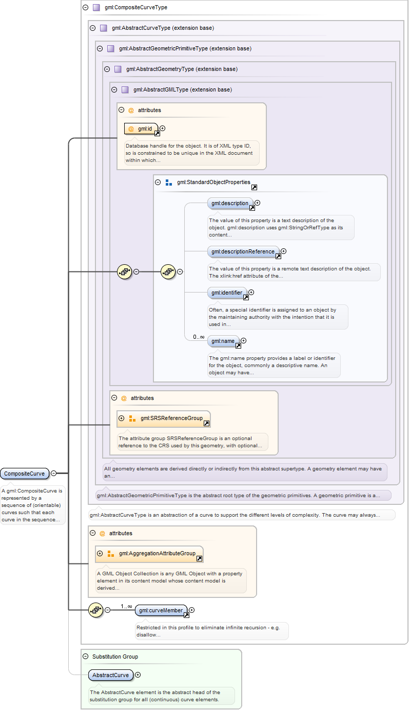
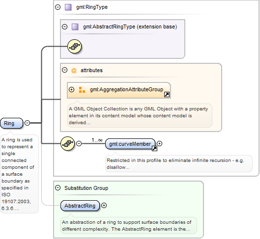
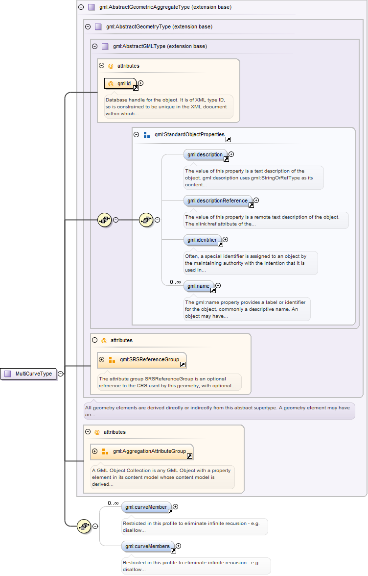
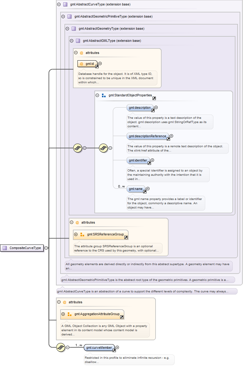
Restricted in this profile to eliminate infinite recursion - e.g. disallowcurveMember/CompositeCurve/curveMember/OrientableCurve/baseCurve/CompositeCurve/curveMember/...
<element name="curveMember"><annotation><documentation>Restricted in this profile to eliminate infinite recursion - e.g. disallow curveMember/CompositeCurve/curveMember/OrientableCurve/baseCurve/CompositeCurve/curveMember/...</documentation></annotation><complexType><annotation><documentation>A property that has a LineString as its value domain or an XLink reference to a remote LineString element (where remote includes the LineString element located elsewhere in the same document). Either the reference or the contained element shall be given, but neither both nor none.</documentation></annotation><sequence minOccurs="0"><choice><element ref="gml:LineString"/><element ref="gml:OrientableCurve"/></choice></sequence><attributeGroup ref="gml:AssociationAttributeGroup"/><attributeGroup ref="gml:OwnershipAttributeGroup"/></complexType></element>
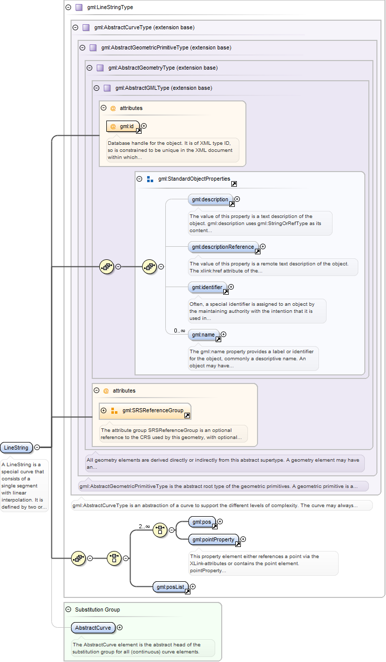
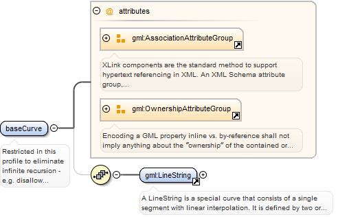
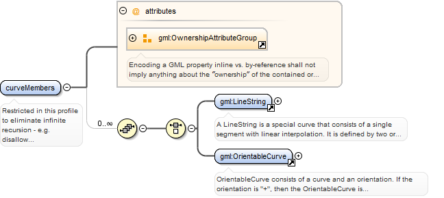
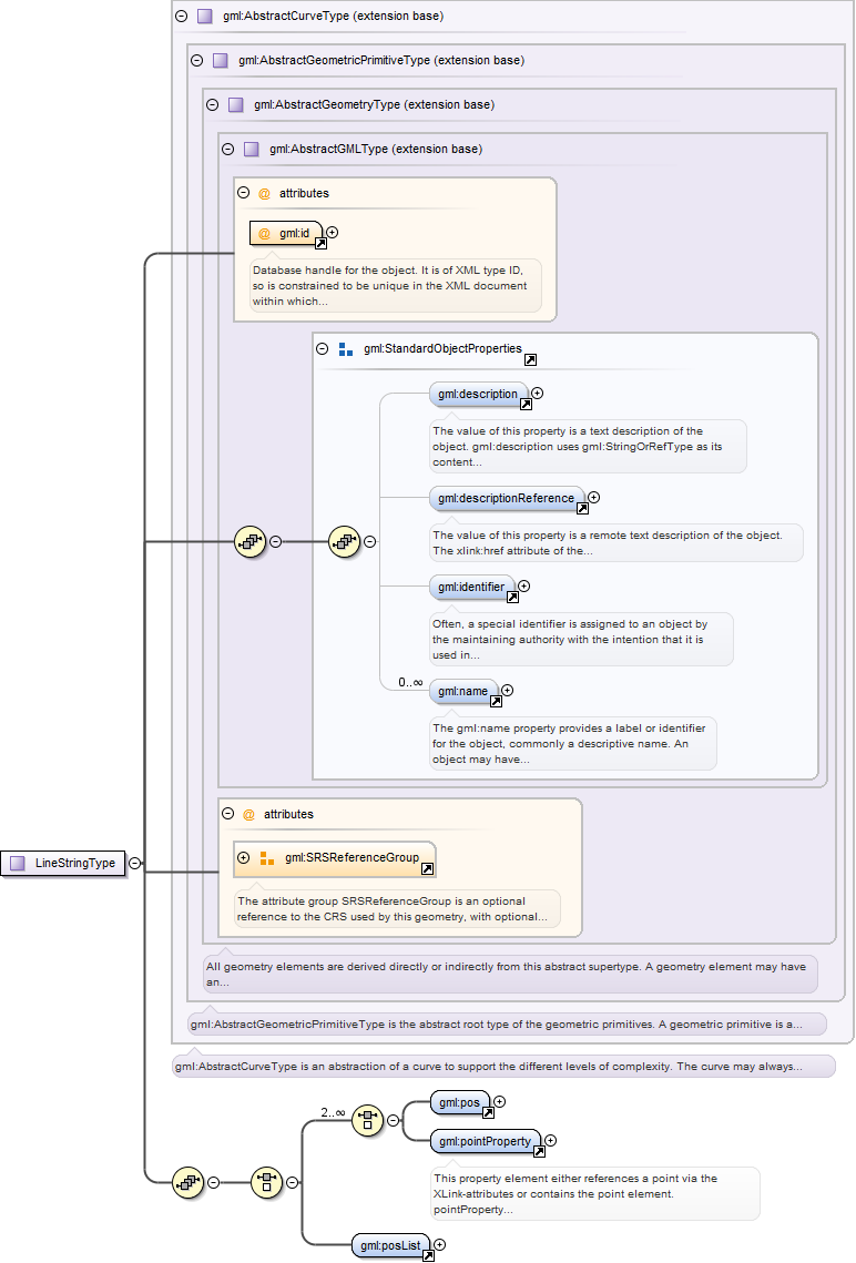
A LineString is a special curve that consists of a single segment with linearinterpolation. It is defined by two or more coordinate tuples, with linear interpolationbetween them. The number of direct positions in the list shall be at leasttwo.
Database handle for the object. It is of XML type ID, so is constrained to beunique in the XML document within which it occurs. An external identifier for the object inthe form of a URI may be constructed using standard XML and XPointer methods. This is doneby concatenating the URI for the document, a fragment separator, and the value of the idattribute.
<element name="LineString" type="gml:LineStringType" substitutionGroup="gml:AbstractCurve"><annotation><documentation>A LineString is a special curve that consists of a single segment with linear interpolation. It is defined by two or more coordinate tuples, with linear interpolation between them. The number of direct positions in the list shall be at least two.</documentation></annotation></element>
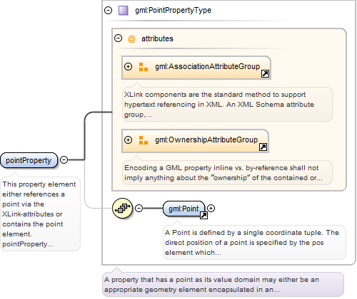
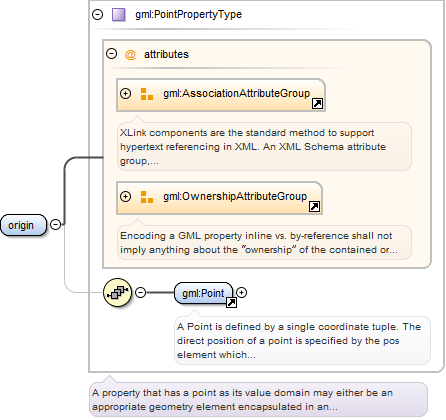
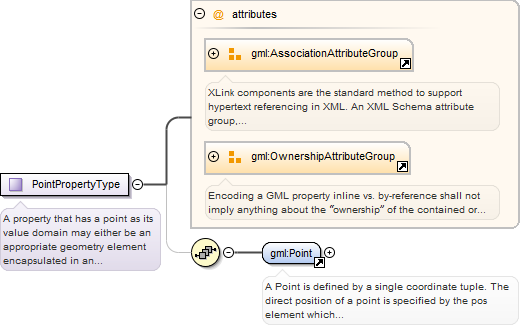
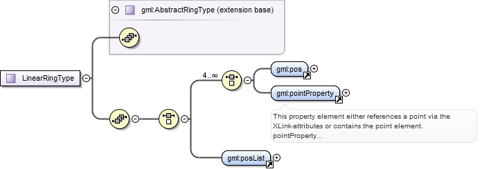
This property element either references a point via the XLink-attributes orcontains the point element. pointProperty is the predefined property which may be used byGML Application Schemas whenever a GML feature has a property with a value that issubstitutable for Point.
<element name="pointProperty" type="gml:PointPropertyType"><annotation><documentation>This property element either references a point via the XLink-attributes or contains the point element. pointProperty is the predefined property which may be used by GML Application Schemas whenever a GML feature has a property with a value that is substitutable for Point.</documentation></annotation></element>
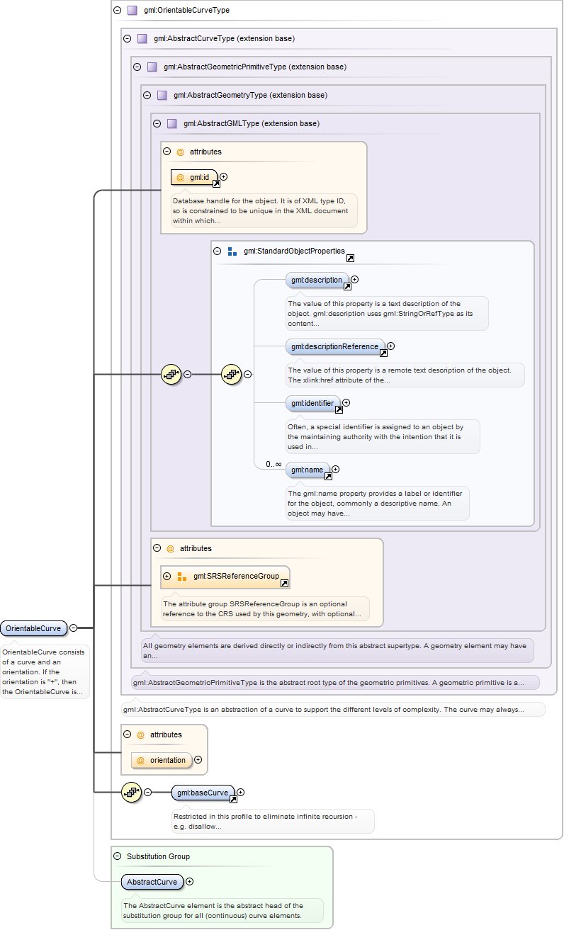
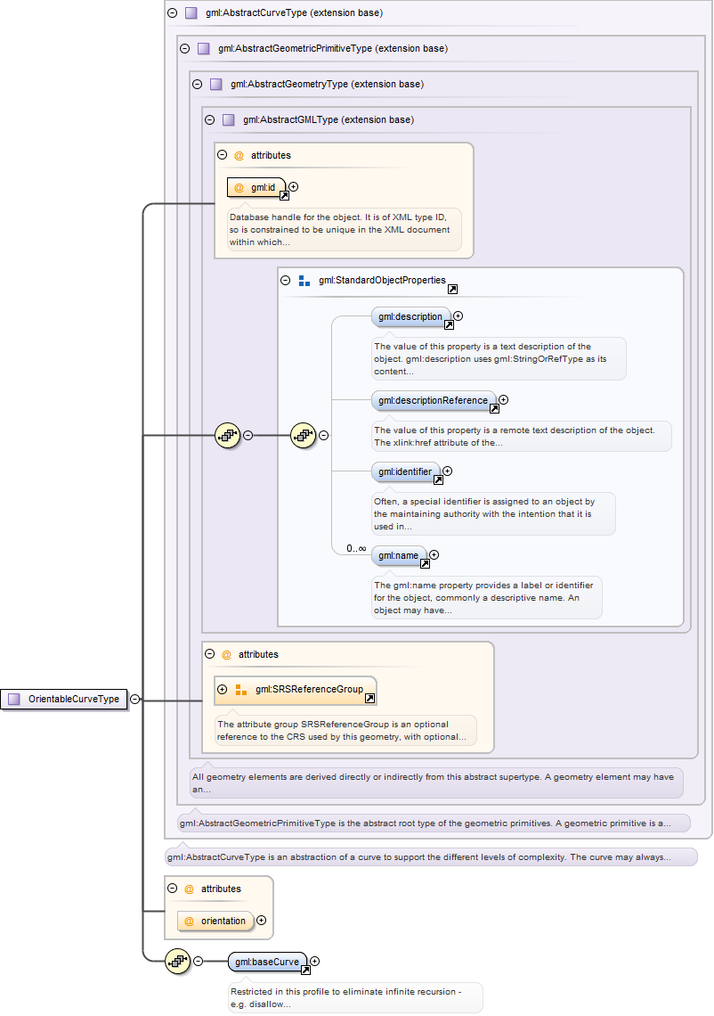
OrientableCurve consists of a curve and an orientation. If the orientation is"+", then the OrientableCurve is identical to the baseCurve. If the orientation is "-", thenthe OrientableCurve is related to another AbstractCurve with a parameterization thatreverses the sense of the curve traversal.
Database handle for the object. It is of XML type ID, so is constrained to beunique in the XML document within which it occurs. An external identifier for the object inthe form of a URI may be constructed using standard XML and XPointer methods. This is doneby concatenating the URI for the document, a fragment separator, and the value of the idattribute.
<element name="OrientableCurve" type="gml:OrientableCurveType" substitutionGroup="gml:AbstractCurve"><annotation><documentation>OrientableCurve consists of a curve and an orientation. If the orientation is "+", then the OrientableCurve is identical to the baseCurve. If the orientation is "-", then the OrientableCurve is related to another AbstractCurve with a parameterization that reverses the sense of the curve traversal.</documentation></annotation></element>
Restricted in this profile to eliminate infinite recursion - e.g. disallowbaseCurve/OrientableCurve/baseCurve/OrientableCurve/baseCurve/OrientableCurve/...
<element name="baseCurve"><annotation><documentation>Restricted in this profile to eliminate infinite recursion - e.g. disallow baseCurve/OrientableCurve/baseCurve/OrientableCurve/baseCurve/OrientableCurve/...</documentation></annotation><complexType><annotation><documentation>A property that has a LineString as its value domain or an XLink reference to a remote LineString element (where remote includes the LineString element located elsewhere in the same document). Either the reference or the contained element shall be given, but neither both nor none.</documentation></annotation><sequence minOccurs="0"><element ref="gml:LineString"/></sequence><attributeGroup ref="gml:AssociationAttributeGroup"/><attributeGroup ref="gml:OwnershipAttributeGroup"/></complexType></element>
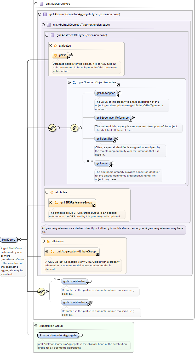
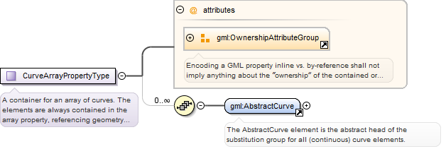
Restricted in this profile to eliminate infinite recursion - e.g. disallowcurveMembers/CompositeCurve/curveMember/OrientableCurve/baseCurve/CompositeCurve/curveMember/...
<element name="curveMembers"><annotation><documentation>Restricted in this profile to eliminate infinite recursion - e.g. disallow curveMembers/CompositeCurve/curveMember/OrientableCurve/baseCurve/CompositeCurve/curveMember/...</documentation></annotation><complexType><annotation><documentation>A container for an array of LineStrings. The LineString elements are always contained inline in the array property, referencing geometry elements or arrays of geometry elements via XLinks is not supported.</documentation></annotation><sequence minOccurs="0" maxOccurs="unbounded"><choice><element ref="gml:LineString"/><element ref="gml:OrientableCurve"/></choice></sequence><attributeGroup ref="gml:OwnershipAttributeGroup"/></complexType></element>
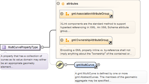
A gml:MultiCurve is defined by one or more gml:AbstractCurves. The members ofthe geometric aggregate may be specified either using the "standard" property(gml:curveMember) or the array property (gml:curveMembers). It is also valid to use both the"standard" and the array properties in the same collection.
Database handle for the object. It is of XML type ID, so is constrained to beunique in the XML document within which it occurs. An external identifier for the object inthe form of a URI may be constructed using standard XML and XPointer methods. This is doneby concatenating the URI for the document, a fragment separator, and the value of the idattribute.
<element name="MultiCurve" type="gml:MultiCurveType" substitutionGroup="gml:AbstractGeometricAggregate"><annotation><documentation>A gml:MultiCurve is defined by one or more gml:AbstractCurves. The members of the geometric aggregate may be specified either using the "standard" property (gml:curveMember) or the array property (gml:curveMembers). It is also valid to use both the "standard" and the array properties in the same collection.</documentation></annotation></element>
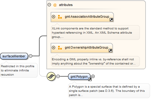
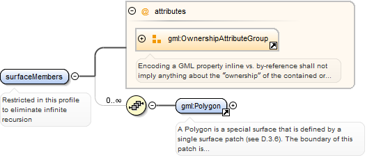
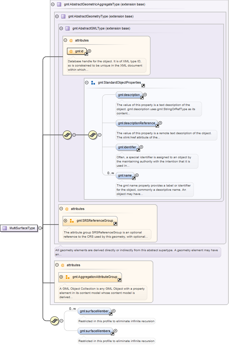
<element name="surfaceMember"><annotation><documentation>Restricted in this profile to eliminate infinite recursion</documentation></annotation><complexType><annotation><documentation>This property element either references a gml:Polygon via the XLink-attributes or contains the gml:Polygon element inline.</documentation></annotation><sequence minOccurs="0"><element ref="gml:Polygon"/></sequence><attributeGroup ref="gml:AssociationAttributeGroup"/><attributeGroup ref="gml:OwnershipAttributeGroup"/></complexType></element>
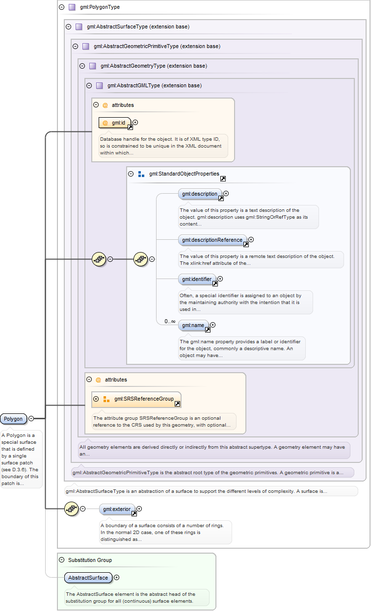
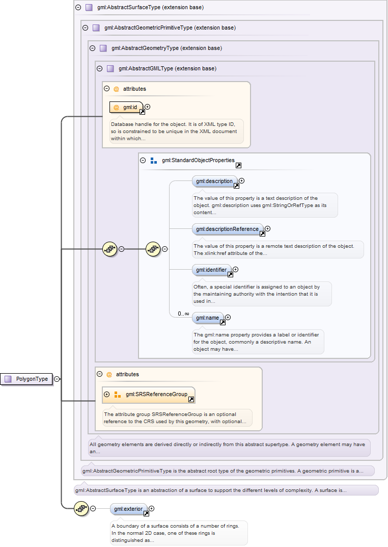
A Polygon is a special surface that is defined by a single surface patch (seeD.3.6). The boundary of this patch is coplanar and the polygon uses planar interpolation inits interior. The elements exterior and interior describe the surface boundary of thepolygon.
Database handle for the object. It is of XML type ID, so is constrained to beunique in the XML document within which it occurs. An external identifier for the object inthe form of a URI may be constructed using standard XML and XPointer methods. This is doneby concatenating the URI for the document, a fragment separator, and the value of the idattribute.
<element name="Polygon" type="gml:PolygonType" substitutionGroup="gml:AbstractSurface"><annotation><documentation>A Polygon is a special surface that is defined by a single surface patch (see D.3.6). The boundary of this patch is coplanar and the polygon uses planar interpolation in its interior. The elements exterior and interior describe the surface boundary of the polygon.</documentation></annotation></element>
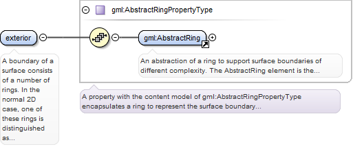
A boundary of a surface consists of a number of rings. In the normal 2D case,one of these rings is distinguished as being the exterior boundary. In a general manifoldthis is not always possible, in which case all boundaries shall be listed as interiorboundaries, and the exterior will be empty.
<element name="exterior" type="gml:AbstractRingPropertyType"><annotation><documentation>A boundary of a surface consists of a number of rings. In the normal 2D case, one of these rings is distinguished as being the exterior boundary. In a general manifold this is not always possible, in which case all boundaries shall be listed as interior boundaries, and the exterior will be empty.</documentation></annotation></element>
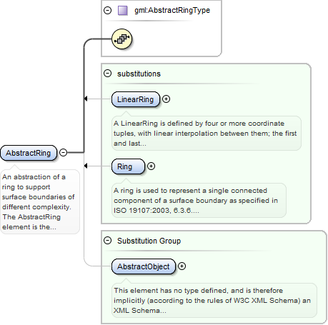
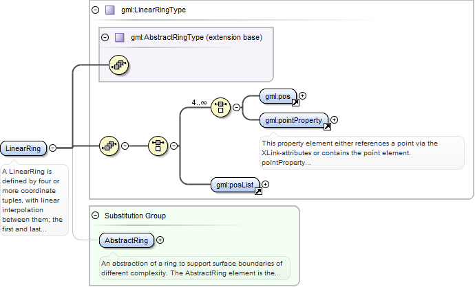
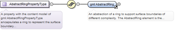
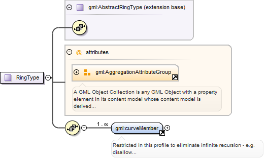
An abstraction of a ring to support surface boundaries of different complexity.The AbstractRing element is the abstract head of the substituition group for all closedboundaries of a surface patch.
<element name="AbstractRing" type="gml:AbstractRingType" abstract="true" substitutionGroup="gml:AbstractObject"><annotation><documentation>An abstraction of a ring to support surface boundaries of different complexity. The AbstractRing element is the abstract head of the substituition group for all closed boundaries of a surface patch.</documentation></annotation></element>
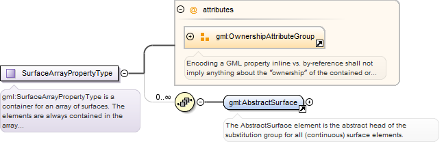
<element name="surfaceMembers"><annotation><documentation>Restricted in this profile to eliminate infinite recursion</documentation></annotation><complexType><annotation><documentation>A container for an array of Polygons. The elements are always contained in the array property, referencing geometry elements or arrays of geometry elements via XLinks is not supported.</documentation></annotation><sequence minOccurs="0" maxOccurs="unbounded"><element ref="gml:Polygon"/></sequence><attributeGroup ref="gml:OwnershipAttributeGroup"/></complexType></element>
Database handle for the object. It is of XML type ID, so is constrained to beunique in the XML document within which it occurs. An external identifier for the object inthe form of a URI may be constructed using standard XML and XPointer methods. This is doneby concatenating the URI for the document, a fragment separator, and the value of the idattribute.
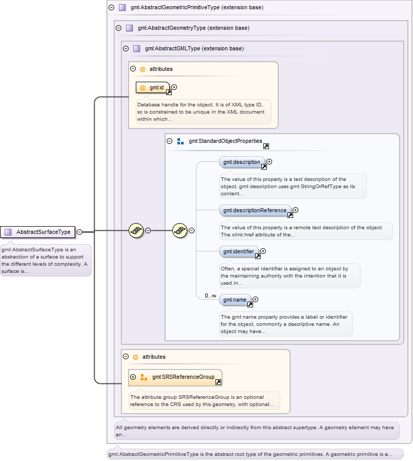
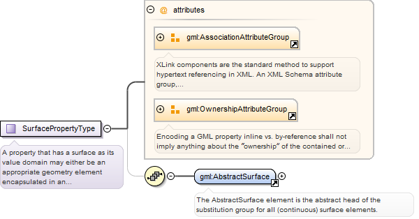
<element name="AbstractSurface" type="gml:AbstractSurfaceType" abstract="true" substitutionGroup="gml:AbstractGeometricPrimitive"><annotation><documentation>The AbstractSurface element is the abstract head of the substitution group for all (continuous) surface elements.</documentation></annotation></element>
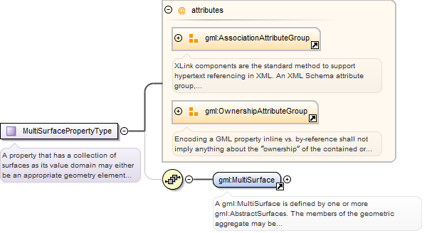
A gml:MultiSurface is defined by one or more gml:AbstractSurfaces. The membersof the geometric aggregate may be specified either using the "standard" property(gml:surfaceMember) or the array property (gml:surfaceMembers). It is also valid to use boththe "standard" and the array properties in the same collection.
Database handle for the object. It is of XML type ID, so is constrained to beunique in the XML document within which it occurs. An external identifier for the object inthe form of a URI may be constructed using standard XML and XPointer methods. This is doneby concatenating the URI for the document, a fragment separator, and the value of the idattribute.
<element name="MultiSurface" type="gml:MultiSurfaceType" substitutionGroup="gml:AbstractGeometricAggregate"><annotation><documentation>A gml:MultiSurface is defined by one or more gml:AbstractSurfaces. The members of the geometric aggregate may be specified either using the "standard" property (gml:surfaceMember) or the array property (gml:surfaceMembers). It is also valid to use both the "standard" and the array properties in the same collection.</documentation></annotation></element>
A LinearRing is defined by four or more coordinate tuples, with linearinterpolation between them; the first and last coordinates shall be coincident. The numberof direct positions in the list shall be at least four.
<element name="LinearRing" type="gml:LinearRingType" substitutionGroup="gml:AbstractRing"><annotation><documentation>A LinearRing is defined by four or more coordinate tuples, with linear interpolation between them; the first and last coordinates shall be coincident. The number of direct positions in the list shall be at least four.</documentation></annotation></element>
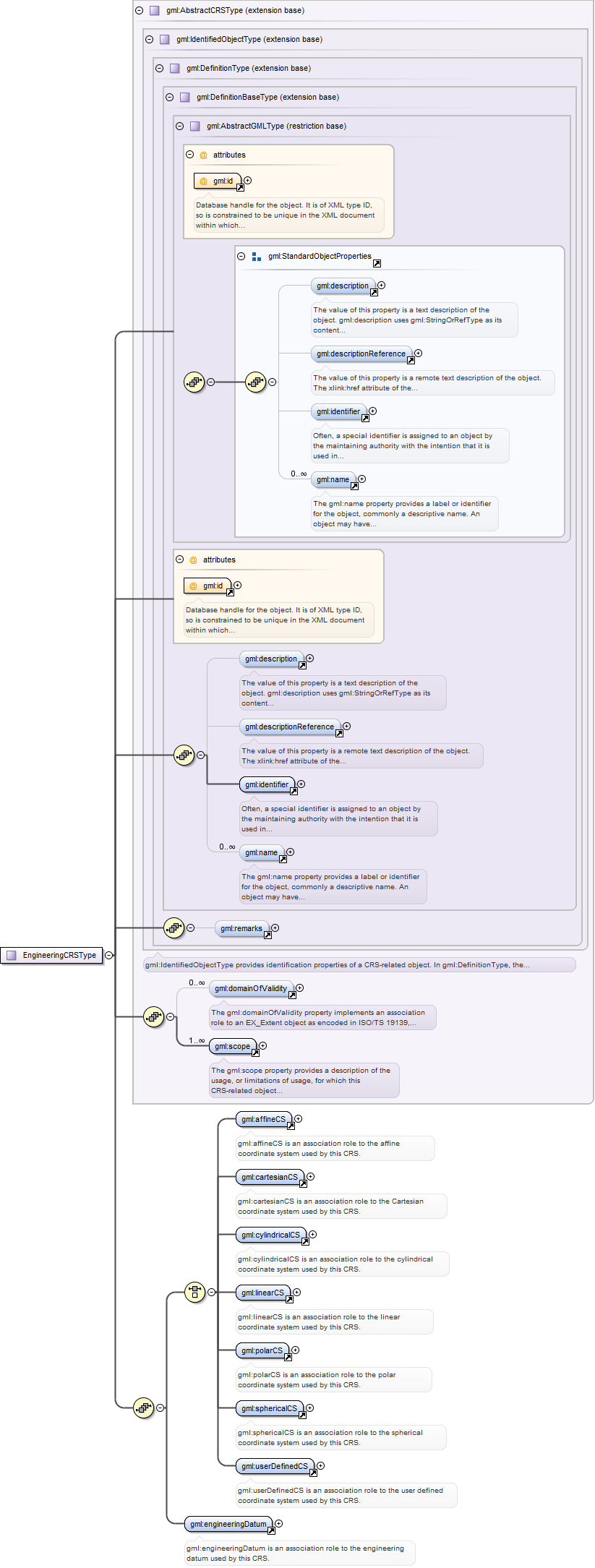
gml:EngineeringCRS is a contextually local coordinate reference system whichcan be divided into two broad categories: - earth-fixed systems applied to engineeringactivities on or near the surface of the earth; - CRSs on moving platforms such as roadvehicles, vessels, aircraft, or spacecraft, see ISO 19111 8.3.
Database handle for the object. It is of XML type ID, so is constrained to beunique in the XML document within which it occurs. An external identifier for the object inthe form of a URI may be constructed using standard XML and XPointer methods. This is doneby concatenating the URI for the document, a fragment separator, and the value of the idattribute.
Source
<element name="EngineeringCRS" type="gml:EngineeringCRSType" substitutionGroup="gml:AbstractSingleCRS"><annotation><documentation>gml:EngineeringCRS is a contextually local coordinate reference system which can be divided into two broad categories: - earth-fixed systems applied to engineering activities on or near the surface of the earth; - CRSs on moving platforms such as road vehicles, vessels, aircraft, or spacecraft, see ISO 19111 8.3.</documentation></annotation></element>
<element name="affineCS" type="gml:AffineCSPropertyType"><annotation><documentation>gml:affineCS is an association role to the affine coordinate system used by this CRS.</documentation></annotation></element>
gml:AffineCS is a two- or three-dimensional coordinate system with straightaxes that are not necessarily orthogonal. An AffineCS shall have two or three gml:axisproperty elements; the number of property elements shall equal the dimension of theCS.
Database handle for the object. It is of XML type ID, so is constrained to beunique in the XML document within which it occurs. An external identifier for the object inthe form of a URI may be constructed using standard XML and XPointer methods. This is doneby concatenating the URI for the document, a fragment separator, and the value of the idattribute.
Source
<element name="AffineCS" type="gml:AffineCSType" substitutionGroup="gml:AbstractCoordinateSystem"><annotation><documentation>gml:AffineCS is a two- or three-dimensional coordinate system with straight axes that are not necessarily orthogonal. An AffineCS shall have two or three gml:axis property elements; the number of property elements shall equal the dimension of the CS.</documentation></annotation></element>
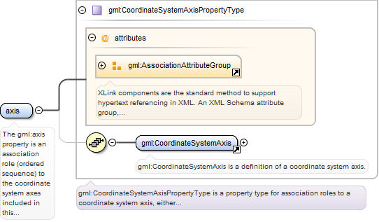
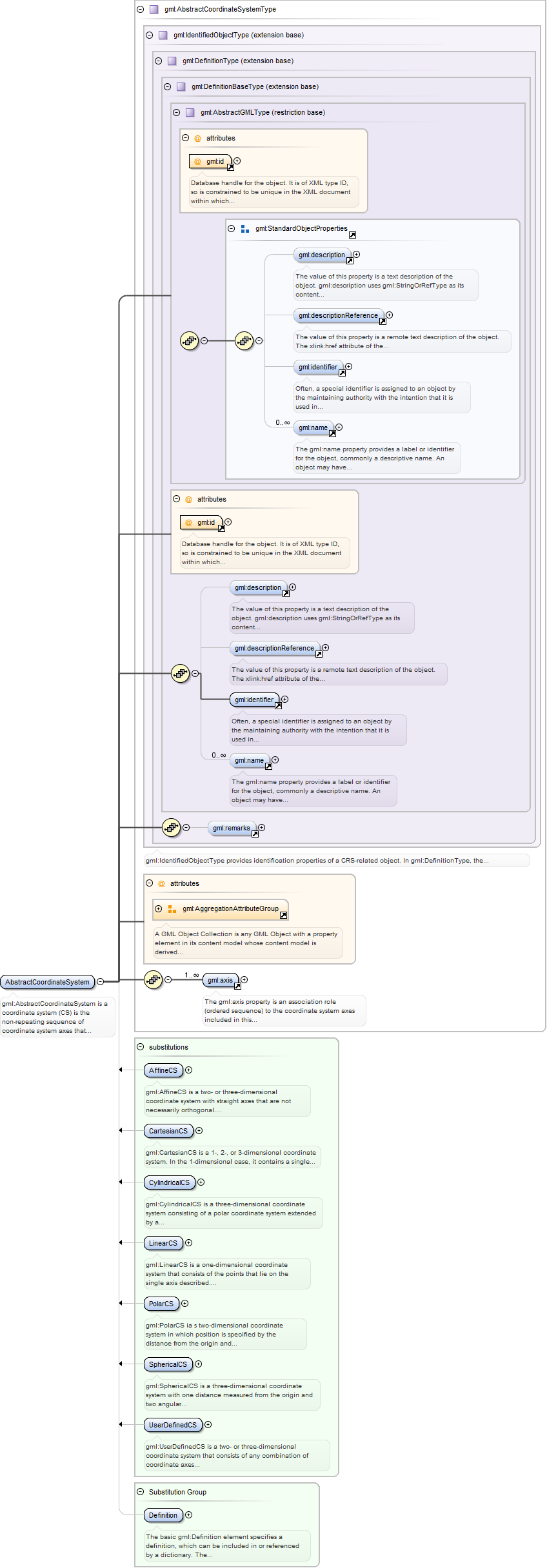
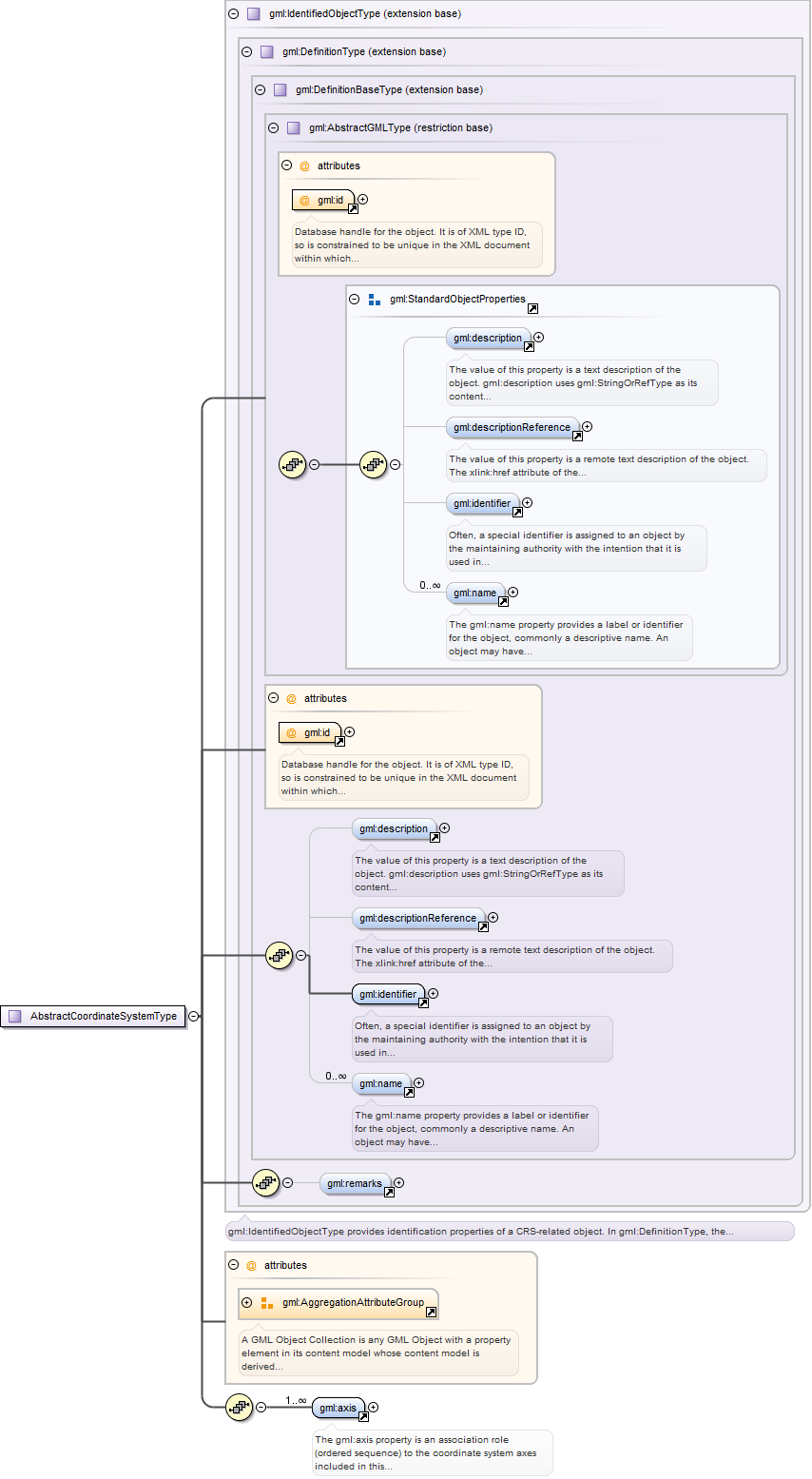
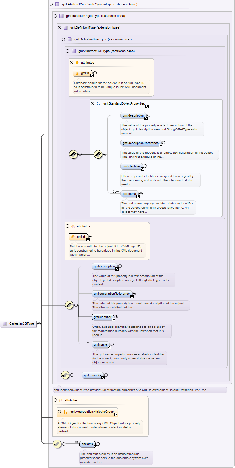
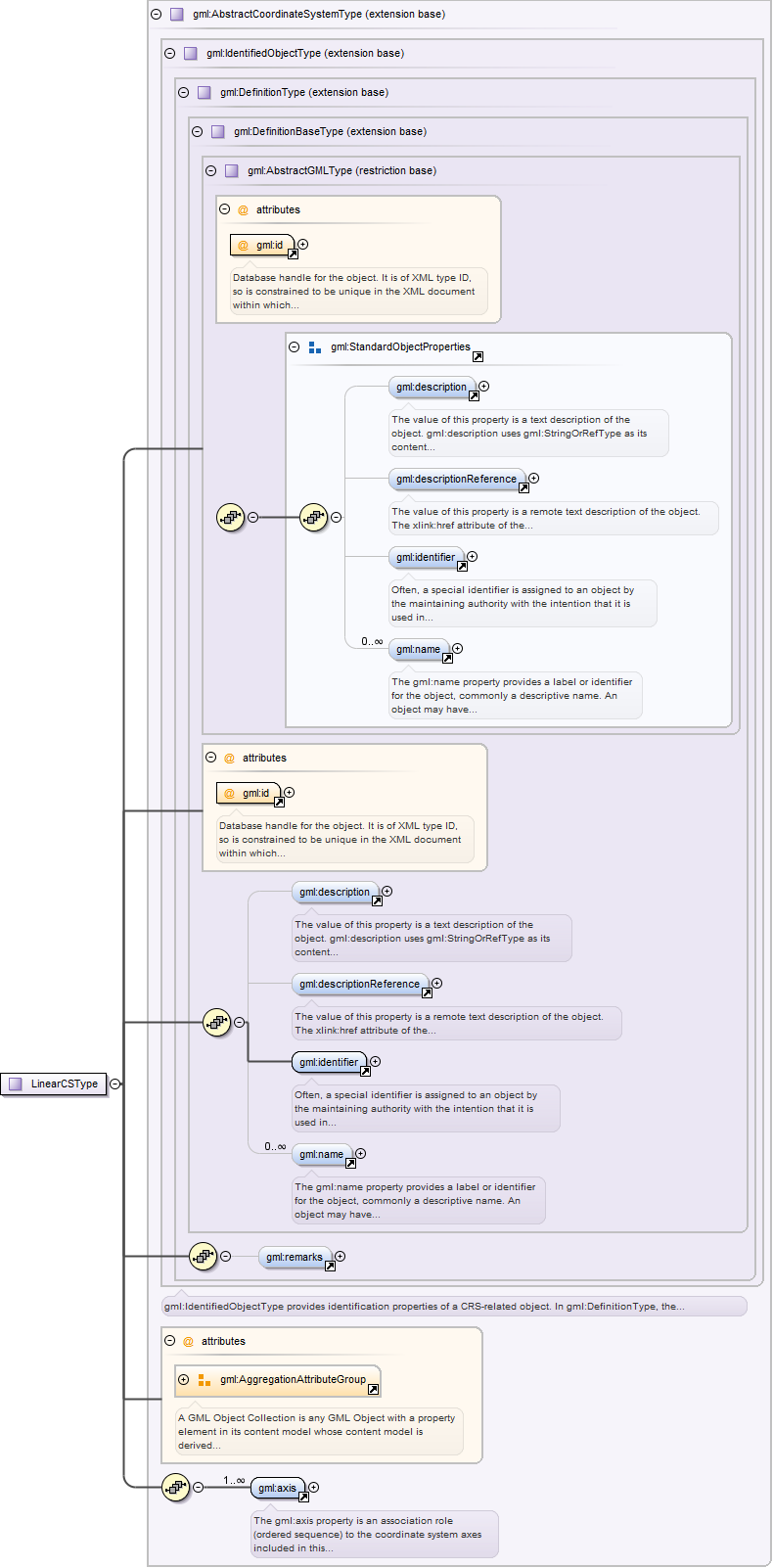
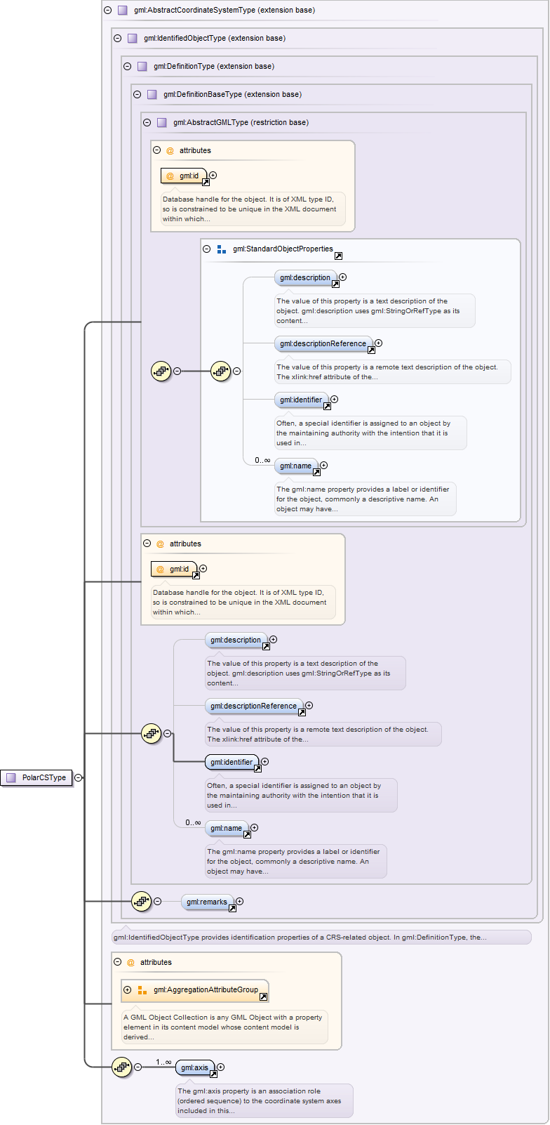
The gml:axis property is an association role (ordered sequence) to thecoordinate system axes included in this coordinate system. The coordinate values in acoordinate tuple shall be recorded in the order in which the coordinate system axesassociations are recorded, whenever those coordinates use a coordinate reference system thatuses this coordinate system. The gml:AggregationAttributeGroup should be used to specifythat the axis objects are ordered.
<element name="axis" type="gml:CoordinateSystemAxisPropertyType"><annotation><documentation>The gml:axis property is an association role (ordered sequence) to the coordinate system axes included in this coordinate system. The coordinate values in a coordinate tuple shall be recorded in the order in which the coordinate system axes associations are recorded, whenever those coordinates use a coordinate reference system that uses this coordinate system. The gml:AggregationAttributeGroup should be used to specify that the axis objects are ordered.</documentation></annotation></element>
<element name="cartesianCS" type="gml:CartesianCSPropertyType"><annotation><documentation>gml:cartesianCS is an association role to the Cartesian coordinate system used by this CRS.</documentation></annotation></element>
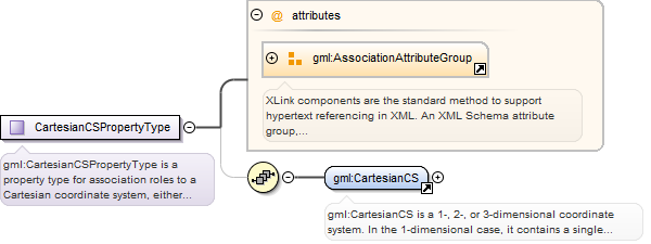
gml:CartesianCS is a 1-, 2-, or 3-dimensional coordinate system. In the1-dimensional case, it contains a single straight coordinate axis. In the 2- and3-dimensional cases gives the position of points relative to orthogonal straight axes. Inthe multi-dimensional case, all axes shall have the same length unit of measure. ACartesianCS shall have one, two, or three gml:axis property elements.
Database handle for the object. It is of XML type ID, so is constrained to beunique in the XML document within which it occurs. An external identifier for the object inthe form of a URI may be constructed using standard XML and XPointer methods. This is doneby concatenating the URI for the document, a fragment separator, and the value of the idattribute.
Source
<element name="CartesianCS" type="gml:CartesianCSType" substitutionGroup="gml:AbstractCoordinateSystem"><annotation><documentation>gml:CartesianCS is a 1-, 2-, or 3-dimensional coordinate system. In the 1-dimensional case, it contains a single straight coordinate axis. In the 2- and 3-dimensional cases gives the position of points relative to orthogonal straight axes. In the multi-dimensional case, all axes shall have the same length unit of measure. A CartesianCS shall have one, two, or three gml:axis property elements.</documentation></annotation></element>
<element name="cylindricalCS" type="gml:CylindricalCSPropertyType"><annotation><documentation>gml:cylindricalCS is an association role to the cylindrical coordinate system used by this CRS.</documentation></annotation></element>
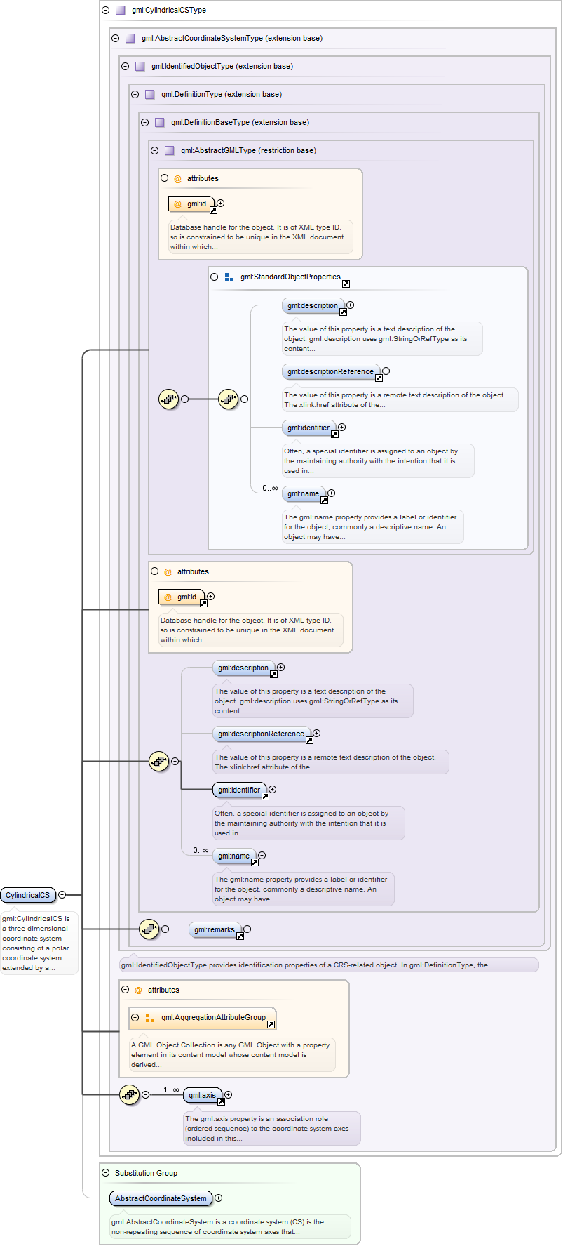
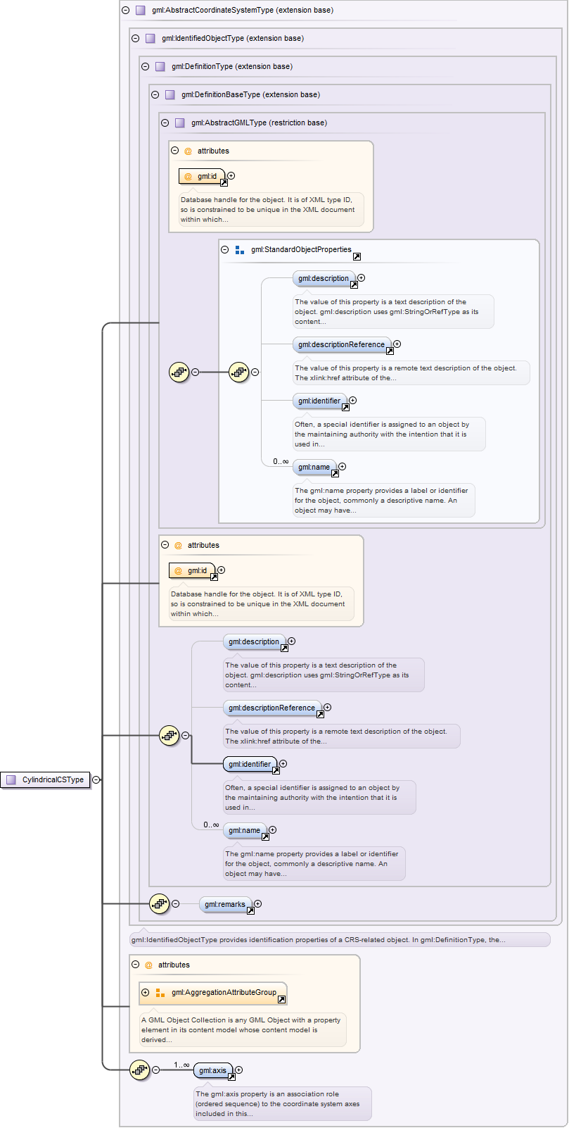
gml:CylindricalCS is a three-dimensional coordinate system consisting of apolar coordinate system extended by a straight coordinate axis perpendicular to the planespanned by the polar coordinate system. A CylindricalCS shall have three gml:axis propertyelements.
Database handle for the object. It is of XML type ID, so is constrained to beunique in the XML document within which it occurs. An external identifier for the object inthe form of a URI may be constructed using standard XML and XPointer methods. This is doneby concatenating the URI for the document, a fragment separator, and the value of the idattribute.
Source
<element name="CylindricalCS" type="gml:CylindricalCSType" substitutionGroup="gml:AbstractCoordinateSystem"><annotation><documentation>gml:CylindricalCS is a three-dimensional coordinate system consisting of a polar coordinate system extended by a straight coordinate axis perpendicular to the plane spanned by the polar coordinate system. A CylindricalCS shall have three gml:axis property elements.</documentation></annotation></element>
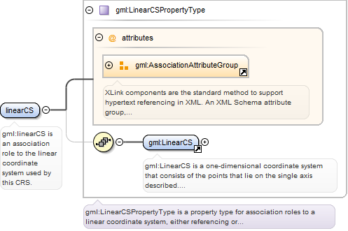
<element name="linearCS" type="gml:LinearCSPropertyType"><annotation><documentation>gml:linearCS is an association role to the linear coordinate system used by this CRS.</documentation></annotation></element>
gml:LinearCS is a one-dimensional coordinate system that consists of the pointsthat lie on the single axis described. The associated coordinate is the distance – with orwithout offset – from the specified datum to the point along the axis. A LinearCS shall haveone gml:axis property element.
Database handle for the object. It is of XML type ID, so is constrained to beunique in the XML document within which it occurs. An external identifier for the object inthe form of a URI may be constructed using standard XML and XPointer methods. This is doneby concatenating the URI for the document, a fragment separator, and the value of the idattribute.
Source
<element name="LinearCS" type="gml:LinearCSType" substitutionGroup="gml:AbstractCoordinateSystem"><annotation><documentation>gml:LinearCS is a one-dimensional coordinate system that consists of the points that lie on the single axis described. The associated coordinate is the distance – with or without offset – from the specified datum to the point along the axis. A LinearCS shall have one gml:axis property element.</documentation></annotation></element>
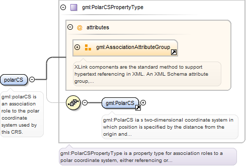
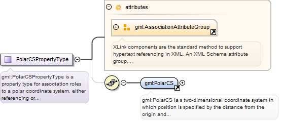
<element name="polarCS" type="gml:PolarCSPropertyType"><annotation><documentation>gml:polarCS is an association role to the polar coordinate system used by this CRS.</documentation></annotation></element>
gml:PolarCS ia s two-dimensional coordinate system in which position isspecified by the distance from the origin and the angle between the line from the origin toa point and a reference direction. A PolarCS shall have two gml:axis propertyelements.
Database handle for the object. It is of XML type ID, so is constrained to beunique in the XML document within which it occurs. An external identifier for the object inthe form of a URI may be constructed using standard XML and XPointer methods. This is doneby concatenating the URI for the document, a fragment separator, and the value of the idattribute.
Source
<element name="PolarCS" type="gml:PolarCSType" substitutionGroup="gml:AbstractCoordinateSystem"><annotation><documentation>gml:PolarCS ia s two-dimensional coordinate system in which position is specified by the distance from the origin and the angle between the line from the origin to a point and a reference direction. A PolarCS shall have two gml:axis property elements.</documentation></annotation></element>
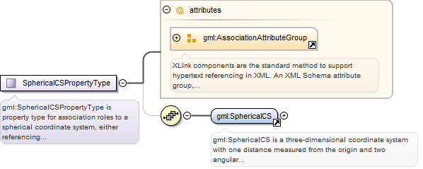
<element name="sphericalCS" type="gml:SphericalCSPropertyType"><annotation><documentation>gml:sphericalCS is an association role to the spherical coordinate system used by this CRS.</documentation></annotation></element>
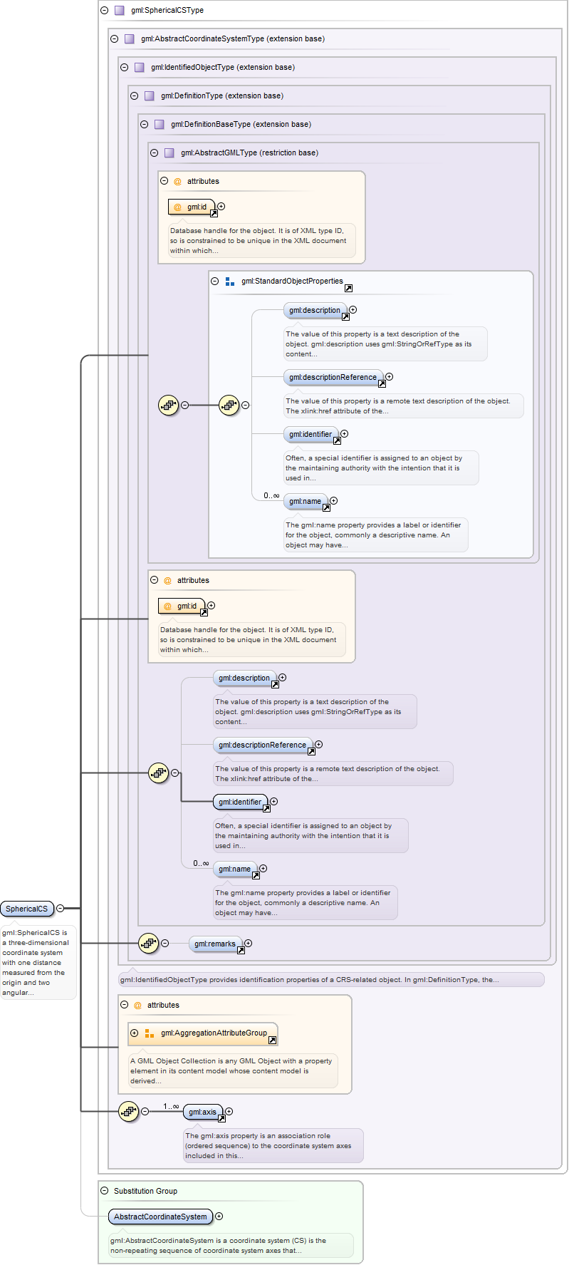
gml:SphericalCS is a three-dimensional coordinate system with one distancemeasured from the origin and two angular coordinates. A SphericalCS shall have threegml:axis property elements.
Database handle for the object. It is of XML type ID, so is constrained to beunique in the XML document within which it occurs. An external identifier for the object inthe form of a URI may be constructed using standard XML and XPointer methods. This is doneby concatenating the URI for the document, a fragment separator, and the value of the idattribute.
Source
<element name="SphericalCS" type="gml:SphericalCSType" substitutionGroup="gml:AbstractCoordinateSystem"><annotation><documentation>gml:SphericalCS is a three-dimensional coordinate system with one distance measured from the origin and two angular coordinates. A SphericalCS shall have three gml:axis property elements.</documentation></annotation></element>
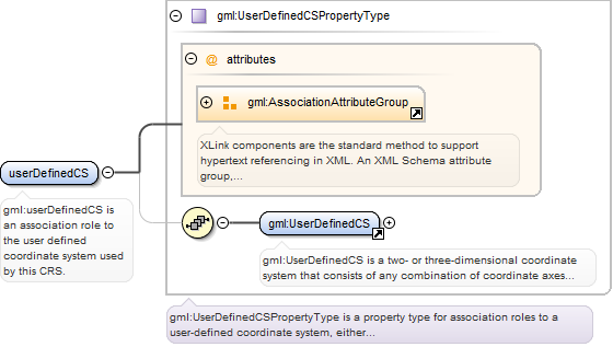
<element name="userDefinedCS" type="gml:UserDefinedCSPropertyType"><annotation><documentation>gml:userDefinedCS is an association role to the user defined coordinate system used by this CRS.</documentation></annotation></element>
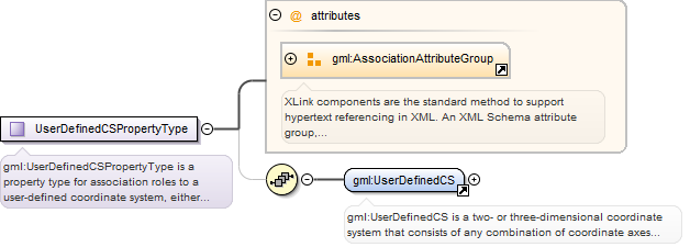
gml:UserDefinedCS is a two- or three-dimensional coordinate system thatconsists of any combination of coordinate axes not covered by any other coordinate systemtype. A UserDefinedCS shall have two or three gml:axis property elements; the number ofproperty elements shall equal the dimension of the CS.
Database handle for the object. It is of XML type ID, so is constrained to beunique in the XML document within which it occurs. An external identifier for the object inthe form of a URI may be constructed using standard XML and XPointer methods. This is doneby concatenating the URI for the document, a fragment separator, and the value of the idattribute.
Source
<element name="UserDefinedCS" type="gml:UserDefinedCSType" substitutionGroup="gml:AbstractCoordinateSystem"><annotation><documentation>gml:UserDefinedCS is a two- or three-dimensional coordinate system that consists of any combination of coordinate axes not covered by any other coordinate system type. A UserDefinedCS shall have two or three gml:axis property elements; the number of property elements shall equal the dimension of the CS.</documentation></annotation></element>
<element name="engineeringDatum" type="gml:EngineeringDatumPropertyType"><annotation><documentation>gml:engineeringDatum is an association role to the engineering datum used by this CRS.</documentation></annotation></element>
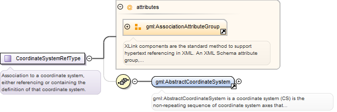
gml:AbstractCoordinateSystem is a coordinate system (CS) is the non-repeatingsequence of coordinate system axes that spans a given coordinate space. A CS is derived froma set of mathematical rules for specifying how coordinates in a given space are to beassigned to points. The coordinate values in a coordinate tuple shall be recorded in theorder in which the coordinate system axes associations are recorded. This abstract complextype shall not be used, extended, or restricted, in an Application Schema, to define aconcrete subtype with a meaning equivalent to a concrete subtype specified in thisdocument.
Database handle for the object. It is of XML type ID, so is constrained to beunique in the XML document within which it occurs. An external identifier for the object inthe form of a URI may be constructed using standard XML and XPointer methods. This is doneby concatenating the URI for the document, a fragment separator, and the value of the idattribute.
Source
<element name="AbstractCoordinateSystem" type="gml:AbstractCoordinateSystemType" abstract="true" substitutionGroup="gml:Definition"><annotation><documentation>gml:AbstractCoordinateSystem is a coordinate system (CS) is the non-repeating sequence of coordinate system axes that spans a given coordinate space. A CS is derived from a set of mathematical rules for specifying how coordinates in a given space are to be assigned to points. The coordinate values in a coordinate tuple shall be recorded in the order in which the coordinate system axes associations are recorded. This abstract complex type shall not be used, extended, or restricted, in an Application Schema, to define a concrete subtype with a meaning equivalent to a concrete subtype specified in this document.</documentation></annotation></element>
Database handle for the object. It is of XML type ID, so is constrained to beunique in the XML document within which it occurs. An external identifier for the object inthe form of a URI may be constructed using standard XML and XPointer methods. This is doneby concatenating the URI for the document, a fragment separator, and the value of the idattribute.
Source
<element name="AbstractSingleCRS" type="gml:AbstractCRSType" abstract="true" substitutionGroup="gml:AbstractCRS"><annotation><documentation>gml:AbstractSingleCRS implements a coordinate reference system consisting of one coordinate system and one datum (as opposed to a Compound CRS).</documentation></annotation></element>
gml:AbstractCRS specifies a coordinate reference system which is usually singlebut may be compound. This abstract complex type shall not be used, extended, or restricted,in a GML Application Schema, to define a concrete subtype with a meaning equivalent to aconcrete subtype specified in this document.
Database handle for the object. It is of XML type ID, so is constrained to beunique in the XML document within which it occurs. An external identifier for the object inthe form of a URI may be constructed using standard XML and XPointer methods. This is doneby concatenating the URI for the document, a fragment separator, and the value of the idattribute.
Source
<element name="AbstractCRS" type="gml:AbstractCRSType" abstract="true" substitutionGroup="gml:Definition"><annotation><documentation>gml:AbstractCRS specifies a coordinate reference system which is usually single but may be compound. This abstract complex type shall not be used, extended, or restricted, in a GML Application Schema, to define a concrete subtype with a meaning equivalent to a concrete subtype specified in this document.</documentation></annotation></element>
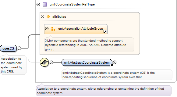
<element name="usesCS" type="gml:CoordinateSystemRefType"><annotation><documentation>Association to the coordinate system used by this CRS.</documentation></annotation></element>
<element name="usesEngineeringDatum" type="gml:EngineeringDatumRefType"><annotation><documentation>Association to the engineering datum used by this CRS.</documentation></annotation></element>
A gml:CompositeCurve is represented by a sequence of (orientable) curves suchthat each curve in the sequence terminates at the start point of the subsequent curve in thelist. curveMember references or contains inline one curve in the composite curve. The curvesare contiguous, the collection of curves is ordered. Therefore, if provided, theaggregationType attribute shall have the value “sequenceâ€.
Database handle for the object. It is of XML type ID, so is constrained to beunique in the XML document within which it occurs. An external identifier for the object inthe form of a URI may be constructed using standard XML and XPointer methods. This is doneby concatenating the URI for the document, a fragment separator, and the value of the idattribute.
<element name="CompositeCurve" type="gml:CompositeCurveType" substitutionGroup="gml:AbstractCurve"><annotation><documentation>A gml:CompositeCurve is represented by a sequence of (orientable) curves such that each curve in the sequence terminates at the start point of the subsequent curve in the list. curveMember references or contains inline one curve in the composite curve. The curves are contiguous, the collection of curves is ordered. Therefore, if provided, the aggregationType attribute shall have the value “sequenceâ€.</documentation></annotation></element>
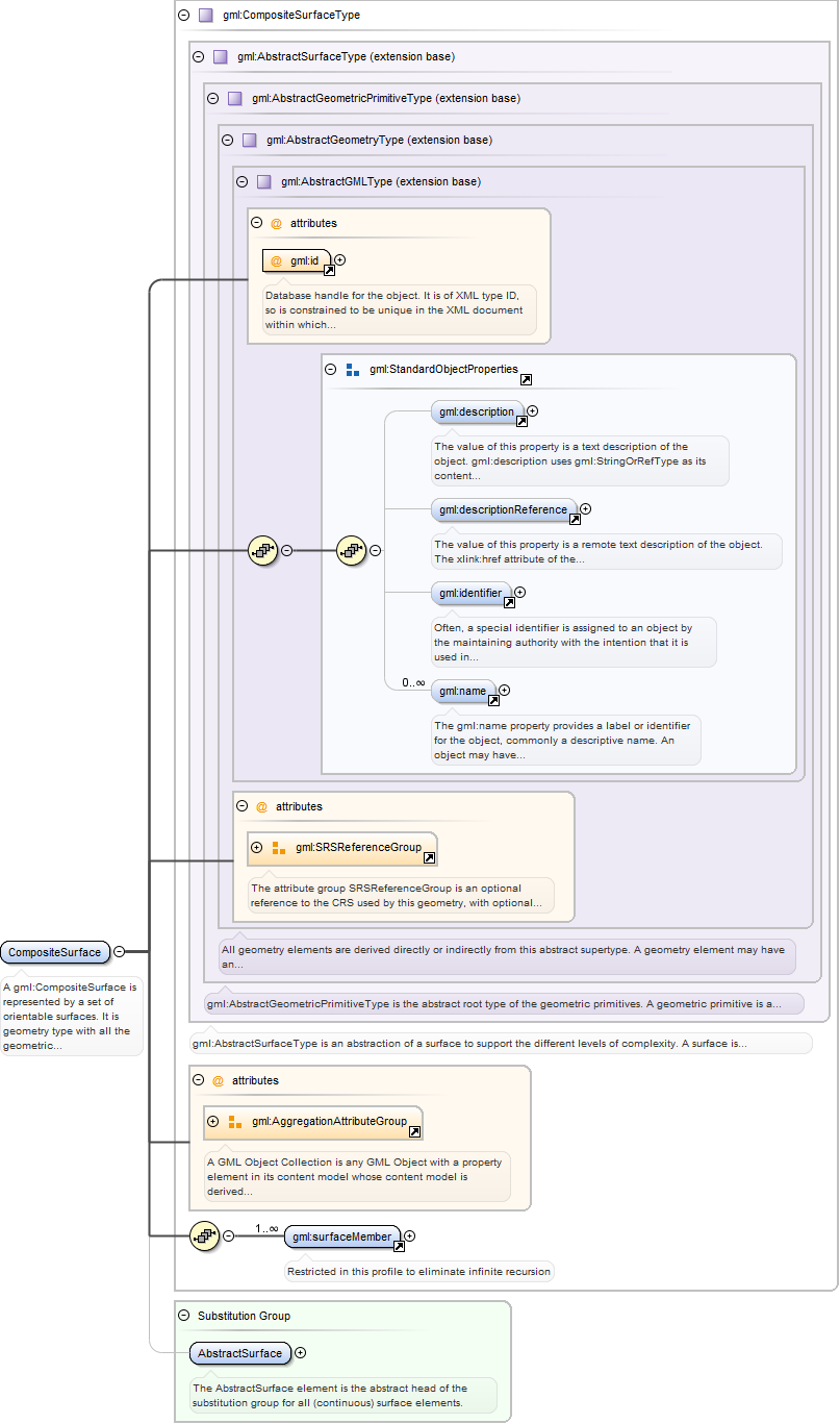
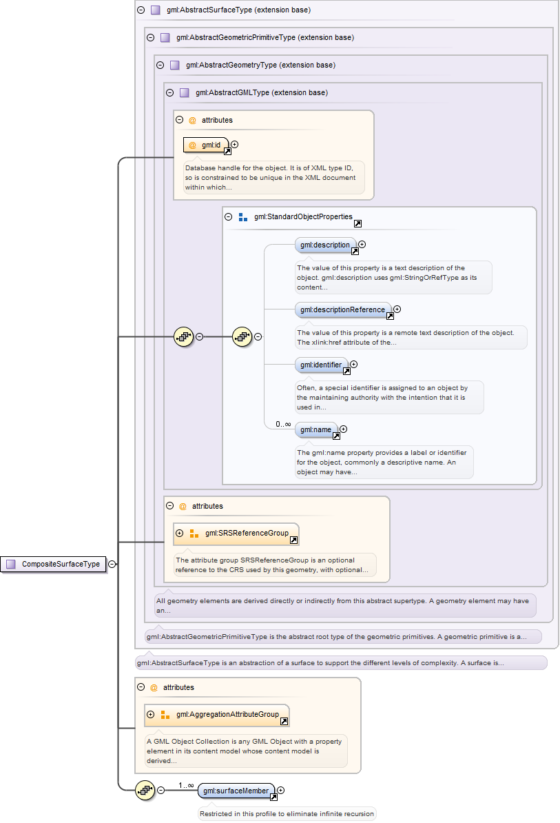
A gml:CompositeSurface is represented by a set of orientable surfaces. It isgeometry type with all the geometric properties of a (primitive) surface. Essentially, acomposite surface is a collection of surfaces that join in pairs on common boundary curvesand which, when considered as a whole, form a single surface. surfaceMember references orcontains inline one surface in the composite surface. The surfaces arecontiguous.
Database handle for the object. It is of XML type ID, so is constrained to beunique in the XML document within which it occurs. An external identifier for the object inthe form of a URI may be constructed using standard XML and XPointer methods. This is doneby concatenating the URI for the document, a fragment separator, and the value of the idattribute.
<element name="CompositeSurface" type="gml:CompositeSurfaceType" substitutionGroup="gml:AbstractSurface"><annotation><documentation>A gml:CompositeSurface is represented by a set of orientable surfaces. It is geometry type with all the geometric properties of a (primitive) surface. Essentially, a composite surface is a collection of surfaces that join in pairs on common boundary curves and which, when considered as a whole, form a single surface. surfaceMember references or contains inline one surface in the composite surface. The surfaces are contiguous.</documentation></annotation></element>
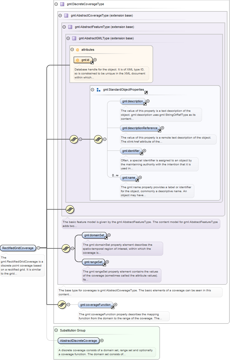
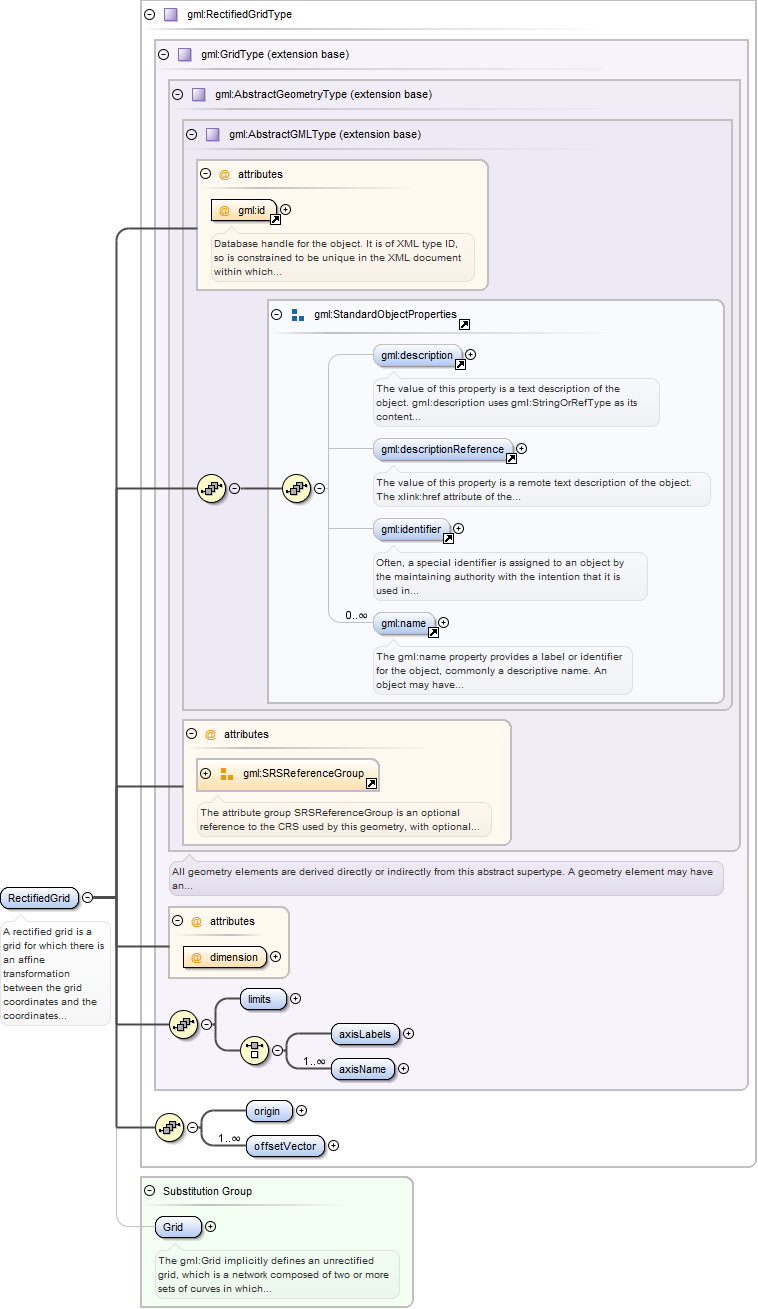
The gml:RectifiedGridCoverage is a discrete point coverage based on a rectifiedgrid. It is similar to the grid coverage except that the points of the grid aregeometrically referenced. The rectified grid coverage has a domain that is agml:RectifiedGrid geometry.
Database handle for the object. It is of XML type ID, so is constrained to beunique in the XML document within which it occurs. An external identifier for the object inthe form of a URI may be constructed using standard XML and XPointer methods. This is doneby concatenating the URI for the document, a fragment separator, and the value of the idattribute.
Source
<element name="RectifiedGridCoverage" type="gml:DiscreteCoverageType" substitutionGroup="gml:AbstractDiscreteCoverage"><annotation><documentation>The gml:RectifiedGridCoverage is a discrete point coverage based on a rectified grid. It is similar to the grid coverage except that the points of the grid are geometrically referenced. The rectified grid coverage has a domain that is a gml:RectifiedGrid geometry.</documentation></annotation></element>
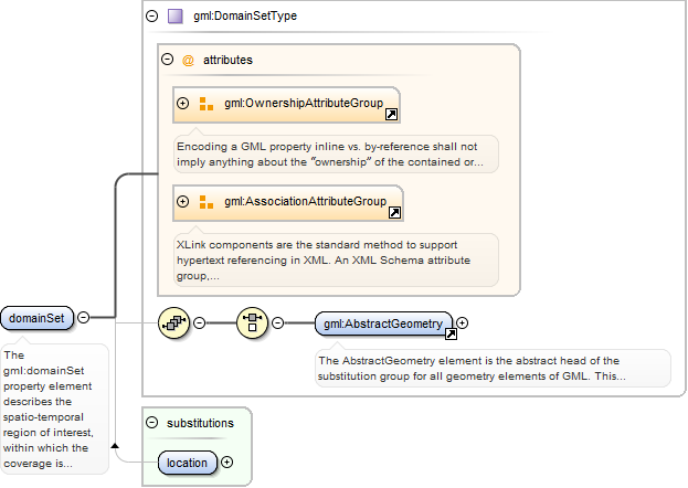
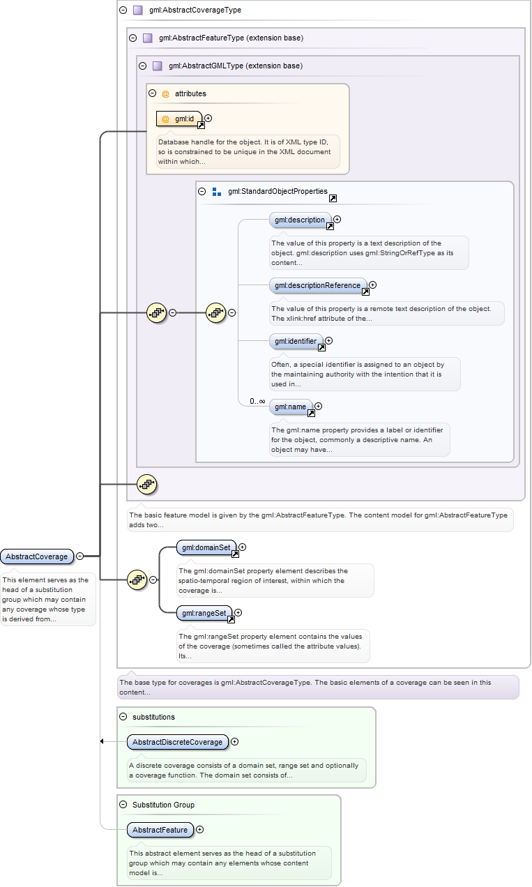
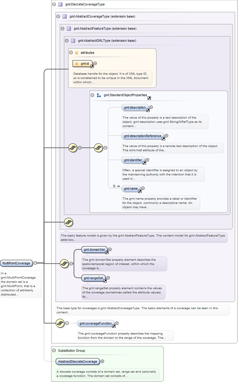
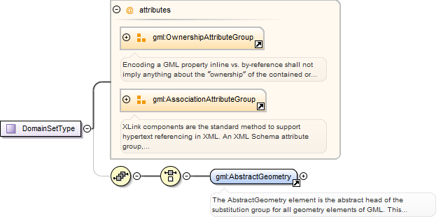
The gml:domainSet property element describes the spatio-temporal region ofinterest, within which the coverage is defined. Its content model is given bygml:DomainSetType. The value of the domain is thus a choice between a gml:AbstractGeometryand a gml:AbstractTimeObject. In the instance these abstract elements will normally besubstituted by a geometry complex or temporal complex, to represent spatial coverages andtime-series, respectively. The presence of the gml:AssociationAttributeGroup means thatdomainSet follows the usual GML property model and may use the xlink:href attribute to pointto the domain, as an alternative to describing the domain inline. Ownership semantics may beprovided using the gml:OwnershipAttributeGroup.
<element name="domainSet" type="gml:DomainSetType"><annotation><documentation>The gml:domainSet property element describes the spatio-temporal region of interest, within which the coverage is defined. Its content model is given by gml:DomainSetType. The value of the domain is thus a choice between a gml:AbstractGeometry and a gml:AbstractTimeObject. In the instance these abstract elements will normally be substituted by a geometry complex or temporal complex, to represent spatial coverages and time-series, respectively. The presence of the gml:AssociationAttributeGroup means that domainSet follows the usual GML property model and may use the xlink:href attribute to point to the domain, as an alternative to describing the domain inline. Ownership semantics may be provided using the gml:OwnershipAttributeGroup.</documentation></annotation></element>
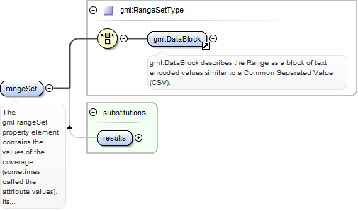
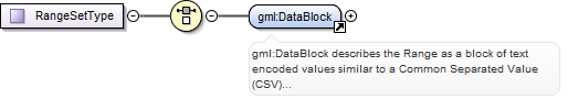
The gml:rangeSet property element contains the values of the coverage(sometimes called the attribute values). Its content model is given by gml:RangeSetType.This content model supports a structural description of the range. The semantic informationdescribing the range set is embedded using a uniform method, as part of the explicit values,or as a template value accompanying the representation using gml:DataBlock and gml:File. Thevalues from each component (or “bandâ€) in the range may be encoded within agml:ValueArray element or a concrete member of the gml:AbstractScalarValueList substitutiongroup . Use of these elements satisfies the value-type homogeneityrequirement.
<element name="rangeSet" type="gml:RangeSetType"><annotation><documentation>The gml:rangeSet property element contains the values of the coverage (sometimes called the attribute values). Its content model is given by gml:RangeSetType. This content model supports a structural description of the range. The semantic information describing the range set is embedded using a uniform method, as part of the explicit values, or as a template value accompanying the representation using gml:DataBlock and gml:File. The values from each component (or “bandâ€) in the range may be encoded within a gml:ValueArray element or a concrete member of the gml:AbstractScalarValueList substitution group . Use of these elements satisfies the value-type homogeneity requirement.</documentation></annotation></element>
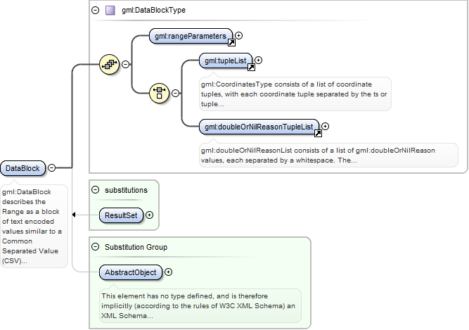
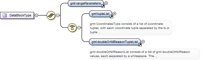
gml:DataBlock describes the Range as a block of text encoded values similar toa Common Separated Value (CSV) representation. The range set parameterization is describedby the property gml:rangeParameters.
<element name="DataBlock" type="gml:DataBlockType" substitutionGroup="gml:AbstractObject"><annotation><documentation>gml:DataBlock describes the Range as a block of text encoded values similar to a Common Separated Value (CSV) representation. The range set parameterization is described by the property gml:rangeParameters.</documentation></annotation></element>
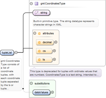
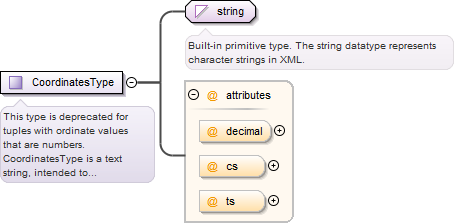
gml:CoordinatesType consists of a list of coordinate tuples, with eachcoordinate tuple separated by the ts or tuple separator (whitespace), and each coordinate inthe tuple by the cs or coordinate separator (comma). The gml:tupleList encoding iseffectively “band-interleavedâ€.
<element name="tupleList" type="gml:CoordinatesType"><annotation><documentation>gml:CoordinatesType consists of a list of coordinate tuples, with each coordinate tuple separated by the ts or tuple separator (whitespace), and each coordinate in the tuple by the cs or coordinate separator (comma). The gml:tupleList encoding is effectively “band-interleavedâ€.</documentation></annotation></element>
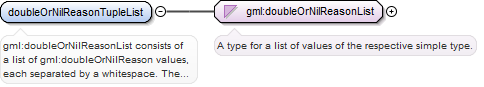
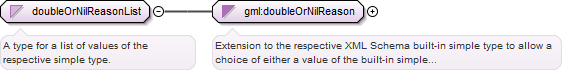
gml:doubleOrNilReasonList consists of a list of gml:doubleOrNilReason values,each separated by a whitespace. The gml:doubleOrNilReason values are grouped into tupleswhere the dimension of each tuple in the list is equal to the number of rangeparameters.
<element name="doubleOrNilReasonTupleList" type="gml:doubleOrNilReasonList"><annotation><documentation>gml:doubleOrNilReasonList consists of a list of gml:doubleOrNilReason values, each separated by a whitespace. The gml:doubleOrNilReason values are grouped into tuples where the dimension of each tuple in the list is equal to the number of range parameters.</documentation></annotation></element>
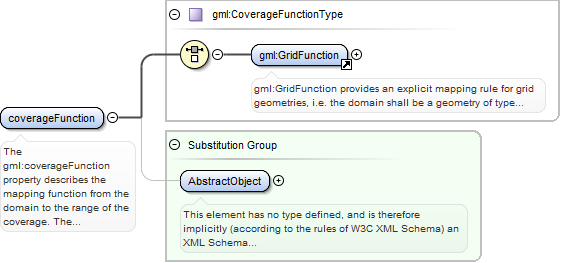
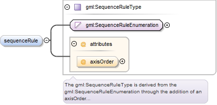
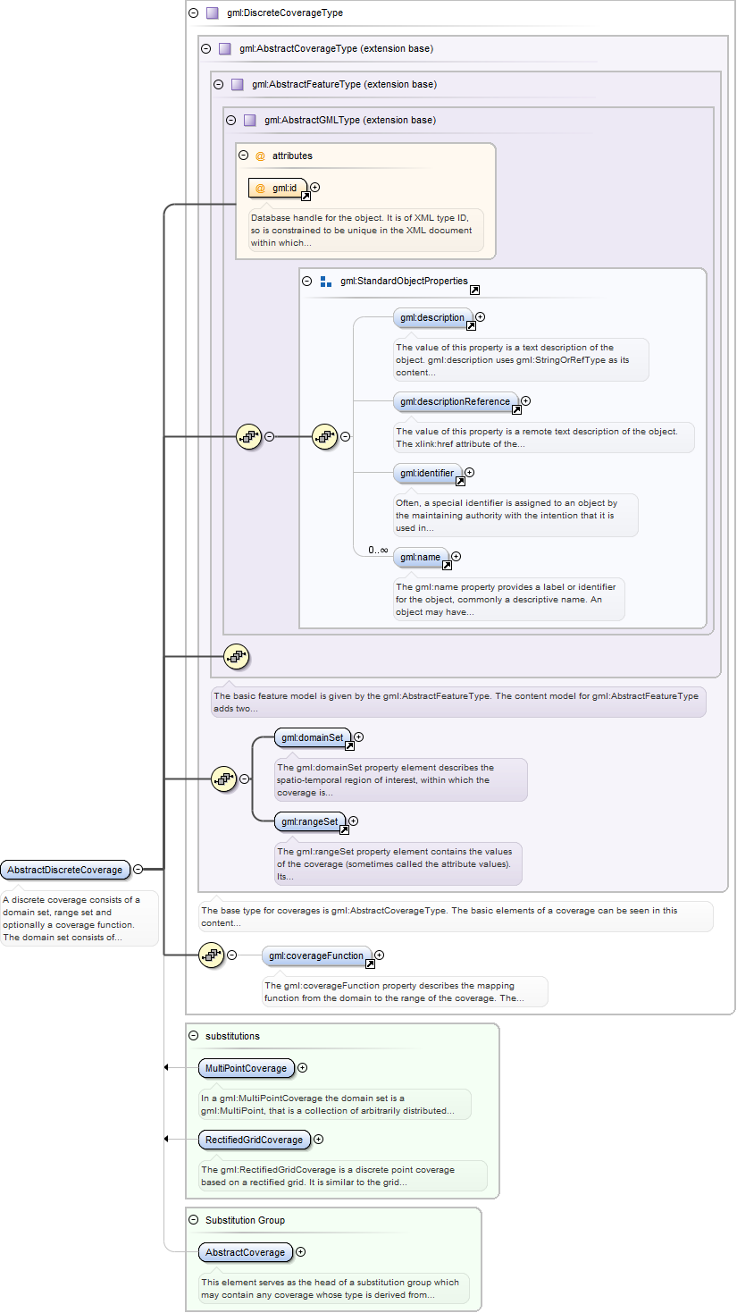
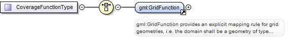
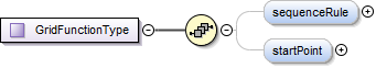
The gml:coverageFunction property describes the mapping function from thedomain to the range of the coverage. The value of the CoverageFunction is one ofgml:CoverageMappingRule and gml:GridFunction. If the gml:coverageFunction property isomitted for a gridded coverage (including rectified gridded coverages) the gml:startPoint isassumed to be the value of the gml:low property in the gml:Grid geometry, and thegml:sequenceRule is assumed to be linear and the gml:axisOrder property is assumed to be“+1 +2â€.
<element name="coverageFunction" type="gml:CoverageFunctionType" substitutionGroup="gml:AbstractObject"><annotation><documentation>The gml:coverageFunction property describes the mapping function from the domain to the range of the coverage. The value of the CoverageFunction is one of gml:CoverageMappingRule and gml:GridFunction. If the gml:coverageFunction property is omitted for a gridded coverage (including rectified gridded coverages) the gml:startPoint is assumed to be the value of the gml:low property in the gml:Grid geometry, and the gml:sequenceRule is assumed to be linear and the gml:axisOrder property is assumed to be “+1 +2â€.</documentation></annotation></element>
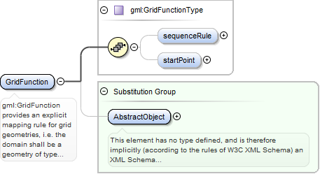
gml:GridFunction provides an explicit mapping rule for grid geometries, i.e.the domain shall be a geometry of type grid. It describes the mapping of grid posts(discrete point grid coverage) or grid cells (discrete surface coverage) to the values inthe range set. The gml:startPoint is the index position of a point in the grid that ismapped to the first point in the range set (this is also the index position of the firstgrid post). If the gml:startPoint property is omitted the gml:startPoint is assumed to beequal to the value of gml:low in the gml:Grid geometry. Subsequent points in the mapping aredetermined by the value of the gml:sequenceRule.
<element name="GridFunction" type="gml:GridFunctionType" substitutionGroup="gml:AbstractObject"><annotation><documentation>gml:GridFunction provides an explicit mapping rule for grid geometries, i.e. the domain shall be a geometry of type grid. It describes the mapping of grid posts (discrete point grid coverage) or grid cells (discrete surface coverage) to the values in the range set. The gml:startPoint is the index position of a point in the grid that is mapped to the first point in the range set (this is also the index position of the first grid post). If the gml:startPoint property is omitted the gml:startPoint is assumed to be equal to the value of gml:low in the gml:Grid geometry. Subsequent points in the mapping are determined by the value of the gml:sequenceRule.</documentation></annotation></element>
This element serves as the head of a substitution group which may contain anycoverage whose type is derived from gml:AbstractCoverageType. It may act as a variable inthe definition of content models where it is required to permit any coverage to bevalid.
Database handle for the object. It is of XML type ID, so is constrained to beunique in the XML document within which it occurs. An external identifier for the object inthe form of a URI may be constructed using standard XML and XPointer methods. This is doneby concatenating the URI for the document, a fragment separator, and the value of the idattribute.
Source
<element name="AbstractCoverage" type="gml:AbstractCoverageType" abstract="true" substitutionGroup="gml:AbstractFeature"><annotation><documentation>This element serves as the head of a substitution group which may contain any coverage whose type is derived from gml:AbstractCoverageType. It may act as a variable in the definition of content models where it is required to permit any coverage to be valid.</documentation></annotation></element>
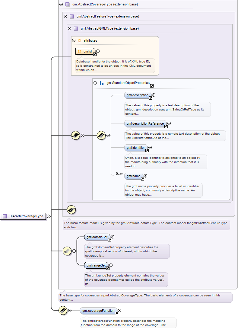
A discrete coverage consists of a domain set, range set and optionally acoverage function. The domain set consists of either spatial or temporal geometry objects,finite in number. The range set is comprised of a finite number of attribute values each ofwhich is associated to every direct position within any single spatiotemporal object in thedomain. In other words, the range values are constant on each spatiotemporal object in thedomain. This coverage function maps each element from the coverage domain to an element inits range. The coverageFunction element describes the mapping function. This element servesas the head of a substitution group which may contain any discrete coverage whose type isderived from gml:DiscreteCoverageType.
Database handle for the object. It is of XML type ID, so is constrained to beunique in the XML document within which it occurs. An external identifier for the object inthe form of a URI may be constructed using standard XML and XPointer methods. This is doneby concatenating the URI for the document, a fragment separator, and the value of the idattribute.
Source
<element name="AbstractDiscreteCoverage" type="gml:DiscreteCoverageType" abstract="true" substitutionGroup="gml:AbstractCoverage"><annotation><documentation>A discrete coverage consists of a domain set, range set and optionally a coverage function. The domain set consists of either spatial or temporal geometry objects, finite in number. The range set is comprised of a finite number of attribute values each of which is associated to every direct position within any single spatiotemporal object in the domain. In other words, the range values are constant on each spatiotemporal object in the domain. This coverage function maps each element from the coverage domain to an element in its range. The coverageFunction element describes the mapping function. This element serves as the head of a substitution group which may contain any discrete coverage whose type is derived from gml:DiscreteCoverageType.</documentation></annotation></element>
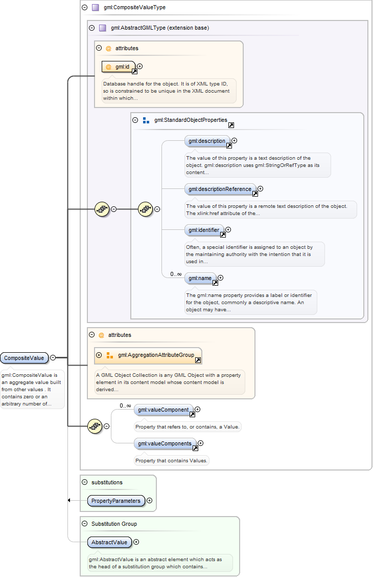
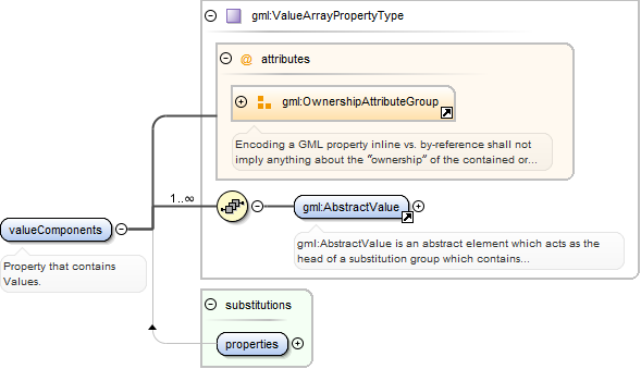
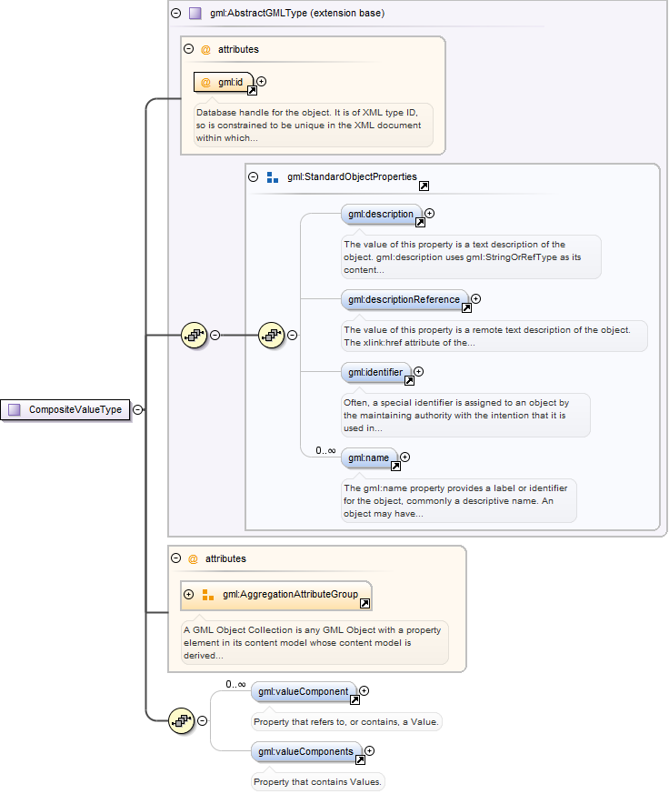
gml:CompositeValue is an aggregate value built from other values . It containszero or an arbitrary number of gml:valueComponent elements, and zero or onegml:valueComponents property elements. It may be used for strongly coupled aggregates(vectors, tensors) or for arbitrary collections of values.
Database handle for the object. It is of XML type ID, so is constrained to beunique in the XML document within which it occurs. An external identifier for the object inthe form of a URI may be constructed using standard XML and XPointer methods. This is doneby concatenating the URI for the document, a fragment separator, and the value of the idattribute.
Source
<element name="CompositeValue" type="gml:CompositeValueType" substitutionGroup="gml:AbstractValue"><annotation><documentation>gml:CompositeValue is an aggregate value built from other values . It contains zero or an arbitrary number of gml:valueComponent elements, and zero or one gml:valueComponents property elements. It may be used for strongly coupled aggregates (vectors, tensors) or for arbitrary collections of values.</documentation></annotation></element>
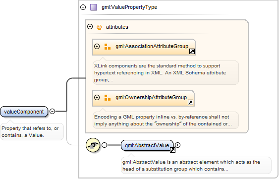
<element name="valueComponent" type="gml:ValuePropertyType"><annotation><documentation>Property that refers to, or contains, a Value.</documentation></annotation></element>
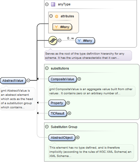
gml:AbstractValue is an abstract element which acts as the head of asubstitution group which contains gml:AbstractScalarValue, gml:AbstractScalarValueList,gml:CompositeValue and gml:ValueExtent, and (transitively) the elements in theirsubstitution groups. These elements may be used in an application schema as variables, sothat in an XML instance document any member of its substitution group mayoccur.
<element name="AbstractValue" type="anyType" abstract="true" substitutionGroup="gml:AbstractObject"><annotation><documentation>gml:AbstractValue is an abstract element which acts as the head of a substitution group which contains gml:AbstractScalarValue, gml:AbstractScalarValueList, gml:CompositeValue and gml:ValueExtent, and (transitively) the elements in their substitution groups. These elements may be used in an application schema as variables, so that in an XML instance document any member of its substitution group may occur.</documentation></annotation></element>
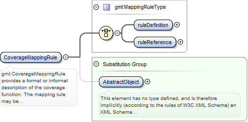
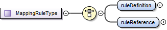
gml:CoverageMappingRule provides a formal or informal description of thecoverage function. The mapping rule may be defined as an in-line string (gml:ruleDefinition)or via a remote reference through xlink:href (gml:ruleReference). If no rule name isspecified, the default is ‘Linear’ with respect to members of the domain in documentorder.
<element name="CoverageMappingRule" type="gml:MappingRuleType" substitutionGroup="gml:AbstractObject"><annotation><documentation>gml:CoverageMappingRule provides a formal or informal description of the coverage function. The mapping rule may be defined as an in-line string (gml:ruleDefinition) or via a remote reference through xlink:href (gml:ruleReference). If no rule name is specified, the default is ‘Linear’ with respect to members of the domain in document order.</documentation></annotation></element>
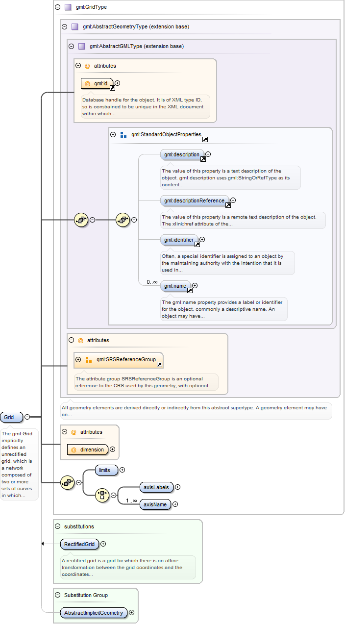
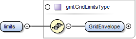
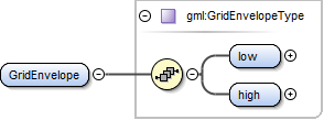
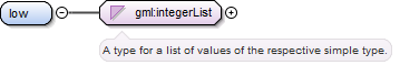
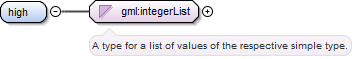
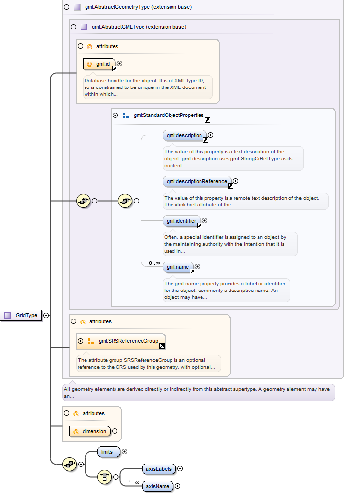
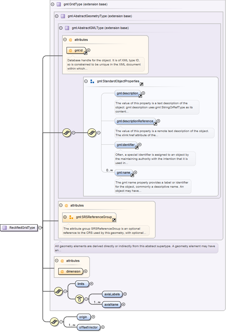
The gml:Grid implicitly defines an unrectified grid, which is a networkcomposed of two or more sets of curves in which the members of each set intersect themembers of the other sets in an algorithmic way. The region of interest within the grid isgiven in terms of its gml:limits, being the grid coordinates of diagonally opposed cornersof a rectangular region. gml:axisLabels is provided with a list of labels of the axes of thegrid (gml:axisName has been deprecated). gml:dimension specifies the dimension of the grid.The gml:limits element contains a single gml:GridEnvelope. The gml:low and gml:high propertyelements of the envelope are each integerLists, which are coordinate tuples, the coordinatesbeing measured as offsets from the origin of the grid along each axis, of the diagonallyopposing corners of a “rectangular†region of interest.
Database handle for the object. It is of XML type ID, so is constrained to beunique in the XML document within which it occurs. An external identifier for the object inthe form of a URI may be constructed using standard XML and XPointer methods. This is doneby concatenating the URI for the document, a fragment separator, and the value of the idattribute.
<element name="Grid" type="gml:GridType" substitutionGroup="gml:AbstractImplicitGeometry"><annotation><documentation>The gml:Grid implicitly defines an unrectified grid, which is a network composed of two or more sets of curves in which the members of each set intersect the members of the other sets in an algorithmic way. The region of interest within the grid is given in terms of its gml:limits, being the grid coordinates of diagonally opposed corners of a rectangular region. gml:axisLabels is provided with a list of labels of the axes of the grid (gml:axisName has been deprecated). gml:dimension specifies the dimension of the grid. The gml:limits element contains a single gml:GridEnvelope. The gml:low and gml:high property elements of the envelope are each integerLists, which are coordinate tuples, the coordinates being measured as offsets from the origin of the grid along each axis, of the diagonally opposing corners of a “rectangular†region of interest.</documentation></annotation></element>
Database handle for the object. It is of XML type ID, so is constrained to beunique in the XML document within which it occurs. An external identifier for the object inthe form of a URI may be constructed using standard XML and XPointer methods. This is doneby concatenating the URI for the document, a fragment separator, and the value of the idattribute.
A rectified grid is a grid for which there is an affine transformation betweenthe grid coordinates and the coordinates of an external coordinate reference system. It isdefined by specifying the position (in some geometric space) of the grid “origin†and ofthe vectors that specify the post locations. Note that the grid limits (post indexes) andaxis name properties are inherited from gml:GridType and that gml:RectifiedGrid adds agml:origin property (contains or references a gml:Point) and a set of gml:offsetVectorproperties.
Database handle for the object. It is of XML type ID, so is constrained to beunique in the XML document within which it occurs. An external identifier for the object inthe form of a URI may be constructed using standard XML and XPointer methods. This is doneby concatenating the URI for the document, a fragment separator, and the value of the idattribute.
<element name="RectifiedGrid" type="gml:RectifiedGridType" substitutionGroup="gml:Grid"><annotation><documentation>A rectified grid is a grid for which there is an affine transformation between the grid coordinates and the coordinates of an external coordinate reference system. It is defined by specifying the position (in some geometric space) of the grid “origin†and of the vectors that specify the post locations. Note that the grid limits (post indexes) and axis name properties are inherited from gml:GridType and that gml:RectifiedGrid adds a gml:origin property (contains or references a gml:Point) and a set of gml:offsetVector properties.</documentation></annotation></element>
In a gml:MultiPointCoverage the domain set is a gml:MultiPoint, that is acollection of arbitrarily distributed geometric points. The content model is identical withgml:DiscreteCoverageType, but that gml:domainSet shall have values gml:MultiPoint. In agml:MultiPointCoverage the mapping from the domain to the range is straightforward. - Forgml:DataBlock encodings the points of the gml:MultiPoint are mapped in document order to thetuples of the data block. - For gml:CompositeValue encodings the points of thegml:MultiPoint are mapped to the members of the composite value in document order. - Forgml:File encodings the points of the gml:MultiPoint are mapped to the records of the file insequential order.
Database handle for the object. It is of XML type ID, so is constrained to beunique in the XML document within which it occurs. An external identifier for the object inthe form of a URI may be constructed using standard XML and XPointer methods. This is doneby concatenating the URI for the document, a fragment separator, and the value of the idattribute.
Source
<element name="MultiPointCoverage" type="gml:DiscreteCoverageType" substitutionGroup="gml:AbstractDiscreteCoverage"><annotation><documentation>In a gml:MultiPointCoverage the domain set is a gml:MultiPoint, that is a collection of arbitrarily distributed geometric points. The content model is identical with gml:DiscreteCoverageType, but that gml:domainSet shall have values gml:MultiPoint. In a gml:MultiPointCoverage the mapping from the domain to the range is straightforward. - For gml:DataBlock encodings the points of the gml:MultiPoint are mapped in document order to the tuples of the data block. - For gml:CompositeValue encodings the points of the gml:MultiPoint are mapped to the members of the composite value in document order. - For gml:File encodings the points of the gml:MultiPoint are mapped to the records of the file in sequential order.</documentation></annotation></element>
A ring is used to represent a single connected component of a surface boundaryas specified in ISO 19107:2003, 6.3.6. Every gml:curveMember references or contains onecurve, i.e. any element which is substitutable for gml:AbstractCurve. In the context of aring, the curves describe the boundary of the surface. The sequence of curves shall becontiguous and connected in a cycle. If provided, the aggregationType attribute shall havethe value “sequence”.
<element name="Ring" type="gml:RingType" substitutionGroup="gml:AbstractRing"><annotation><documentation>A ring is used to represent a single connected component of a surface boundary as specified in ISO 19107:2003, 6.3.6. Every gml:curveMember references or contains one curve, i.e. any element which is substitutable for gml:AbstractCurve. In the context of a ring, the curves describe the boundary of the surface. The sequence of curves shall be contiguous and connected in a cycle. If provided, the aggregationType attribute shall have the value “sequence”.</documentation></annotation></element>
A property that has a point as its value domain may either be an appropriategeometry element encapsulated in an element of this type or an XLink reference to a remotegeometry element (where remote includes geometry elements located elsewhere in the samedocument). Either the reference or the contained element shall be given, but neither bothnor none.
<complexType name="PointPropertyType"><annotation><documentation>A property that has a point as its value domain may either be an appropriate geometry element encapsulated in an element of this type or an XLink reference to a remote geometry element (where remote includes geometry elements located elsewhere in the same document). Either the reference or the contained element shall be given, but neither both nor none.</documentation></annotation><sequence minOccurs="0"><element ref="gml:Point"/></sequence><attributeGroup ref="gml:AssociationAttributeGroup"/><attributeGroup ref="gml:OwnershipAttributeGroup"/></complexType>
Database handle for the object. It is of XML type ID, so is constrained to beunique in the XML document within which it occurs. An external identifier for the object inthe form of a URI may be constructed using standard XML and XPointer methods. This is doneby concatenating the URI for the document, a fragment separator, and the value of the idattribute.
gml:AbstractGeometricPrimitiveType is the abstract root type of the geometricprimitives. A geometric primitive is a geometric object that is not decomposed further intoother primitives in the system. All primitives are oriented in the direction implied by thesequence of their coordinate tuples.
Database handle for the object. It is of XML type ID, so is constrained to beunique in the XML document within which it occurs. An external identifier for the object inthe form of a URI may be constructed using standard XML and XPointer methods. This is doneby concatenating the URI for the document, a fragment separator, and the value of the idattribute.
<complexType name="AbstractGeometricPrimitiveType" abstract="true"><annotation><documentation>gml:AbstractGeometricPrimitiveType is the abstract root type of the geometric primitives. A geometric primitive is a geometric object that is not decomposed further into other primitives in the system. All primitives are oriented in the direction implied by the sequence of their coordinate tuples.</documentation></annotation><complexContent><extension base="gml:AbstractGeometryType"/></complexContent></complexType>
All geometry elements are derived directly or indirectly from this abstractsupertype. A geometry element may have an identifying attribute (gml:id), one or more names(elements identifier and name) and a description (elements description anddescriptionReference) . It may be associated with a spatial reference system (attributegroup gml:SRSReferenceGroup). The following rules shall be adhered to: - Every geometry typeshall derive from this abstract type. - Every geometry element (i.e. an element of ageometry type) shall be directly or indirectly in the substitution group ofAbstractGeometry.
Database handle for the object. It is of XML type ID, so is constrained to beunique in the XML document within which it occurs. An external identifier for the object inthe form of a URI may be constructed using standard XML and XPointer methods. This is doneby concatenating the URI for the document, a fragment separator, and the value of the idattribute.
<complexType name="AbstractGeometryType" abstract="true"><annotation><documentation>All geometry elements are derived directly or indirectly from this abstract supertype. A geometry element may have an identifying attribute (gml:id), one or more names (elements identifier and name) and a description (elements description and descriptionReference) . It may be associated with a spatial reference system (attribute group gml:SRSReferenceGroup). The following rules shall be adhered to: - Every geometry type shall derive from this abstract type. - Every geometry element (i.e. an element of a geometry type) shall be directly or indirectly in the substitution group of AbstractGeometry.</documentation></annotation><complexContent><extension base="gml:AbstractGMLType"><attributeGroup ref="gml:SRSReferenceGroup"/></extension></complexContent></complexType>
Database handle for the object. It is of XML type ID, so is constrained to beunique in the XML document within which it occurs. An external identifier for the object inthe form of a URI may be constructed using standard XML and XPointer methods. This is doneby concatenating the URI for the document, a fragment separator, and the value of the idattribute.
gml:NilReasonType defines a content model that allows recording of anexplanation for a void value or other exception. gml:NilReasonType is a union of thefollowing enumerated values: - inapplicable there is no value - missing the correct value isnot readily available to the sender of this data. Furthermore, a correct value may not exist- template the value will be available later - unknown the correct value is not known to,and not computable by, the sender of this data. However, a correct value probably exists -withheld the value is not divulged - other:text other brief explanation, where text is astring of two or more characters with no included spaces and - anyURI which should refer toa resource which describes the reason for the exception A particular community may choose toassign more detailed semantics to the standard values provided. Alternatively, the URImethod enables a specific or more complete explanation for the absence of a value to beprovided elsewhere and indicated by-reference in an instance document. gml:NilReasonType isused as a member of a union in a number of simple content types where it is necessary topermit a value from the NilReasonType union as an alternative to the primarytype.
<simpleType name="NilReasonType"><annotation><documentation>gml:NilReasonType defines a content model that allows recording of an explanation for a void value or other exception. gml:NilReasonType is a union of the following enumerated values: - inapplicable there is no value - missing the correct value is not readily available to the sender of this data. Furthermore, a correct value may not exist - template the value will be available later - unknown the correct value is not known to, and not computable by, the sender of this data. However, a correct value probably exists - withheld the value is not divulged - other:text other brief explanation, where text is a string of two or more characters with no included spaces and - anyURI which should refer to a resource which describes the reason for the exception A particular community may choose to assign more detailed semantics to the standard values provided. Alternatively, the URI method enables a specific or more complete explanation for the absence of a value to be provided elsewhere and indicated by-reference in an instance document. gml:NilReasonType is used as a member of a union in a number of simple content types where it is necessary to permit a value from the NilReasonType union as an alternative to the primary type.</documentation></annotation><union memberTypes="gml:NilReasonEnumeration anyURI"/></simpleType>
<complexType name="ReferenceType"><annotation><documentation>gml:ReferenceType is intended to be used in application schemas directly, if a property element shall use a “by-reference only” encoding.</documentation></annotation><sequence/><attributeGroup ref="gml:OwnershipAttributeGroup"/><attributeGroup ref="gml:AssociationAttributeGroup"/></complexType>
<complexType name="CodeWithAuthorityType"><annotation><documentation>gml:CodeWithAuthorityType requires that the codeSpace attribute is provided in an instance.</documentation></annotation><simpleContent><restriction base="gml:CodeType"><pattern value="urn:diggs:def:feature:[A-Z]{1,8}:[A-z0-9_\.\-]{1,200}"/><attribute name="codeSpace" type="anyURI" use="required"/></restriction></simpleContent></complexType>
gml:CodeType is a generalized type to be used for a term, keyword or name. Itadds a XML attribute codeSpace to a term, where the value of the codeSpace attribute (ifpresent) shall indicate a dictionary, thesaurus, classification scheme, authority, orpattern for the term.
<complexType name="CodeType"><annotation><documentation>gml:CodeType is a generalized type to be used for a term, keyword or name. It adds a XML attribute codeSpace to a term, where the value of the codeSpace attribute (if present) shall indicate a dictionary, thesaurus, classification scheme, authority, or pattern for the term.</documentation></annotation><simpleContent><extension base="string"><attribute name="codeSpace" type="anyURI"/></extension></simpleContent></complexType>
<simpleType name="NCNameList"><annotation><documentation>A type for a list of values of the respective simple type.</documentation></annotation><list itemType="NCName"/></simpleType>
Direct position instances hold the coordinates for a position within somecoordinate reference system (CRS). Since direct positions, as data types, will often beincluded in larger objects (such as geometry elements) that have references to CRS, thesrsName attribute will in general be missing, if this particular direct position is includedin a larger element with such a reference to a CRS. In this case, the CRS is implicitlyassumed to take on the value of the containing object's CRS. if no srsName attribute isgiven, the CRS shall be specified as part of the larger context this geometry element ispart of, typically a geometric object like a point, curve, etc.
<complexType name="DirectPositionType"><annotation><documentation>Direct position instances hold the coordinates for a position within some coordinate reference system (CRS). Since direct positions, as data types, will often be included in larger objects (such as geometry elements) that have references to CRS, the srsName attribute will in general be missing, if this particular direct position is included in a larger element with such a reference to a CRS. In this case, the CRS is implicitly assumed to take on the value of the containing object's CRS. if no srsName attribute is given, the CRS shall be specified as part of the larger context this geometry element is part of, typically a geometric object like a point, curve, etc.</documentation></annotation><simpleContent><extension base="gml:doubleList"><attributeGroup ref="gml:SRSReferenceGroup"/></extension></simpleContent></complexType>
<simpleType name="doubleList"><annotation><documentation>A type for a list of values of the respective simple type.</documentation></annotation><list itemType="double"/></simpleType>
Database handle for the object. It is of XML type ID, so is constrained to beunique in the XML document within which it occurs. An external identifier for the object inthe form of a URI may be constructed using standard XML and XPointer methods. This is doneby concatenating the URI for the document, a fragment separator, and the value of the idattribute.
Database handle for the object. It is of XML type ID, so is constrained to beunique in the XML document within which it occurs. An external identifier for the object inthe form of a URI may be constructed using standard XML and XPointer methods. This is doneby concatenating the URI for the document, a fragment separator, and the value of the idattribute.
gml:IdentifiedObjectType provides identification properties of a CRS-relatedobject. In gml:DefinitionType, the gml:identifier element shall be the primary name by whichthis object is identified, encoding the "name" attribute in the UML model. Zero or more ofthe gml:name elements can be an unordered set of "identifiers", encoding the "identifier"attribute in the UML model. Each of these gml:name elements can reference elsewhere theobject's defining information or be an identifier by which this object can be referenced.Zero or more other gml:name elements can be an unordered set of "alias" alternative names bywhich this CRS related object is identified, encoding the "alias" attributes in the UMLmodel. An object may have several aliases, typically used in different contexts. The contextfor an alias is indicated by the value of its (optional) codeSpace attribute. Any neededversion information shall be included in the codeSpace attribute of a gml:identifier andgml:name elements. In this use, the gml:remarks element in the gml:DefinitionType shallcontain comments on or information about this object, including data sourceinformation.
Database handle for the object. It is of XML type ID, so is constrained to beunique in the XML document within which it occurs. An external identifier for the object inthe form of a URI may be constructed using standard XML and XPointer methods. This is doneby concatenating the URI for the document, a fragment separator, and the value of the idattribute.
Source
<complexType name="IdentifiedObjectType" abstract="true"><annotation><documentation>gml:IdentifiedObjectType provides identification properties of a CRS-related object. In gml:DefinitionType, the gml:identifier element shall be the primary name by which this object is identified, encoding the "name" attribute in the UML model. Zero or more of the gml:name elements can be an unordered set of "identifiers", encoding the "identifier" attribute in the UML model. Each of these gml:name elements can reference elsewhere the object's defining information or be an identifier by which this object can be referenced. Zero or more other gml:name elements can be an unordered set of "alias" alternative names by which this CRS related object is identified, encoding the "alias" attributes in the UML model. An object may have several aliases, typically used in different contexts. The context for an alias is indicated by the value of its (optional) codeSpace attribute. Any needed version information shall be included in the codeSpace attribute of a gml:identifier and gml:name elements. In this use, the gml:remarks element in the gml:DefinitionType shall contain comments on or information about this object, including data source information.</documentation></annotation><complexContent><extension base="gml:DefinitionType"/></complexContent></complexType>
Database handle for the object. It is of XML type ID, so is constrained to beunique in the XML document within which it occurs. An external identifier for the object inthe form of a URI may be constructed using standard XML and XPointer methods. This is doneby concatenating the URI for the document, a fragment separator, and the value of the idattribute.
Database handle for the object. It is of XML type ID, so is constrained to beunique in the XML document within which it occurs. An external identifier for the object inthe form of a URI may be constructed using standard XML and XPointer methods. This is doneby concatenating the URI for the document, a fragment separator, and the value of the idattribute.
Database handle for the object. It is of XML type ID, so is constrained to beunique in the XML document within which it occurs. An external identifier for the object inthe form of a URI may be constructed using standard XML and XPointer methods. This is doneby concatenating the URI for the document, a fragment separator, and the value of the idattribute.
The uom attribute provides an identifier of the unit of measure used forthis coordinate system axis. The value of this coordinate in a coordinate tuple shallbe recorded using this unit of measure, whenever those coordinates use a coordinatereference system that uses a coordinate system that uses this axis.
Source
<complexType name="CoordinateSystemAxisType"><complexContent><extension base="gml:IdentifiedObjectType"><sequence><element ref="gml:axisAbbrev"/><element ref="gml:axisDirection"/><element ref="gml:minimumValue" minOccurs="0"/><element ref="gml:maximumValue" minOccurs="0"/><element ref="gml:rangeMeaning" minOccurs="0"/></sequence><attribute name="uom" type="gml:UomIdentifier" use="required"><annotation><documentation>The uom attribute provides an identifier of the unit of measure used for this coordinate system axis. The value of this coordinate in a coordinate tuple shall be recorded using this unit of measure, whenever those coordinates use a coordinate reference system that uses a coordinate system that uses this axis.</documentation></annotation></attribute></extension></complexContent></complexType>
<simpleType name="UomIdentifier"><annotation><documentation>The simple type gml:UomIdentifer defines the syntax and value space of the unit of measure identifier.</documentation></annotation><union memberTypes="gml:UomSymbol gml:UomURI"/></simpleType>
This type specifies a character string of length at least one, and restrictedsuch that it must not contain any of the following characters: “:” (colon), “ “ (space),(newline), (carriage return), (tab). This allows values corresponding to familiarabbreviations, such as “kg”, “m/s”, etc. It is recommended that the symbol be an identifierfor a unit of measure as specified in the “Unified Code of Units of Measure" (UCUM)(http://aurora.regenstrief.org/UCUM). This provides a set of symbols and a grammar forconstructing identifiers for units of measure that are unique, and may be easily enteredwith a keyboard supporting the limited character set known as 7-bit ASCII. ISO 2955 formerlyprovided a specification with this scope, but was withdrawn in 2001. UCUM largely followsISO 2955 with modifications to remove ambiguities and other problems.
Diagram
Type
restriction of string
Facets
pattern
[^: \n\r\t]+
Source
<simpleType name="UomSymbol"><annotation><documentation>This type specifies a character string of length at least one, and restricted such that it must not contain any of the following characters: “:” (colon), “ “ (space), (newline), (carriage return), (tab). This allows values corresponding to familiar abbreviations, such as “kg”, “m/s”, etc. It is recommended that the symbol be an identifier for a unit of measure as specified in the “Unified Code of Units of Measure" (UCUM) (http://aurora.regenstrief.org/UCUM). This provides a set of symbols and a grammar for constructing identifiers for units of measure that are unique, and may be easily entered with a keyboard supporting the limited character set known as 7-bit ASCII. ISO 2955 formerly provided a specification with this scope, but was withdrawn in 2001. UCUM largely follows ISO 2955 with modifications to remove ambiguities and other problems.</documentation></annotation><restriction base="string"><pattern value="[^: \n\r\t]+"/></restriction></simpleType>
This type specifies a URI, restricted such that it must start with one of thefollowing sequences: “#”, “./”, “../”, or a string of characters followed by a “:”. Thesepatterns ensure that the most common URI forms are supported, including absolute andrelative URIs and URIs that are simple fragment identifiers, but prohibits certain forms ofrelative URI that could be mistaken for unit of measure symbol . NOTE It is possible tore-write such a relative URI to conform to the restriction (e.g. “./m/s”). In an instancedocument, on elements of type gml:MeasureType the mandatory uom attribute shall carry avalue corresponding to either - a conventional unit of measure symbol, - a link to adefinition of a unit of measure that does not have a conventional symbol, or when it isdesired to indicate a precise or variant definition.
Diagram
Type
restriction of anyURI
Facets
pattern
([a-zA-Z][a-zA-Z0-9\-\+\.]*:|\.\./|\./|#).*
Source
<simpleType name="UomURI"><annotation><documentation>This type specifies a URI, restricted such that it must start with one of the following sequences: “#”, “./”, “../”, or a string of characters followed by a “:”. These patterns ensure that the most common URI forms are supported, including absolute and relative URIs and URIs that are simple fragment identifiers, but prohibits certain forms of relative URI that could be mistaken for unit of measure symbol . NOTE It is possible to re-write such a relative URI to conform to the restriction (e.g. “./m/s”). In an instance document, on elements of type gml:MeasureType the mandatory uom attribute shall carry a value corresponding to either - a conventional unit of measure symbol, - a link to a definition of a unit of measure that does not have a conventional symbol, or when it is desired to indicate a precise or variant definition.</documentation></annotation><restriction base="anyURI"><pattern value="([a-zA-Z][a-zA-Z0-9\-\+\.]*:|\.\./|\./|#).*"/></restriction></simpleType>
A property that has a curve as its value domain may either be an appropriategeometry element encapsulated in an element of this type or an XLink reference to a remotegeometry element (where remote includes geometry elements located elsewhere in the samedocument). Either the reference or the contained element shall be given, but neither bothnor none.
<complexType name="CurvePropertyType"><annotation><documentation>A property that has a curve as its value domain may either be an appropriate geometry element encapsulated in an element of this type or an XLink reference to a remote geometry element (where remote includes geometry elements located elsewhere in the same document). Either the reference or the contained element shall be given, but neither both nor none.</documentation></annotation><sequence minOccurs="0"><element ref="gml:AbstractCurve"/></sequence><attributeGroup ref="gml:AssociationAttributeGroup"/><attributeGroup ref="gml:OwnershipAttributeGroup"/></complexType>
gml:AbstractCurveType is an abstraction of a curve to support the differentlevels of complexity. The curve may always be viewed as a geometric primitive, i.e. iscontinuous.
Database handle for the object. It is of XML type ID, so is constrained to beunique in the XML document within which it occurs. An external identifier for the object inthe form of a URI may be constructed using standard XML and XPointer methods. This is doneby concatenating the URI for the document, a fragment separator, and the value of the idattribute.
<complexType name="AbstractCurveType" abstract="true"><annotation><documentation>gml:AbstractCurveType is an abstraction of a curve to support the different levels of complexity. The curve may always be viewed as a geometric primitive, i.e. is continuous.</documentation></annotation><complexContent><extension base="gml:AbstractGeometricPrimitiveType"/></complexContent></complexType>
The basic feature model is given by the gml:AbstractFeatureType. The contentmodel for gml:AbstractFeatureType adds two specific properties suitable for geographicfeatures to the content model defined in gml:AbstractGMLType. The value of the gml:boundedByproperty describes an envelope that encloses the entire feature instance, and is primarilyuseful for supporting rapid searching for features that occur in a particular location. Thevalue of the gml:location property describes the extent, position or relative location ofthe feature.
Database handle for the object. It is of XML type ID, so is constrained to beunique in the XML document within which it occurs. An external identifier for the object inthe form of a URI may be constructed using standard XML and XPointer methods. This is doneby concatenating the URI for the document, a fragment separator, and the value of the idattribute.
Source
<complexType name="AbstractFeatureType" abstract="true"><annotation><documentation>The basic feature model is given by the gml:AbstractFeatureType. The content model for gml:AbstractFeatureType adds two specific properties suitable for geographic features to the content model defined in gml:AbstractGMLType. The value of the gml:boundedBy property describes an envelope that encloses the entire feature instance, and is primarily useful for supporting rapid searching for features that occur in a particular location. The value of the gml:location property describes the extent, position or relative location of the feature.</documentation></annotation><complexContent><extension base="gml:AbstractGMLType"><sequence><!-- DSB restricted from profile
<element ref="gml:boundedBy" minOccurs="0"/>
--></sequence></extension></complexContent></complexType>
Database handle for the object. It is of XML type ID, so is constrained to beunique in the XML document within which it occurs. An external identifier for the object inthe form of a URI may be constructed using standard XML and XPointer methods. This is doneby concatenating the URI for the document, a fragment separator, and the value of the idattribute.
Database handle for the object. It is of XML type ID, so is constrained to beunique in the XML document within which it occurs. An external identifier for the object inthe form of a URI may be constructed using standard XML and XPointer methods. This is doneby concatenating the URI for the document, a fragment separator, and the value of the idattribute.
A geometric property may either be any geometry element encapsulated in anelement of this type or an XLink reference to a remote geometry element (where remoteincludes geometry elements located elsewhere in the same or another document). Note thateither the reference or the contained element shall be given, but not both or none. If afeature has a property that takes a geometry element as its value, this is called a geometryproperty. A generic type for such a geometry property isGeometryPropertyType.
<complexType name="GeometryPropertyType"><annotation><documentation>A geometric property may either be any geometry element encapsulated in an element of this type or an XLink reference to a remote geometry element (where remote includes geometry elements located elsewhere in the same or another document). Note that either the reference or the contained element shall be given, but not both or none. If a feature has a property that takes a geometry element as its value, this is called a geometry property. A generic type for such a geometry property is GeometryPropertyType.</documentation></annotation><sequence minOccurs="0"><element ref="gml:AbstractGeometry"/></sequence><attributeGroup ref="gml:AssociationAttributeGroup"/><attributeGroup ref="gml:OwnershipAttributeGroup"/></complexType>
If a feature has a property which takes an array of geometry elements as itsvalue, this is called a geometry array property. A generic type for such a geometry propertyis GeometryArrayPropertyType. The elements are always contained inline in the arrayproperty, referencing geometry elements or arrays of geometry elements via XLinks is notsupported.
<complexType name="GeometryArrayPropertyType"><annotation><documentation>If a feature has a property which takes an array of geometry elements as its value, this is called a geometry array property. A generic type for such a geometry property is GeometryArrayPropertyType. The elements are always contained inline in the array property, referencing geometry elements or arrays of geometry elements via XLinks is not supported.</documentation></annotation><sequence minOccurs="0" maxOccurs="unbounded"><element ref="gml:AbstractGeometry"/></sequence><attributeGroup ref="gml:OwnershipAttributeGroup"/></complexType>
A property that has a geometric aggregate as its value domain may either be anappropriate geometry element encapsulated in an element of this type or an XLink referenceto a remote geometry element (where remote includes geometry elements located elsewhere inthe same document). Either the reference or the contained element shall be given, butneither both nor none.
<complexType name="MultiGeometryPropertyType"><annotation><documentation>A property that has a geometric aggregate as its value domain may either be an appropriate geometry element encapsulated in an element of this type or an XLink reference to a remote geometry element (where remote includes geometry elements located elsewhere in the same document). Either the reference or the contained element shall be given, but neither both nor none.</documentation></annotation><sequence minOccurs="0"><element ref="gml:AbstractGeometricAggregate"/></sequence><attributeGroup ref="gml:AssociationAttributeGroup"/><attributeGroup ref="gml:OwnershipAttributeGroup"/></complexType>
A property that has a collection of points as its value domain may either be anappropriate geometry element encapsulated in an element of this type or an XLink referenceto a remote geometry element (where remote includes geometry elements located elsewhere inthe same document). Either the reference or the contained element shall be given, butneither both nor none.
<complexType name="MultiPointPropertyType"><annotation><documentation>A property that has a collection of points as its value domain may either be an appropriate geometry element encapsulated in an element of this type or an XLink reference to a remote geometry element (where remote includes geometry elements located elsewhere in the same document). Either the reference or the contained element shall be given, but neither both nor none.</documentation></annotation><sequence minOccurs="0"><element ref="gml:MultiPoint"/></sequence><attributeGroup ref="gml:AssociationAttributeGroup"/><attributeGroup ref="gml:OwnershipAttributeGroup"/></complexType>
Database handle for the object. It is of XML type ID, so is constrained to beunique in the XML document within which it occurs. An external identifier for the object inthe form of a URI may be constructed using standard XML and XPointer methods. This is doneby concatenating the URI for the document, a fragment separator, and the value of the idattribute.
gml:PointArrayPropertyType is a container for an array of points. The elementsare always contained inline in the array property, referencing geometry elements or arraysof geometry elements via XLinks is not supported.
<complexType name="PointArrayPropertyType"><annotation><documentation>gml:PointArrayPropertyType is a container for an array of points. The elements are always contained inline in the array property, referencing geometry elements or arrays of geometry elements via XLinks is not supported.</documentation></annotation><sequence minOccurs="0" maxOccurs="unbounded"><element ref="gml:Point"/></sequence><attributeGroup ref="gml:OwnershipAttributeGroup"/></complexType>
Database handle for the object. It is of XML type ID, so is constrained to beunique in the XML document within which it occurs. An external identifier for the object inthe form of a URI may be constructed using standard XML and XPointer methods. This is doneby concatenating the URI for the document, a fragment separator, and the value of the idattribute.
Database handle for the object. It is of XML type ID, so is constrained to beunique in the XML document within which it occurs. An external identifier for the object inthe form of a URI may be constructed using standard XML and XPointer methods. This is doneby concatenating the URI for the document, a fragment separator, and the value of the idattribute.
posList instances (and other instances with the content model specified byDirectPositionListType) hold the coordinates for a sequence of direct positions within thesame coordinate reference system (CRS). if no srsName attribute is given, the CRS shall bespecified as part of the larger context this geometry element is part of, typically ageometric object like a point, curve, etc. The optional attribute count specifies the numberof direct positions in the list. If the attribute count is present then the attributesrsDimension shall be present, too. The number of entries in the list is equal to theproduct of the dimensionality of the coordinate reference system (i.e. it is a derived valueof the coordinate reference system definition) and the number of directpositions.
<complexType name="DirectPositionListType"><annotation><documentation>posList instances (and other instances with the content model specified by DirectPositionListType) hold the coordinates for a sequence of direct positions within the same coordinate reference system (CRS). if no srsName attribute is given, the CRS shall be specified as part of the larger context this geometry element is part of, typically a geometric object like a point, curve, etc. The optional attribute count specifies the number of direct positions in the list. If the attribute count is present then the attribute srsDimension shall be present, too. The number of entries in the list is equal to the product of the dimensionality of the coordinate reference system (i.e. it is a derived value of the coordinate reference system definition) and the number of direct positions.</documentation></annotation><simpleContent><extension base="gml:doubleList"><attributeGroup ref="gml:SRSReferenceGroup"/><attribute name="count" type="positiveInteger"/></extension></simpleContent></complexType>
Database handle for the object. It is of XML type ID, so is constrained to beunique in the XML document within which it occurs. An external identifier for the object inthe form of a URI may be constructed using standard XML and XPointer methods. This is doneby concatenating the URI for the document, a fragment separator, and the value of the idattribute.
<simpleType name="SignType"><annotation><documentation>gml:SignType is a convenience type with values “+” (plus) and “-“ (minus).</documentation></annotation><restriction base="string"><enumeration value="-"/><enumeration value="+"/></restriction></simpleType>
A container for an array of curves. The elements are always contained in thearray property, referencing geometry elements or arrays of geometry elements via XLinks isnot supported.
<complexType name="CurveArrayPropertyType"><annotation><documentation>A container for an array of curves. The elements are always contained in the array property, referencing geometry elements or arrays of geometry elements via XLinks is not supported.</documentation></annotation><sequence minOccurs="0" maxOccurs="unbounded"><element ref="gml:AbstractCurve"/></sequence><attributeGroup ref="gml:OwnershipAttributeGroup"/></complexType>
A property that has a collection of curves as its value domain may either be anappropriate geometry element encapsulated in an element of this type or an XLink referenceto a remote geometry element (where remote includes geometry elements located elsewhere inthe same document). Either the reference or the contained element shall be given, butneither both nor none.
<complexType name="MultiCurvePropertyType"><annotation><documentation>A property that has a collection of curves as its value domain may either be an appropriate geometry element encapsulated in an element of this type or an XLink reference to a remote geometry element (where remote includes geometry elements located elsewhere in the same document). Either the reference or the contained element shall be given, but neither both nor none.</documentation></annotation><sequence minOccurs="0"><element ref="gml:MultiCurve"/></sequence><attributeGroup ref="gml:AssociationAttributeGroup"/><attributeGroup ref="gml:OwnershipAttributeGroup"/></complexType>
Database handle for the object. It is of XML type ID, so is constrained to beunique in the XML document within which it occurs. An external identifier for the object inthe form of a URI may be constructed using standard XML and XPointer methods. This is doneby concatenating the URI for the document, a fragment separator, and the value of the idattribute.
Database handle for the object. It is of XML type ID, so is constrained to beunique in the XML document within which it occurs. An external identifier for the object inthe form of a URI may be constructed using standard XML and XPointer methods. This is doneby concatenating the URI for the document, a fragment separator, and the value of the idattribute.
gml:AbstractSurfaceType is an abstraction of a surface to support the differentlevels of complexity. A surface is always a continuous region of a plane.
Database handle for the object. It is of XML type ID, so is constrained to beunique in the XML document within which it occurs. An external identifier for the object inthe form of a URI may be constructed using standard XML and XPointer methods. This is doneby concatenating the URI for the document, a fragment separator, and the value of the idattribute.
<complexType name="AbstractSurfaceType" abstract="true"><annotation><documentation>gml:AbstractSurfaceType is an abstraction of a surface to support the different levels of complexity. A surface is always a continuous region of a plane.</documentation></annotation><complexContent><extension base="gml:AbstractGeometricPrimitiveType"/></complexContent></complexType>
<complexType name="AbstractRingPropertyType"><annotation><documentation>A property with the content model of gml:AbstractRingPropertyType encapsulates a ring to represent the surface boundary property of a surface.</documentation></annotation><sequence><element ref="gml:AbstractRing"/></sequence></complexType>
A property that has a surface as its value domain may either be an appropriategeometry element encapsulated in an element of this type or an XLink reference to a remotegeometry element (where remote includes geometry elements located elsewhere in the samedocument). Either the reference or the contained element shall be given, but neither bothnor none.
<complexType name="SurfacePropertyType"><annotation><documentation>A property that has a surface as its value domain may either be an appropriate geometry element encapsulated in an element of this type or an XLink reference to a remote geometry element (where remote includes geometry elements located elsewhere in the same document). Either the reference or the contained element shall be given, but neither both nor none.</documentation></annotation><sequence minOccurs="0"><element ref="gml:AbstractSurface"/></sequence><attributeGroup ref="gml:AssociationAttributeGroup"/><attributeGroup ref="gml:OwnershipAttributeGroup"/></complexType>
A property that has a collection of surfaces as its value domain may either bean appropriate geometry element encapsulated in an element of this type or an XLinkreference to a remote geometry element (where remote includes geometry elements locatedelsewhere in the same document). Either the reference or the contained element shall begiven, but neither both nor none.
<complexType name="MultiSurfacePropertyType"><annotation><documentation>A property that has a collection of surfaces as its value domain may either be an appropriate geometry element encapsulated in an element of this type or an XLink reference to a remote geometry element (where remote includes geometry elements located elsewhere in the same document). Either the reference or the contained element shall be given, but neither both nor none.</documentation></annotation><sequence minOccurs="0"><element ref="gml:MultiSurface"/></sequence><attributeGroup ref="gml:AssociationAttributeGroup"/><attributeGroup ref="gml:OwnershipAttributeGroup"/></complexType>
gml:SurfaceArrayPropertyType is a container for an array of surfaces. Theelements are always contained in the array property, referencing geometry elements or arraysof geometry elements via XLinks is not supported.
<complexType name="SurfaceArrayPropertyType"><annotation><documentation>gml:SurfaceArrayPropertyType is a container for an array of surfaces. The elements are always contained in the array property, referencing geometry elements or arrays of geometry elements via XLinks is not supported.</documentation></annotation><sequence minOccurs="0" maxOccurs="unbounded"><element ref="gml:AbstractSurface"/></sequence><attributeGroup ref="gml:OwnershipAttributeGroup"/></complexType>
Database handle for the object. It is of XML type ID, so is constrained to beunique in the XML document within which it occurs. An external identifier for the object inthe form of a URI may be constructed using standard XML and XPointer methods. This is doneby concatenating the URI for the document, a fragment separator, and the value of the idattribute.
Database handle for the object. It is of XML type ID, so is constrained to beunique in the XML document within which it occurs. An external identifier for the object inthe form of a URI may be constructed using standard XML and XPointer methods. This is doneby concatenating the URI for the document, a fragment separator, and the value of the idattribute.
gml:AffineCSPropertyType is a property type for association roles to an affinecoordinate system, either referencing or containing the definition of that coordinatesystem.
<complexType name="AffineCSPropertyType"><annotation><documentation>gml:AffineCSPropertyType is a property type for association roles to an affine coordinate system, either referencing or containing the definition of that coordinate system.</documentation></annotation><sequence minOccurs="0"><element ref="gml:AffineCS"/></sequence><attributeGroup ref="gml:AssociationAttributeGroup"/></complexType>
Database handle for the object. It is of XML type ID, so is constrained to beunique in the XML document within which it occurs. An external identifier for the object inthe form of a URI may be constructed using standard XML and XPointer methods. This is doneby concatenating the URI for the document, a fragment separator, and the value of the idattribute.
Database handle for the object. It is of XML type ID, so is constrained to beunique in the XML document within which it occurs. An external identifier for the object inthe form of a URI may be constructed using standard XML and XPointer methods. This is doneby concatenating the URI for the document, a fragment separator, and the value of the idattribute.
gml:CoordinateSystemAxisPropertyType is a property type for association rolesto a coordinate system axis, either referencing or containing the definition of thataxis.
<complexType name="CoordinateSystemAxisPropertyType"><annotation><documentation>gml:CoordinateSystemAxisPropertyType is a property type for association roles to a coordinate system axis, either referencing or containing the definition of that axis.</documentation></annotation><sequence minOccurs="0"><element ref="gml:CoordinateSystemAxis"/></sequence><attributeGroup ref="gml:AssociationAttributeGroup"/></complexType>
gml:CartesianCSPropertyType is a property type for association roles to aCartesian coordinate system, either referencing or containing the definition of thatcoordinate system.
<complexType name="CartesianCSPropertyType"><annotation><documentation>gml:CartesianCSPropertyType is a property type for association roles to a Cartesian coordinate system, either referencing or containing the definition of that coordinate system.</documentation></annotation><sequence minOccurs="0"><element ref="gml:CartesianCS"/></sequence><attributeGroup ref="gml:AssociationAttributeGroup"/></complexType>
Database handle for the object. It is of XML type ID, so is constrained to beunique in the XML document within which it occurs. An external identifier for the object inthe form of a URI may be constructed using standard XML and XPointer methods. This is doneby concatenating the URI for the document, a fragment separator, and the value of the idattribute.
gml:CylindricalCSPropertyType is a property type for association roles to acylindrical coordinate system, either referencing or containing the definition of thatcoordinate system.
<complexType name="CylindricalCSPropertyType"><annotation><documentation>gml:CylindricalCSPropertyType is a property type for association roles to a cylindrical coordinate system, either referencing or containing the definition of that coordinate system.</documentation></annotation><sequence minOccurs="0"><element ref="gml:CylindricalCS"/></sequence><attributeGroup ref="gml:AssociationAttributeGroup"/></complexType>
Database handle for the object. It is of XML type ID, so is constrained to beunique in the XML document within which it occurs. An external identifier for the object inthe form of a URI may be constructed using standard XML and XPointer methods. This is doneby concatenating the URI for the document, a fragment separator, and the value of the idattribute.
gml:LinearCSPropertyType is a property type for association roles to a linearcoordinate system, either referencing or containing the definition of that coordinatesystem.
<complexType name="LinearCSPropertyType"><annotation><documentation>gml:LinearCSPropertyType is a property type for association roles to a linear coordinate system, either referencing or containing the definition of that coordinate system.</documentation></annotation><sequence minOccurs="0"><element ref="gml:LinearCS"/></sequence><attributeGroup ref="gml:AssociationAttributeGroup"/></complexType>
Database handle for the object. It is of XML type ID, so is constrained to beunique in the XML document within which it occurs. An external identifier for the object inthe form of a URI may be constructed using standard XML and XPointer methods. This is doneby concatenating the URI for the document, a fragment separator, and the value of the idattribute.
gml:PolarCSPropertyType is a property type for association roles to a polarcoordinate system, either referencing or containing the definition of that coordinatesystem.
<complexType name="PolarCSPropertyType"><annotation><documentation>gml:PolarCSPropertyType is a property type for association roles to a polar coordinate system, either referencing or containing the definition of that coordinate system.</documentation></annotation><sequence minOccurs="0"><element ref="gml:PolarCS"/></sequence><attributeGroup ref="gml:AssociationAttributeGroup"/></complexType>
Database handle for the object. It is of XML type ID, so is constrained to beunique in the XML document within which it occurs. An external identifier for the object inthe form of a URI may be constructed using standard XML and XPointer methods. This is doneby concatenating the URI for the document, a fragment separator, and the value of the idattribute.
gml:SphericalCSPropertyType is property type for association roles to aspherical coordinate system, either referencing or containing the definition of thatcoordinate system.
<complexType name="SphericalCSPropertyType"><annotation><documentation>gml:SphericalCSPropertyType is property type for association roles to a spherical coordinate system, either referencing or containing the definition of that coordinate system.</documentation></annotation><sequence minOccurs="0"><element ref="gml:SphericalCS"/></sequence><attributeGroup ref="gml:AssociationAttributeGroup"/></complexType>
Database handle for the object. It is of XML type ID, so is constrained to beunique in the XML document within which it occurs. An external identifier for the object inthe form of a URI may be constructed using standard XML and XPointer methods. This is doneby concatenating the URI for the document, a fragment separator, and the value of the idattribute.
gml:UserDefinedCSPropertyType is a property type for association roles to auser-defined coordinate system, either referencing or containing the definition of thatcoordinate system.
<complexType name="UserDefinedCSPropertyType"><annotation><documentation>gml:UserDefinedCSPropertyType is a property type for association roles to a user-defined coordinate system, either referencing or containing the definition of that coordinate system.</documentation></annotation><sequence minOccurs="0"><element ref="gml:UserDefinedCS"/></sequence><attributeGroup ref="gml:AssociationAttributeGroup"/></complexType>
Database handle for the object. It is of XML type ID, so is constrained to beunique in the XML document within which it occurs. An external identifier for the object inthe form of a URI may be constructed using standard XML and XPointer methods. This is doneby concatenating the URI for the document, a fragment separator, and the value of the idattribute.
gml:EngineeringDatumPropertyType is a property type for association roles to anengineering datum, either referencing or containing the definition of thatdatum.
<complexType name="EngineeringDatumPropertyType"><annotation><documentation>gml:EngineeringDatumPropertyType is a property type for association roles to an engineering datum, either referencing or containing the definition of that datum.</documentation></annotation><sequence minOccurs="0"><element ref="gml:EngineeringDatum"/></sequence><attributeGroup ref="gml:AssociationAttributeGroup"/></complexType>
<complexType name="CoordinateSystemRefType"><annotation><documentation>Association to a coordinate system, either referencing or containing the definition of that coordinate system.</documentation></annotation><sequence minOccurs="0"><element ref="gml:AbstractCoordinateSystem"/></sequence><attributeGroup ref="gml:AssociationAttributeGroup"/></complexType>
<complexType name="EngineeringDatumRefType"><annotation><documentation>Association to an engineering datum, either referencing or containing the definition of that datum.</documentation></annotation><sequence minOccurs="0"><element ref="gml:EngineeringDatum"/></sequence><attributeGroup ref="gml:AssociationAttributeGroup"/></complexType>
gml:MeasureType supports recording an amount encoded as a value of XML Schemadouble, together with a units of measure indicated by an attribute uom, short for “units Ofmeasure”. The value of the uom attribute identifies a reference system for the amount,usually a ratio or interval scale.
<complexType name="MeasureType"><annotation><documentation>gml:MeasureType supports recording an amount encoded as a value of XML Schema double, together with a units of measure indicated by an attribute uom, short for “units Of measure”. The value of the uom attribute identifies a reference system for the amount, usually a ratio or interval scale.</documentation></annotation><simpleContent><extension base="double"><attribute name="uom" type="gml:UomIdentifier" use="required"/></extension></simpleContent></complexType>
<complexType name="VectorType"><annotation><documentation>For some applications the components of the position may be adjusted to yield a unit vector.</documentation></annotation><simpleContent><restriction base="gml:DirectPositionType"/></simpleContent></complexType>
To associate metadata described by any XML Schema with a GML object, a propertyelement shall be defined whose content model is derived by extension fromgml:AbstractMetadataPropertyType. The value of such a property shall be metadata. Thecontent model of such a property type, i.e. the metadata application schema shall bespecified by the GML Application Schema. By default, this abstract property type does notimply any ownership of the metadata. The owns attribute of gml:OwnershipAttributeGroup maybe used on a metadata property element instance to assert ownership of the metadata. Ifmetadata following the conceptual model of ISO 19115 is to be encoded in a GML document, thecorresponding Implementation Specification specified in ISO/TS 19139 shall be used to encodethe metadata information.
<complexType name="AbstractMetadataPropertyType" abstract="true"><annotation><documentation>To associate metadata described by any XML Schema with a GML object, a property element shall be defined whose content model is derived by extension from gml:AbstractMetadataPropertyType. The value of such a property shall be metadata. The content model of such a property type, i.e. the metadata application schema shall be specified by the GML Application Schema. By default, this abstract property type does not imply any ownership of the metadata. The owns attribute of gml:OwnershipAttributeGroup may be used on a metadata property element instance to assert ownership of the metadata. If metadata following the conceptual model of ISO 19115 is to be encoded in a GML document, the corresponding Implementation Specification specified in ISO/TS 19139 shall be used to encode the metadata information.</documentation></annotation><sequence/><attributeGroup ref="gml:OwnershipAttributeGroup"/></complexType>
Database handle for the object. It is of XML type ID, so is constrained to beunique in the XML document within which it occurs. An external identifier for the object inthe form of a URI may be constructed using standard XML and XPointer methods. This is doneby concatenating the URI for the document, a fragment separator, and the value of the idattribute.
Database handle for the object. It is of XML type ID, so is constrained to beunique in the XML document within which it occurs. An external identifier for the object inthe form of a URI may be constructed using standard XML and XPointer methods. This is doneby concatenating the URI for the document, a fragment separator, and the value of the idattribute.
Database handle for the object. It is of XML type ID, so is constrained to beunique in the XML document within which it occurs. An external identifier for the object inthe form of a URI may be constructed using standard XML and XPointer methods. This is doneby concatenating the URI for the document, a fragment separator, and the value of the idattribute.
The base type for coverages is gml:AbstractCoverageType. The basic elements ofa coverage can be seen in this content model: the coverage contains gml:domainSet andgml:rangeSet properties. The gml:domainSet property describes the domain of the coverage andthe gml:rangeSet property describes the range of the coverage.
Database handle for the object. It is of XML type ID, so is constrained to beunique in the XML document within which it occurs. An external identifier for the object inthe form of a URI may be constructed using standard XML and XPointer methods. This is doneby concatenating the URI for the document, a fragment separator, and the value of the idattribute.
Source
<complexType name="AbstractCoverageType" abstract="true"><annotation><documentation>The base type for coverages is gml:AbstractCoverageType. The basic elements of a coverage can be seen in this content model: the coverage contains gml:domainSet and gml:rangeSet properties. The gml:domainSet property describes the domain of the coverage and the gml:rangeSet property describes the range of the coverage.</documentation></annotation><complexContent><extension base="gml:AbstractFeatureType"><sequence><element ref="gml:domainSet"/><element ref="gml:rangeSet"/></sequence></extension></complexContent></complexType>
This type is deprecated for tuples with ordinate values that are numbers.CoordinatesType is a text string, intended to be used to record an array of tuples orcoordinates. While it is not possible to enforce the internal structure of the stringthrough schema validation, some optional attributes have been provided in previous versionsof GML to support a description of the internal structure. These attributes are deprecated.The attributes were intended to be used as follows: Decimal symbol used for a decimal point(default=â€.†a stop or period) cs symbol used to separate components within a tuple orcoordinate string (default=â€,†a comma) ts symbol used to separate tuples or coordinatestrings (default=†“ a space) Since it is based on the XML Schema string type,CoordinatesType may be used in the construction of tables of tuples or arrays of tuples,including ones that contain mixed text and numeric values.
<complexType name="CoordinatesType"><annotation><documentation>This type is deprecated for tuples with ordinate values that are numbers. CoordinatesType is a text string, intended to be used to record an array of tuples or coordinates. While it is not possible to enforce the internal structure of the string through schema validation, some optional attributes have been provided in previous versions of GML to support a description of the internal structure. These attributes are deprecated. The attributes were intended to be used as follows: Decimal symbol used for a decimal point (default=â€.†a stop or period) cs symbol used to separate components within a tuple or coordinate string (default=â€,†a comma) ts symbol used to separate tuples or coordinate strings (default=†“ a space) Since it is based on the XML Schema string type, CoordinatesType may be used in the construction of tables of tuples or arrays of tuples, including ones that contain mixed text and numeric values.</documentation></annotation><simpleContent><extension base="string"><attribute name="decimal" type="string" default="."/><attribute name="cs" type="string" default=","/><attribute name="ts" type="string" default=" "/></extension></simpleContent></complexType>
<simpleType name="doubleOrNilReasonList"><annotation><documentation>A type for a list of values of the respective simple type.</documentation></annotation><list itemType="gml:doubleOrNilReason"/></simpleType>
The gml:SequenceRuleType is derived from the gml:SequenceRuleEnumerationthrough the addition of an axisOrder attribute. The gml:SequenceRuleEnumeration is anenumerated type. The rule names are defined in ISO 19123. If no rule name is specified thedefault is “Linearâ€.
<complexType name="SequenceRuleType"><annotation><documentation>The gml:SequenceRuleType is derived from the gml:SequenceRuleEnumeration through the addition of an axisOrder attribute. The gml:SequenceRuleEnumeration is an enumerated type. The rule names are defined in ISO 19123. If no rule name is specified the default is “Linearâ€.</documentation></annotation><simpleContent><extension base="gml:SequenceRuleEnumeration"><!--DSB: REMOVED FROM PROFILE
<attribute name="order" type="gml:IncrementOrder">
<annotation>
<appinfo>deprecated</appinfo>
</annotation>
</attribute>
--><attribute name="axisOrder" type="gml:AxisDirectionList"/></extension></simpleContent></complexType>
The different values in a gml:AxisDirectionList indicate the incrementationorder to be used on all axes of the grid. Each axis shall be mentioned once and onlyonce.
<simpleType name="AxisDirectionList"><annotation><documentation>The different values in a gml:AxisDirectionList indicate the incrementation order to be used on all axes of the grid. Each axis shall be mentioned once and only once.</documentation></annotation><list itemType="gml:AxisDirection"/></simpleType>
<simpleType name="integerList"><annotation><documentation>A type for a list of values of the respective simple type.</documentation></annotation><list itemType="integer"/></simpleType>
Database handle for the object. It is of XML type ID, so is constrained to beunique in the XML document within which it occurs. An external identifier for the object inthe form of a URI may be constructed using standard XML and XPointer methods. This is doneby concatenating the URI for the document, a fragment separator, and the value of the idattribute.
The value of a gml:AxisDirection indicates the incrementation order to be usedon an axis of the grid.
Diagram
Type
restriction of string
Facets
pattern
[\+\-][1-9][0-9]*
Source
<simpleType name="AxisDirection"><annotation><documentation>The value of a gml:AxisDirection indicates the incrementation order to be used on an axis of the grid.</documentation></annotation><restriction base="string"><pattern value="[\+\-][1-9][0-9]*"/></restriction></simpleType>
Extension to the respective XML Schema built-in simple type to allow a choiceof either a value of the built-in simple type or a reason for a nil value.
<simpleType name="doubleOrNilReason"><annotation><documentation>Extension to the respective XML Schema built-in simple type to allow a choice of either a value of the built-in simple type or a reason for a nil value.</documentation></annotation><union memberTypes="gml:NilReasonEnumeration double anyURI"/></simpleType>
Database handle for the object. It is of XML type ID, so is constrained to beunique in the XML document within which it occurs. An external identifier for the object inthe form of a URI may be constructed using standard XML and XPointer methods. This is doneby concatenating the URI for the document, a fragment separator, and the value of the idattribute.
Database handle for the object. It is of XML type ID, so is constrained to beunique in the XML document within which it occurs. An external identifier for the object inthe form of a URI may be constructed using standard XML and XPointer methods. This is doneby concatenating the URI for the document, a fragment separator, and the value of the idattribute.
Database handle for the object. It is of XML type ID, so is constrained to beunique in the XML document within which it occurs. An external identifier for the object inthe form of a URI may be constructed using standard XML and XPointer methods. This is doneby concatenating the URI for the document, a fragment separator, and the value of the idattribute.
<attribute name="id" type="ID"><annotation><documentation>Database handle for the object. It is of XML type ID, so is constrained to be unique in the XML document within which it occurs. An external identifier for the object in the form of a URI may be constructed using standard XML and XPointer methods. This is done by concatenating the URI for the document, a fragment separator, and the value of the id attribute.</documentation></annotation></attribute>
XLink components are the standard method to support hypertext referencing inXML. An XML Schema attribute group, gml:AssociationAttributeGroup, is provided to supportthe use of Xlinks as the method for indicating the value of a property by reference in auniform manner in GML.
<attributeGroup name="AssociationAttributeGroup"><annotation><documentation>XLink components are the standard method to support hypertext referencing in XML. An XML Schema attribute group, gml:AssociationAttributeGroup, is provided to support the use of Xlinks as the method for indicating the value of a property by reference in a uniform manner in GML.</documentation></annotation><!--DSB: restricted in this profile to just xlink:href and xlink:title attributes
<attributeGroup ref="xlink:simpleAttrs"/>
--><attribute ref="xlink:href"/><attribute ref="xlink:title"/><attribute name="nilReason" type="gml:NilReasonType"/></attributeGroup>
Encoding a GML property inline vs. by-reference shall not imply anything aboutthe “ownership” of the contained or referenced GML Object, i.e. the encoding style shall notimply any “deep-copy” or “deep-delete” semantics. To express ownership over the contained orreferenced GML Object, the gml:OwnershipAttributeGroup attribute group may be added toobject-valued property elements. If the attribute group is not part of the content model ofsuch a property element, then the value may not be “owned”. When the value of the ownsattribute is "true", the existence of inline or referenced object(s) depends upon theexistence of the parent object.
<attributeGroup name="OwnershipAttributeGroup"><annotation><documentation>Encoding a GML property inline vs. by-reference shall not imply anything about the “ownership” of the contained or referenced GML Object, i.e. the encoding style shall not imply any “deep-copy” or “deep-delete” semantics. To express ownership over the contained or referenced GML Object, the gml:OwnershipAttributeGroup attribute group may be added to object-valued property elements. If the attribute group is not part of the content model of such a property element, then the value may not be “owned”. When the value of the owns attribute is "true", the existence of inline or referenced object(s) depends upon the existence of the parent object.</documentation></annotation><attribute name="owns" type="boolean" default="false"/></attributeGroup>
The attribute group SRSReferenceGroup is an optional reference to the CRS usedby this geometry, with optional additional information to simplify the processing of thecoordinates when a more complete definition of the CRS is not needed. In general theattribute srsName points to a CRS instance of gml:AbstractCoordinateReferenceSystem. Forwell-known references it is not required that the CRS description exists at the location theURI points to. If no srsName attribute is given, the CRS shall be specified as part of thelarger context this geometry element is part of.
<attributeGroup name="SRSReferenceGroup"><annotation><documentation>The attribute group SRSReferenceGroup is an optional reference to the CRS used by this geometry, with optional additional information to simplify the processing of the coordinates when a more complete definition of the CRS is not needed. In general the attribute srsName points to a CRS instance of gml:AbstractCoordinateReferenceSystem. For well-known references it is not required that the CRS description exists at the location the URI points to. If no srsName attribute is given, the CRS shall be specified as part of the larger context this geometry element is part of.</documentation></annotation><attribute name="srsName" type="anyURI"/><attribute name="srsDimension" type="positiveInteger"/><attributeGroup ref="gml:SRSInformationGroup"/></attributeGroup>
The attributes uomLabels and axisLabels, defined in the SRSInformationGroupattribute group, are optional additional and redundant information for a CRS to simplify theprocessing of the coordinate values when a more complete definition of the CRS is notneeded. This information shall be the same as included in the complete definition of theCRS, referenced by the srsName attribute. When the srsName attribute is included, eitherboth or neither of the axisLabels and uomLabels attributes shall be included. When thesrsName attribute is omitted, both of these attributes shall be omitted. The attributeaxisLabels is an ordered list of labels for all the axes of this CRS. The gml:axisAbbrevvalue should be used for these axis labels, after spaces and forbidden characters areremoved. When the srsName attribute is included, this attribute is optional. When thesrsName attribute is omitted, this attribute shall also be omitted. The attribute uomLabelsis an ordered list of unit of measure (uom) labels for all the axes of this CRS. The valueof the string in the gml:catalogSymbol should be used for this uom labels, after spaces andforbidden characters are removed. When the axisLabels attribute is included, this attributeshall also be included. When the axisLabels attribute is omitted, this attribute shall alsobe omitted.
<attributeGroup name="SRSInformationGroup"><annotation><documentation>The attributes uomLabels and axisLabels, defined in the SRSInformationGroup attribute group, are optional additional and redundant information for a CRS to simplify the processing of the coordinate values when a more complete definition of the CRS is not needed. This information shall be the same as included in the complete definition of the CRS, referenced by the srsName attribute. When the srsName attribute is included, either both or neither of the axisLabels and uomLabels attributes shall be included. When the srsName attribute is omitted, both of these attributes shall be omitted. The attribute axisLabels is an ordered list of labels for all the axes of this CRS. The gml:axisAbbrev value should be used for these axis labels, after spaces and forbidden characters are removed. When the srsName attribute is included, this attribute is optional. When the srsName attribute is omitted, this attribute shall also be omitted. The attribute uomLabels is an ordered list of unit of measure (uom) labels for all the axes of this CRS. The value of the string in the gml:catalogSymbol should be used for this uom labels, after spaces and forbidden characters are removed. When the axisLabels attribute is included, this attribute shall also be included. When the axisLabels attribute is omitted, this attribute shall also be omitted.</documentation></annotation><attribute name="axisLabels" type="gml:NCNameList"/><attribute name="uomLabels" type="gml:NCNameList"/></attributeGroup>
A GML Object Collection is any GML Object with a property element in itscontent model whose content model is derived by extension from gml:AbstractMemberType. Inaddition, the complex type describing the content model of the GML Object Collection mayalso include a reference to the attribute group gml:AggregationAttributeGroup to provideadditional information about the semantics of the object collection. This information may beused by applications to group GML objects, and optionally to order and index them. Theallowed values for the aggregationType attribute are defined by gml:AggregationType. See 8.4of ISO/IEC 11404:1996 for the meaning of the values in the enumeration.
<attributeGroup name="AggregationAttributeGroup"><annotation><documentation>A GML Object Collection is any GML Object with a property element in its content model whose content model is derived by extension from gml:AbstractMemberType. In addition, the complex type describing the content model of the GML Object Collection may also include a reference to the attribute group gml:AggregationAttributeGroup to provide additional information about the semantics of the object collection. This information may be used by applications to group GML objects, and optionally to order and index them. The allowed values for the aggregationType attribute are defined by gml:AggregationType. See 8.4 of ISO/IEC 11404:1996 for the meaning of the values in the enumeration.</documentation></annotation><attribute name="aggregationType" type="gml:AggregationType"/></attributeGroup>