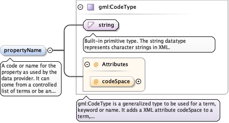
A code or name for the property as used by the data provider. It cancome from a controlled list of terms or be an uncontrolled textstring, and is commonly used to label a column of a log sheet orgive the property a local meaning. The value must be unique amongthe properties in the dataValues block transmitted as part of thismeasurement. No DIGGS-authored dictionary currently exists for thiselement.
<element maxOccurs="1" minOccurs="0" name="propertyName" type="gml:CodeType"><annotation><documentation>A code or name for the property as used by the data provider. It can come from a controlled list of terms or be an uncontrolled text string, and is commonly used to label a column of a log sheet or give the property a local meaning. The value must be unique among the properties in the dataValues block transmitted as part of this measurement. No DIGGS-authored dictionary currently exists for this element.</documentation></annotation></element>
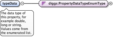
<element maxOccurs="1" minOccurs="1" name="typeData" type="diggs:PropertyDataTypeEnumType"><annotation><documentation>The data type of this property, for example double, long or string. Values come from the enumerated list.</documentation></annotation></element>
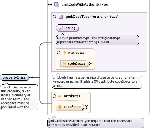
The official name of this property, taken from a dictionary ofdefined terms. The codeSpace must be populated with the URI of thedefinition, so that applications can validate the value as a knownproperty. Use the DIGGS property dictionary that serves the hostmeasurement: properties.xml, cpt_interpreted_properties.xml,gp_properties.xml, gr_inj_properties.xml, mwd_properties.xml orpil_properties.xml.
<element maxOccurs="1" minOccurs="1" name="propertyClass" type="gml:CodeWithAuthorityType"><annotation><documentation>The official name of this property, taken from a dictionary of defined terms. The codeSpace must be populated with the URI of the definition, so that applications can validate the value as a known property. Use the DIGGS property dictionary that serves the host measurement: properties.xml, cpt_interpreted_properties.xml, gp_properties.xml, gr_inj_properties.xml, mwd_properties.xml or pil_properties.xml.</documentation></annotation></element>
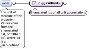
The unit of measure of the property. Values come from the enumeratedlist, or "Other: xx", where xx is a user-defined term whose meaningdiffers from every listed value (not a synonym of one).
<element maxOccurs="1" minOccurs="0" name="uom" type="diggs:AllUnits"><annotation><documentation>The unit of measure of the property. Values come from the enumerated list, or "Other: xx", where xx is a user-defined term whose meaning differs from every listed value (not a synonym of one).</documentation></annotation></element>
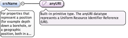
For properties that represent a position (for example depth down aborehole, or a geographic position, both in a time-indexed record),the pointer to the spatial reference system the position belongs to:a geospatialSRS, a localCartesianCRS or aLinearSpatialReferenceSystem. The URI must resolve to one of thoseobjects.
Diagram
Type
anyURI
Properties
content
simple
minOccurs
0
Source
<element minOccurs="0" name="srsName" type="anyURI"><annotation><documentation>For properties that represent a position (for example depth down a borehole, or a geographic position, both in a time-indexed record), the pointer to the spatial reference system the position belongs to: a geospatialSRS, a localCartesianCRS or a LinearSpatialReferenceSystem. The URI must resolve to one of those objects.</documentation></annotation></element>
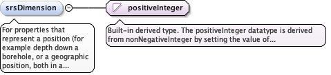
For properties that represent a position (for example depth down aborehole, or a geographic position, both in a time-indexed record),the dimensionality of the spatial reference system. WheresrsDimension is greater than 1, the coordinates in the dataValuesblock cannot be space-separated, because a parser would read thespace as the end of a data record; separate them with |, so thatcoordinates 10 4 12 are written 10|4|12.
Diagram
Type
positiveInteger
Properties
content
simple
minOccurs
0
Source
<element minOccurs="0" name="srsDimension" type="positiveInteger"><annotation><documentation>For properties that represent a position (for example depth down a borehole, or a geographic position, both in a time-indexed record), the dimensionality of the spatial reference system. Where srsDimension is greater than 1, the coordinates in the dataValues block cannot be space-separated, because a parser would read the space as the end of a data record; separate them with |, so that coordinates 10 4 12 are written 10|4|12.</documentation></annotation></element>
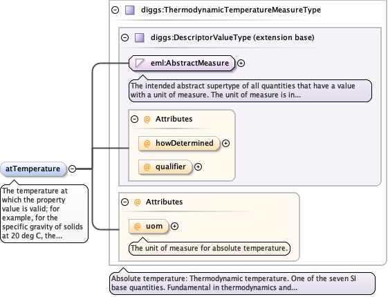
<element maxOccurs="1" minOccurs="0" name="atTemperature" type="diggs:ThermodynamicTemperatureMeasureType"><annotation><documentation>The temperature at which the property value is valid; for example, for the specific gravity of solids at 20 deg C, the temperature value.</documentation></annotation></element>
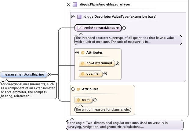
For directional measurements, such as a component of an extensometeror accelerometer, the compass bearing, relative to true north, ofthe measurement axis.
<element minOccurs="0" name="measurementAxisBearing" type="diggs:PlaneAngleMeasureType"><annotation><documentation>For directional measurements, such as a component of an extensometer or accelerometer, the compass bearing, relative to true north, of the measurement axis.</documentation></annotation></element>
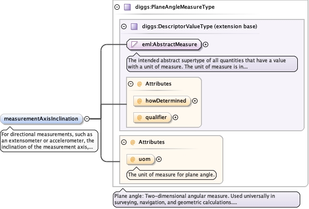
<element minOccurs="0" name="measurementAxisInclination" type="diggs:PlaneAngleMeasureType"><annotation><documentation>For directional measurements, such as an extensometer or accelerometer, the inclination of the measurement axis, positive down from horizontal.</documentation></annotation></element>
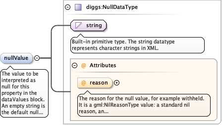
The value to be interpreted as null for this property in thedataValues block. An empty string is the default null representationwhen none is defined. The reason attribute gives the reason for thenull value, for example withheld; it can be customized with anOther: qualifier (for example Other: below detection limit) or referto a URI for a fuller definition.
The reason for the null value, for example withheld. It is agml:NilReasonType value: a standard nil reason, an "other:" term (forexample other:below detection limit), or a URI to a fuller definition.
Source
<element maxOccurs="1" minOccurs="0" name="nullValue" type="diggs:NullDataType"><annotation><documentation>The value to be interpreted as null for this property in the dataValues block. An empty string is the default null representation when none is defined. The reason attribute gives the reason for the null value, for example withheld; it can be customized with an Other: qualifier (for example Other: below detection limit) or refer to a URI for a fuller definition.</documentation></annotation></element>
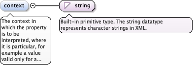
The context in which the property is to be interpreted, where it isparticular, for example a value valid only for a range of overburdenpressures.
Diagram
Type
string
Properties
content
simple
minOccurs
0
Source
<element minOccurs="0" name="context" type="string"><annotation><documentation>The context in which the property is to be interpreted, where it is particular, for example a value valid only for a range of overburden pressures.</documentation></annotation></element>
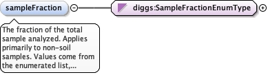
The fraction of the total sample analyzed. Applies primarily tonon-soil samples. Values come from the enumerated list, or "Other:xx", where xx is a user-defined term whose meaning differs fromevery listed value (not a synonym of one).
<element minOccurs="0" name="sampleFraction" type="diggs:SampleFractionEnumType"><annotation><documentation>The fraction of the total sample analyzed. Applies primarily to non-soil samples. Values come from the enumerated list, or "Other: xx", where xx is a user-defined term whose meaning differs from every listed value (not a synonym of one).</documentation></annotation></element>
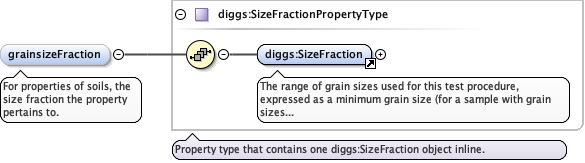
<element minOccurs="0" name="grainsizeFraction" type="diggs:SizeFractionPropertyType"><annotation><documentation>For properties of soils, the size fraction the property pertains to.</documentation></annotation></element>
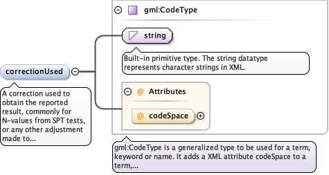
A correction used to obtain the reported result, commonly forN-values from SPT tests, or any other adjustment made to thereported data. A controlled term is preferred. Repeat for eachcorrection. No DIGGS-authored dictionary currently exists for thiselement.
<element minOccurs="0" maxOccurs="unbounded" name="correctionUsed" type="gml:CodeType"><annotation><documentation>A correction used to obtain the reported result, commonly for N-values from SPT tests, or any other adjustment made to the reported data. A controlled term is preferred. Repeat for each correction. No DIGGS-authored dictionary currently exists for this element.</documentation></annotation></element>
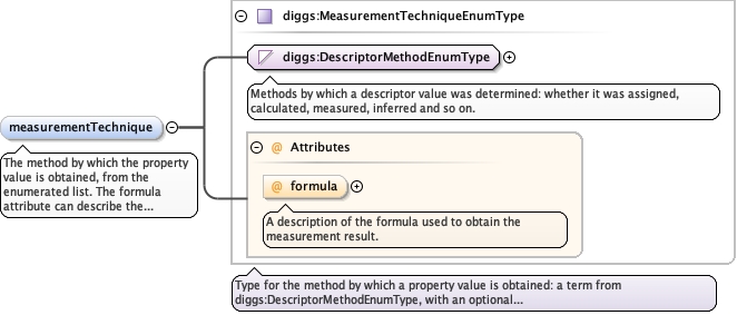
A description of the formula used to obtain the measurement result.
Source
<element minOccurs="0" name="measurementTechnique" type="diggs:MeasurementTechniqueEnumType"><annotation><documentation>The method by which the property value is obtained, from the enumerated list. The formula attribute can describe the formula used.</documentation></annotation></element>
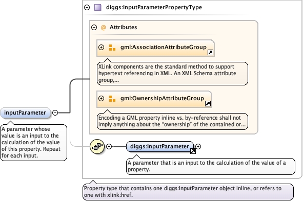
<element minOccurs="0" name="inputParameter" type="diggs:InputParameterPropertyType" maxOccurs="unbounded"><annotation><documentation>A parameter whose value is an input to the calculation of the value of this property. Repeat for each input.</documentation></annotation></element>
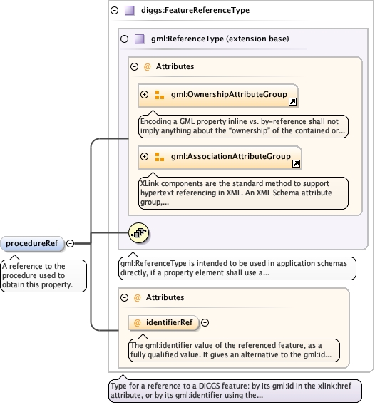
The gml:identifier value of the referenced feature, as a fully qualifiedvalue. It gives an alternative to the gml:id in xlink:href for findingthe referenced feature, mainly to reference a feature by a globallyunique identifier and where naming conflicts occur with gml:id whenaccessing data in external files.
<element minOccurs="0" name="procedureRef" type="diggs:FeatureReferenceType"><annotation><documentation>A reference to the procedure used to obtain this property.</documentation></annotation></element>
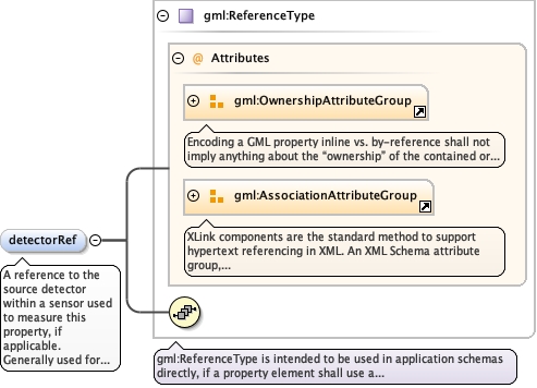
A reference to the source detector within a sensor used to measurethis property, if applicable. Generally used for well logs, downholelogging procedures, monitoring equipment or MWD readings. Given byreference only.
<element name="detectorRef" type="gml:ReferenceType" minOccurs="0" maxOccurs="1"><annotation><appinfo>diggs:Detector</appinfo><documentation>A reference to the source detector within a sensor used to measure this property, if applicable. Generally used for well logs, downhole logging procedures, monitoring equipment or MWD readings. Given by reference only.</documentation></annotation></element>
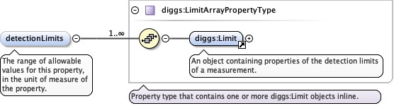
<element maxOccurs="1" minOccurs="0" name="detectionLimits" type="diggs:LimitArrayPropertyType"><annotation><documentation>The range of allowable values for this property, in the unit of measure of the property.</documentation></annotation></element>
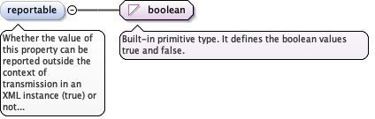
Whether the value of this property can be reported outside thecontext of transmission in an XML instance (true) or not (false).
Diagram
Type
boolean
Properties
content
simple
minOccurs
0
maxOccurs
1
default
true
Source
<element maxOccurs="1" minOccurs="0" name="reportable" type="boolean" default="true"><annotation><documentation>Whether the value of this property can be reported outside the context of transmission in an XML instance (true) or not (false).</documentation></annotation></element>
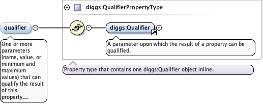
<element maxOccurs="unbounded" minOccurs="0" name="qualifier" type="diggs:QualifierPropertyType"><annotation><documentation>One or more parameters (name, value, or minimum and maximum values) that can qualify the result of this property. Repeat for each qualifier.</documentation></annotation></element>
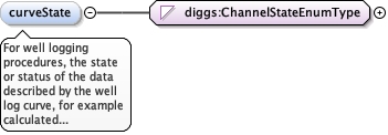
For well logging procedures, the state or status of the datadescribed by the well log curve, for example calculated from anothersource, from archive, or raw real time. Values come from theenumerated list.
Sensor data is recorded into downhole memory of a tool, ratherthan transmitting in "real time" to surface.
enumeration
processed
Results of calculations based on measurements.
enumeration
real time
Measurements at the actual time.
Source
<element maxOccurs="1" minOccurs="0" name="curveState" type="diggs:ChannelStateEnumType"><annotation><documentation>For well logging procedures, the state or status of the data described by the well log curve, for example calculated from another source, from archive, or raw real time. Values come from the enumerated list.</documentation></annotation></element>
Data produced by simulation rather than measurement.
enumeration
spliced
Derived by splicing values from two or more otherchannels.
enumeration
sampled
Derived by sampling values from one or more otherchannels.
enumeration
model
Based on modeled results derived from the values in one or more otherchannels.
Source
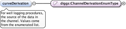
<element maxOccurs="1" minOccurs="0" name="curveDerivation" type="diggs:ChannelDerivationEnumType"><annotation><documentation>For well logging procedures, the source of the data in the channel. Values come from the enumerated list.</documentation></annotation></element>
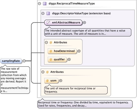
The unit of measure for reciprocal time or frequency.
Source
<element maxOccurs="1" minOccurs="0" name="samplingRate" type="diggs:ReciprocalTimeMeasureType"><annotation><documentation>The raw rate of measurement collection from which any moving averages are derived. Report it if measurementTechnique is moving average.</documentation></annotation></element>
Database handle for the object. It is of XML type ID, so is constrained to beunique in the XML document within which it occurs. An external identifier for the object inthe form of a URI may be constructed using standard XML and XPointer methods. This is doneby concatenating the URI for the document, a fragment separator, and the value of the idattribute.
An integer that indicates the position of the property result in thedataValues property.
Source
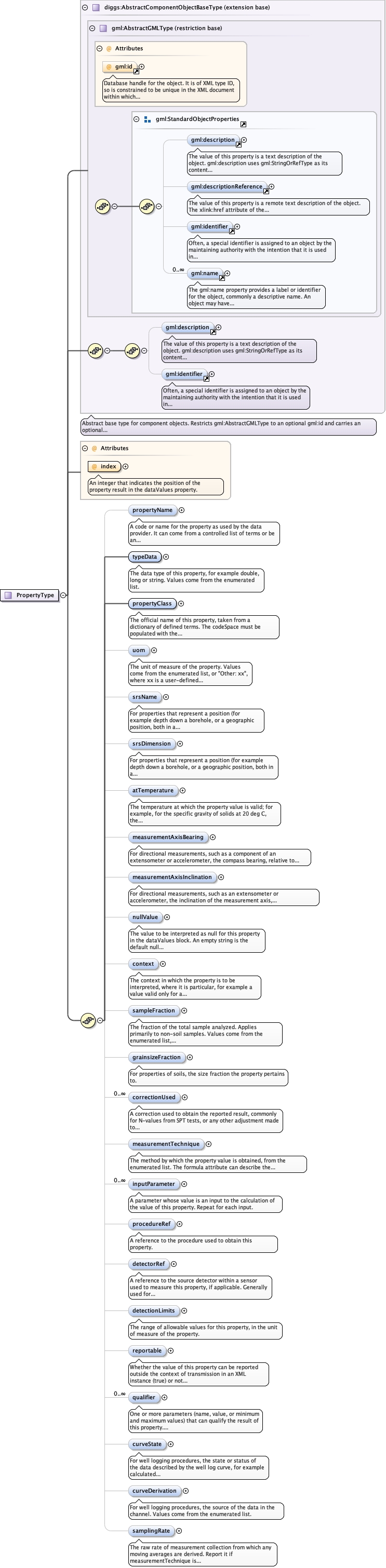
<complexType name="PropertyType"><complexContent><extension base="diggs:AbstractComponentObjectBaseType"><sequence><element maxOccurs="1" minOccurs="0" name="propertyName" type="gml:CodeType"><annotation><documentation>A code or name for the property as used by the data provider. It can come from a controlled list of terms or be an uncontrolled text string, and is commonly used to label a column of a log sheet or give the property a local meaning. The value must be unique among the properties in the dataValues block transmitted as part of this measurement. No DIGGS-authored dictionary currently exists for this element.</documentation></annotation></element><element maxOccurs="1" minOccurs="1" name="typeData" type="diggs:PropertyDataTypeEnumType"><annotation><documentation>The data type of this property, for example double, long or string. Values come from the enumerated list.</documentation></annotation></element><element maxOccurs="1" minOccurs="1" name="propertyClass" type="gml:CodeWithAuthorityType"><annotation><documentation>The official name of this property, taken from a dictionary of defined terms. The codeSpace must be populated with the URI of the definition, so that applications can validate the value as a known property. Use the DIGGS property dictionary that serves the host measurement: properties.xml, cpt_interpreted_properties.xml, gp_properties.xml, gr_inj_properties.xml, mwd_properties.xml or pil_properties.xml.</documentation></annotation></element><element maxOccurs="1" minOccurs="0" name="uom" type="diggs:AllUnits"><annotation><documentation>The unit of measure of the property. Values come from the enumerated list, or "Other: xx", where xx is a user-defined term whose meaning differs from every listed value (not a synonym of one).</documentation></annotation></element><element minOccurs="0" name="srsName" type="anyURI"><annotation><documentation>For properties that represent a position (for example depth down a borehole, or a geographic position, both in a time-indexed record), the pointer to the spatial reference system the position belongs to: a geospatialSRS, a localCartesianCRS or a LinearSpatialReferenceSystem. The URI must resolve to one of those objects.</documentation></annotation></element><element minOccurs="0" name="srsDimension" type="positiveInteger"><annotation><documentation>For properties that represent a position (for example depth down a borehole, or a geographic position, both in a time-indexed record), the dimensionality of the spatial reference system. Where srsDimension is greater than 1, the coordinates in the dataValues block cannot be space-separated, because a parser would read the space as the end of a data record; separate them with |, so that coordinates 10 4 12 are written 10|4|12.</documentation></annotation></element><element maxOccurs="1" minOccurs="0" name="atTemperature" type="diggs:ThermodynamicTemperatureMeasureType"><annotation><documentation>The temperature at which the property value is valid; for example, for the specific gravity of solids at 20 deg C, the temperature value.</documentation></annotation></element><element minOccurs="0" name="measurementAxisBearing" type="diggs:PlaneAngleMeasureType"><annotation><documentation>For directional measurements, such as a component of an extensometer or accelerometer, the compass bearing, relative to true north, of the measurement axis.</documentation></annotation></element><element minOccurs="0" name="measurementAxisInclination" type="diggs:PlaneAngleMeasureType"><annotation><documentation>For directional measurements, such as an extensometer or accelerometer, the inclination of the measurement axis, positive down from horizontal.</documentation></annotation></element><element maxOccurs="1" minOccurs="0" name="nullValue" type="diggs:NullDataType"><annotation><documentation>The value to be interpreted as null for this property in the dataValues block. An empty string is the default null representation when none is defined. The reason attribute gives the reason for the null value, for example withheld; it can be customized with an Other: qualifier (for example Other: below detection limit) or refer to a URI for a fuller definition.</documentation></annotation></element><element minOccurs="0" name="context" type="string"><annotation><documentation>The context in which the property is to be interpreted, where it is particular, for example a value valid only for a range of overburden pressures.</documentation></annotation></element><element minOccurs="0" name="sampleFraction" type="diggs:SampleFractionEnumType"><annotation><documentation>The fraction of the total sample analyzed. Applies primarily to non-soil samples. Values come from the enumerated list, or "Other: xx", where xx is a user-defined term whose meaning differs from every listed value (not a synonym of one).</documentation></annotation></element><element minOccurs="0" name="grainsizeFraction" type="diggs:SizeFractionPropertyType"><annotation><documentation>For properties of soils, the size fraction the property pertains to.</documentation></annotation></element><element minOccurs="0" maxOccurs="unbounded" name="correctionUsed" type="gml:CodeType"><annotation><documentation>A correction used to obtain the reported result, commonly for N-values from SPT tests, or any other adjustment made to the reported data. A controlled term is preferred. Repeat for each correction. No DIGGS-authored dictionary currently exists for this element.</documentation></annotation></element><element minOccurs="0" name="measurementTechnique" type="diggs:MeasurementTechniqueEnumType"><annotation><documentation>The method by which the property value is obtained, from the enumerated list. The formula attribute can describe the formula used.</documentation></annotation></element><element minOccurs="0" name="inputParameter" type="diggs:InputParameterPropertyType" maxOccurs="unbounded"><annotation><documentation>A parameter whose value is an input to the calculation of the value of this property. Repeat for each input.</documentation></annotation></element><element minOccurs="0" name="procedureRef" type="diggs:FeatureReferenceType"><annotation><documentation>A reference to the procedure used to obtain this property.</documentation></annotation></element><element name="detectorRef" type="gml:ReferenceType" minOccurs="0" maxOccurs="1"><annotation><appinfo>diggs:Detector</appinfo><documentation>A reference to the source detector within a sensor used to measure this property, if applicable. Generally used for well logs, downhole logging procedures, monitoring equipment or MWD readings. Given by reference only.</documentation></annotation></element><element maxOccurs="1" minOccurs="0" name="detectionLimits" type="diggs:LimitArrayPropertyType"><annotation><documentation>The range of allowable values for this property, in the unit of measure of the property.</documentation></annotation></element><element maxOccurs="1" minOccurs="0" name="reportable" type="boolean" default="true"><annotation><documentation>Whether the value of this property can be reported outside the context of transmission in an XML instance (true) or not (false).</documentation></annotation></element><element maxOccurs="unbounded" minOccurs="0" name="qualifier" type="diggs:QualifierPropertyType"><annotation><documentation>One or more parameters (name, value, or minimum and maximum values) that can qualify the result of this property. Repeat for each qualifier.</documentation></annotation></element><element maxOccurs="1" minOccurs="0" name="curveState" type="diggs:ChannelStateEnumType"><annotation><documentation>For well logging procedures, the state or status of the data described by the well log curve, for example calculated from another source, from archive, or raw real time. Values come from the enumerated list.</documentation></annotation></element><element maxOccurs="1" minOccurs="0" name="curveDerivation" type="diggs:ChannelDerivationEnumType"><annotation><documentation>For well logging procedures, the source of the data in the channel. Values come from the enumerated list.</documentation></annotation></element><element maxOccurs="1" minOccurs="0" name="samplingRate" type="diggs:ReciprocalTimeMeasureType"><annotation><documentation>The raw rate of measurement collection from which any moving averages are derived. Report it if measurementTechnique is moving average.</documentation></annotation></element></sequence><attribute name="index" type="positiveInteger" use="required"><annotation><documentation>An integer that indicates the position of the property result in the dataValues property.</documentation></annotation></attribute></extension></complexContent></complexType>
<attribute name="index" type="positiveInteger" use="required"><annotation><documentation>An integer that indicates the position of the property result in the dataValues property.</documentation></annotation></attribute>