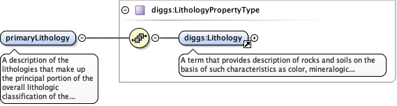
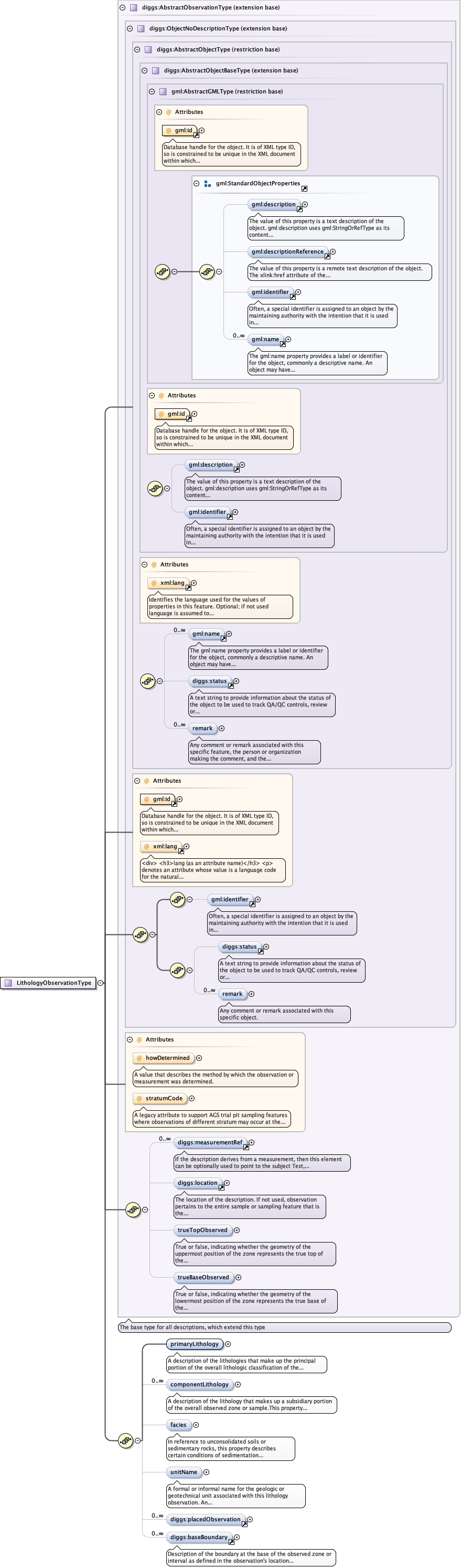
<element name="primaryLithology" type="diggs:LithologyPropertyType"><annotation><documentation>A description of the lithologies that make up the principal portion of the overall lithologic classification of the observed zone or sample,</documentation></annotation></element>
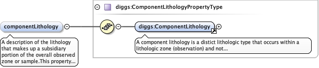
A description of the lithology that makes up asubsidiary portion of the overall observed zone or sample.This property would be used where the lithology is observed to be distinct from the primary lithology, for example where a zone is interbedded or the component lithology occurs in inclusions or in a specific part of the zone but is otherwise not separated out, This property can also be used in soil descriptions, where lithologic components such as sand, gravel and fines where specific details about the components (eg. silty sand with gravel) are recorded and therefore the use of the constituent property is not sufficient.
<element minOccurs="0" name="componentLithology" type="diggs:ComponentLithologyPropertyType" maxOccurs="unbounded"><annotation><documentation>A description of the lithology that makes up a subsidiary portion of the overall observed zone or sample.This property would be used where the lithology is observed to be distinct from the primary lithology, for example where a zone is interbedded or the component lithology occurs in inclusions or in a specific part of the zone but is otherwise not separated out, This property can also be used in soil descriptions, where lithologic components such as sand, gravel and fines where specific details about the components (eg. silty sand with gravel) are recorded and therefore the use of the constituent property is not sufficient.</documentation></annotation></element>
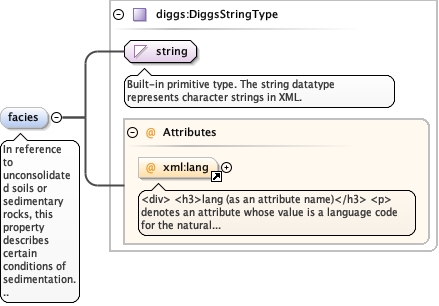
In reference to unconsolidated soils or sedimentaryrocks, this property describes certain conditions of sedimentationthat reflect a particular process or depositional environment. Someexamples might be alluvium, dune sand, river terrace deposits,hemipelagic sediment, etc. Facies designations do not imply anyorder within a stratigraphic column. Facies terms used to defineinformal geologic units that occur in stratigraphic order (eg. unitsdo not repeat within a stratigraphic column) should be reported in aStratigraphySystem. For metamorphic rocks, this property is used todescribe a set of mineral assemblages that form under similarpressures and temperatures (eg. zeolite facies, blueschistfacies).
<div><h3>lang (as an attribute name)</h3><p>denotes an attribute whose value is a language code for the natural language of the content of any element; its value is inherited. This name is reserved by virtue of its definition in the XML specification.</p></div><div><h4>Notes</h4><p>Attempting to install the relevant ISO 2- and 3-letter codes as the enumerated possible values is probably never going to be a realistic possibility.</p><p>See BCP 47 at<a href="http://www.rfc-editor.org/rfc/bcp/bcp47.txt">http://www.rfc-editor.org/rfc/bcp/bcp47.txt</a>and the IANA language subtag registry at<a href="http://www.iana.org/assignments/language-subtag-registry">http://www.iana.org/assignments/language-subtag-registry</a>for further information.</p><p>The union allows for the 'un-declaration' of xml:lang with the empty string.</p></div>
Source
<element minOccurs="0" name="facies" type="diggs:DiggsStringType"><annotation><documentation>In reference to unconsolidated soils or sedimentary rocks, this property describes certain conditions of sedimentation that reflect a particular process or depositional environment. Some examples might be alluvium, dune sand, river terrace deposits, hemipelagic sediment, etc. Facies designations do not imply any order within a stratigraphic column. Facies terms used to define informal geologic units that occur in stratigraphic order (eg. units do not repeat within a stratigraphic column) should be reported in a StratigraphySystem. For metamorphic rocks, this property is used to describe a set of mineral assemblages that form under similar pressures and temperatures (eg. zeolite facies, blueschist facies).</documentation></annotation></element>
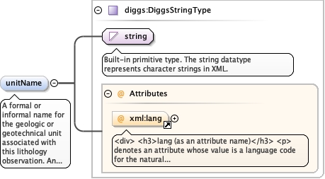
A formal or informal name for the geologic or geotechnical unit associated with this lithology observation. An uncontrolled string, examples might be "Unit A" "Merrit Sand" "Bay Mud", etc. This property would be used in cases where a StratigraphySystem or GeoUnitSystem
<div><h3>lang (as an attribute name)</h3><p>denotes an attribute whose value is a language code for the natural language of the content of any element; its value is inherited. This name is reserved by virtue of its definition in the XML specification.</p></div><div><h4>Notes</h4><p>Attempting to install the relevant ISO 2- and 3-letter codes as the enumerated possible values is probably never going to be a realistic possibility.</p><p>See BCP 47 at<a href="http://www.rfc-editor.org/rfc/bcp/bcp47.txt">http://www.rfc-editor.org/rfc/bcp/bcp47.txt</a>and the IANA language subtag registry at<a href="http://www.iana.org/assignments/language-subtag-registry">http://www.iana.org/assignments/language-subtag-registry</a>for further information.</p><p>The union allows for the 'un-declaration' of xml:lang with the empty string.</p></div>
Source
<element minOccurs="0" name="unitName" type="diggs:DiggsStringType"><annotation><documentation>A formal or informal name for the geologic or geotechnical unit associated with this lithology observation. An uncontrolled string, examples might be "Unit A" "Merrit Sand" "Bay Mud", etc. This property would be used in cases where a StratigraphySystem or GeoUnitSystem</documentation></annotation></element>
Database handle for the object. It is of XML type ID, so is constrained to beunique in the XML document within which it occurs. An external identifier for the object inthe form of a URI may be constructed using standard XML and XPointer methods. This is doneby concatenating the URI for the document, a fragment separator, and the value of the idattribute.
A legacy attribute to support AGS trial pit sampling featureswhere observations of different stratum may occur at the same depth in apit. It is a reference letter or number whose sole purpose is to linkthe stratum shown on a face sketch of the trial pit to the specificobservation.
<div><h3>lang (as an attribute name)</h3><p>denotes an attribute whose value is a language code for the natural language of the content of any element; its value is inherited. This name is reserved by virtue of its definition in the XML specification.</p></div><div><h4>Notes</h4><p>Attempting to install the relevant ISO 2- and 3-letter codes as the enumerated possible values is probably never going to be a realistic possibility.</p><p>See BCP 47 at<a href="http://www.rfc-editor.org/rfc/bcp/bcp47.txt">http://www.rfc-editor.org/rfc/bcp/bcp47.txt</a>and the IANA language subtag registry at<a href="http://www.iana.org/assignments/language-subtag-registry">http://www.iana.org/assignments/language-subtag-registry</a>for further information.</p><p>The union allows for the 'un-declaration' of xml:lang with the empty string.</p></div>
Source
<complexType name="LithologyObservationType"><complexContent><extension base="diggs:AbstractObservationType"><sequence><element name="primaryLithology" type="diggs:LithologyPropertyType"><annotation><documentation>A description of the lithologies that make up the principal portion of the overall lithologic classification of the observed zone or sample,</documentation></annotation></element><element minOccurs="0" name="componentLithology" type="diggs:ComponentLithologyPropertyType" maxOccurs="unbounded"><annotation><documentation>A description of the lithology that makes up a subsidiary portion of the overall observed zone or sample.This property would be used where the lithology is observed to be distinct from the primary lithology, for example where a zone is interbedded or the component lithology occurs in inclusions or in a specific part of the zone but is otherwise not separated out, This property can also be used in soil descriptions, where lithologic components such as sand, gravel and fines where specific details about the components (eg. silty sand with gravel) are recorded and therefore the use of the constituent property is not sufficient.</documentation></annotation></element><element minOccurs="0" name="facies" type="diggs:DiggsStringType"><annotation><documentation>In reference to unconsolidated soils or sedimentary rocks, this property describes certain conditions of sedimentation that reflect a particular process or depositional environment. Some examples might be alluvium, dune sand, river terrace deposits, hemipelagic sediment, etc. Facies designations do not imply any order within a stratigraphic column. Facies terms used to define informal geologic units that occur in stratigraphic order (eg. units do not repeat within a stratigraphic column) should be reported in a StratigraphySystem. For metamorphic rocks, this property is used to describe a set of mineral assemblages that form under similar pressures and temperatures (eg. zeolite facies, blueschist facies).</documentation></annotation></element><element minOccurs="0" name="unitName" type="diggs:DiggsStringType"><annotation><documentation>A formal or informal name for the geologic or geotechnical unit associated with this lithology observation. An uncontrolled string, examples might be "Unit A" "Merrit Sand" "Bay Mud", etc. This property would be used in cases where a StratigraphySystem or GeoUnitSystem</documentation></annotation></element><element maxOccurs="unbounded" minOccurs="0" ref="diggs:placedObservation"/><element minOccurs="0" ref="diggs:baseBoundary" maxOccurs="unbounded"/></sequence></extension></complexContent></complexType>