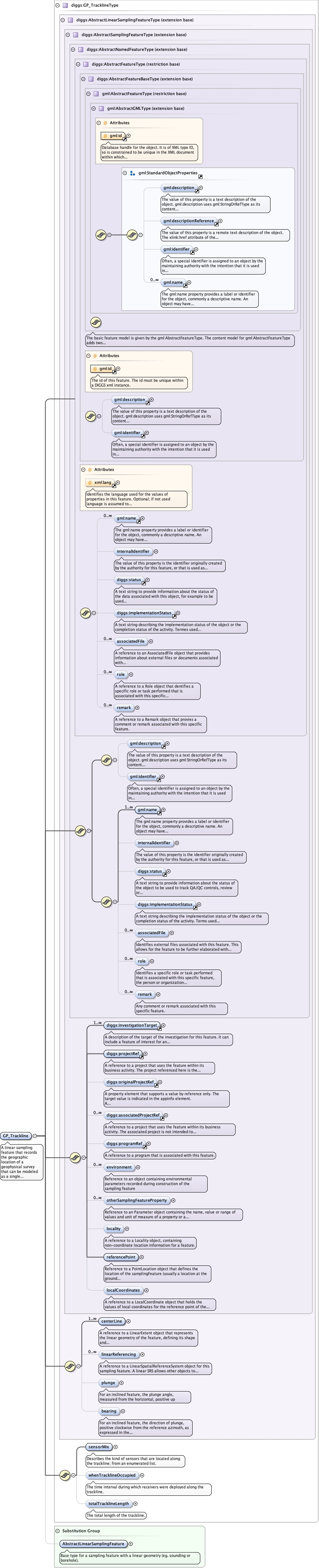
A linear sampling feature that records the geographic location of ageophysical survey that can be modeled as a single linestring - such as aground-surface transect, marine trackline, or airborne flightline, where receivers(and optionally source devices) are placed on or moved along the track. This differsfrom the more general Transect sampling feature insofar as its use impliesassociation with a GeophysicalFieldSurvey measurement as well as possibly beingassociated with other GP_Trackline features as part of a GP_Multitrack samplingfeature. As with all linear sampling features, the geometry is specified by thecenterline property using 2D or 3D coordinates within a known geographic orprojected coordinate system. Allthough not required, where possible the centerlinevertices should occur at specific receiver locations where measurements are obtainedor at measurement locations for a receiver that is moving along the track (orderedin the direction of movement).
Database handle for the object. It is of XML type ID, so is constrained to beunique in the XML document within which it occurs. An external identifier for the object inthe form of a URI may be constructed using standard XML and XPointer methods. This is doneby concatenating the URI for the document, a fragment separator, and the value of the idattribute.
<div><h3>lang (as an attribute name)</h3><p>denotes an attribute whose value is a language code for the natural language of the content of any element; its value is inherited. This name is reserved by virtue of its definition in the XML specification.</p></div><div><h4>Notes</h4><p>Attempting to install the relevant ISO 2- and 3-letter codes as the enumerated possible values is probably never going to be a realistic possibility.</p><p>See BCP 47 at<a href="http://www.rfc-editor.org/rfc/bcp/bcp47.txt">http://www.rfc-editor.org/rfc/bcp/bcp47.txt</a>and the IANA language subtag registry at<a href="http://www.iana.org/assignments/language-subtag-registry">http://www.iana.org/assignments/language-subtag-registry</a>for further information.</p><p>The union allows for the 'un-declaration' of xml:lang with the empty string.</p></div>
Source
<element name="GP_Trackline" substitutionGroup="diggs:AbstractLinearSamplingFeature" type="diggs:GP_TracklineType"><annotation><documentation>A linear sampling feature that records the geographic location of a geophysical survey that can be modeled as a single linestring - such as a ground-surface transect, marine trackline, or airborne flightline, where receivers (and optionally source devices) are placed on or moved along the track. This differs from the more general Transect sampling feature insofar as its use implies association with a GeophysicalFieldSurvey measurement as well as possibly being associated with other GP_Trackline features as part of a GP_Multitrack sampling feature. As with all linear sampling features, the geometry is specified by the centerline property using 2D or 3D coordinates within a known geographic or projected coordinate system. Allthough not required, where possible the centerline vertices should occur at specific receiver locations where measurements are obtained or at measurement locations for a receiver that is moving along the track (ordered in the direction of movement).</documentation></annotation></element>