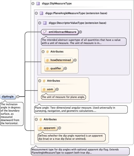
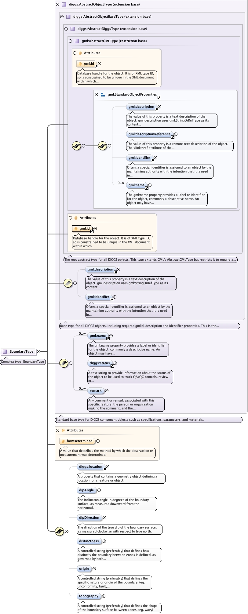
<element minOccurs="0" name="dipAngle" type="diggs:DipMeasureType"><annotation><documentation>The inclinaton angle in degrees of the boundary surface, as measured downward from the horizontal.</documentation></annotation></element>
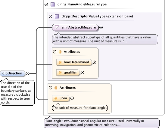
<element minOccurs="0" name="dipDirection" type="diggs:PlaneAngleMeasureType"><annotation><documentation>The direction of the true dip of the boundary surface, as measured clockwise with respect to true north.</documentation></annotation></element>
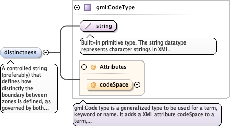
A controlled string (preferably) that defines howdistinctly the boundary between zones is defined, as governed byboth the contrast between adjacent zones and by the width of theboundary. (eg. sharp, gradational)
<element minOccurs="0" name="distinctness" type="gml:CodeType"><annotation><documentation>A controlled string (preferably) that defines how distinctly the boundary between zones is defined, as governed by both the contrast between adjacent zones and by the width of the boundary. (eg. sharp, gradational)</documentation></annotation></element>
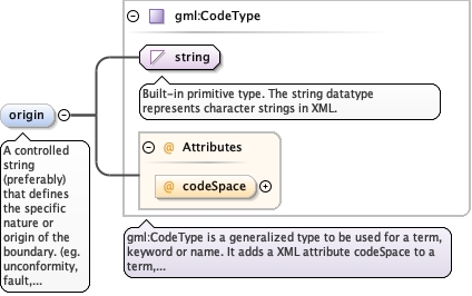
<element minOccurs="0" name="origin" type="gml:CodeType"><annotation><documentation>A controlled string (preferably) that defines the specific nature or origin of the boundary. (eg. unconformity, fault, etc.)</documentation></annotation></element>
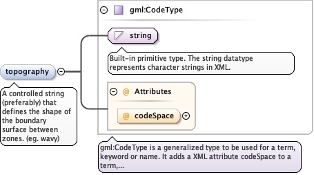
<element minOccurs="0" name="topography" type="gml:CodeType"><annotation><documentation>A controlled string (preferably) that defines the shape of the boundary surface between zones. (eg. wavy)</documentation></annotation></element>
Database handle for the object. It is of XML type ID, so is constrained to beunique in the XML document within which it occurs. An external identifier for the object inthe form of a URI may be constructed using standard XML and XPointer methods. This is doneby concatenating the URI for the document, a fragment separator, and the value of the idattribute.
A value that describes the method by which the observation ormeasurement was determined.
Source
<complexType name="BoundaryType"><annotation><documentation>Complex type: BoundaryType</documentation></annotation><complexContent><extension base="diggs:AbstractObjectType"><sequence><element minOccurs="0" ref="diggs:location"/><element minOccurs="0" name="dipAngle" type="diggs:DipMeasureType"><annotation><documentation>The inclinaton angle in degrees of the boundary surface, as measured downward from the horizontal.</documentation></annotation></element><element minOccurs="0" name="dipDirection" type="diggs:PlaneAngleMeasureType"><annotation><documentation>The direction of the true dip of the boundary surface, as measured clockwise with respect to true north.</documentation></annotation></element><element minOccurs="0" name="distinctness" type="gml:CodeType"><annotation><documentation>A controlled string (preferably) that defines how distinctly the boundary between zones is defined, as governed by both the contrast between adjacent zones and by the width of the boundary. (eg. sharp, gradational)</documentation></annotation></element><element minOccurs="0" name="origin" type="gml:CodeType"><annotation><documentation>A controlled string (preferably) that defines the specific nature or origin of the boundary. (eg. unconformity, fault, etc.)</documentation></annotation></element><element minOccurs="0" name="topography" type="gml:CodeType"><annotation><documentation>A controlled string (preferably) that defines the shape of the boundary surface between zones. (eg. wavy)</documentation></annotation></element></sequence><attribute name="howDetermined" type="diggs:DescriptorMethodEnumType"><annotation><documentation>A value that describes the method by which the observation or measurement was determined.</documentation></annotation></attribute></extension></complexContent></complexType>
<attribute name="howDetermined" type="diggs:DescriptorMethodEnumType"><annotation><documentation>A value that describes the method by which the observation or measurement was determined.</documentation></annotation></attribute>