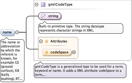
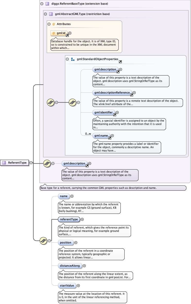
The name or abbreviation by which the referent is known, for exampleGS (ground surface), KB (kelly bushing), RT (rotary table), SF (seafloor) or TOC (top of core, or top of casing). Use the DIGGSdictionary referentName.xml for the list of values; its entriesaccept either the full name or a common abbreviation as the value.Identify the entry with codeSpace, for examplereferentName.xml#ground_surface; this also resolves an abbreviationthat two entries share.
<element maxOccurs="1" minOccurs="0" name="name" type="gml:CodeType"><annotation><documentation>The name or abbreviation by which the referent is known, for example GS (ground surface), KB (kelly bushing), RT (rotary table), SF (sea floor) or TOC (top of core, or top of casing). Use the DIGGS dictionary referentName.xml for the list of values; its entries accept either the full name or a common abbreviation as the value. Identify the entry with codeSpace, for example referentName.xml#ground_surface; this also resolves an abbreviation that two entries share.</documentation></annotation></element>
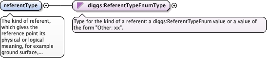
The kind of referent, which gives the reference point its physicalor logical meaning, for example ground surface, kelly bushing,kickoff point, top of core or bottom of core. Values come from theenumerated list, or "Other: xx", where xx is a user-defined termwhose meaning differs from every listed value (not a synonym ofone).
<element name="referentType" type="diggs:ReferentTypeEnumType"><annotation><documentation>The kind of referent, which gives the reference point its physical or logical meaning, for example ground surface, kelly bushing, kickoff point, top of core or bottom of core. Values come from the enumerated list, or "Other: xx", where xx is a user-defined term whose meaning differs from every listed value (not a synonym of one).</documentation></annotation></element>
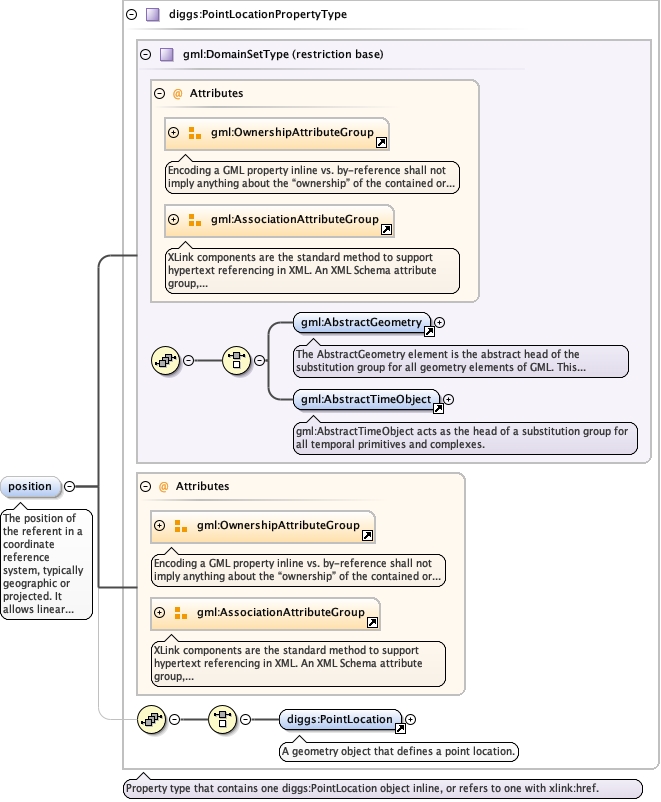
The position of the referent in a coordinate reference system,typically geographic or projected. It allows linear referencecoordinates to be transformed to geographic coordinates.
<element minOccurs="0" name="position" type="diggs:PointLocationPropertyType"><annotation><documentation>The position of the referent in a coordinate reference system, typically geographic or projected. It allows linear reference coordinates to be transformed to geographic coordinates.</documentation></annotation></element>
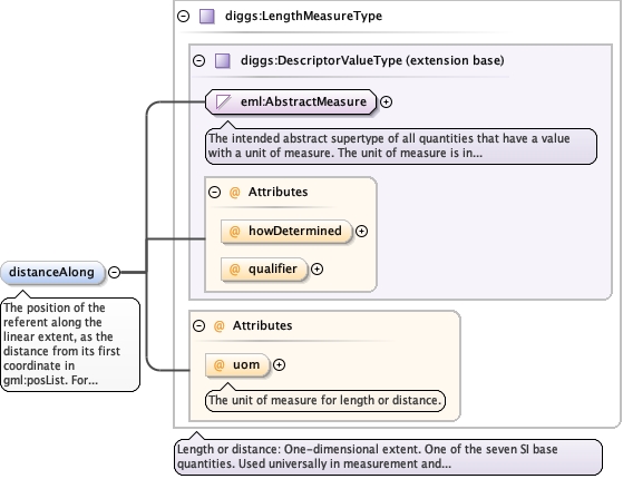
The position of the referent along the linear extent, as thedistance from its first coordinate in gml:posList. For example, akelly bushing at the first point has a distance of 0, and a groundsurface 5 ft below it has 5 ft.
<element name="distanceAlong" type="diggs:LengthMeasureType" minOccurs="0"><annotation><documentation>The position of the referent along the linear extent, as the distance from its first coordinate in gml:posList. For example, a kelly bushing at the first point has a distance of 0, and a ground surface 5 ft below it has 5 ft.</documentation></annotation></element>
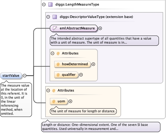
<element minOccurs="0" name="startValue" type="diggs:LengthMeasureType"><annotation><documentation>The measure value at the location of this referent. It is 0, in the unit of the linear referencing method, when omitted.</documentation></annotation></element>
Database handle for the object. It is of XML type ID, so is constrained to beunique in the XML document within which it occurs. An external identifier for the object inthe form of a URI may be constructed using standard XML and XPointer methods. This is doneby concatenating the URI for the document, a fragment separator, and the value of the idattribute.
Source
<complexType name="ReferentType"><complexContent><extension base="diggs:ReferentBaseType"><sequence><element maxOccurs="1" minOccurs="0" name="name" type="gml:CodeType"><annotation><documentation>The name or abbreviation by which the referent is known, for example GS (ground surface), KB (kelly bushing), RT (rotary table), SF (sea floor) or TOC (top of core, or top of casing). Use the DIGGS dictionary referentName.xml for the list of values; its entries accept either the full name or a common abbreviation as the value. Identify the entry with codeSpace, for example referentName.xml#ground_surface; this also resolves an abbreviation that two entries share.</documentation></annotation></element><element name="referentType" type="diggs:ReferentTypeEnumType"><annotation><documentation>The kind of referent, which gives the reference point its physical or logical meaning, for example ground surface, kelly bushing, kickoff point, top of core or bottom of core. Values come from the enumerated list, or "Other: xx", where xx is a user-defined term whose meaning differs from every listed value (not a synonym of one).</documentation></annotation></element><element minOccurs="0" name="position" type="diggs:PointLocationPropertyType"><annotation><documentation>The position of the referent in a coordinate reference system, typically geographic or projected. It allows linear reference coordinates to be transformed to geographic coordinates.</documentation></annotation></element><element name="distanceAlong" type="diggs:LengthMeasureType" minOccurs="0"><annotation><documentation>The position of the referent along the linear extent, as the distance from its first coordinate in gml:posList. For example, a kelly bushing at the first point has a distance of 0, and a ground surface 5 ft below it has 5 ft.</documentation></annotation></element><element minOccurs="0" name="startValue" type="diggs:LengthMeasureType"><annotation><documentation>The measure value at the location of this referent. It is 0, in the unit of the linear referencing method, when omitted.</documentation></annotation></element></sequence></extension></complexContent></complexType>