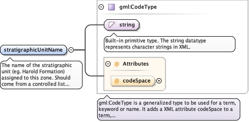
The name of the stratigraphic unit (eg. Harold Formation)assigned to this zone. Should come from a controlled list based onthe subtype of the layer system.
<element name="stratigraphicUnitName" type="gml:CodeType" maxOccurs="unbounded"><annotation><documentation>The name of the stratigraphic unit (eg. Harold Formation) assigned to this zone. Should come from a controlled list based on the subtype of the layer system.</documentation></annotation></element>
<div><h3>lang (as an attribute name)</h3><p>denotes an attribute whose value is a language code for the natural language of the content of any element; its value is inherited. This name is reserved by virtue of its definition in the XML specification.</p></div><div><h4>Notes</h4><p>Attempting to install the relevant ISO 2- and 3-letter codes as the enumerated possible values is probably never going to be a realistic possibility.</p><p>See BCP 47 at<a href="http://www.rfc-editor.org/rfc/bcp/bcp47.txt">http://www.rfc-editor.org/rfc/bcp/bcp47.txt</a>and the IANA language subtag registry at<a href="http://www.iana.org/assignments/language-subtag-registry">http://www.iana.org/assignments/language-subtag-registry</a>for further information.</p><p>The union allows for the 'un-declaration' of xml:lang with the empty string.</p></div>
Source
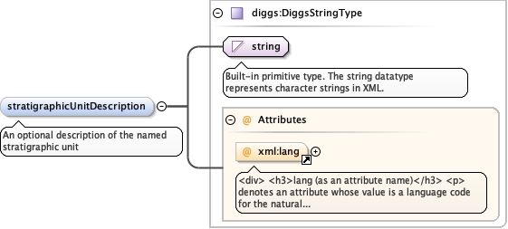
<element minOccurs="0" name="stratigraphicUnitDescription" type="diggs:DiggsStringType"><annotation><documentation>An optional description of the named stratigraphic unit</documentation></annotation></element>
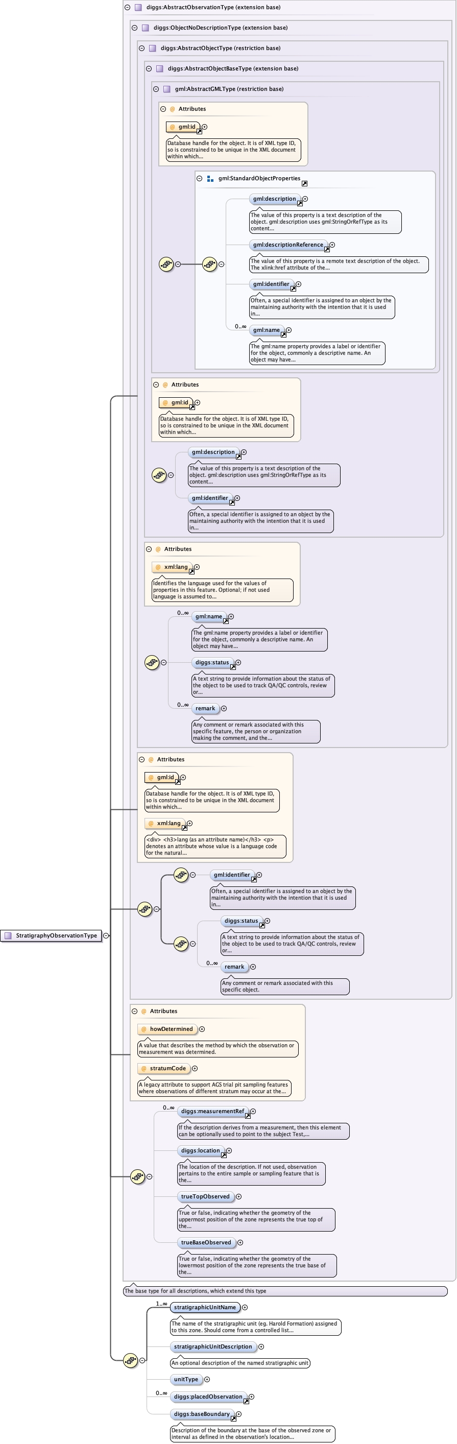
Database handle for the object. It is of XML type ID, so is constrained to beunique in the XML document within which it occurs. An external identifier for the object inthe form of a URI may be constructed using standard XML and XPointer methods. This is doneby concatenating the URI for the document, a fragment separator, and the value of the idattribute.
A legacy attribute to support AGS trial pit sampling featureswhere observations of different stratum may occur at the same depth in apit. It is a reference letter or number whose sole purpose is to linkthe stratum shown on a face sketch of the trial pit to the specificobservation.
<div><h3>lang (as an attribute name)</h3><p>denotes an attribute whose value is a language code for the natural language of the content of any element; its value is inherited. This name is reserved by virtue of its definition in the XML specification.</p></div><div><h4>Notes</h4><p>Attempting to install the relevant ISO 2- and 3-letter codes as the enumerated possible values is probably never going to be a realistic possibility.</p><p>See BCP 47 at<a href="http://www.rfc-editor.org/rfc/bcp/bcp47.txt">http://www.rfc-editor.org/rfc/bcp/bcp47.txt</a>and the IANA language subtag registry at<a href="http://www.iana.org/assignments/language-subtag-registry">http://www.iana.org/assignments/language-subtag-registry</a>for further information.</p><p>The union allows for the 'un-declaration' of xml:lang with the empty string.</p></div>
Source
<complexType name="StratigraphyObservationType"><complexContent><extension base="diggs:AbstractObservationType"><sequence><element name="stratigraphicUnitName" type="gml:CodeType" maxOccurs="unbounded"><annotation><documentation>The name of the stratigraphic unit (eg. Harold Formation) assigned to this zone. Should come from a controlled list based on the subtype of the layer system.</documentation></annotation></element><element minOccurs="0" name="stratigraphicUnitDescription" type="diggs:DiggsStringType"><annotation><documentation>An optional description of the named stratigraphic unit</documentation></annotation></element><element minOccurs="0" name="unitType" type="diggs:StratUnitExtEnumType"/><element maxOccurs="unbounded" minOccurs="0" ref="diggs:placedObservation"/><element minOccurs="0" ref="diggs:baseBoundary"><annotation><documentation>Description of the boundary at the base of the observed zone or interval as defined in the observation's location property</documentation></annotation></element></sequence></extension></complexContent></complexType>