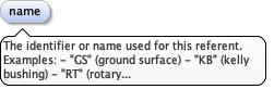
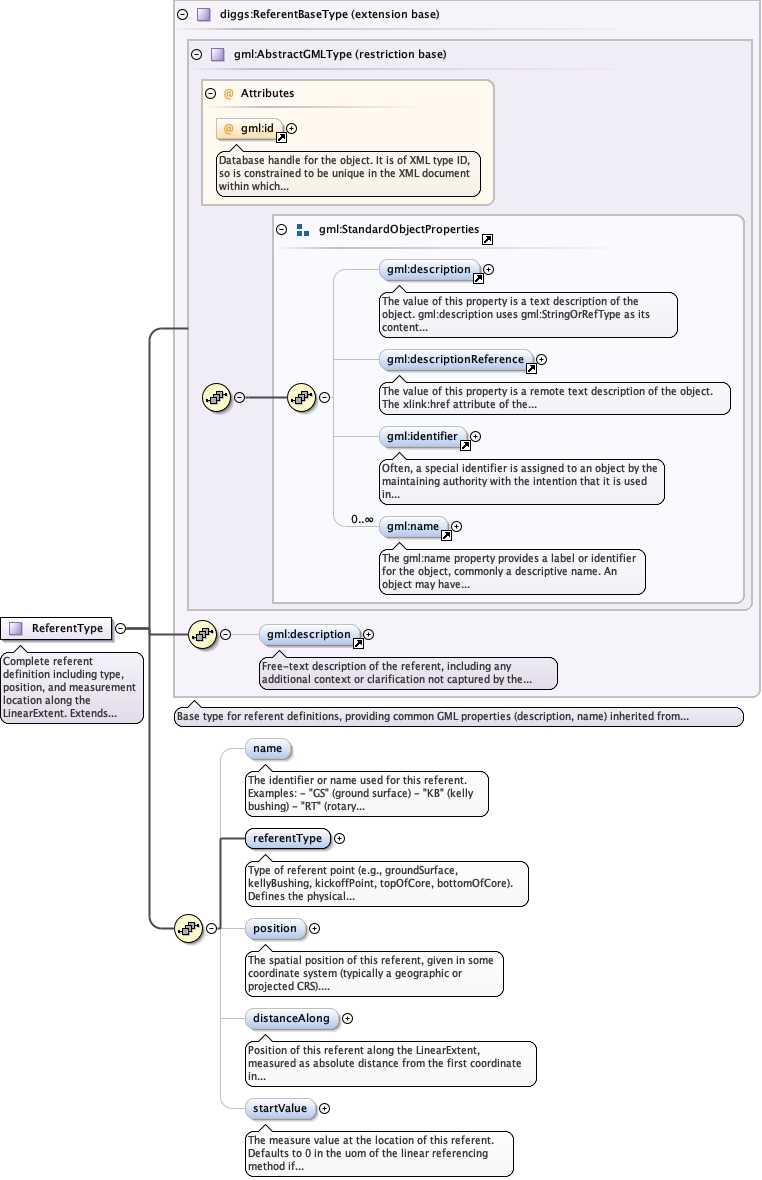
The identifier or name used for this referent. Examples:- "GS" (ground surface)- "KB" (kelly bushing)- "RT" (rotary table)- "SF" (seafloor)- "TOC" (top of core)- "BOC" (bottom of core)
Diagram
Properties
minOccurs
0
maxOccurs
1
Source
<element maxOccurs="1" minOccurs="0" name="name"><annotation><documentation>The identifier or name used for this referent. Examples: - "GS" (ground surface) - "KB" (kelly bushing) - "RT" (rotary table) - "SF" (seafloor) - "TOC" (top of core) - "BOC" (bottom of core)</documentation></annotation></element>
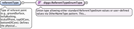
Type of referent point (e.g., groundSurface, kellyBushing, kickoffPoint, topOfCore, bottomOfCore). Defines the physical or logical meaning of the reference point.See ReferentTypeEnum for complete list of standard geotechnical and geophysical referent types.
<element name="referentType" type="diggs:ReferentTypeEnumType"><annotation><documentation>Type of referent point (e.g., groundSurface, kellyBushing, kickoffPoint, topOfCore, bottomOfCore). Defines the physical or logical meaning of the reference point. See ReferentTypeEnum for complete list of standard geotechnical and geophysical referent types.</documentation></annotation></element>
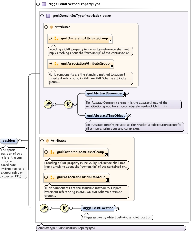
The spatial position of this referent, given in some coordinate system (typically a geographic or projected CRS).Provides the absolute 3D coordinates of the referent point, enabling transformation between linear reference coordinates and geographic coordinates.
The 'actuate' attribute is used to communicate the desired timing of traversal from the starting resource to the ending resource; it's value should be treated as follows:onLoad - traverse to the ending resource immediately on loading the starting resource onRequest - traverse from the starting resource to the ending resource only on a post-loading event triggered for this purpose other - behavior is unconstrained; examine other markup in link for hints none - behavior is unconstrained
The 'show' attribute is used to communicate the desired presentation of the ending resource on traversal from the starting resource; it's value should be treated as follows: new - load ending resource in a new window, frame, pane, or other presentation contextreplace - load the resource in the same window, frame, pane, or other presentation contextembed - load ending resource in place of the presentation of the starting resourceother - behavior is unconstrained; examine other markup in the link for hints none - behavior is unconstrained
<element minOccurs="0" name="position" type="diggs:PointLocationPropertyType"><annotation><documentation>The spatial position of this referent, given in some coordinate system (typically a geographic or projected CRS). Provides the absolute 3D coordinates of the referent point, enabling transformation between linear reference coordinates and geographic coordinates.</documentation></annotation></element>
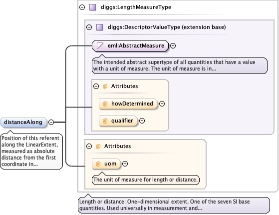
Position of this referent along the LinearExtent, measured as absolute distance from the first coordinate in gml:posList. Examples:- Kelly bushing at 0.0 ft (at rig floor, first point)- Ground surface at 5.0 ft (below kelly bushing)- Kickoff point at 150.0 ft (where well deviates from vertical)- Trackline start at 0.0 m (beginning of survey line)- Top of core at 0.0 ft (core sample origin)- Bottom of core at 1.5 ft (end of core sample)
<element name="distanceAlong" type="diggs:LengthMeasureType" minOccurs="0"><annotation><documentation>Position of this referent along the LinearExtent, measured as absolute distance from the first coordinate in gml:posList. Examples: - Kelly bushing at 0.0 ft (at rig floor, first point) - Ground surface at 5.0 ft (below kelly bushing) - Kickoff point at 150.0 ft (where well deviates from vertical) - Trackline start at 0.0 m (beginning of survey line) - Top of core at 0.0 ft (core sample origin) - Bottom of core at 1.5 ft (end of core sample)</documentation></annotation></element>
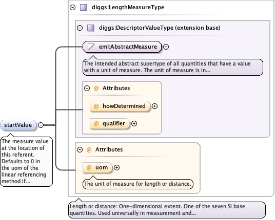
<element minOccurs="0" name="startValue" type="diggs:LengthMeasureType"><annotation><documentation>The measure value at the location of this referent. Defaults to 0 in the uom of the linear referencing method if omitted.</documentation></annotation></element>
Complex Type diggs:ReferentType
Namespace
http://diggsml.org/schemas/3
Annotations
Complete referent definition including type, position, and measurement location along the LinearExtent.Extends ReferentBaseType to add:- referentType: Classification of the referent (groundSurface, kellyBushing, topOfCore, etc.)- position: Optional 3D spatial coordinates of the referent- distanceAlong: Position along the LinearExtent where this referent is located
Database handle for the object. It is of XML type ID, so is constrained to beunique in the XML document within which it occurs. An external identifier for the object inthe form of a URI may be constructed using standard XML and XPointer methods. This is doneby concatenating the URI for the document, a fragment separator, and the value of the idattribute.
Source
<complexType name="ReferentType"><annotation><documentation>Complete referent definition including type, position, and measurement location along the LinearExtent. Extends ReferentBaseType to add: - referentType: Classification of the referent (groundSurface, kellyBushing, topOfCore, etc.) - position: Optional 3D spatial coordinates of the referent - distanceAlong: Position along the LinearExtent where this referent is located</documentation></annotation><complexContent><extension base="diggs:ReferentBaseType"><sequence><element maxOccurs="1" minOccurs="0" name="name"><annotation><documentation>The identifier or name used for this referent. Examples: - "GS" (ground surface) - "KB" (kelly bushing) - "RT" (rotary table) - "SF" (seafloor) - "TOC" (top of core) - "BOC" (bottom of core)</documentation></annotation></element><element name="referentType" type="diggs:ReferentTypeEnumType"><annotation><documentation>Type of referent point (e.g., groundSurface, kellyBushing, kickoffPoint, topOfCore, bottomOfCore). Defines the physical or logical meaning of the reference point. See ReferentTypeEnum for complete list of standard geotechnical and geophysical referent types.</documentation></annotation></element><element minOccurs="0" name="position" type="diggs:PointLocationPropertyType"><annotation><documentation>The spatial position of this referent, given in some coordinate system (typically a geographic or projected CRS). Provides the absolute 3D coordinates of the referent point, enabling transformation between linear reference coordinates and geographic coordinates.</documentation></annotation></element><element name="distanceAlong" type="diggs:LengthMeasureType" minOccurs="0"><annotation><documentation>Position of this referent along the LinearExtent, measured as absolute distance from the first coordinate in gml:posList. Examples: - Kelly bushing at 0.0 ft (at rig floor, first point) - Ground surface at 5.0 ft (below kelly bushing) - Kickoff point at 150.0 ft (where well deviates from vertical) - Trackline start at 0.0 m (beginning of survey line) - Top of core at 0.0 ft (core sample origin) - Bottom of core at 1.5 ft (end of core sample)</documentation></annotation></element><element minOccurs="0" name="startValue" type="diggs:LengthMeasureType"><annotation><documentation>The measure value at the location of this referent. Defaults to 0 in the uom of the linear referencing method if omitted.</documentation></annotation></element></sequence></extension></complexContent></complexType>