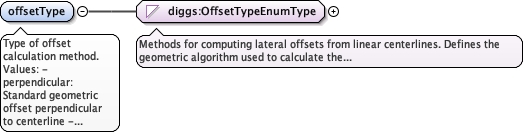
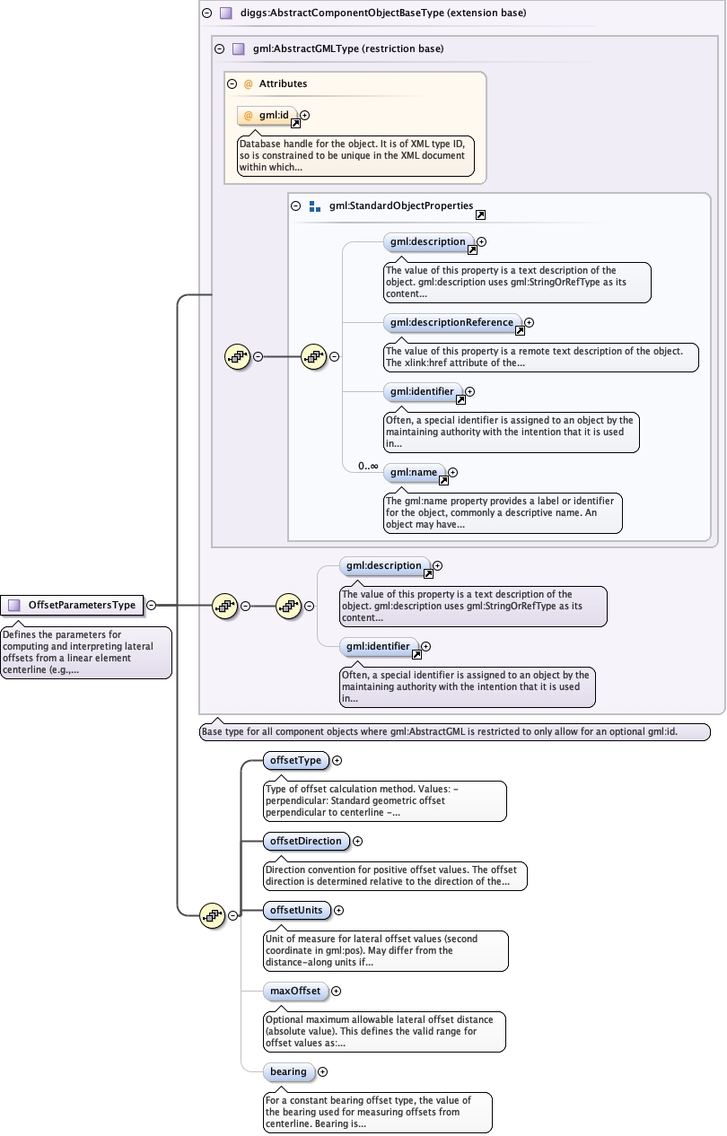
Type of offset calculation method.Values:- perpendicular: Standard geometric offset perpendicular to centerline- constantBearing: Offset at fixed compass bearing- radial: Radial offset from center point
Offset perpendicular to the tangent of the centerline at each point. Standard geometric offset method.At each position along the centerline, the offset is measured perpendicular to the local tangent direction. This is the most common method for straight or gently curved features.
enumeration
constantBearing
Offset at a constant compass bearing from centerline points. Used in marine surveys with fixed sensor arrays.Rather than perpendicular to the local tangent, offset is measured at a fixed azimuth. Useful when instruments maintain constant orientation relative to north rather than relative to vessel heading.
enumeration
radial
Offset radially from a center point. May be used for circular or spiral survey patterns.Offset is measured radially outward from a defined center point, rather than perpendicular to the centerline. Applicable for circular grid patterns or radial sampling designs.
Source
<element name="offsetType" type="diggs:OffsetTypeEnumType" default="perpendicular"><annotation><documentation>Type of offset calculation method. Values: - perpendicular: Standard geometric offset perpendicular to centerline - constantBearing: Offset at fixed compass bearing - radial: Radial offset from center point</documentation></annotation></element>
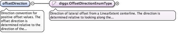
Direction convention for positive offset values.The offset direction is determined relative to the direction of the LinearElement (from first to last coordinate in gml:posList):- "right": Positive offset to the right when looking along the line- "left": Positive offset to the left when looking along the line- "starboard": Marine convention, positive to starboard (right)- "port": Marine convention, positive to port (left)Negative offset values represent the opposite direction.Zero offset represents position on the centerline.
Positive offset is to the right when looking along the LinearElement
from first to last coordinate. Standard for terrestrial applications
(transects, pipelines, road alignments).
enumeration
left
Positive offset is to the left when looking along the LinearElement
from first to last coordinate. Less common but available if the
application prefers left-positive convention.
enumeration
starboard
Positive offset is to starboard (right side when facing bow/forward
direction). Marine convention for geophysical tracklines and
marine surveys. Equivalent to "right" but uses nautical terminology
for consistency with marine operations.
enumeration
port
Positive offset is to port (left side when facing bow/forward
direction). Marine convention for geophysical tracklines.
Equivalent to "left" but uses nautical terminology. Less common
as most marine systems use starboard-positive convention.
Source
<element name="offsetDirection" type="diggs:OffsetDirectionEnumType" default="right"><annotation><documentation>Direction convention for positive offset values. The offset direction is determined relative to the direction of the LinearElement (from first to last coordinate in gml:posList): - "right": Positive offset to the right when looking along the line - "left": Positive offset to the left when looking along the line - "starboard": Marine convention, positive to starboard (right) - "port": Marine convention, positive to port (left) Negative offset values represent the opposite direction. Zero offset represents position on the centerline.</documentation></annotation></element>
Unit of measure for lateral offset values (second coordinate in gml:pos). May differ from the distance-along units if needed, though typically they are the same.Examples: ft, m, km
<element name="offsetUnits" type="diggs:LengthUomEnumType"><annotation><documentation>Unit of measure for lateral offset values (second coordinate in gml:pos). May differ from the distance-along units if needed, though typically they are the same. Examples: ft, m, km</documentation></annotation></element>
Optional maximum allowable lateral offset distance (absolute value).This defines the valid range for offset values as:[-maxOffset, +maxOffset]Useful for:- Defining swath width of geophysical instruments- Limiting sampling extent from transect centerline- Validating offset coordinatesExample: maxOffset=200 means valid offsets are -200 to +200 in the specified offsetUnits.
Diagram
Type
double
Properties
content
simple
minOccurs
0
Source
<element name="maxOffset" type="double" minOccurs="0"><annotation><documentation>Optional maximum allowable lateral offset distance (absolute value). This defines the valid range for offset values as: [-maxOffset, +maxOffset] Useful for: - Defining swath width of geophysical instruments - Limiting sampling extent from transect centerline - Validating offset coordinates Example: maxOffset=200 means valid offsets are -200 to +200 in the specified offsetUnits.</documentation></annotation></element>
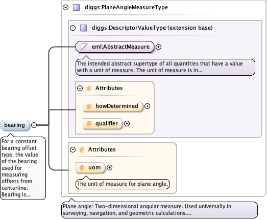
For a constant bearing offset type, the value of the bearing used for measuring offsets from centerline.Bearing is typically measured as azimuth from north (0-360 degrees) or as a compass bearing. Required when offsetType is "constantBearing".
<element minOccurs="0" name="bearing" type="diggs:PlaneAngleMeasureType"><annotation><documentation>For a constant bearing offset type, the value of the bearing used for measuring offsets from centerline. Bearing is typically measured as azimuth from north (0-360 degrees) or as a compass bearing. Required when offsetType is "constantBearing".</documentation></annotation></element>
Complex Type diggs:OffsetParametersType
Namespace
http://diggsml.org/schemas/3
Annotations
Defines the parameters for computing and interpreting lateral offsets from a linear element centerline (e.g., LinearExtent).Lateral offset is the perpendicular distance from the centerline of the linear element. This is commonly used for:- Geophysical surveys: Side-scan sonar, sub-bottom profilers collect data on swaths perpendicular to the vessel trackline- Transect sampling: Soil or environmental samples collected at regular intervals along a survey line, with additional samples offset to the sides to characterize spatial variability- Pipeline monitoring: Sensors or test points located parallel to but offset from the pipeline centerlineThe offset direction (right/left or starboard/port) defines which side of the centerline is considered positive. Negative values represent the opposite side.
Database handle for the object. It is of XML type ID, so is constrained to beunique in the XML document within which it occurs. An external identifier for the object inthe form of a URI may be constructed using standard XML and XPointer methods. This is doneby concatenating the URI for the document, a fragment separator, and the value of the idattribute.
Source
<complexType name="OffsetParametersType"><annotation><documentation>Defines the parameters for computing and interpreting lateral offsets from a linear element centerline (e.g., LinearExtent). Lateral offset is the perpendicular distance from the centerline of the linear element. This is commonly used for: - Geophysical surveys: Side-scan sonar, sub-bottom profilers collect data on swaths perpendicular to the vessel trackline - Transect sampling: Soil or environmental samples collected at regular intervals along a survey line, with additional samples offset to the sides to characterize spatial variability - Pipeline monitoring: Sensors or test points located parallel to but offset from the pipeline centerline The offset direction (right/left or starboard/port) defines which side of the centerline is considered positive. Negative values represent the opposite side.</documentation></annotation><complexContent><extension base="diggs:AbstractComponentObjectBaseType"><sequence><element name="offsetType" type="diggs:OffsetTypeEnumType" default="perpendicular"><annotation><documentation>Type of offset calculation method. Values: - perpendicular: Standard geometric offset perpendicular to centerline - constantBearing: Offset at fixed compass bearing - radial: Radial offset from center point</documentation></annotation></element><element name="offsetDirection" type="diggs:OffsetDirectionEnumType" default="right"><annotation><documentation>Direction convention for positive offset values. The offset direction is determined relative to the direction of the LinearElement (from first to last coordinate in gml:posList): - "right": Positive offset to the right when looking along the line - "left": Positive offset to the left when looking along the line - "starboard": Marine convention, positive to starboard (right) - "port": Marine convention, positive to port (left) Negative offset values represent the opposite direction. Zero offset represents position on the centerline.</documentation></annotation></element><element name="offsetUnits" type="diggs:LengthUomEnumType"><annotation><documentation>Unit of measure for lateral offset values (second coordinate in gml:pos). May differ from the distance-along units if needed, though typically they are the same. Examples: ft, m, km</documentation></annotation></element><element name="maxOffset" type="double" minOccurs="0"><annotation><documentation>Optional maximum allowable lateral offset distance (absolute value). This defines the valid range for offset values as: [-maxOffset, +maxOffset] Useful for: - Defining swath width of geophysical instruments - Limiting sampling extent from transect centerline - Validating offset coordinates Example: maxOffset=200 means valid offsets are -200 to +200 in the specified offsetUnits.</documentation></annotation></element><element minOccurs="0" name="bearing" type="diggs:PlaneAngleMeasureType"><annotation><documentation>For a constant bearing offset type, the value of the bearing used for measuring offsets from centerline. Bearing is typically measured as azimuth from north (0-360 degrees) or as a compass bearing. Required when offsetType is "constantBearing".</documentation></annotation></element></sequence></extension></complexContent></complexType>