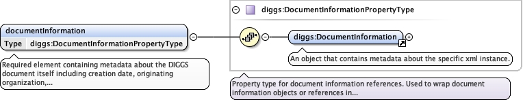
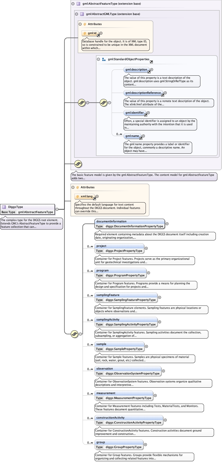
Required element containing metadata about the DIGGS document itself including creation date, originating organization, software used, coordinate reference systems employed, and other document-level information. This element must appear exactly once and should be the first element in the document content.
<element name="documentInformation" type="diggs:DocumentInformationPropertyType" minOccurs="1" maxOccurs="1"><annotation><documentation>Required element containing metadata about the DIGGS document itself including creation date, originating organization, software used, coordinate reference systems employed, and other document-level information. This element must appear exactly once and should be the first element in the document content.</documentation></annotation></element>
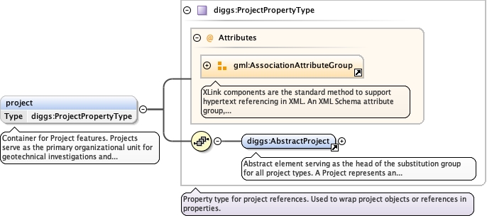
Container for Project features. Projects serve as the primary organizational unit for geotechnical investigations and construction activities. Each project typically represents a single site investigation, construction project, monitoring or research program. Most other features in the document will reference back to their associated project(s).
The 'actuate' attribute is used to communicate the desired timing of traversal from the starting resource to the ending resource; it's value should be treated as follows:onLoad - traverse to the ending resource immediately on loading the starting resource onRequest - traverse from the starting resource to the ending resource only on a post-loading event triggered for this purpose other - behavior is unconstrained; examine other markup in link for hints none - behavior is unconstrained
The 'show' attribute is used to communicate the desired presentation of the ending resource on traversal from the starting resource; it's value should be treated as follows: new - load ending resource in a new window, frame, pane, or other presentation contextreplace - load the resource in the same window, frame, pane, or other presentation contextembed - load ending resource in place of the presentation of the starting resourceother - behavior is unconstrained; examine other markup in the link for hints none - behavior is unconstrained
<element name="project" type="diggs:ProjectPropertyType" minOccurs="0" maxOccurs="unbounded"><annotation><documentation>Container for Project features. Projects serve as the primary organizational unit for geotechnical investigations and construction activities. Each project typically represents a single site investigation, construction project, monitoring or research program. Most other features in the document will reference back to their associated project(s).</documentation></annotation></element>
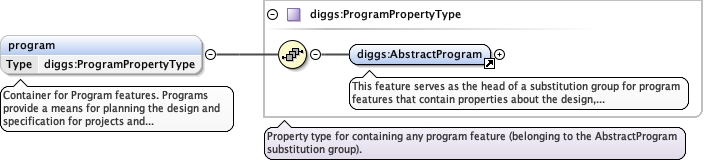
Container for Program features. Programs provide a means for planning the design and specification for projects and related features not yet constructed or fully completed.
<element minOccurs="0" name="program" type="diggs:ProgramPropertyType" maxOccurs="unbounded"><annotation><documentation>Container for Program features. Programs provide a means for planning the design and specification for projects and related features not yet constructed or fully completed.</documentation></annotation></element>
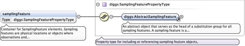
Container for SamplingFeature elements. Sampling features are physical locations or objects where observations and measurements are made or activities conducted, including boreholes, test pits, monitoring wells, CPT soundings, surface sample locations, geophysical lines, and other investigation features. These features define the spatial framework for data collection.
<element minOccurs="0" name="samplingFeature" type="diggs:SamplingFeaturePropertyType" maxOccurs="unbounded"><annotation><documentation>Container for SamplingFeature elements. Sampling features are physical locations or objects where observations and measurements are made or activities conducted, including boreholes, test pits, monitoring wells, CPT soundings, surface sample locations, geophysical lines, and other investigation features. These features define the spatial framework for data collection.</documentation></annotation></element>
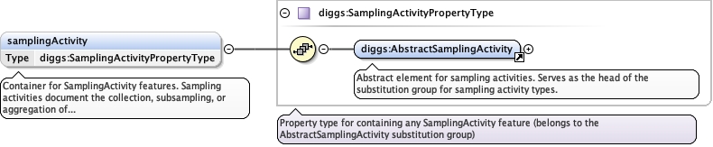
Container for SamplingActivity features. Sampling activities document the collection, subsampling, or aggregation of physical samples. Each activity records the time, location, methods, equipment, and environmental conditions under which samples were obtained, along with recovery information and sample production details.
<element minOccurs="0" name="samplingActivity" type="diggs:SamplingActivityPropertyType" maxOccurs="unbounded"><annotation><documentation>Container for SamplingActivity features. Sampling activities document the collection, subsampling, or aggregation of physical samples. Each activity records the time, location, methods, equipment, and environmental conditions under which samples were obtained, along with recovery information and sample production details.</documentation></annotation></element>
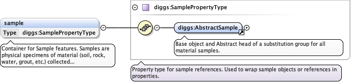
Container for Sample features. Samples are physical specimens of material (soil, rock, water, grout, etc.) collected from sampling features or created for a project that are destined for analysis and testing. Each sample records its physical condition and chain of custody, and links to the sampling activity that produced it.
<element name="sample" type="diggs:SamplePropertyType" minOccurs="0" maxOccurs="unbounded"><annotation><documentation>Container for Sample features. Samples are physical specimens of material (soil, rock, water, grout, etc.) collected from sampling features or created for a project that are destined for analysis and testing. Each sample records its physical condition and chain of custody, and links to the sampling activity that produced it.</documentation></annotation></element>
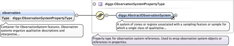
Container for ObservationSystem features. Observation systems organize qualitative descriptions and interpretive classifications along sampling features or samples. Examples include lithologic descriptions, discontinuity logs, stratigraphic interpretations, and other qualitative characterizations. Each system contains multiple zones or regions (observations) with consistent description methodology.
<element minOccurs="0" name="observation" type="diggs:ObservationSystemPropertyType" maxOccurs="unbounded"><annotation><documentation>Container for ObservationSystem features. Observation systems organize qualitative descriptions and interpretive classifications along sampling features or samples. Examples include lithologic descriptions, discontinuity logs, stratigraphic interpretations, and other qualitative characterizations. Each system contains multiple zones or regions (observations) with consistent description methodology.</documentation></annotation></element>
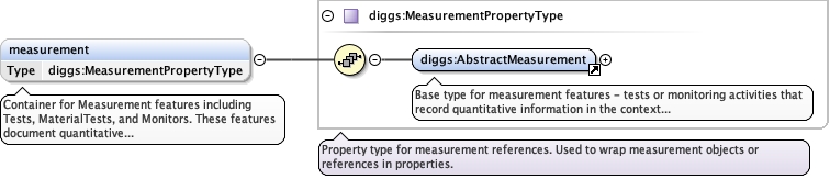
Container for Measurement features including Tests, MaterialTests, and Monitors. These features document quantitative testing and monitoring activities. Tests are field or lab procedures where the results are relevant to spatial locations. MaterialTests are laboratory procedures on samples that have no location relevance (eg. tests on grout samples). Monitors are long-term measurements at specific locations where the results vary with time.
<element minOccurs="0" name="measurement" type="diggs:MeasurementPropertyType" maxOccurs="unbounded"><annotation><documentation>Container for Measurement features including Tests, MaterialTests, and Monitors. These features document quantitative testing and monitoring activities. Tests are field or lab procedures where the results are relevant to spatial locations. MaterialTests are laboratory procedures on samples that have no location relevance (eg. tests on grout samples). Monitors are long-term measurements at specific locations where the results vary with time.</documentation></annotation></element>
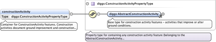
Container for ConstructionActivity features. Construction activities document ground improvement and construction operations such as grouting, pile installation, soil mixing, dewatering, ground freezing, and other activities that modify ground conditions. Each activity records methods, equipment, materials, and construction/performance data.
<element minOccurs="0" name="constructionActivity" type="diggs:ConstructionActivityPropertyType" maxOccurs="unbounded"><annotation><documentation>Container for ConstructionActivity features. Construction activities document ground improvement and construction operations such as grouting, pile installation, soil mixing, dewatering, ground freezing, and other activities that modify ground conditions. Each activity records methods, equipment, materials, and construction/performance data.</documentation></annotation></element>
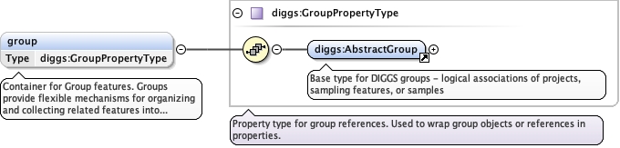
Container for Group features. Groups provide flexible mechanisms for organizing and collecting related features into logical sets. Examples include grouping all boreholes from a specific investigation phase, all tests on a particular geologic unit, or all monitoring activities in a specific area.
<element name="group" type="diggs:GroupPropertyType" minOccurs="0" maxOccurs="unbounded"><annotation><documentation>Container for Group features. Groups provide flexible mechanisms for organizing and collecting related features into logical sets. Examples include grouping all boreholes from a specific investigation phase, all tests on a particular geologic unit, or all monitoring activities in a specific area.</documentation></annotation></element>
Complex Type diggs:DiggsType
Namespace
http://diggsml.org/schemas/3
Annotations
The complex type for the DIGGS root element. Extends GML's AbstractFeatureType to provide a feature collection that can contain multiple projects and all associated data objects. The structure allows for flexible organization of data while maintaining referential integrity through gml:id and xlink:href relationships.
Database handle for the object. It is of XML type ID, so is constrained to beunique in the XML document within which it occurs. An external identifier for the object inthe form of a URI may be constructed using standard XML and XPointer methods. This is doneby concatenating the URI for the document, a fragment separator, and the value of the idattribute.
<div><h3>lang (as an attribute name)</h3><p>denotes an attribute whose value is a language code for the natural language of the content of any element; its value is inherited. This name is reserved by virtue of its definition in the XML specification.</p></div><div><h4>Notes</h4><p>Attempting to install the relevant ISO 2- and 3-letter codes as the enumerated possible values is probably never going to be a realistic possibility.</p><p>See BCP 47 at<a href="http://www.rfc-editor.org/rfc/bcp/bcp47.txt">http://www.rfc-editor.org/rfc/bcp/bcp47.txt</a>and the IANA language subtag registry at<a href="http://www.iana.org/assignments/language-subtag-registry">http://www.iana.org/assignments/language-subtag-registry</a>for further information.</p><p>The union allows for the 'un-declaration' of xml:lang with the empty string.</p></div>
Source
<complexType name="DiggsType"><annotation><documentation>The complex type for the DIGGS root element. Extends GML's AbstractFeatureType to provide a feature collection that can contain multiple projects and all associated data objects. The structure allows for flexible organization of data while maintaining referential integrity through gml:id and xlink:href relationships.</documentation></annotation><complexContent><extension base="gml:AbstractFeatureType"><sequence><element name="documentInformation" type="diggs:DocumentInformationPropertyType" minOccurs="1" maxOccurs="1"><annotation><documentation>Required element containing metadata about the DIGGS document itself including creation date, originating organization, software used, coordinate reference systems employed, and other document-level information. This element must appear exactly once and should be the first element in the document content.</documentation></annotation></element><element name="project" type="diggs:ProjectPropertyType" minOccurs="0" maxOccurs="unbounded"><annotation><documentation>Container for Project features. Projects serve as the primary organizational unit for geotechnical investigations and construction activities. Each project typically represents a single site investigation, construction project, monitoring or research program. Most other features in the document will reference back to their associated project(s).</documentation></annotation></element><element minOccurs="0" name="program" type="diggs:ProgramPropertyType" maxOccurs="unbounded"><annotation><documentation>Container for Program features. Programs provide a means for planning the design and specification for projects and related features not yet constructed or fully completed.</documentation></annotation></element><element minOccurs="0" name="samplingFeature" type="diggs:SamplingFeaturePropertyType" maxOccurs="unbounded"><annotation><documentation>Container for SamplingFeature elements. Sampling features are physical locations or objects where observations and measurements are made or activities conducted, including boreholes, test pits, monitoring wells, CPT soundings, surface sample locations, geophysical lines, and other investigation features. These features define the spatial framework for data collection.</documentation></annotation></element><element minOccurs="0" name="samplingActivity" type="diggs:SamplingActivityPropertyType" maxOccurs="unbounded"><annotation><documentation>Container for SamplingActivity features. Sampling activities document the collection, subsampling, or aggregation of physical samples. Each activity records the time, location, methods, equipment, and environmental conditions under which samples were obtained, along with recovery information and sample production details.</documentation></annotation></element><element name="sample" type="diggs:SamplePropertyType" minOccurs="0" maxOccurs="unbounded"><annotation><documentation>Container for Sample features. Samples are physical specimens of material (soil, rock, water, grout, etc.) collected from sampling features or created for a project that are destined for analysis and testing. Each sample records its physical condition and chain of custody, and links to the sampling activity that produced it.</documentation></annotation></element><element minOccurs="0" name="observation" type="diggs:ObservationSystemPropertyType" maxOccurs="unbounded"><annotation><documentation>Container for ObservationSystem features. Observation systems organize qualitative descriptions and interpretive classifications along sampling features or samples. Examples include lithologic descriptions, discontinuity logs, stratigraphic interpretations, and other qualitative characterizations. Each system contains multiple zones or regions (observations) with consistent description methodology.</documentation></annotation></element><element minOccurs="0" name="measurement" type="diggs:MeasurementPropertyType" maxOccurs="unbounded"><annotation><documentation>Container for Measurement features including Tests, MaterialTests, and Monitors. These features document quantitative testing and monitoring activities. Tests are field or lab procedures where the results are relevant to spatial locations. MaterialTests are laboratory procedures on samples that have no location relevance (eg. tests on grout samples). Monitors are long-term measurements at specific locations where the results vary with time.</documentation></annotation></element><element minOccurs="0" name="constructionActivity" type="diggs:ConstructionActivityPropertyType" maxOccurs="unbounded"><annotation><documentation>Container for ConstructionActivity features. Construction activities document ground improvement and construction operations such as grouting, pile installation, soil mixing, dewatering, ground freezing, and other activities that modify ground conditions. Each activity records methods, equipment, materials, and construction/performance data.</documentation></annotation></element><element name="group" type="diggs:GroupPropertyType" minOccurs="0" maxOccurs="unbounded"><annotation><documentation>Container for Group features. Groups provide flexible mechanisms for organizing and collecting related features into logical sets. Examples include grouping all boreholes from a specific investigation phase, all tests on a particular geologic unit, or all monitoring activities in a specific area.</documentation></annotation></element></sequence><attribute ref="xml:lang"><annotation><documentation>Specifies the default language for text content throughout the DIGGS document. Individual features can override this with their own xml:lang attributes. If not specified, English is assumed. Use ISO 639 language codes (e.g., "en" for English, "fr" for French, "es" for Spanish).</documentation></annotation></attribute></extension></complexContent></complexType>