Namespace http://diggsml.org/schemas/3
Annotations
A sampling feature feature that is a deep, narrow excavation made by
drilling and/or extraction of earth material. Boreholes are constructed typically
for the purpose of investigating subsurface geologic or geotechnical conditions,
exploring for water or oil, for installation of wells or other downhole monitoring
installations.
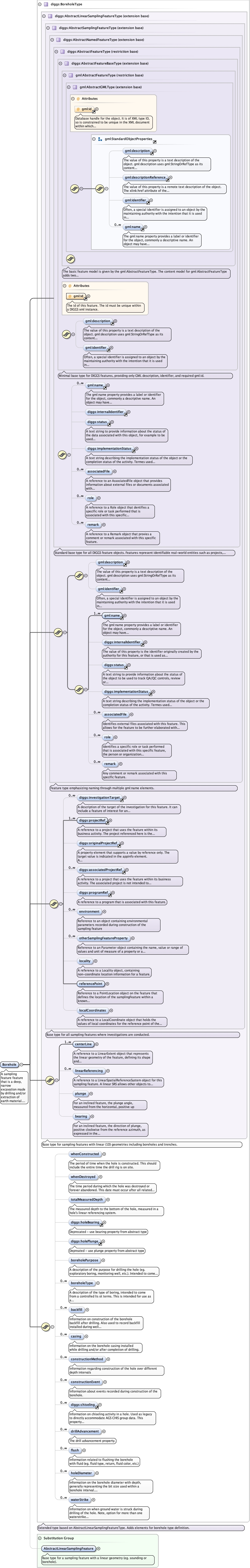
Diagram
Type diggs:BoreholeType
Type hierarchy
Properties
content
complex
abstract
false
Substitution Group Affiliation
Model
gml:description{0,1} ,
gml:identifier{0,1} ,
gml:name+ ,
diggs:internalIdentifier{0,1} ,
diggs:status{0,1} ,
diggs:implementationStatus{0,1} ,
diggs:associatedFile* ,
diggs:role* ,
diggs:remark* ,
diggs:investigationTarget* ,
diggs:projectRef+ ,
diggs:originalProjectRef{0,1} ,
diggs:associatedProjectRef* ,
diggs:programRef{0,1} ,
diggs:environment* ,
diggs:otherSamplingFeatureProperty* ,
diggs:locality{0,1} ,
diggs:referencePoint ,
diggs:localCoordinates{0,1} ,
diggs:centerLine+ ,
diggs:linearReferencing* ,
diggs:plunge{0,1} ,
diggs:bearing{0,1} ,
diggs:whenConstructed{0,1} ,
diggs:whenDestroyed{0,1} ,
diggs:totalMeasuredDepth{0,1} ,
diggs:holeBearing{0,1} ,
diggs:holePlunge{0,1} ,
diggs:boreholePurpose{0,1} ,
diggs:boreholeType* ,
diggs:backfill* ,
diggs:casing* ,
diggs:constructionMethod* ,
diggs:constructionEvent* ,
diggs:chiseling* ,
diggs:drillAdvancement* ,
diggs:flush* ,
diggs:holeDiameter* ,
diggs:waterStrike*
Children diggs:associatedFile diggs:associatedProjectRef diggs:backfill diggs:bearing diggs:boreholePurpose diggs:boreholeType diggs:casing diggs:centerLine diggs:chiseling diggs:constructionEvent diggs:constructionMethod diggs:drillAdvancement diggs:environment diggs:flush diggs:holeBearing diggs:holeDiameter diggs:holePlunge diggs:implementationStatus diggs:internalIdentifier diggs:investigationTarget diggs:linearReferencing diggs:localCoordinates diggs:locality diggs:originalProjectRef diggs:otherSamplingFeatureProperty diggs:plunge diggs:programRef diggs:projectRef diggs:referencePoint diggs:remark diggs:role diggs:status diggs:totalMeasuredDepth diggs:waterStrike diggs:whenConstructed diggs:whenDestroyed gml:description gml:identifier gml:name
Instance
<diggs:Borehole gml:id= "" xmlns:diggs= "http://diggsml.org/schemas/3" xmlns:gml= "http://www.opengis.net/gml/3.2" >
<gml:description xlink:actuate= "" xlink:arcrole= "" xlink:href= "" nilReason= "" xlink:role= "" xlink:show= "" xlink:title= "" xlink:type= "simple" > {0,1} </gml:description>
<gml:identifier codeSpace= "" > {0,1} </gml:identifier>
<gml:name codeSpace= "" > {1,unbounded} </gml:name>
<diggs:internalIdentifier codeSpace= "" > {0,1} </diggs:internalIdentifier>
<diggs:status codeSpace= "" > {0,1} </diggs:status>
<diggs:implementationStatus codeSpace= "" > {0,1} </diggs:implementationStatus>
<diggs:associatedFile xlink:actuate= "" xlink:arcrole= "" xlink:href= "" nilReason= "" owns= "false" xlink:role= "" xlink:show= "" xlink:title= "" xlink:type= "simple" > {0,unbounded} </diggs:associatedFile>
<diggs:role > {0,unbounded} </diggs:role>
<diggs:remark > {0,unbounded} </diggs:remark>
<diggs:investigationTarget > {0,unbounded} </diggs:investigationTarget>
<diggs:projectRef xlink:actuate= "" xlink:arcrole= "" xlink:href= "" identifierRef= "" nilReason= "" owns= "false" xlink:role= "" xlink:show= "" xlink:title= "" xlink:type= "simple" > {1,unbounded} </diggs:projectRef>
<diggs:originalProjectRef xlink:actuate= "" xlink:arcrole= "" xlink:href= "" identifierRef= "" nilReason= "" owns= "false" xlink:role= "" xlink:show= "" xlink:title= "" xlink:type= "simple" > {0,1} </diggs:originalProjectRef>
<diggs:associatedProjectRef xlink:actuate= "" xlink:arcrole= "" xlink:href= "" identifierRef= "" nilReason= "" owns= "false" xlink:role= "" xlink:show= "" xlink:title= "" xlink:type= "simple" > {0,unbounded} </diggs:associatedProjectRef>
<diggs:programRef xlink:actuate= "" xlink:arcrole= "" xlink:href= "" identifierRef= "" nilReason= "" owns= "false" xlink:role= "" xlink:show= "" xlink:title= "" xlink:type= "simple" > {0,1} </diggs:programRef>
<diggs:environment > {0,unbounded} </diggs:environment>
<diggs:otherSamplingFeatureProperty > {0,unbounded} </diggs:otherSamplingFeatureProperty>
<diggs:locality > {0,1} </diggs:locality>
<diggs:referencePoint xlink:role= "" xlink:actuate= "" xlink:show= "" xlink:arcrole= "" xlink:title= "" xlink:href= "" xlink:type= "simple" nilReason= "" owns= "false" > {1,1} </diggs:referencePoint>
<diggs:localCoordinates > {0,1} </diggs:localCoordinates>
<diggs:centerLine xlink:actuate= "" xlink:role= "" xlink:arcrole= "" xlink:show= "" xlink:title= "" xlink:href= "" xlink:type= "simple" nilReason= "" owns= "false" > {1,unbounded} </diggs:centerLine>
<diggs:linearReferencing > {0,unbounded} </diggs:linearReferencing>
<diggs:plunge howDetermined= "" qualifier= "" uom= "" > {0,1} </diggs:plunge>
<diggs:bearing howDetermined= "" qualifier= "" refAzimuth= "" uom= "" > {0,1} </diggs:bearing>
<diggs:whenConstructed > {0,1} </diggs:whenConstructed>
<diggs:whenDestroyed > {0,1} </diggs:whenDestroyed>
<diggs:totalMeasuredDepth howDetermined= "" qualifier= "" uom= "" > {0,1} </diggs:totalMeasuredDepth>
<diggs:holeBearing howDetermined= "" qualifier= "" uom= "" > {0,1} </diggs:holeBearing>
<diggs:holePlunge howDetermined= "" qualifier= "" uom= "" > {0,1} </diggs:holePlunge>
<diggs:boreholePurpose codeSpace= "" > {0,1} </diggs:boreholePurpose>
<diggs:boreholeType codeSpace= "" > {0,unbounded} </diggs:boreholeType>
<diggs:backfill > {0,unbounded} </diggs:backfill>
<diggs:casing > {0,unbounded} </diggs:casing>
<diggs:constructionMethod > {0,unbounded} </diggs:constructionMethod>
<diggs:constructionEvent > {0,unbounded} </diggs:constructionEvent>
<diggs:chiseling > {0,unbounded} </diggs:chiseling>
<diggs:drillAdvancement setName= "" > {0,unbounded} </diggs:drillAdvancement>
<diggs:flush > {0,unbounded} </diggs:flush>
<diggs:holeDiameter > {0,unbounded} </diggs:holeDiameter>
<diggs:waterStrike > {0,unbounded} </diggs:waterStrike>
</diggs:Borehole>
Attributes
QName
Type
Use
Annotation
gml:id ID required
Database handle for the object. It is of XML type ID, so is constrained to be
unique in the XML document within which it occurs. An external identifier for the object in
the form of a URI may be constructed using standard XML and XPointer methods. This is done
by concatenating the URI for the document, a fragment separator, and the value of the id
attribute.
Source
<element abstract= "false" name= "Borehole" substitutionGroup= "diggs:AbstractLinearSamplingFeature" type= "diggs:BoreholeType" >
<annotation >
<documentation > A sampling feature feature that is a deep, narrow excavation made by drilling and/or extraction of earth material. Boreholes are constructed typically for the purpose of investigating subsurface geologic or geotechnical conditions, exploring for water or oil, for installation of wells or other downhole monitoring installations. </documentation>
</annotation>
</element>