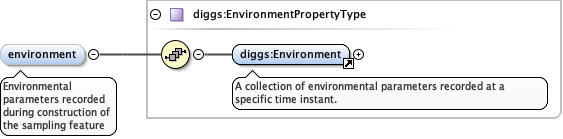
<element maxOccurs="unbounded" minOccurs="0" name="environment" type="diggs:EnvironmentPropertyType"><annotation><documentation>Environmental parameters recorded during construction of the sampling feature</documentation></annotation></element>
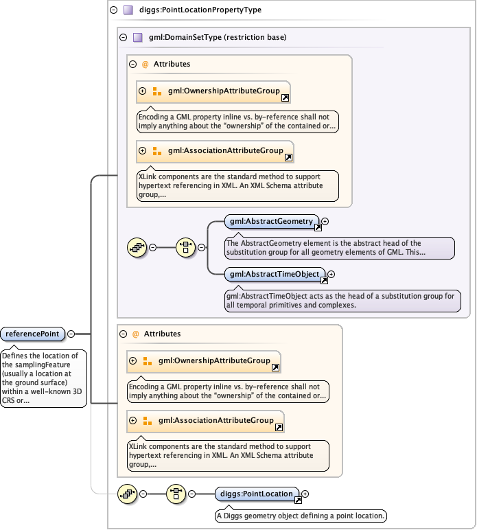
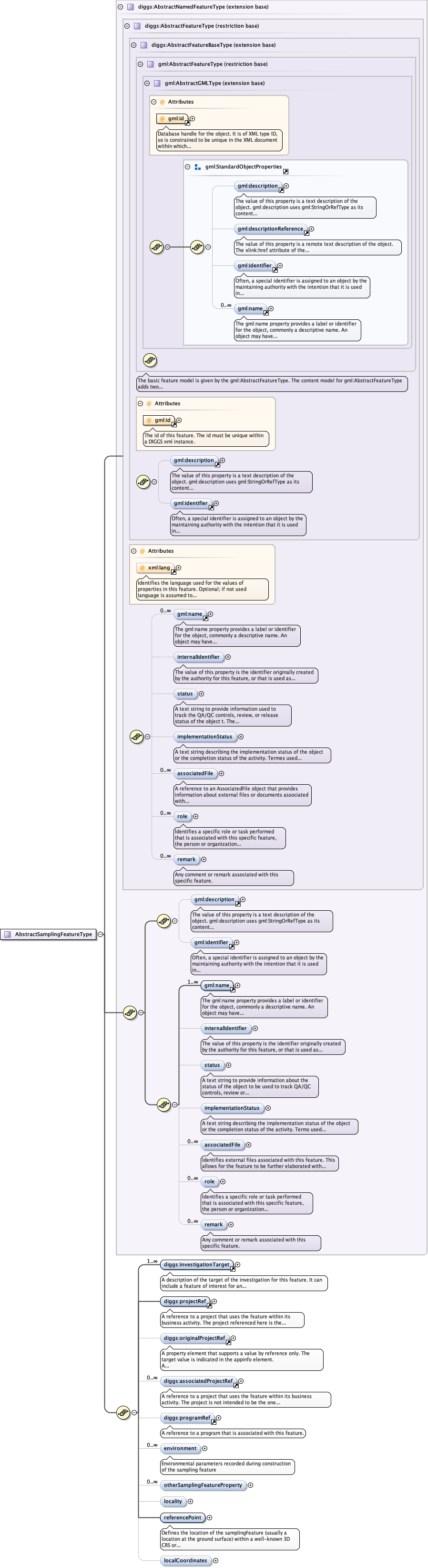
Defines the location of the samplingFeature (usually alocation at the ground surface) within a well-known 3D CRS orcombined CRS (geographic or projected, and elevation), as anextension of gml:Point object with an additional uncertaintyproperty
The 'actuate' attribute is used to communicate the desired timing of traversal from the starting resource to the ending resource; it's value should be treated as follows:onLoad - traverse to the ending resource immediately on loading the starting resource onRequest - traverse from the starting resource to the ending resource only on a post-loading event triggered for this purpose other - behavior is unconstrained; examine other markup in link for hints none - behavior is unconstrained
The 'show' attribute is used to communicate the desired presentation of the ending resource on traversal from the starting resource; it's value should be treated as follows: new - load ending resource in a new window, frame, pane, or other presentation contextreplace - load the resource in the same window, frame, pane, or other presentation contextembed - load ending resource in place of the presentation of the starting resourceother - behavior is unconstrained; examine other markup in the link for hints none - behavior is unconstrained
<element name="referencePoint" type="diggs:PointLocationPropertyType" minOccurs="1"><annotation><documentation>Defines the location of the samplingFeature (usually a location at the ground surface) within a well-known 3D CRS or combined CRS (geographic or projected, and elevation), as an extension of gml:Point object with an additional uncertainty property</documentation></annotation></element>
Database handle for the object. It is of XML type ID, so is constrained to beunique in the XML document within which it occurs. An external identifier for the object inthe form of a URI may be constructed using standard XML and XPointer methods. This is doneby concatenating the URI for the document, a fragment separator, and the value of the idattribute.
<div><h3>lang (as an attribute name)</h3><p>denotes an attribute whose value is a language code for the natural language of the content of any element; its value is inherited. This name is reserved by virtue of its definition in the XML specification.</p></div><div><h4>Notes</h4><p>Attempting to install the relevant ISO 2- and 3-letter codes as the enumerated possible values is probably never going to be a realistic possibility.</p><p>See BCP 47 at<a href="http://www.rfc-editor.org/rfc/bcp/bcp47.txt">http://www.rfc-editor.org/rfc/bcp/bcp47.txt</a>and the IANA language subtag registry at<a href="http://www.iana.org/assignments/language-subtag-registry">http://www.iana.org/assignments/language-subtag-registry</a>for further information.</p><p>The union allows for the 'un-declaration' of xml:lang with the empty string.</p></div>
Source
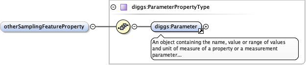
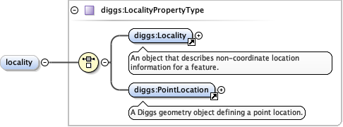
<complexType name="AbstractSamplingFeatureType" abstract="true"><complexContent><extension base="diggs:AbstractNamedFeatureType"><sequence><element ref="diggs:investigationTarget" maxOccurs="unbounded" minOccurs="1"/><element ref="diggs:projectRef"/><element minOccurs="0" ref="diggs:originalProjectRef"/><element maxOccurs="unbounded" minOccurs="0" ref="diggs:associatedProjectRef"/><element minOccurs="0" ref="diggs:programRef"/><element maxOccurs="unbounded" minOccurs="0" name="environment" type="diggs:EnvironmentPropertyType"><annotation><documentation>Environmental parameters recorded during construction of the sampling feature</documentation></annotation></element><element maxOccurs="unbounded" minOccurs="0" name="otherSamplingFeatureProperty" type="diggs:ParameterPropertyType"/><element name="locality" type="diggs:LocalityPropertyType" minOccurs="0" maxOccurs="1"/><element name="referencePoint" type="diggs:PointLocationPropertyType" minOccurs="1"><annotation><documentation>Defines the location of the samplingFeature (usually a location at the ground surface) within a well-known 3D CRS or combined CRS (geographic or projected, and elevation), as an extension of gml:Point object with an additional uncertainty property</documentation></annotation></element><element minOccurs="0" name="localCoordinates" type="diggs:LocalCoordinatePropertyType"/></sequence></extension></complexContent></complexType>