| Namespace | http://www.opengis.net/gml/3.2 | |||||||||||||
|
Annotations
|
|
|||||||||||||
|
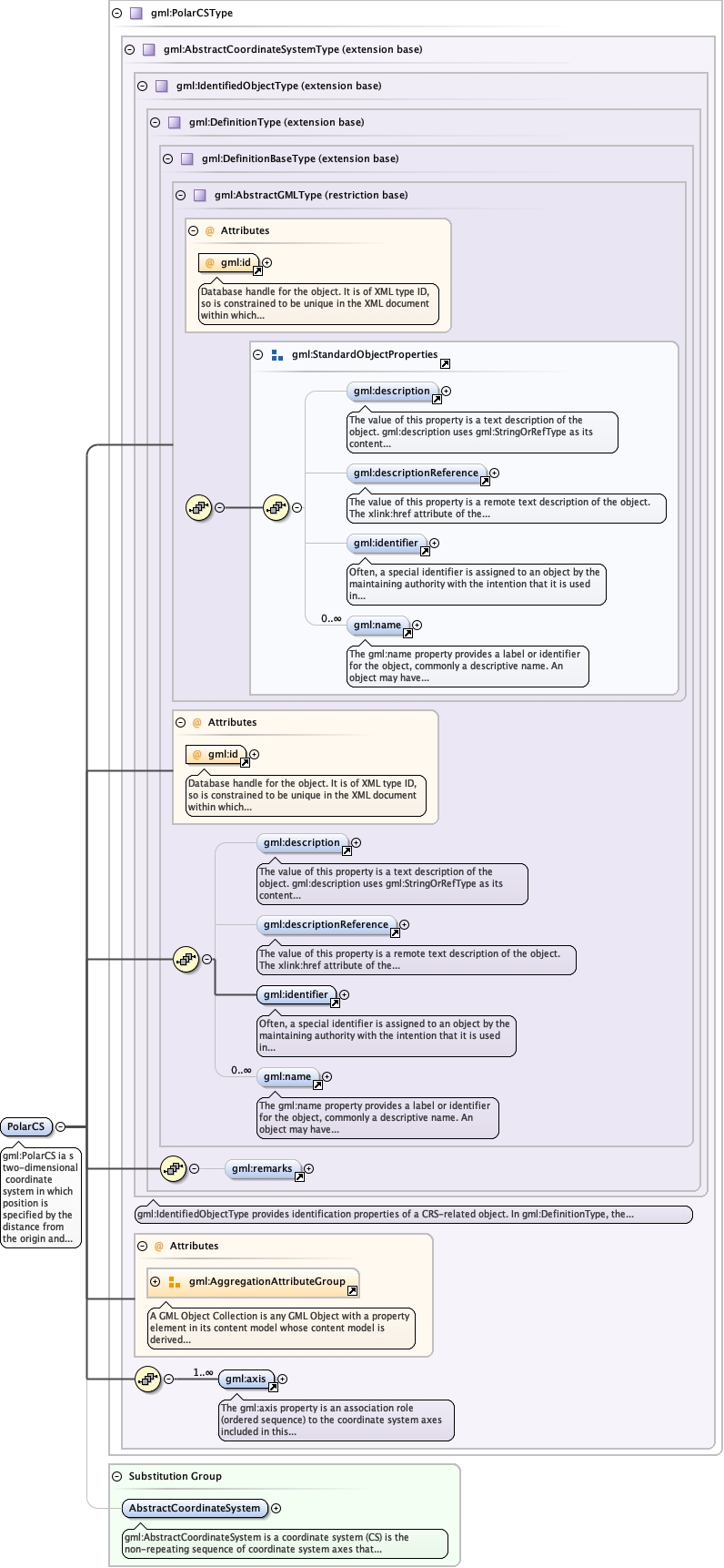
Diagram
|
 |
|||||||||||||
| Type | gml:PolarCSType | |||||||||||||
| Type hierarchy | ||||||||||||||
|
Properties
|
|
|||||||||||||
| Substitution Group Affiliation | ||||||||||||||
|
Used by
|
|
|||||||||||||
| Model | ||||||||||||||
| Children | gml:axis, gml:description, gml:descriptionReference, gml:identifier, gml:name, gml:remarks | |||||||||||||
|
Instance
|
|
|||||||||||||
|
Attributes
|
|
|||||||||||||
|
Source
|
|