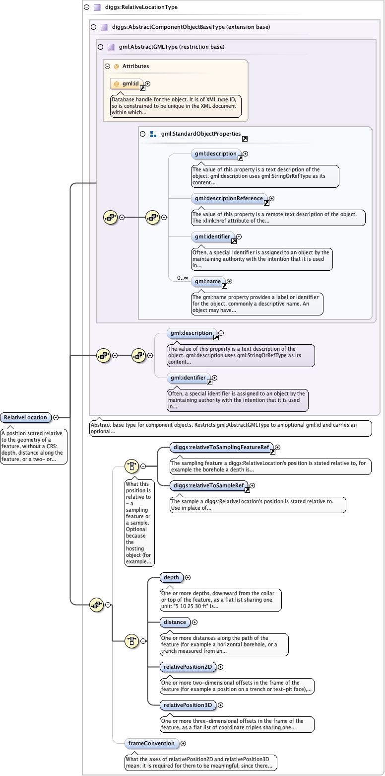
A position stated relative to the geometry of a feature, without a CRS: depth,distance along the feature, or a two- or three-dimensional offset in the frame ofthe feature. Generic to any planned position where a real spatial reference systemdoes not yet exist, such as a design-stage sample position. It is not a degenerateor provisional geometry but a different kind of fact, stated without any CRS, and soit is not admitted by diggs:LocationPropertyType and does not substitutediggs:AbstractGeometry: a realized position is normally stated within the linearreferencing system of the feature or a diggs:LocalCartesianCRS, and adiggs:LocalCartesianCRS requires a real origin and axis location, which do not existbefore the feature does. Resolving a planned position against the actual geometry ofa realized feature is a validation job. Depth (downward from the collar or top ofthe feature) and distance (along the path of the feature) are separate elementsbecause they are different measurements, as are relativePosition2D andrelativePosition3D, which name the chunk width. Several positions are stated as alist in one element: "samples at 5, 10, 25 and 30 ft" is one diggs:RelativeLocationwith a four-item depth list; that a list divides evenly by its chunk width is notenforced, as for gml:posList. Per-position metadata, such as a different method orremark at one depth, is not expressible here: a position that needs its own is adifferent sample design with its own scope.
Database handle for the object. It is of XML type ID, so is constrained to beunique in the XML document within which it occurs. An external identifier for the object inthe form of a URI may be constructed using standard XML and XPointer methods. This is doneby concatenating the URI for the document, a fragment separator, and the value of the idattribute.
Source
<element name="RelativeLocation" type="diggs:RelativeLocationType"><annotation><documentation>A position stated relative to the geometry of a feature, without a CRS: depth, distance along the feature, or a two- or three-dimensional offset in the frame of the feature. Generic to any planned position where a real spatial reference system does not yet exist, such as a design-stage sample position. It is not a degenerate or provisional geometry but a different kind of fact, stated without any CRS, and so it is not admitted by diggs:LocationPropertyType and does not substitute diggs:AbstractGeometry: a realized position is normally stated within the linear referencing system of the feature or a diggs:LocalCartesianCRS, and a diggs:LocalCartesianCRS requires a real origin and axis location, which do not exist before the feature does. Resolving a planned position against the actual geometry of a realized feature is a validation job. Depth (downward from the collar or top of the feature) and distance (along the path of the feature) are separate elements because they are different measurements, as are relativePosition2D and relativePosition3D, which name the chunk width. Several positions are stated as a list in one element: "samples at 5, 10, 25 and 30 ft" is one diggs:RelativeLocation with a four-item depth list; that a list divides evenly by its chunk width is not enforced, as for gml:posList. Per-position metadata, such as a different method or remark at one depth, is not expressible here: a position that needs its own is a different sample design with its own scope.</documentation></annotation></element>