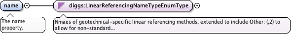
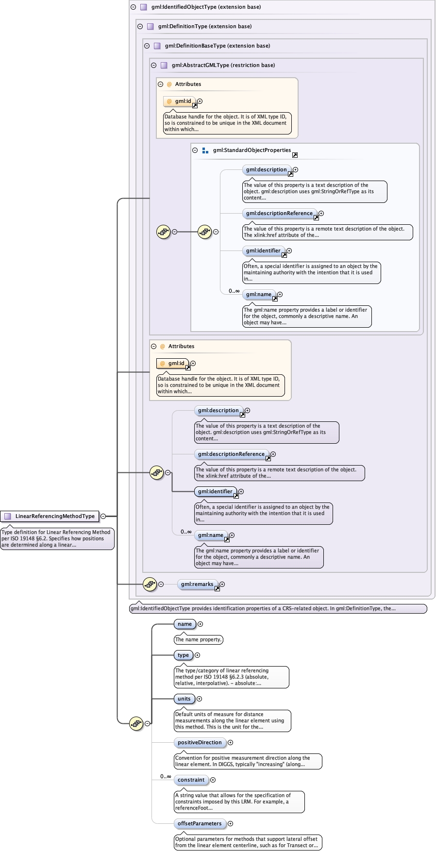
<element name="name" type="diggs:LinearReferencingNameTypeEnumType"><annotation><documentation>The name property.</documentation></annotation></element>
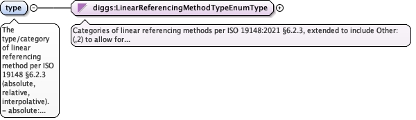
The type/category of linear referencing method per ISO 19148 §6.2.3 (absolute, relative, interpolative).- absolute: Distance from fixed origin (typically first coordinate)- relative: Distance from a specified referent point- interpolative: Position determined by interpolation between known control points
<element name="type" type="diggs:LinearReferencingMethodTypeEnumType"><annotation><documentation>The type/category of linear referencing method per ISO 19148 §6.2.3 (absolute, relative, interpolative). - absolute: Distance from fixed origin (typically first coordinate) - relative: Distance from a specified referent point - interpolative: Position determined by interpolation between known control points</documentation></annotation></element>
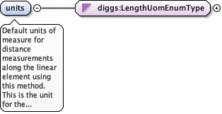
Default units of measure for distance measurements along the linear element using this method. This is the unit for the first coordinate value (distance along).Common values: ft, m, km, mi
<element name="units" type="diggs:LengthUomEnumType"><annotation><documentation>Default units of measure for distance measurements along the linear element using this method. This is the unit for the first coordinate value (distance along). Common values: ft, m, km, mi</documentation></annotation></element>
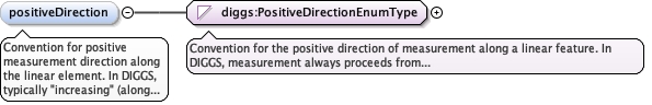
Convention for positive measurement direction along the linear element. In DIGGS, typically "increasing" (along coordinate order). Semantic labels (downward, upward, forward) provide clarity but don't change the fundamental coordinate-order-based direction.Values:- increasing: Default, follows coordinate order- downward: Semantic label for boreholes (positive is deeper)- upward: Semantic label (positive is shallower)- forward: Semantic label for horizontal features
Positive direction follows coordinate order from first to last.This is the DIGGS standard and default convention.
enumeration
downward
Semantic label indicating positive is downward (deeper).
Common for boreholes where first coordinate is collar and
last is bottom of hole. Measurements increase with depth.
enumeration
upward
Semantic label indicating positive is upward (shallower).
May be used for core logging from bottom to top, or for
elevation-based referencing systems.
enumeration
forward
Semantic label for horizontal features indicating positive is in the forward direction of survey or alignment.Common for transects, pipelines, and tracklines.
Source
<element name="positiveDirection" type="diggs:PositiveDirectionEnumType" minOccurs="0" default="increasing"><annotation><documentation>Convention for positive measurement direction along the linear element. In DIGGS, typically "increasing" (along coordinate order). Semantic labels (downward, upward, forward) provide clarity but don't change the fundamental coordinate-order-based direction. Values: - increasing: Default, follows coordinate order - downward: Semantic label for boreholes (positive is deeper) - upward: Semantic label (positive is shallower) - forward: Semantic label for horizontal features</documentation></annotation></element>
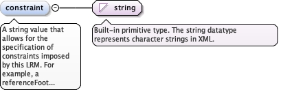
A string value that allows for the specification of constraints imposed by this LRM. Forexample, a referenceFoot Linear Referencing Method can specify that referents cannot be of type "line start" or "Line end".
Diagram
Type
string
Properties
content
simple
minOccurs
0
maxOccurs
unbounded
Source
<element maxOccurs="unbounded" minOccurs="0" name="constraint" type="string"><annotation><documentation>A string value that allows for the specification of constraints imposed by this LRM. For example, a referenceFoot Linear Referencing Method can specify that referents cannot be of type "line start" or "Line end".</documentation></annotation></element>
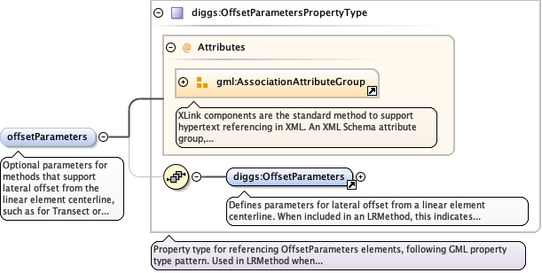
Optional parameters for methods that support lateral offset from the linear element centerline, such as for Transect or TrialPit sampling features.When PRESENT: This method supports 2D positioning- LinearSRS using this method has srsDimension = 2- Coordinates are encoded as: <gml:pos>distance offset</gml:pos>- First value = distance along (in 'units')- Second value = lateral offset (in 'offsetParameters/offsetUnits')- Positive offset direction defined by 'offsetParameters/offsetDirection'When ABSENT: This method supports 1D positioning only- LinearSRS using this method has srsDimension = 1- Coordinates are encoded as: <gml:pos>distance</gml:pos>Used for:- Transects with offset soil sampling- Geophysical tracklines with side-scan sonar swaths- Pipelines with offset monitoring points- Survey lines with offset test pits- Trial or test pits with offset sampling locations
The 'actuate' attribute is used to communicate the desired timing of traversal from the starting resource to the ending resource; it's value should be treated as follows:onLoad - traverse to the ending resource immediately on loading the starting resource onRequest - traverse from the starting resource to the ending resource only on a post-loading event triggered for this purpose other - behavior is unconstrained; examine other markup in link for hints none - behavior is unconstrained
The 'show' attribute is used to communicate the desired presentation of the ending resource on traversal from the starting resource; it's value should be treated as follows: new - load ending resource in a new window, frame, pane, or other presentation contextreplace - load the resource in the same window, frame, pane, or other presentation contextembed - load ending resource in place of the presentation of the starting resourceother - behavior is unconstrained; examine other markup in the link for hints none - behavior is unconstrained
<element name="offsetParameters" type="diggs:OffsetParametersPropertyType" minOccurs="0"><annotation><documentation>Optional parameters for methods that support lateral offset from the linear element centerline, such as for Transect or TrialPit sampling features. When PRESENT: This method supports 2D positioning - LinearSRS using this method has srsDimension = 2 - Coordinates are encoded as: <gml:pos>distance offset</gml:pos> - First value = distance along (in 'units') - Second value = lateral offset (in 'offsetParameters/offsetUnits') - Positive offset direction defined by 'offsetParameters/offsetDirection' When ABSENT: This method supports 1D positioning only - LinearSRS using this method has srsDimension = 1 - Coordinates are encoded as: <gml:pos>distance</gml:pos> Used for: - Transects with offset soil sampling - Geophysical tracklines with side-scan sonar swaths - Pipelines with offset monitoring points - Survey lines with offset test pits - Trial or test pits with offset sampling locations</documentation></annotation></element>
Complex Type diggs:LinearReferencingMethodType
Namespace
http://diggsml.org/schemas/3
Annotations
Type definition for Linear Referencing Method per ISO 19148 §6.2.Specifies how positions are determined along a linear feature. DIGGS LR methods rely on the LinearExtent geometry to establish the spatial framework. The method defines how measures are computed from or applied to that geometry.Methods can be 1-dimensional (distance along only) or 2-dimensional (distance along + lateral offset). The presence of offsetParameters determines the dimensionality:- offsetParameters absent: 1D method, srsDimension=1, gml:pos="distance"- offsetParameters present: 2D method, srsDimension=2, gml:pos="distance offset"DIGGS examples:- 1D: Borehole depth from ground surface- 1D: Well measured depth from casing top- 2D: Transect with offset sampling- 2D: Geophysical trackline with swath data
Database handle for the object. It is of XML type ID, so is constrained to beunique in the XML document within which it occurs. An external identifier for the object inthe form of a URI may be constructed using standard XML and XPointer methods. This is doneby concatenating the URI for the document, a fragment separator, and the value of the idattribute.
Source
<complexType name="LinearReferencingMethodType"><annotation><documentation>Type definition for Linear Referencing Method per ISO 19148 §6.2. Specifies how positions are determined along a linear feature. DIGGS LR methods rely on the LinearExtent geometry to establish the spatial framework. The method defines how measures are computed from or applied to that geometry. Methods can be 1-dimensional (distance along only) or 2-dimensional (distance along + lateral offset). The presence of offsetParameters determines the dimensionality: - offsetParameters absent: 1D method, srsDimension=1, gml:pos="distance" - offsetParameters present: 2D method, srsDimension=2, gml:pos="distance offset" DIGGS examples: - 1D: Borehole depth from ground surface - 1D: Well measured depth from casing top - 2D: Transect with offset sampling - 2D: Geophysical trackline with swath data</documentation></annotation><complexContent><extension base="gml:IdentifiedObjectType"><sequence><element name="name" type="diggs:LinearReferencingNameTypeEnumType"><annotation><documentation>The name property.</documentation></annotation></element><element name="type" type="diggs:LinearReferencingMethodTypeEnumType"><annotation><documentation>The type/category of linear referencing method per ISO 19148 §6.2.3 (absolute, relative, interpolative). - absolute: Distance from fixed origin (typically first coordinate) - relative: Distance from a specified referent point - interpolative: Position determined by interpolation between known control points</documentation></annotation></element><element name="units" type="diggs:LengthUomEnumType"><annotation><documentation>Default units of measure for distance measurements along the linear element using this method. This is the unit for the first coordinate value (distance along). Common values: ft, m, km, mi</documentation></annotation></element><element name="positiveDirection" type="diggs:PositiveDirectionEnumType" minOccurs="0" default="increasing"><annotation><documentation>Convention for positive measurement direction along the linear element. In DIGGS, typically "increasing" (along coordinate order). Semantic labels (downward, upward, forward) provide clarity but don't change the fundamental coordinate-order-based direction. Values: - increasing: Default, follows coordinate order - downward: Semantic label for boreholes (positive is deeper) - upward: Semantic label (positive is shallower) - forward: Semantic label for horizontal features</documentation></annotation></element><element maxOccurs="unbounded" minOccurs="0" name="constraint" type="string"><annotation><documentation>A string value that allows for the specification of constraints imposed by this LRM. For example, a referenceFoot Linear Referencing Method can specify that referents cannot be of type "line start" or "Line end".</documentation></annotation></element><element name="offsetParameters" type="diggs:OffsetParametersPropertyType" minOccurs="0"><annotation><documentation>Optional parameters for methods that support lateral offset from the linear element centerline, such as for Transect or TrialPit sampling features. When PRESENT: This method supports 2D positioning - LinearSRS using this method has srsDimension = 2 - Coordinates are encoded as: <gml:pos>distance offset</gml:pos> - First value = distance along (in 'units') - Second value = lateral offset (in 'offsetParameters/offsetUnits') - Positive offset direction defined by 'offsetParameters/offsetDirection' When ABSENT: This method supports 1D positioning only - LinearSRS using this method has srsDimension = 1 - Coordinates are encoded as: <gml:pos>distance</gml:pos> Used for: - Transects with offset soil sampling - Geophysical tracklines with side-scan sonar swaths - Pipelines with offset monitoring points - Survey lines with offset test pits - Trial or test pits with offset sampling locations</documentation></annotation></element></sequence></extension></complexContent></complexType>