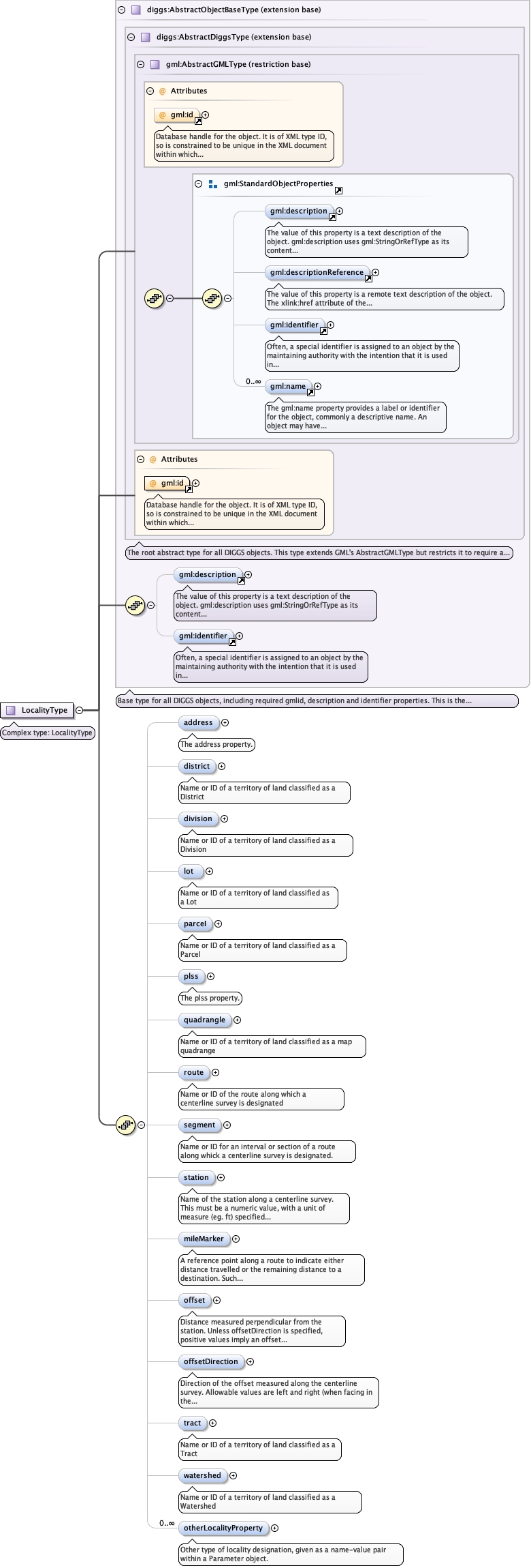
Name or ID of a territory of land classified as aDistrict
Diagram
Type
string
Properties
content
simple
minOccurs
0
maxOccurs
1
Source
<element name="district" type="string" minOccurs="0" maxOccurs="1"><annotation><documentation>Name or ID of a territory of land classified as a District</documentation></annotation></element>
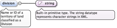
Name or ID of a territory of land classified as aDivision
Diagram
Type
string
Properties
content
simple
minOccurs
0
maxOccurs
1
Source
<element name="division" type="string" minOccurs="0" maxOccurs="1"><annotation><documentation>Name or ID of a territory of land classified as a Division</documentation></annotation></element>
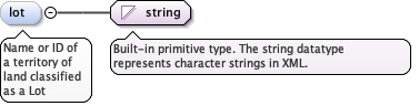
Name or ID of a territory of land classified as a Lot
Diagram
Type
string
Properties
content
simple
minOccurs
0
Source
<element minOccurs="0" name="lot" type="string"><annotation><documentation>Name or ID of a territory of land classified as a Lot</documentation></annotation></element>
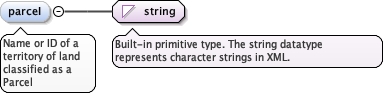
Name or ID of a territory of land classified as a Parcel
Diagram
Type
string
Properties
content
simple
minOccurs
0
maxOccurs
1
Source
<element name="parceI" type="string" minOccurs="0" maxOccurs="1"><annotation><documentation>Name or ID of a territory of land classified as a Parcel</documentation></annotation></element>
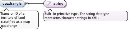
Name or ID of a territory of land classified as a mapquadrange
Diagram
Type
string
Properties
content
simple
minOccurs
0
maxOccurs
1
Source
<element name="quadrangle" type="string" minOccurs="0" maxOccurs="1"><annotation><documentation>Name or ID of a territory of land classified as a map quadrange</documentation></annotation></element>
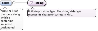
Name or ID of the route along which a centerline surveyis designated
Diagram
Type
string
Properties
content
simple
minOccurs
0
maxOccurs
1
Source
<element name="route" type="string" minOccurs="0" maxOccurs="1"><annotation><documentation>Name or ID of the route along which a centerline survey is designated</documentation></annotation></element>
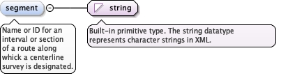
Name or ID for an interval or section of a route alongwhick a centerline survey is designated.
Diagram
Type
string
Properties
content
simple
minOccurs
0
maxOccurs
1
Source
<element name="segment" type="string" minOccurs="0" maxOccurs="1"><annotation><documentation>Name or ID for an interval or section of a route along whick a centerline survey is designated.</documentation></annotation></element>
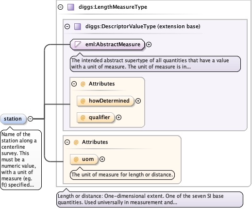
Name of the station along a centerline survey. This mustbe a numeric value, with a unit of measure (eg. ft) specified in theuom attribute. Systems that store station values as a string thatinclude a plus sign (+) need to strip out the + and specify the uomfor encoding to DIGGS.
<element name="station" type="diggs:LengthMeasureType" minOccurs="0" maxOccurs="1"><annotation><documentation>Name of the station along a centerline survey. This must be a numeric value, with a unit of measure (eg. ft) specified in the uom attribute. Systems that store station values as a string that include a plus sign (+) need to strip out the + and specify the uom for encoding to DIGGS.</documentation></annotation></element>
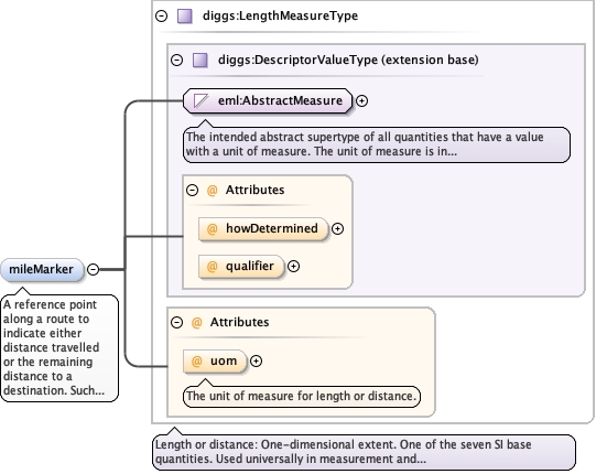
A reference point along a route to indicate eitherdistance travelled or the remaining distance to a destination. Suchreferences are also used by maintenance engineers and emergencyservices to direct them to specific points where their presence isrequired. This term is sometimes used to denote a location on a roadeven if no physical sign is present. This is a numerical value a maydiffer from a station id used for specific routesurveys.
<element name="mileMarker" type="diggs:LengthMeasureType" minOccurs="0" maxOccurs="1"><annotation><documentation>A reference point along a route to indicate either distance travelled or the remaining distance to a destination. Such references are also used by maintenance engineers and emergency services to direct them to specific points where their presence is required. This term is sometimes used to denote a location on a road even if no physical sign is present. This is a numerical value a may differ from a station id used for specific route surveys.</documentation></annotation></element>
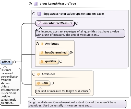
Distance measured perpendicular from the station. UnlessoffsetDirection is specified, positive values imply an offset to theright when facing in the direction of increasing station value.Negative values imply an offset to the left.
<element name="offset" type="diggs:LengthMeasureType" minOccurs="0" maxOccurs="1" form="qualified"><annotation><documentation>Distance measured perpendicular from the station. Unless offsetDirection is specified, positive values imply an offset to the right when facing in the direction of increasing station value. Negative values imply an offset to the left.</documentation></annotation></element>
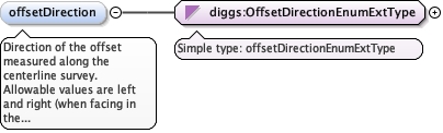
Direction of the offset measured along the centerlinesurvey. Allowable values are left and right (when facing in thedirection of increasing station value.
<element name="offsetDirection" type="diggs:OffsetDirectionEnumExtType" minOccurs="0" maxOccurs="1"><annotation><documentation>Direction of the offset measured along the centerline survey. Allowable values are left and right (when facing in the direction of increasing station value.</documentation></annotation></element>
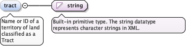
Name or ID of a territory of land classified as a Tract
Diagram
Type
string
Properties
content
simple
minOccurs
0
maxOccurs
1
Source
<element name="tract" type="string" minOccurs="0" maxOccurs="1"><annotation><documentation>Name or ID of a territory of land classified as a Tract</documentation></annotation></element>
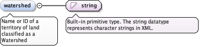
Name or ID of a territory of land classified as aWatershed
Diagram
Type
string
Properties
content
simple
minOccurs
0
maxOccurs
1
Source
<element name="watershed" type="string" minOccurs="0" maxOccurs="1"><annotation><documentation>Name or ID of a territory of land classified as a Watershed</documentation></annotation></element>
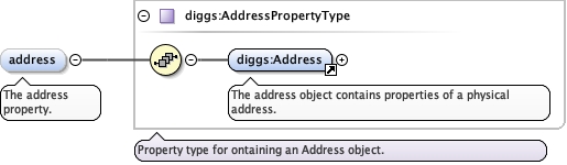
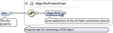
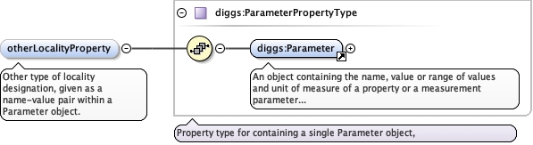
<element name="otherLocalityProperty" type="diggs:ParameterPropertyType" minOccurs="0" maxOccurs="unbounded"><annotation><documentation>Other type of locality designation, given as a name-value pair within a Parameter object.</documentation></annotation></element>
Database handle for the object. It is of XML type ID, so is constrained to beunique in the XML document within which it occurs. An external identifier for the object inthe form of a URI may be constructed using standard XML and XPointer methods. This is doneby concatenating the URI for the document, a fragment separator, and the value of the idattribute.
Source
<complexType name="LocalityType"><annotation><documentation>Complex type: LocalityType</documentation></annotation><complexContent><extension base="diggs:AbstractObjectBaseType"><sequence><element name="address" type="diggs:AddressPropertyType" minOccurs="0" maxOccurs="1"><annotation><documentation>The address property.</documentation></annotation></element><element name="district" type="string" minOccurs="0" maxOccurs="1"><annotation><documentation>Name or ID of a territory of land classified as a District</documentation></annotation></element><element name="division" type="string" minOccurs="0" maxOccurs="1"><annotation><documentation>Name or ID of a territory of land classified as a Division</documentation></annotation></element><element minOccurs="0" name="lot" type="string"><annotation><documentation>Name or ID of a territory of land classified as a Lot</documentation></annotation></element><element name="parceI" type="string" minOccurs="0" maxOccurs="1"><annotation><documentation>Name or ID of a territory of land classified as a Parcel</documentation></annotation></element><element name="plss" type="diggs:PlssPropertyType" minOccurs="0" maxOccurs="1"><annotation><documentation>The plss property.</documentation></annotation></element><element name="quadrangle" type="string" minOccurs="0" maxOccurs="1"><annotation><documentation>Name or ID of a territory of land classified as a map quadrange</documentation></annotation></element><element name="route" type="string" minOccurs="0" maxOccurs="1"><annotation><documentation>Name or ID of the route along which a centerline survey is designated</documentation></annotation></element><element name="segment" type="string" minOccurs="0" maxOccurs="1"><annotation><documentation>Name or ID for an interval or section of a route along whick a centerline survey is designated.</documentation></annotation></element><element name="station" type="diggs:LengthMeasureType" minOccurs="0" maxOccurs="1"><annotation><documentation>Name of the station along a centerline survey. This must be a numeric value, with a unit of measure (eg. ft) specified in the uom attribute. Systems that store station values as a string that include a plus sign (+) need to strip out the + and specify the uom for encoding to DIGGS.</documentation></annotation></element><element name="mileMarker" type="diggs:LengthMeasureType" minOccurs="0" maxOccurs="1"><annotation><documentation>A reference point along a route to indicate either distance travelled or the remaining distance to a destination. Such references are also used by maintenance engineers and emergency services to direct them to specific points where their presence is required. This term is sometimes used to denote a location on a road even if no physical sign is present. This is a numerical value a may differ from a station id used for specific route surveys.</documentation></annotation></element><element name="offset" type="diggs:LengthMeasureType" minOccurs="0" maxOccurs="1" form="qualified"><annotation><documentation>Distance measured perpendicular from the station. Unless offsetDirection is specified, positive values imply an offset to the right when facing in the direction of increasing station value. Negative values imply an offset to the left.</documentation></annotation></element><element name="offsetDirection" type="diggs:OffsetDirectionEnumExtType" minOccurs="0" maxOccurs="1"><annotation><documentation>Direction of the offset measured along the centerline survey. Allowable values are left and right (when facing in the direction of increasing station value.</documentation></annotation></element><element name="tract" type="string" minOccurs="0" maxOccurs="1"><annotation><documentation>Name or ID of a territory of land classified as a Tract</documentation></annotation></element><element name="watershed" type="string" minOccurs="0" maxOccurs="1"><annotation><documentation>Name or ID of a territory of land classified as a Watershed</documentation></annotation></element><element name="otherLocalityProperty" type="diggs:ParameterPropertyType" minOccurs="0" maxOccurs="unbounded"><annotation><documentation>Other type of locality designation, given as a name-value pair within a Parameter object.</documentation></annotation></element></sequence></extension></complexContent></complexType>