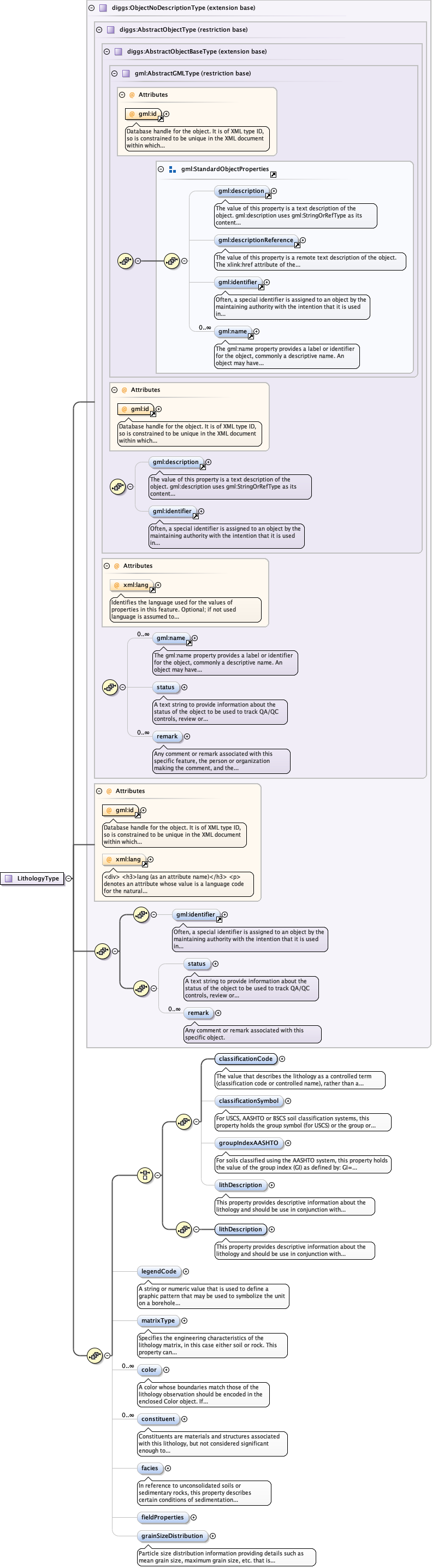
<complexType name="LithologyType" mixed="false">
<annotation>
<documentation/>
</annotation>
<complexContent>
<extension base="diggs:ObjectNoDescriptionType">
<sequence>
<choice>
<sequence>
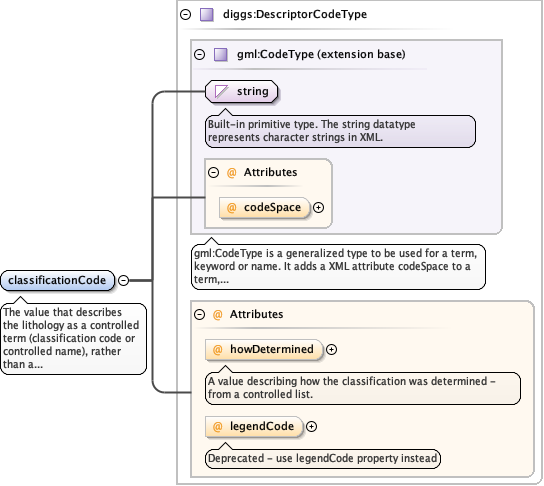
<element name="classificationCode" type="diggs:DescriptorCodeType" minOccurs="1" maxOccurs="1">
  <annotation>
    <documentation>The value that describes the lithology as a controlled term (classification code or controlled name), rather than a simply descriptive one. Examples: 1) For soils described using the Unified Soil Classification, this value should be the "group name" as defined in Figures 1,2 and 3 of ASTM D 2487 or Figures 1 and 2 of ASTM D 2488, eg "Silty sand" or "Gravelly silt with sand". Where the group name is not specified, the "group symbol" should be used instead (eg. "SM" "ML"). 2) For soils described using the AASHTO soil classification system, this value should be the group or subgroup classification (eg. "A-3", "A-2-6"). 3) For soils classified using the USDA, Shepard (1954), or Folk classifications based on soil textures, this value would be the textural classification, eg. "sandy loam" (USDA), "sand-silt-clay" (Shepard), or "muddy Sand" (Folk, 7 class) 4) For soils classified using the British Soil Classification System, this value would be the recommended name (eg. "CLAY of very high plasticity"), or the group symbol if the standard name is not given (eg. "CV") 5) For rock, for example as defined by the American Geosciences Institute (AGI) glossary, this value would be ther rock name (eg. "dolostone", "basalt", "pebbly mudstone"). Either a classificationCode value or lithDescription value must be present. The codespace attribute is mandatory and preferably is a link to the appropriate DIGGS codelist dictionary, should contain te authority code for any standard system, or a link to a dictionary of a non-standard or proprietary system. Standard codespace codes are as follows: USCS - Unified Soil Classification System AASHTO - AASHTO System for subgrades USDA - US Dept. of Agriculture textural classification BSCS - British Soil Classification System SHEP - Shepard (1954) textural clasification FOLK5 - Folk 5-class system for sediments FOLK7 - Folk 7-class system for sediments FOLK16 - Folk 16-class system for sediments AGI - American Geosciences Institute Glossary</documentation>
  </annotation>
</element>
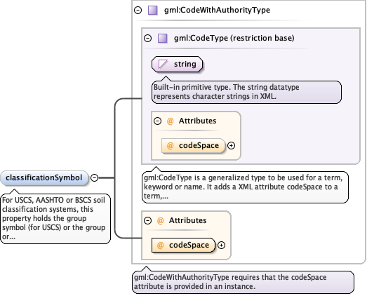
<element minOccurs="0" name="classificationSymbol" maxOccurs="1" type="gml:CodeWithAuthorityType">
  <annotation>
    <documentation>For USCS, AASHTO or BSCS soil classification systems, this property holds the group symbol (for USCS) or the group or appropriate subgroup classification (for AASHTO and BSCS). Symbology for nan-standard or proprietary classifications may also be reported here. Codespace attribute is mandatory and should preferably a link to the associated DIGGS dictionary, or be either USCS, AASHTO, or BSCS for those systems, or an authority code for non-standard systems.</documentation>
  </annotation>
</element>
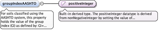
<element minOccurs="0" name="groupIndexAASHTO" type="positiveInteger">
  <annotation>
    <documentation>For soils classified using the AASHTO system, this property holds the value of the group index (GI) as defined by: GI= (F–35)[0.2+0.005(LL– 40)}+(F–15)(PI–10) where F is the percentage passing the 75 μm (0.075 mm) sieve, expressed as a whole number. This percentage is based only on the material passing the 75 μm sieve, LL is the liquid limit and PI is the plasticity index.</documentation>
  </annotation>
</element>
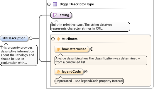
<element minOccurs="0" name="lithDescription" type="diggs:DescriptorType">
  <annotation>
    <documentation>This property provides descriptive information about the lithology and should be use in conjunction with classificationCode. If the information is recorded, lithDescription include a description of color,facies, grain size disctribution, constituents and field properties, even if those properties are not specifically encoded (eg. well-graded sand (SW), fine-grained, dark grey, massive, dry, hard). If the lithology description does not include any controlled term that serves to classify it, then lithDescription must be used instead of classificationCode, i.e., either classificationCode or lithDescription must contain a value (although both may contain values and is preferred).</documentation>
  </annotation>
</element>
</sequence>
<sequence>
<element minOccurs="1" name="lithDescription" type="diggs:DescriptorType">
<annotation>
<documentation>This property provides descriptive information about the lithology and should be use in conjunction with classificationCode. If the information is recorded, lithDescription include a description of color,facies, grain size disctribution, constituents and field properties, even if those properties are not specifically encoded (eg. well-graded sand (SW), fine-grained, dark grey, massive, dry, hard). If the lithology description does not include any controlled term that serves to classify it, then lithDescription must be used instead of classificationCode, i.e., either classificationCode or lithDescription must contain a value (although both may contain values and is preferred).</documentation>
</annotation>
</element>
</sequence>
</choice>
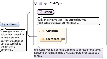
<element minOccurs="0" name="legendCode" type="gml:CodeType">
  <annotation>
    <documentation>A string or numeric value that is used to define a graphic pattern that may be used to symbolize the unit on a borehole log or map.</documentation>
  </annotation>
</element>
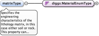
<element minOccurs="0" name="matrixType" type="diggs:MaterialEnumType">
  <annotation>
    <documentation>Specifies the engineering characteristics of the lithology matrix, in this case either soil or rock. This property can typically be inferred from the classificationCode, but is included here to simplify data ingestion into data systems that may store rock and soil physical property information in different objects or tables.</documentation>
  </annotation>
</element>
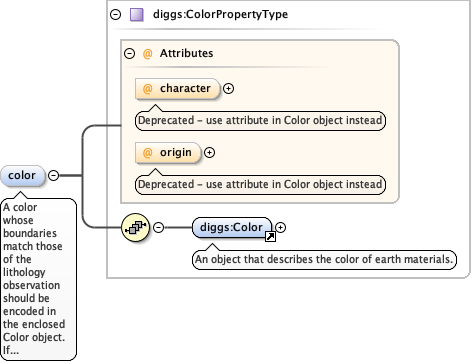
<element maxOccurs="unbounded" name="color" type="diggs:ColorPropertyType" minOccurs="0">
  <annotation>
    <documentation>A color whose boundaries match those of the lithology observation should be encoded in the enclosed Color object. If there are depth-specific changes in color taht are significant and do not match the boundaries of the lithologyObservation, then a ColorSystem can be defined to represent those data instead of encoding separate lithologyObservations to record only changes in color. Also, ancillary color changes in color within a lithologyObservation can be added as a description only within a PlacedObservation.</documentation>
  </annotation>
</element>
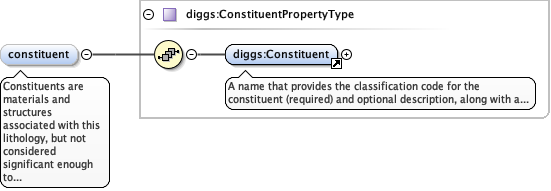
<element minOccurs="0" name="constituent" type="diggs:ConstituentPropertyType" maxOccurs="unbounded">
  <annotation>
    <documentation>Constituents are materials and structures associated with this lithology, but not considered significant enough to record as part of a ConstituentSystem, or where location within a lithology observation is not important to preserve (except as a comment). Constituents of a lithology are descriptions that generally fall into one of the following classes: 1) types of sedimentary or physical structures, 2) types of lithologic, mineralogic or organic accessories (eg. presence of calcite, gas odor, etc.), 3) types and degree of bioturbation features, 4) types of diagenetic structures, 5) types of physical structures produced by sampling, 6) types of fossils, 7) types of trace fossils, 8) types of fractures</documentation>
  </annotation>
</element>
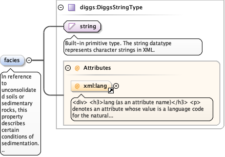
<element minOccurs="0" name="facies" type="diggs:DiggsStringType">
  <annotation>
    <documentation>In reference to unconsolidated soils or sedimentary rocks, this property describes certain conditions of sedimentation that reflect a particular process or depositional environment. Some examples might be alluvium, dune sand, river terrace deposits, hemipelagic sediment, etc. Facies designations do not imply any order within a stratigraphic column. Facies terms used to define informal geologic units that occur in stratigraphic order (eg. units do not repeat within a stratigraphic column) should be reported in a StratigraphySystem. For metamorphic rocks, this property is used to describe a set of mineral assemblages that form under similar pressures and temperatures (eg. zeolite facies, blueschist facies).</documentation>
  </annotation>
</element>
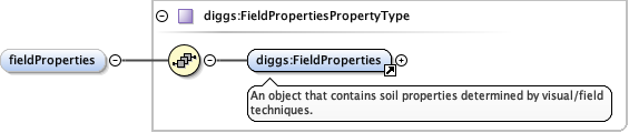
<element minOccurs="0" name="fieldProperties" type="diggs:FieldPropertiesPropertyType"/>
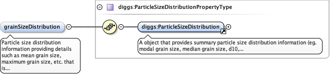
<element minOccurs="0" name="grainSizeDistribution" type="diggs:ParticleSizeDistributionPropertyType">
  <annotation>
    <documentation>Particle size distribution information providing details such as mean grain size, maximum grain size, etc. that is attributable a Lithology</documentation>
  </annotation>
</element>
</sequence>
</extension>
</complexContent>
</complexType>
|