| Namespace | http://diggsml.org/schema-dev | |||||||||
|
Annotations
|
|
|||||||||
|
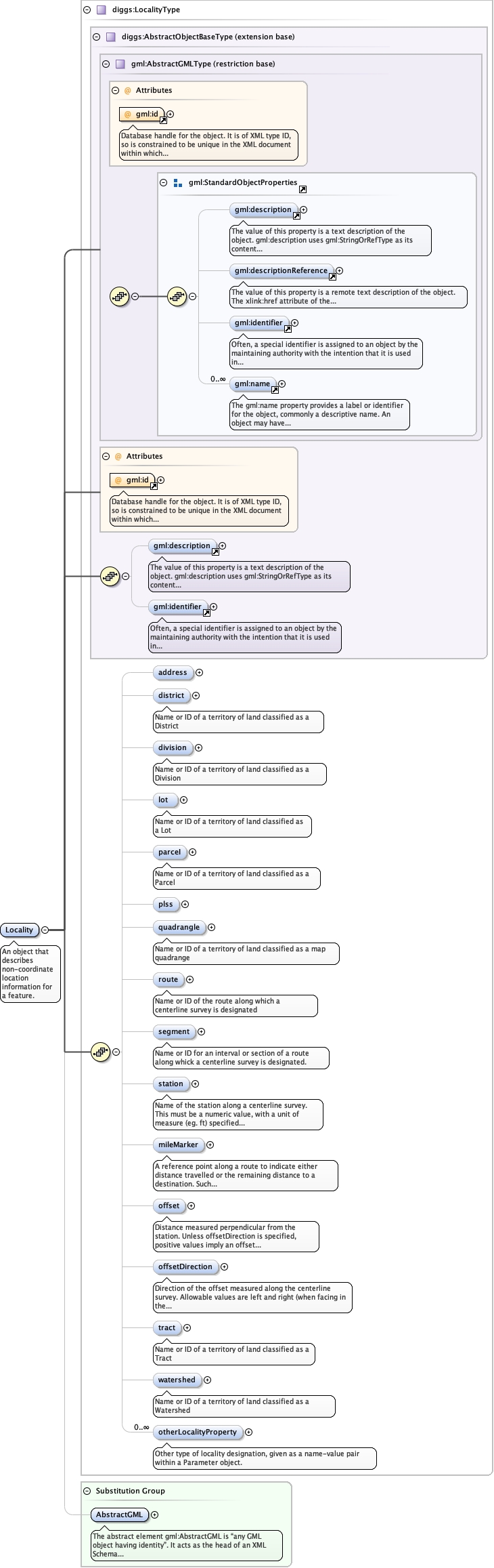
Diagram
|
 |
|||||||||
| Type | diggs:LocalityType | |||||||||
| Type hierarchy | ||||||||||
|
Properties
|
|
|||||||||
| Substitution Group Affiliation | ||||||||||
|
Used by
|
|
|||||||||
| Model |
gml:description{0,1} , gml:identifier{0,1} , diggs:address{0,1} , diggs:district{0,1} , diggs:division{0,1} , diggs:lot{0,1} , diggs:parceI{0,1} , diggs:plss{0,1} , diggs:quadrangle{0,1} , diggs:route{0,1} , diggs:segment{0,1} , diggs:station{0,1} , diggs:mileMarker{0,1} , diggs:offset{0,1} , diggs:offsetDirection{0,1} , diggs:tract{0,1} , diggs:watershed{0,1} , diggs:otherLocalityProperty*
|
|||||||||
| Children | diggs:address, diggs:district, diggs:division, diggs:lot, diggs:mileMarker, diggs:offset, diggs:offsetDirection, diggs:otherLocalityProperty, diggs:parceI, diggs:plss, diggs:quadrangle, diggs:route, diggs:segment, diggs:station, diggs:tract, diggs:watershed, gml:description, gml:identifier | |||||||||
|
Instance
|
|
|||||||||
|
Attributes
|
|
|||||||||
|
Source
|
|