<div><h3>lang (as an attribute name)</h3><p>denotes an attribute whose value is a language code for the natural language of the content of any element; its value is inherited. This name is reserved by virtue of its definition in the XML specification.</p></div><div><h4>Notes</h4><p>Attempting to install the relevant ISO 2- and 3-letter codes as the enumerated possible values is probably never going to be a realistic possibility.</p><p>See BCP 47 at<a href="http://www.rfc-editor.org/rfc/bcp/bcp47.txt">http://www.rfc-editor.org/rfc/bcp/bcp47.txt</a>and the IANA language subtag registry at<a href="http://www.iana.org/assignments/language-subtag-registry">http://www.iana.org/assignments/language-subtag-registry</a>for further information.</p><p>The union allows for the 'un-declaration' of xml:lang with the empty string.</p></div>
Source
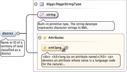
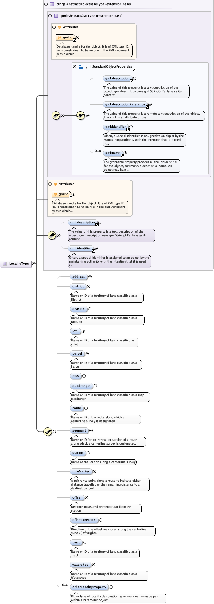
<element name="district" type="diggs:DiggsStringType" minOccurs="0" maxOccurs="1"><annotation><documentation>Name or ID of a territory of land classified as a District</documentation></annotation></element>
<div><h3>lang (as an attribute name)</h3><p>denotes an attribute whose value is a language code for the natural language of the content of any element; its value is inherited. This name is reserved by virtue of its definition in the XML specification.</p></div><div><h4>Notes</h4><p>Attempting to install the relevant ISO 2- and 3-letter codes as the enumerated possible values is probably never going to be a realistic possibility.</p><p>See BCP 47 at<a href="http://www.rfc-editor.org/rfc/bcp/bcp47.txt">http://www.rfc-editor.org/rfc/bcp/bcp47.txt</a>and the IANA language subtag registry at<a href="http://www.iana.org/assignments/language-subtag-registry">http://www.iana.org/assignments/language-subtag-registry</a>for further information.</p><p>The union allows for the 'un-declaration' of xml:lang with the empty string.</p></div>
Source
<element name="division" type="diggs:DiggsStringType" minOccurs="0" maxOccurs="1"><annotation><documentation>Name or ID of a territory of land classified as a Division</documentation></annotation></element>
<div><h3>lang (as an attribute name)</h3><p>denotes an attribute whose value is a language code for the natural language of the content of any element; its value is inherited. This name is reserved by virtue of its definition in the XML specification.</p></div><div><h4>Notes</h4><p>Attempting to install the relevant ISO 2- and 3-letter codes as the enumerated possible values is probably never going to be a realistic possibility.</p><p>See BCP 47 at<a href="http://www.rfc-editor.org/rfc/bcp/bcp47.txt">http://www.rfc-editor.org/rfc/bcp/bcp47.txt</a>and the IANA language subtag registry at<a href="http://www.iana.org/assignments/language-subtag-registry">http://www.iana.org/assignments/language-subtag-registry</a>for further information.</p><p>The union allows for the 'un-declaration' of xml:lang with the empty string.</p></div>
Source
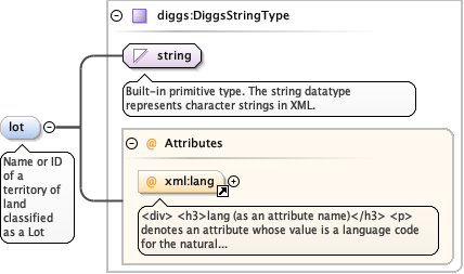
<element minOccurs="0" name="lot" type="diggs:DiggsStringType"><annotation><documentation>Name or ID of a territory of land classified as a Lot</documentation></annotation></element>
<div><h3>lang (as an attribute name)</h3><p>denotes an attribute whose value is a language code for the natural language of the content of any element; its value is inherited. This name is reserved by virtue of its definition in the XML specification.</p></div><div><h4>Notes</h4><p>Attempting to install the relevant ISO 2- and 3-letter codes as the enumerated possible values is probably never going to be a realistic possibility.</p><p>See BCP 47 at<a href="http://www.rfc-editor.org/rfc/bcp/bcp47.txt">http://www.rfc-editor.org/rfc/bcp/bcp47.txt</a>and the IANA language subtag registry at<a href="http://www.iana.org/assignments/language-subtag-registry">http://www.iana.org/assignments/language-subtag-registry</a>for further information.</p><p>The union allows for the 'un-declaration' of xml:lang with the empty string.</p></div>
Source
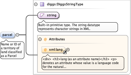
<element name="parceI" type="diggs:DiggsStringType" minOccurs="0" maxOccurs="1"><annotation><documentation>Name or ID of a territory of land classified as a Parcel</documentation></annotation></element>
<div><h3>lang (as an attribute name)</h3><p>denotes an attribute whose value is a language code for the natural language of the content of any element; its value is inherited. This name is reserved by virtue of its definition in the XML specification.</p></div><div><h4>Notes</h4><p>Attempting to install the relevant ISO 2- and 3-letter codes as the enumerated possible values is probably never going to be a realistic possibility.</p><p>See BCP 47 at<a href="http://www.rfc-editor.org/rfc/bcp/bcp47.txt">http://www.rfc-editor.org/rfc/bcp/bcp47.txt</a>and the IANA language subtag registry at<a href="http://www.iana.org/assignments/language-subtag-registry">http://www.iana.org/assignments/language-subtag-registry</a>for further information.</p><p>The union allows for the 'un-declaration' of xml:lang with the empty string.</p></div>
Source
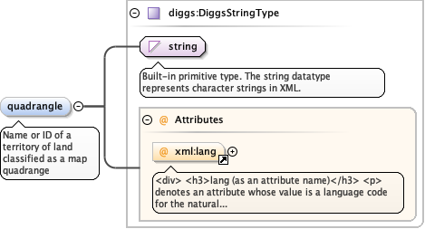
<element name="quadrangle" type="diggs:DiggsStringType" minOccurs="0" maxOccurs="1"><annotation><documentation>Name or ID of a territory of land classified as a map quadrange</documentation></annotation></element>
<div><h3>lang (as an attribute name)</h3><p>denotes an attribute whose value is a language code for the natural language of the content of any element; its value is inherited. This name is reserved by virtue of its definition in the XML specification.</p></div><div><h4>Notes</h4><p>Attempting to install the relevant ISO 2- and 3-letter codes as the enumerated possible values is probably never going to be a realistic possibility.</p><p>See BCP 47 at<a href="http://www.rfc-editor.org/rfc/bcp/bcp47.txt">http://www.rfc-editor.org/rfc/bcp/bcp47.txt</a>and the IANA language subtag registry at<a href="http://www.iana.org/assignments/language-subtag-registry">http://www.iana.org/assignments/language-subtag-registry</a>for further information.</p><p>The union allows for the 'un-declaration' of xml:lang with the empty string.</p></div>
Source
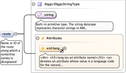
<element name="route" type="diggs:DiggsStringType" minOccurs="0" maxOccurs="1"><annotation><documentation>Name or ID of the route along which a centerline survey is designated</documentation></annotation></element>
<div><h3>lang (as an attribute name)</h3><p>denotes an attribute whose value is a language code for the natural language of the content of any element; its value is inherited. This name is reserved by virtue of its definition in the XML specification.</p></div><div><h4>Notes</h4><p>Attempting to install the relevant ISO 2- and 3-letter codes as the enumerated possible values is probably never going to be a realistic possibility.</p><p>See BCP 47 at<a href="http://www.rfc-editor.org/rfc/bcp/bcp47.txt">http://www.rfc-editor.org/rfc/bcp/bcp47.txt</a>and the IANA language subtag registry at<a href="http://www.iana.org/assignments/language-subtag-registry">http://www.iana.org/assignments/language-subtag-registry</a>for further information.</p><p>The union allows for the 'un-declaration' of xml:lang with the empty string.</p></div>
Source
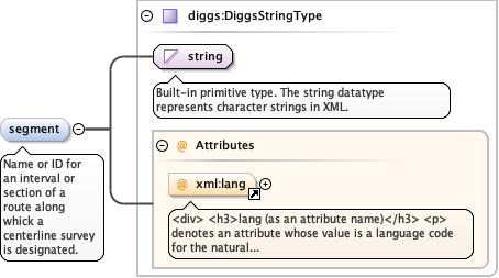
<element name="segment" type="diggs:DiggsStringType" minOccurs="0" maxOccurs="1"><annotation><documentation>Name or ID for an interval or section of a route along whick a centerline survey is designated.</documentation></annotation></element>
<div><h3>lang (as an attribute name)</h3><p>denotes an attribute whose value is a language code for the natural language of the content of any element; its value is inherited. This name is reserved by virtue of its definition in the XML specification.</p></div><div><h4>Notes</h4><p>Attempting to install the relevant ISO 2- and 3-letter codes as the enumerated possible values is probably never going to be a realistic possibility.</p><p>See BCP 47 at<a href="http://www.rfc-editor.org/rfc/bcp/bcp47.txt">http://www.rfc-editor.org/rfc/bcp/bcp47.txt</a>and the IANA language subtag registry at<a href="http://www.iana.org/assignments/language-subtag-registry">http://www.iana.org/assignments/language-subtag-registry</a>for further information.</p><p>The union allows for the 'un-declaration' of xml:lang with the empty string.</p></div>
Source
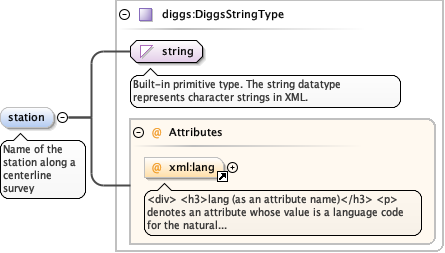
<element name="station" type="diggs:DiggsStringType" minOccurs="0" maxOccurs="1"><annotation><documentation>Name of the station along a centerline survey</documentation></annotation></element>
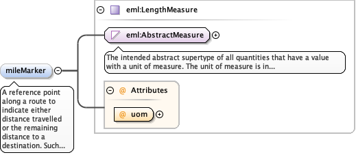
A reference point along a route to indicate eitherdistance travelled or the remaining distance to a destination. Suchreferences are also used by maintenance engineers and emergencyservices to direct them to specific points where their presence isrequired. This term is sometimes used to denote a location on a roadeven if no physical sign is present. This is a numerical value a maydiffer from a station id used for specific routesurveys.
<element name="mileMarker" type="eml:LengthMeasure" minOccurs="0" maxOccurs="1"><annotation><documentation>A reference point along a route to indicate either distance travelled or the remaining distance to a destination. Such references are also used by maintenance engineers and emergency services to direct them to specific points where their presence is required. This term is sometimes used to denote a location on a road even if no physical sign is present. This is a numerical value a may differ from a station id used for specific route surveys.</documentation></annotation></element>
<div><h3>lang (as an attribute name)</h3><p>denotes an attribute whose value is a language code for the natural language of the content of any element; its value is inherited. This name is reserved by virtue of its definition in the XML specification.</p></div><div><h4>Notes</h4><p>Attempting to install the relevant ISO 2- and 3-letter codes as the enumerated possible values is probably never going to be a realistic possibility.</p><p>See BCP 47 at<a href="http://www.rfc-editor.org/rfc/bcp/bcp47.txt">http://www.rfc-editor.org/rfc/bcp/bcp47.txt</a>and the IANA language subtag registry at<a href="http://www.iana.org/assignments/language-subtag-registry">http://www.iana.org/assignments/language-subtag-registry</a>for further information.</p><p>The union allows for the 'un-declaration' of xml:lang with the empty string.</p></div>
Source
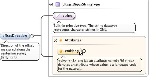
<element name="offsetDirection" type="diggs:DiggsStringType" minOccurs="0" maxOccurs="1"><annotation><documentation>Direction of the offset measured along the centerline survey (left/right).</documentation></annotation></element>
<div><h3>lang (as an attribute name)</h3><p>denotes an attribute whose value is a language code for the natural language of the content of any element; its value is inherited. This name is reserved by virtue of its definition in the XML specification.</p></div><div><h4>Notes</h4><p>Attempting to install the relevant ISO 2- and 3-letter codes as the enumerated possible values is probably never going to be a realistic possibility.</p><p>See BCP 47 at<a href="http://www.rfc-editor.org/rfc/bcp/bcp47.txt">http://www.rfc-editor.org/rfc/bcp/bcp47.txt</a>and the IANA language subtag registry at<a href="http://www.iana.org/assignments/language-subtag-registry">http://www.iana.org/assignments/language-subtag-registry</a>for further information.</p><p>The union allows for the 'un-declaration' of xml:lang with the empty string.</p></div>
Source
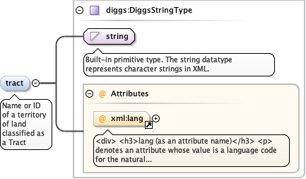
<element name="tract" type="diggs:DiggsStringType" minOccurs="0" maxOccurs="1"><annotation><documentation>Name or ID of a territory of land classified as a Tract</documentation></annotation></element>
<div><h3>lang (as an attribute name)</h3><p>denotes an attribute whose value is a language code for the natural language of the content of any element; its value is inherited. This name is reserved by virtue of its definition in the XML specification.</p></div><div><h4>Notes</h4><p>Attempting to install the relevant ISO 2- and 3-letter codes as the enumerated possible values is probably never going to be a realistic possibility.</p><p>See BCP 47 at<a href="http://www.rfc-editor.org/rfc/bcp/bcp47.txt">http://www.rfc-editor.org/rfc/bcp/bcp47.txt</a>and the IANA language subtag registry at<a href="http://www.iana.org/assignments/language-subtag-registry">http://www.iana.org/assignments/language-subtag-registry</a>for further information.</p><p>The union allows for the 'un-declaration' of xml:lang with the empty string.</p></div>
Source
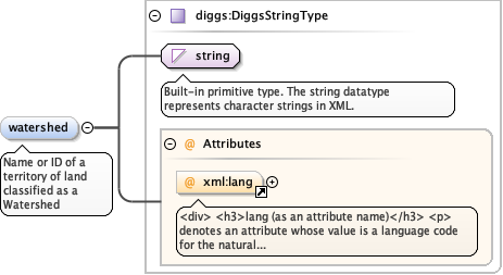
<element name="watershed" type="diggs:DiggsStringType" minOccurs="0" maxOccurs="1"><annotation><documentation>Name or ID of a territory of land classified as a Watershed</documentation></annotation></element>
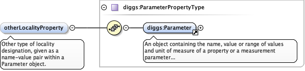
<element name="otherLocalityProperty" type="diggs:ParameterPropertyType" minOccurs="0" maxOccurs="unbounded"><annotation><documentation>Other type of locality designation, given as a name-value pair within a Parameter object.</documentation></annotation></element>
Database handle for the object. It is of XML type ID, so is constrained to beunique in the XML document within which it occurs. An external identifier for the object inthe form of a URI may be constructed using standard XML and XPointer methods. This is doneby concatenating the URI for the document, a fragment separator, and the value of the idattribute.
Source
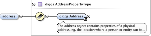
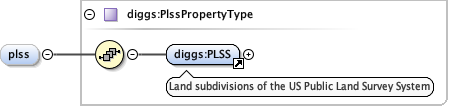
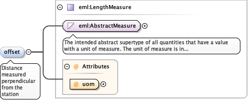
<complexType name="LocalityType"><complexContent><extension base="diggs:AbstractObjectBaseType"><sequence><element name="address" type="diggs:AddressPropertyType" minOccurs="0" maxOccurs="1"/><element name="district" type="diggs:DiggsStringType" minOccurs="0" maxOccurs="1"><annotation><documentation>Name or ID of a territory of land classified as a District</documentation></annotation></element><element name="division" type="diggs:DiggsStringType" minOccurs="0" maxOccurs="1"><annotation><documentation>Name or ID of a territory of land classified as a Division</documentation></annotation></element><element minOccurs="0" name="lot" type="diggs:DiggsStringType"><annotation><documentation>Name or ID of a territory of land classified as a Lot</documentation></annotation></element><element name="parceI" type="diggs:DiggsStringType" minOccurs="0" maxOccurs="1"><annotation><documentation>Name or ID of a territory of land classified as a Parcel</documentation></annotation></element><element name="plss" type="diggs:PlssPropertyType" minOccurs="0" maxOccurs="1"/><element name="quadrangle" type="diggs:DiggsStringType" minOccurs="0" maxOccurs="1"><annotation><documentation>Name or ID of a territory of land classified as a map quadrange</documentation></annotation></element><element name="route" type="diggs:DiggsStringType" minOccurs="0" maxOccurs="1"><annotation><documentation>Name or ID of the route along which a centerline survey is designated</documentation></annotation></element><element name="segment" type="diggs:DiggsStringType" minOccurs="0" maxOccurs="1"><annotation><documentation>Name or ID for an interval or section of a route along whick a centerline survey is designated.</documentation></annotation></element><element name="station" type="diggs:DiggsStringType" minOccurs="0" maxOccurs="1"><annotation><documentation>Name of the station along a centerline survey</documentation></annotation></element><element name="mileMarker" type="eml:LengthMeasure" minOccurs="0" maxOccurs="1"><annotation><documentation>A reference point along a route to indicate either distance travelled or the remaining distance to a destination. Such references are also used by maintenance engineers and emergency services to direct them to specific points where their presence is required. This term is sometimes used to denote a location on a road even if no physical sign is present. This is a numerical value a may differ from a station id used for specific route surveys.</documentation></annotation></element><element name="offset" type="eml:LengthMeasure" minOccurs="0" maxOccurs="1" form="qualified"><annotation><documentation>Distance measured perpendicular from the station</documentation></annotation></element><element name="offsetDirection" type="diggs:DiggsStringType" minOccurs="0" maxOccurs="1"><annotation><documentation>Direction of the offset measured along the centerline survey (left/right).</documentation></annotation></element><element name="tract" type="diggs:DiggsStringType" minOccurs="0" maxOccurs="1"><annotation><documentation>Name or ID of a territory of land classified as a Tract</documentation></annotation></element><element name="watershed" type="diggs:DiggsStringType" minOccurs="0" maxOccurs="1"><annotation><documentation>Name or ID of a territory of land classified as a Watershed</documentation></annotation></element><element name="otherLocalityProperty" type="diggs:ParameterPropertyType" minOccurs="0" maxOccurs="unbounded"><annotation><documentation>Other type of locality designation, given as a name-value pair within a Parameter object.</documentation></annotation></element></sequence></extension></complexContent></complexType>