| Namespace | http://diggsml.org/schema-dev | ||||||||||
|
Annotations
|
|
||||||||||
|
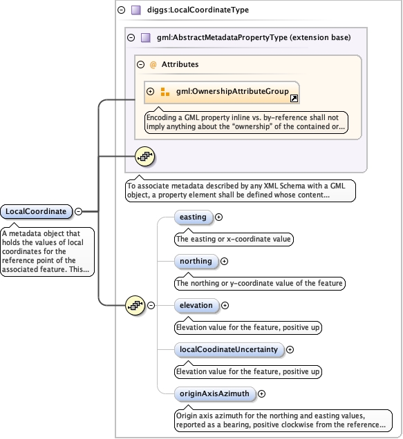
Diagram
|
 |
||||||||||
| Type | diggs:LocalCoordinateType | ||||||||||
| Type hierarchy | |||||||||||
|
Properties
|
|
||||||||||
|
Used by
|
|
||||||||||
| Model | |||||||||||
| Children | diggs:easting, diggs:elevation, diggs:localCoodinateUncertainty, diggs:northing, diggs:originAxisAzimuth | ||||||||||
|
Instance
|
|
||||||||||
|
Attributes
|
|
||||||||||
|
Source
|
|