| Namespace | http://diggsml.org/schemas/3 | |||||||||||||||||||
|
Annotations
|
|
|||||||||||||||||||
|
Diagram
|
 |
|||||||||||||||||||
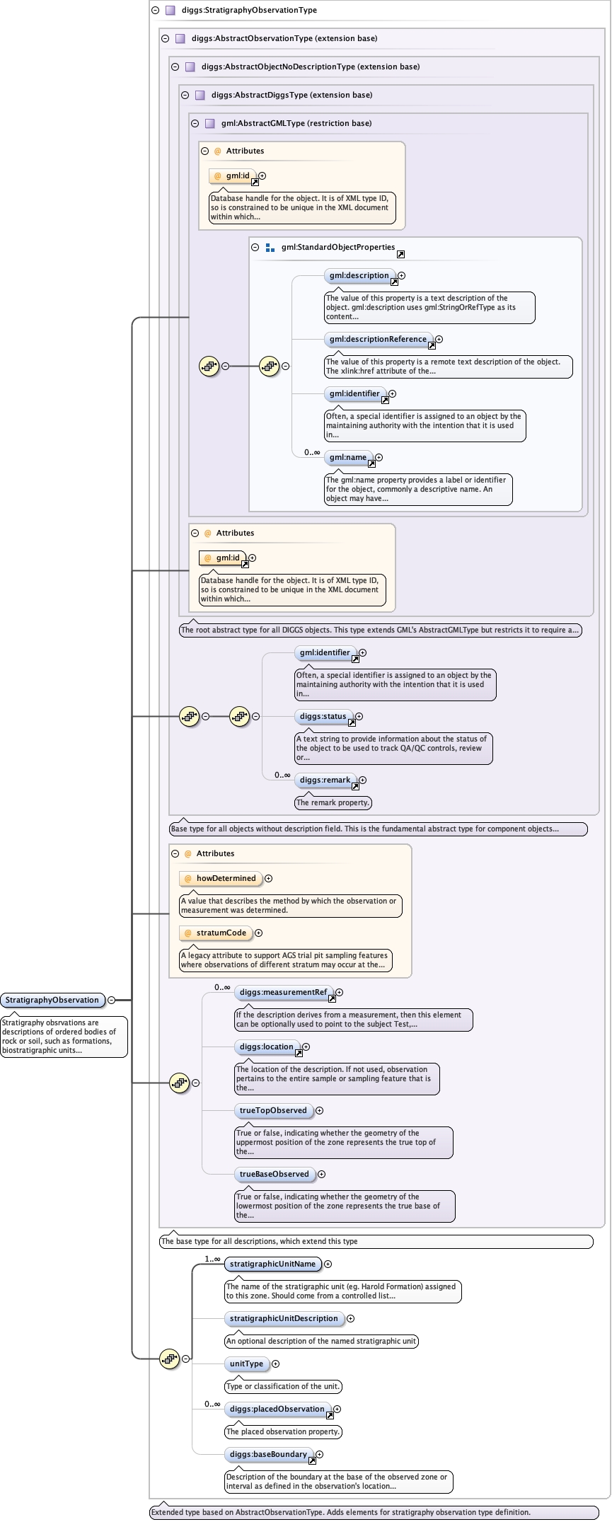
| Type | diggs:StratigraphyObservationType | |||||||||||||||||||
| Type hierarchy | ||||||||||||||||||||
|
Properties
|
|
|||||||||||||||||||
|
Used by
|
|
|||||||||||||||||||
| Model |
gml:identifier{0,1} , diggs:status{0,1} , diggs:remark* , diggs:measurementRef* , diggs:location{0,1} , diggs:trueTopObserved{0,1} , diggs:trueBaseObserved{0,1} , diggs:stratigraphicUnitName+ , diggs:stratigraphicUnitDescription{0,1} , diggs:unitType{0,1} , diggs:placedObservation* , diggs:baseBoundary{0,1}
|
|||||||||||||||||||
| Children | diggs:baseBoundary, diggs:location, diggs:measurementRef, diggs:placedObservation, diggs:remark, diggs:status, diggs:stratigraphicUnitDescription, diggs:stratigraphicUnitName, diggs:trueBaseObserved, diggs:trueTopObserved, diggs:unitType, gml:identifier | |||||||||||||||||||
|
Instance
|
|
|||||||||||||||||||
|
Attributes
|
|
|||||||||||||||||||
| Schema location | file:/Users/dponti/GitHub/diggs-schema/core/Core.xsd |