| Namespace | http://diggsml.org/schemas/3 | |||||||||||||||||||||||||
|
Annotations
|
|
|||||||||||||||||||||||||
|
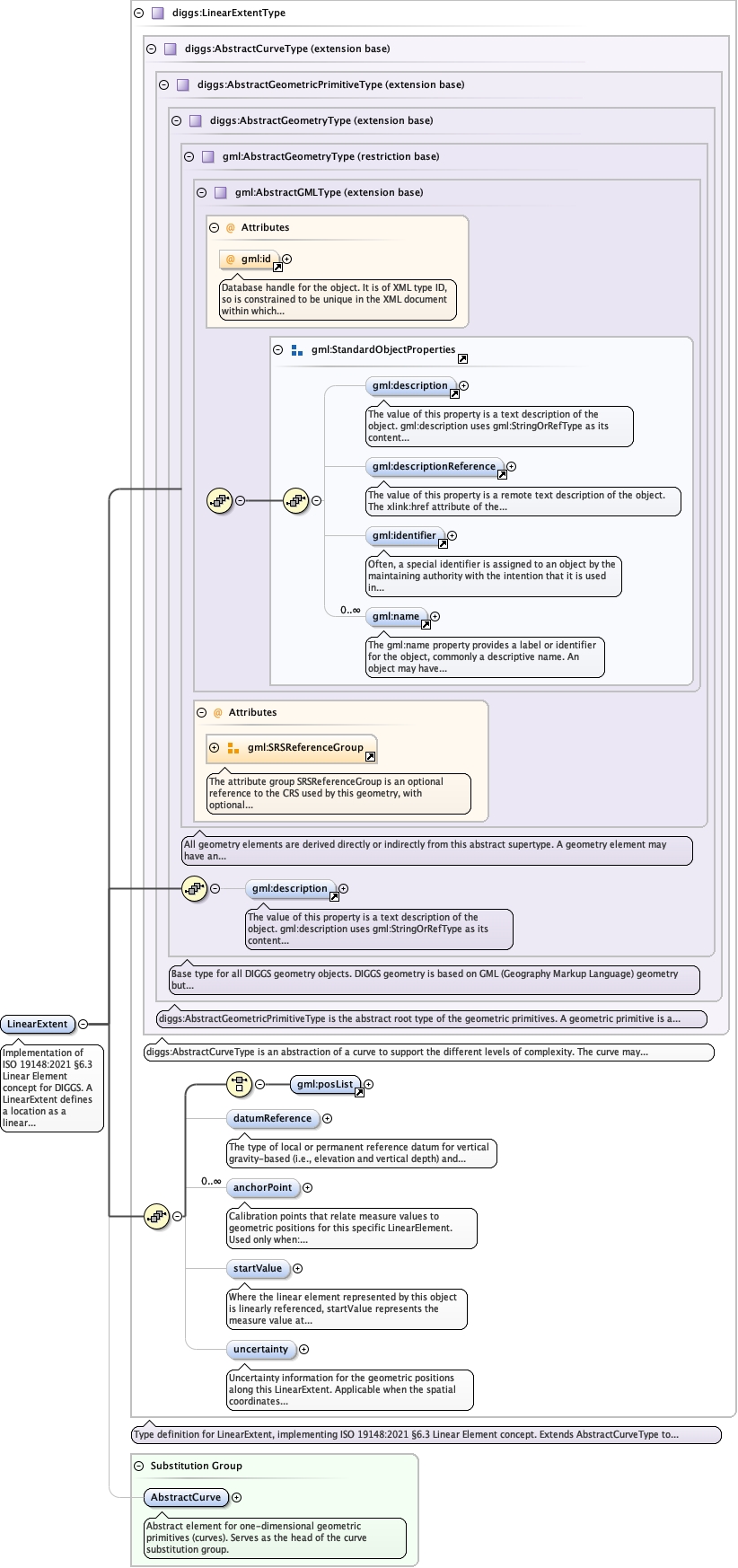
Diagram
|
 |
|||||||||||||||||||||||||
| Type | diggs:LinearExtentType | |||||||||||||||||||||||||
| Type hierarchy | ||||||||||||||||||||||||||
|
Properties
|
|
|||||||||||||||||||||||||
| Substitution Group Affiliation | ||||||||||||||||||||||||||
|
Used by
|
||||||||||||||||||||||||||
| Model | ||||||||||||||||||||||||||
| Children | diggs:anchorPoint, diggs:datumReference, diggs:startValue, diggs:uncertainty, gml:description, gml:posList | |||||||||||||||||||||||||
|
Instance
|
|
|||||||||||||||||||||||||
|
Attributes
|
|
|||||||||||||||||||||||||
| Schema location | file:/Users/dponti/GitHub/diggs-schema/core/Core.xsd |