| Namespace | http://diggsml.org/schemas/3 | |||||||||||||||||||
|
Annotations
|
|
|||||||||||||||||||
|
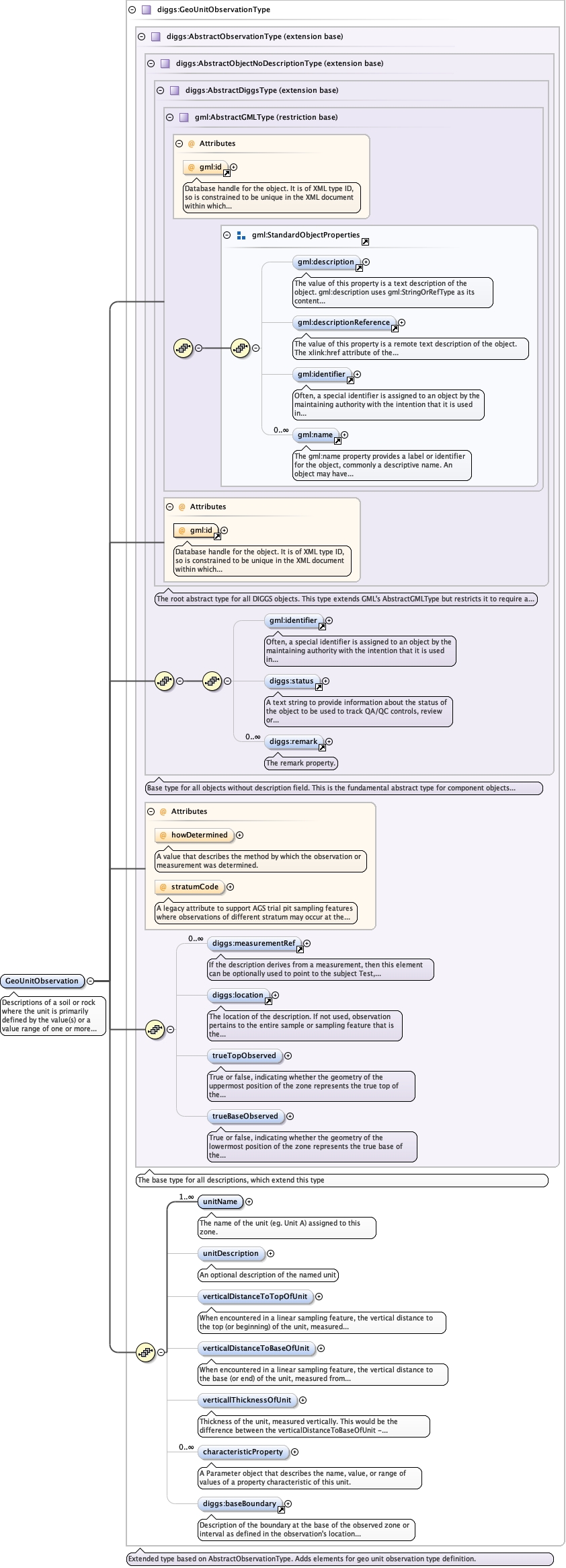
Diagram
|
 |
|||||||||||||||||||
| Type | diggs:GeoUnitObservationType | |||||||||||||||||||
| Type hierarchy | ||||||||||||||||||||
|
Properties
|
|
|||||||||||||||||||
|
Used by
|
|
|||||||||||||||||||
| Model |
gml:identifier{0,1} , diggs:status{0,1} , diggs:remark* , diggs:measurementRef* , diggs:location{0,1} , diggs:trueTopObserved{0,1} , diggs:trueBaseObserved{0,1} , diggs:unitName+ , diggs:unitDescription{0,1} , diggs:verticalDistanceToTopOfUnit{0,1} , diggs:verticalDistanceToBaseOfUnit{0,1} , diggs:verticallThicknessOfUnit{0,1} , diggs:characteristicProperty* , diggs:baseBoundary{0,1}
|
|||||||||||||||||||
| Children | diggs:baseBoundary, diggs:characteristicProperty, diggs:location, diggs:measurementRef, diggs:remark, diggs:status, diggs:trueBaseObserved, diggs:trueTopObserved, diggs:unitDescription, diggs:unitName, diggs:verticalDistanceToBaseOfUnit, diggs:verticalDistanceToTopOfUnit, diggs:verticallThicknessOfUnit, gml:identifier | |||||||||||||||||||
|
Instance
|
|
|||||||||||||||||||
|
Attributes
|
|
|||||||||||||||||||
|
Source
|
|