| Namespace | http://diggsml.org/schemas/3 | ||||||||||||||
|
Annotations
|
|
||||||||||||||
|
Diagram
|
 |
||||||||||||||
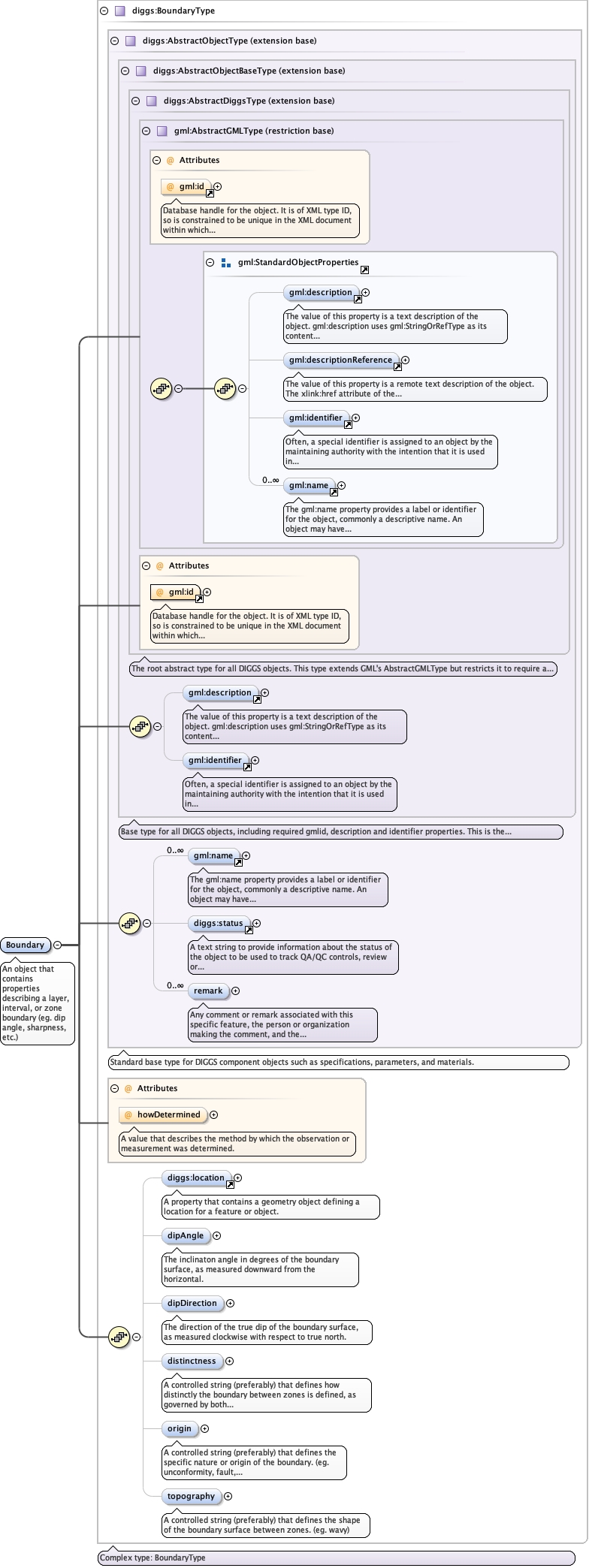
| Type | diggs:BoundaryType | ||||||||||||||
| Type hierarchy | |||||||||||||||
|
Properties
|
|
||||||||||||||
|
Used by
|
|
||||||||||||||
| Model | |||||||||||||||
| Children | diggs:dipAngle, diggs:dipDirection, diggs:distinctness, diggs:location, diggs:origin, diggs:remark, diggs:status, diggs:topography, gml:description, gml:identifier, gml:name | ||||||||||||||
|
Instance
|
|
||||||||||||||
|
Attributes
|
|
||||||||||||||
|
Source
|
|