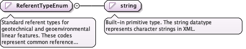
Standard referent types for geotechnical and geoenvironmental linear features. These codes represent common reference points used in drilling, sampling, and geophysical operations.Organized by application area:- Drilling: groundSurface, kellyBushing, rotaryTable, rotaryBushing, crownValve, derrickFloor, kickoffPoint- Marine: seafloor, mudline, meanSeaLevel, tidal datums- Borehole/Well: topOfCasing, bottomOfCasing, topOfHole, bottomOfHole, casingFlange- Core: topOfCore, bottomOfCore- Survey: start, end, intersection, benchMark
Diagram
Type
restriction of string
Facets
enumeration
ground surface
Natural or existing ground surface at the location of the
feature. Common reference for boreholes, CPT soundings, test pits,
and other subsurface investigations.
enumeration
kelly bushing
Kelly bushing on a drilling rig, typically the reference point for measured depth in rotary drilling operations. Located at the top of the kelly drive system.Note: See also 'rotaryBushing' which is the preferred term.
enumeration
rotary bushing
The bushing seated in the rotary table through which the kelly or drill string passes during drilling operations. The elevation of the rotary bushing (often referred to as RKB - Rotary Kelly Bushing) is a common datum reference for measuring drilled depths and is typically a few feet above the drill floor elevation.This is the preferred term over 'kelly bushing'.
enumeration
rotary table
Rotary table on a drilling rig, alternative reference point
for measured depth measurements. The rotating platform through
which the drill string passes.
enumeration
crown valve
The valve assembly located at the crown of the derrick or mast,
typically at or near the crown block. Used as a reference datum
for depth measurements in drilling operations, representing one
of the highest fixed points on the rig structure.
enumeration
derrick floor
Derrick floor or rig floor elevation, sometimes used as
alternative to kelly bushing or rotary table. The main working
platform of the drilling rig.
enumeration
mudline
River or lakebed surface in over-water drilling operations.
The sediment-water interface in non-marine aquatic environments.
enumeration
sea floor
Seafloor surface, used in marine geophysical and geotechnical
surveys. Typically the reference for measured depth in subsea
wells and offshore boreholes.
enumeration
mean sea level
Mean sea level, used as vertical datum reference in marine
and coastal environments. The arithmetic mean of hourly water
elevations observed over a specific 19-year cycle (National
Tidal Datum Epoch).
enumeration
lowest astronomical tide
The lowest tide level over the duration of the National Tidal
Datum Epoch (19 years). Used as a low-water datum in some
coastal applications.
enumeration
mean higher high water
A tidal datum. The average of the higher high water height of
each tidal day observed over the National Tidal Datum Epoch
(19 years). Applicable in areas with mixed tidal regimes.
enumeration
mean high water
A tidal datum. The average of all the high water heights observed
over the National Tidal Datum Epoch (19 years).
enumeration
mean lower low water
A tidal datum. The average of the lower low water height of each
tidal day observed over the National Tidal Datum Epoch (19 years).
Common datum for nautical charts in the United States.
enumeration
mean low water
A tidal datum. The average of all the low water heights observed
over the National Tidal Datum Epoch (19 years).
enumeration
mean tide level
A tidal datum. The arithmetic mean of mean high water and mean
low water. Same as half-tide level.
enumeration
top of casing
Top of protective casing in a borehole or well. May be used
as reference for depth measurements in monitoring wells and
environmental boreholes.
enumeration
bottom of casing
Base of protective casing in a borehole or well. Marks the
transition from cased to open hole.
enumeration
casing flange
A flange affixed to the top of the casing string used to attach
production equipment. Common reference in oil/gas wells.
enumeration
kickoff point
Point at which a borehole deviates from vertical in directional
drilling operations. Important reference for deviated well paths
and horizontal drilling.
enumeration
top of hole
The top of a drilled hole - generally synonymous with ground
surface unless drilled within an excavation or from a platform.
enumeration
bottom of hole
Terminal end of a borehole or well at maximum penetration depth.
Total depth (TD) of the hole.
enumeration
top of core
The defined top of a core sample. Used when referencing positions
within core samples that may be handled separately from the parent
borehole. Common anchor point for core sample linear referencing.
enumeration
bottom of core
The defined base of a core sample. Used for core recovery
calculations and sample referencing. Often provides a better-defined
reference than top of core when slough is present at the top of
cored interval. Common anchor point for bottom-up core logging.
enumeration
line start
Starting point of a geophysical trackline or survey transect.
Corresponds to first coordinate in LinearExtent. Common reference
for distance along survey lines.
enumeration
line end
Ending point of a geophysical trackline or survey transect.
Corresponds to last coordinate in LinearExtent.
enumeration
intersection
Intersection point where this linear feature crosses another
linear feature. Common in grid-based geophysical surveys where
perpendicular survey lines create a network of tie points.
enumeration
benchmark
Surveyed benchmark used as elevation reference for the feature.
A monumented point with known coordinates in a geodetic reference
system.
Source
<simpleType name="ReferentTypeEnum"><annotation><documentation>Standard referent types for geotechnical and geoenvironmental linear features. These codes represent common reference points used in drilling, sampling, and geophysical operations. Organized by application area: - Drilling: groundSurface, kellyBushing, rotaryTable, rotaryBushing, crownValve, derrickFloor, kickoffPoint - Marine: seafloor, mudline, meanSeaLevel, tidal datums - Borehole/Well: topOfCasing, bottomOfCasing, topOfHole, bottomOfHole, casingFlange - Core: topOfCore, bottomOfCore - Survey: start, end, intersection, benchMark</documentation></annotation><restriction base="string"><enumeration value="ground surface"><annotation><documentation>Natural or existing ground surface at the location of the feature. Common reference for boreholes, CPT soundings, test pits, and other subsurface investigations.</documentation></annotation></enumeration><enumeration value="kelly bushing"><annotation><documentation>Kelly bushing on a drilling rig, typically the reference point for measured depth in rotary drilling operations. Located at the top of the kelly drive system. Note: See also 'rotaryBushing' which is the preferred term.</documentation></annotation></enumeration><enumeration value="rotary bushing"><annotation><documentation>The bushing seated in the rotary table through which the kelly or drill string passes during drilling operations. The elevation of the rotary bushing (often referred to as RKB - Rotary Kelly Bushing) is a common datum reference for measuring drilled depths and is typically a few feet above the drill floor elevation. This is the preferred term over 'kelly bushing'.</documentation></annotation></enumeration><enumeration value="rotary table"><annotation><documentation>Rotary table on a drilling rig, alternative reference point for measured depth measurements. The rotating platform through which the drill string passes.</documentation></annotation></enumeration><enumeration value="crown valve"><annotation><documentation>The valve assembly located at the crown of the derrick or mast, typically at or near the crown block. Used as a reference datum for depth measurements in drilling operations, representing one of the highest fixed points on the rig structure.</documentation></annotation></enumeration><enumeration value="derrick floor"><annotation><documentation>Derrick floor or rig floor elevation, sometimes used as alternative to kelly bushing or rotary table. The main working platform of the drilling rig.</documentation></annotation></enumeration><enumeration value="mudline"><annotation><documentation>River or lakebed surface in over-water drilling operations. The sediment-water interface in non-marine aquatic environments.</documentation></annotation></enumeration><enumeration value="sea floor"><annotation><documentation>Seafloor surface, used in marine geophysical and geotechnical surveys. Typically the reference for measured depth in subsea wells and offshore boreholes.</documentation></annotation></enumeration><enumeration value="mean sea level"><annotation><documentation>Mean sea level, used as vertical datum reference in marine and coastal environments. The arithmetic mean of hourly water elevations observed over a specific 19-year cycle (National Tidal Datum Epoch).</documentation></annotation></enumeration><enumeration value="lowest astronomical tide"><annotation><documentation>The lowest tide level over the duration of the National Tidal Datum Epoch (19 years). Used as a low-water datum in some coastal applications.</documentation></annotation></enumeration><enumeration value="mean higher high water"><annotation><documentation>A tidal datum. The average of the higher high water height of each tidal day observed over the National Tidal Datum Epoch (19 years). Applicable in areas with mixed tidal regimes.</documentation></annotation></enumeration><enumeration value="mean high water"><annotation><documentation>A tidal datum. The average of all the high water heights observed over the National Tidal Datum Epoch (19 years).</documentation></annotation></enumeration><enumeration value="mean lower low water"><annotation><documentation>A tidal datum. The average of the lower low water height of each tidal day observed over the National Tidal Datum Epoch (19 years). Common datum for nautical charts in the United States.</documentation></annotation></enumeration><enumeration value="mean low water"><annotation><documentation>A tidal datum. The average of all the low water heights observed over the National Tidal Datum Epoch (19 years).</documentation></annotation></enumeration><enumeration value="mean tide level"><annotation><documentation>A tidal datum. The arithmetic mean of mean high water and mean low water. Same as half-tide level.</documentation></annotation></enumeration><enumeration value="top of casing"><annotation><documentation>Top of protective casing in a borehole or well. May be used as reference for depth measurements in monitoring wells and environmental boreholes.</documentation></annotation></enumeration><enumeration value="bottom of casing"><annotation><documentation>Base of protective casing in a borehole or well. Marks the transition from cased to open hole.</documentation></annotation></enumeration><enumeration value="casing flange"><annotation><documentation>A flange affixed to the top of the casing string used to attach production equipment. Common reference in oil/gas wells.</documentation></annotation></enumeration><enumeration value="kickoff point"><annotation><documentation>Point at which a borehole deviates from vertical in directional drilling operations. Important reference for deviated well paths and horizontal drilling.</documentation></annotation></enumeration><enumeration value="top of hole"><annotation><documentation>The top of a drilled hole - generally synonymous with ground surface unless drilled within an excavation or from a platform.</documentation></annotation></enumeration><enumeration value="bottom of hole"><annotation><documentation>Terminal end of a borehole or well at maximum penetration depth. Total depth (TD) of the hole.</documentation></annotation></enumeration><enumeration value="top of core"><annotation><documentation>The defined top of a core sample. Used when referencing positions within core samples that may be handled separately from the parent borehole. Common anchor point for core sample linear referencing.</documentation></annotation></enumeration><enumeration value="bottom of core"><annotation><documentation>The defined base of a core sample. Used for core recovery calculations and sample referencing. Often provides a better-defined reference than top of core when slough is present at the top of cored interval. Common anchor point for bottom-up core logging.</documentation></annotation></enumeration><enumeration value="line start"><annotation><documentation>Starting point of a geophysical trackline or survey transect. Corresponds to first coordinate in LinearExtent. Common reference for distance along survey lines.</documentation></annotation></enumeration><enumeration value="line end"><annotation><documentation>Ending point of a geophysical trackline or survey transect. Corresponds to last coordinate in LinearExtent.</documentation></annotation></enumeration><enumeration value="intersection"><annotation><documentation>Intersection point where this linear feature crosses another linear feature. Common in grid-based geophysical surveys where perpendicular survey lines create a network of tie points.</documentation></annotation></enumeration><enumeration value="benchmark"><annotation><documentation>Surveyed benchmark used as elevation reference for the feature. A monumented point with known coordinates in a geodetic reference system.</documentation></annotation></enumeration></restriction></simpleType>